After yesterday’s trek, we were up for something a bit lighter. Two ferry companies offer service to Great Blasket Island, once the westernmost inhabited island in Europe, now devoid of permanent residents since 1954. We didn’t know much about it before today, but it sounded like an interesting place to visit and an opportunity for scenic (and not too lengthy) hike.
Getting to the island is not always easy or even possible. The pier at Dunquin looks quite improbable at first glance, with the access path snaking crazily down a cliffside toward a pair of jagged rocks. In the old days, the island residents were sometimes cut off from the mainland for months at a time due to bad weather. In our case, the ferries ran today, but were predicting no service for tomorrow or the next several days.
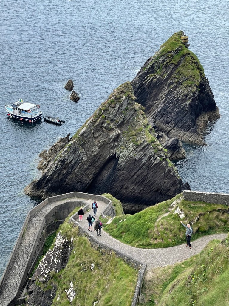
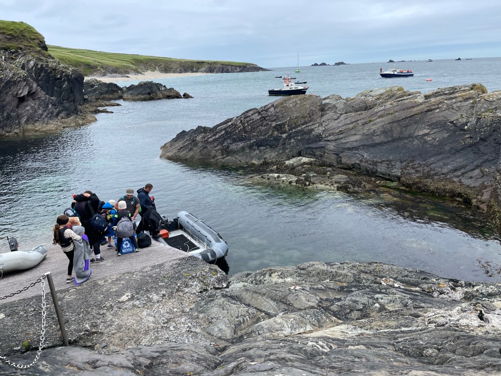
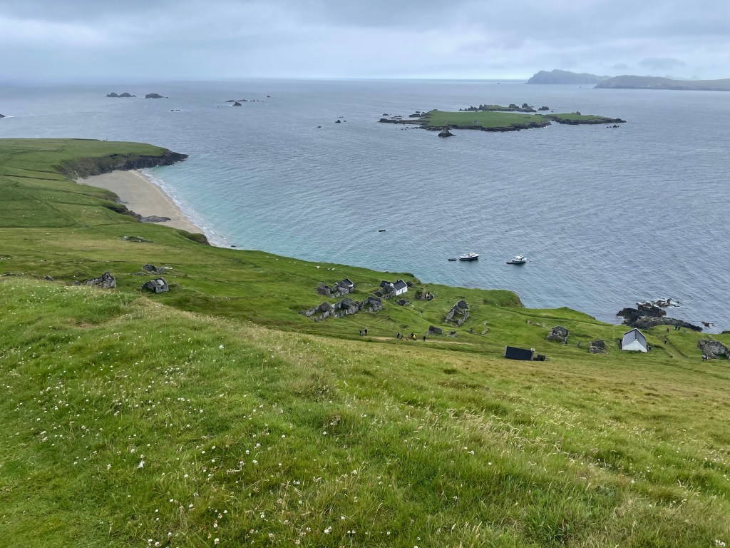
The passage is three km across and the primitive landing on the island can only be reached by smaller boats, so each ferry tows an inflatable Zodiac behind it for disembarking. (Note that Great Blasket is the largest of the six Blasket Islands, and is described by our guidebook as the “least inaccessible”.)
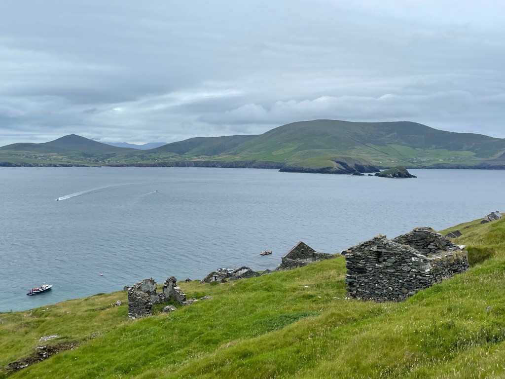
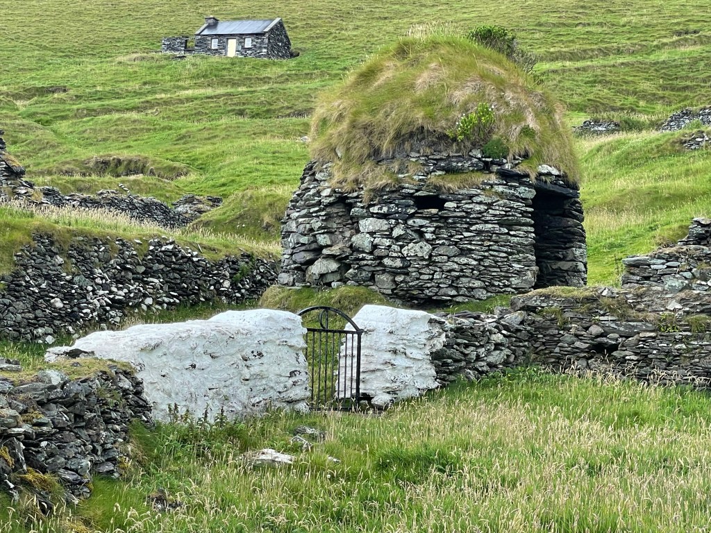
Once landed, one can explore the ruins of the old village. Many of their islanders dismantled and took their roofs with them when they evacuated, but the stone walls are mostly still standing. A few structures have been maintained or restored for the tourist trade – in fact, we learned it is possible to stay overnight on the island by renting one of the remaining intact buildings.

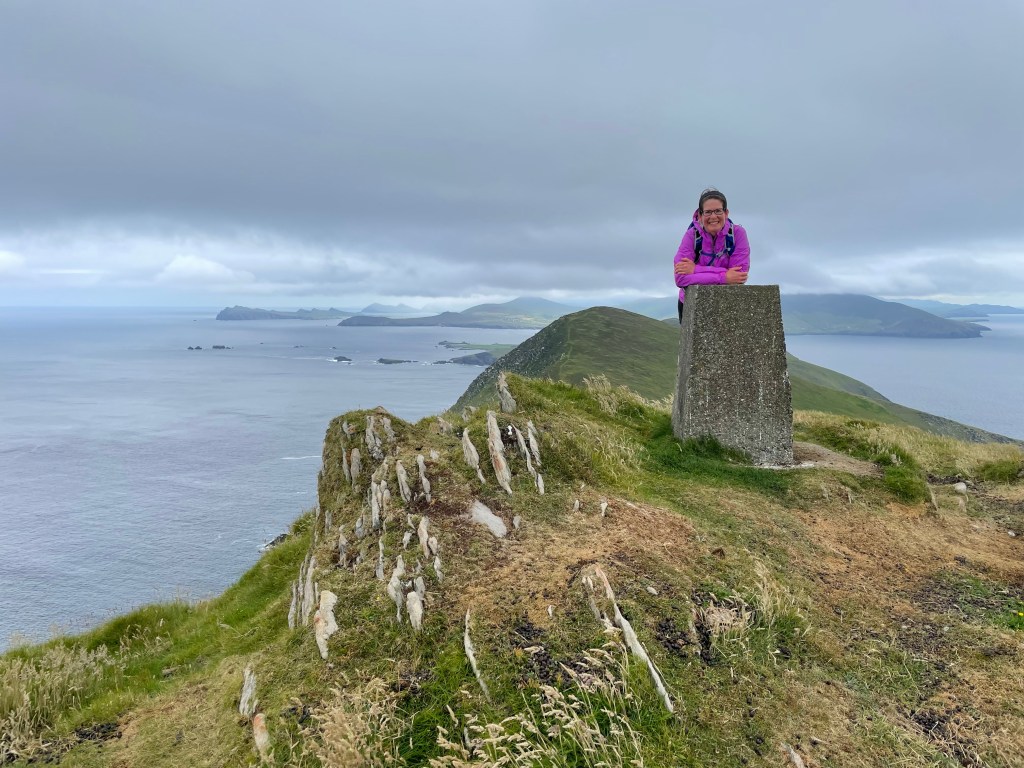
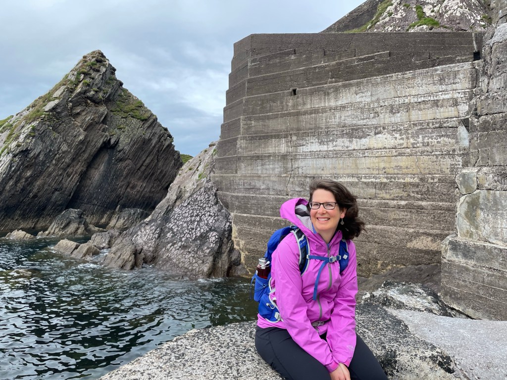
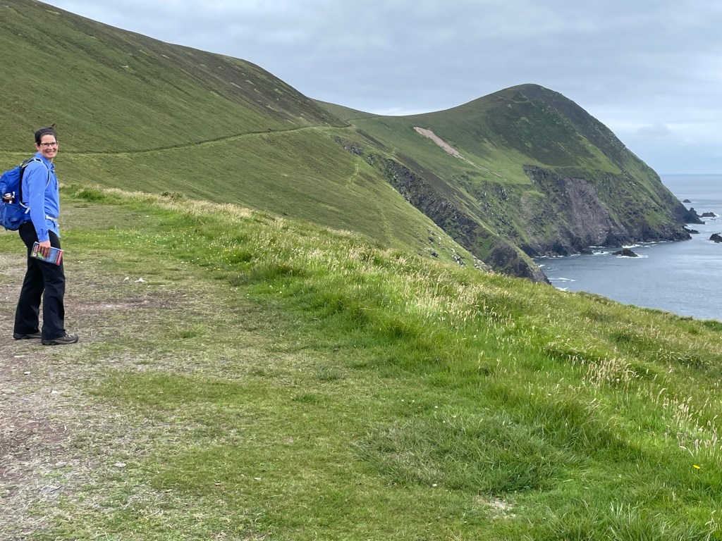
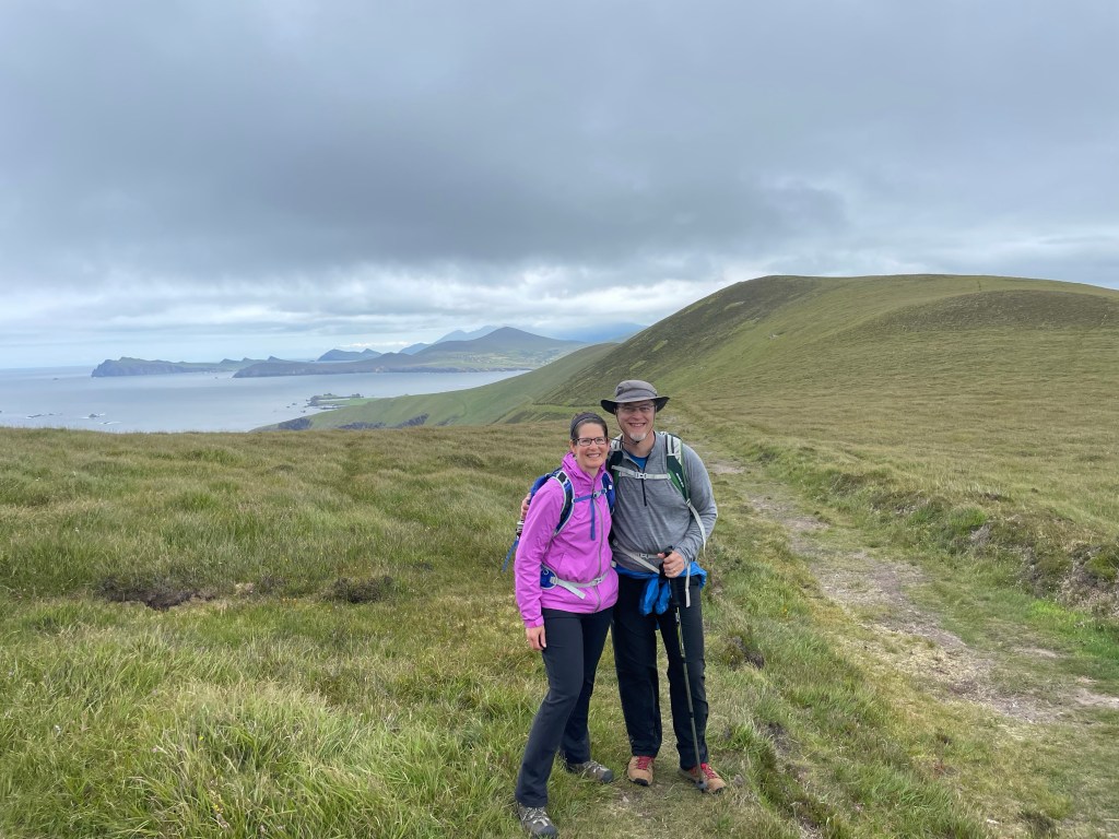
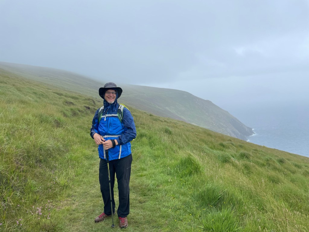
The island itself is a long ridge, about 6 km long and 1 km wide, with the village at the northeast end. We planned a hike that made a loop from the village, with a long stem extending down the spine of the island. The paths are grassy terraces cut laboriously into the slope of the island; they are readily visible and easy to follow. We hiked up to the high point of the island, called An Cro Mor (elev. 292m). The lead picture for day shows Susannah at the summit.
The island residents (180 at peak population) had names for hundreds of places and features, such as rocks, inlets, reefs, etc.; the intersection between the loop and the stem trail was known satirically as the “traffic lights” (in Irish Gaelic, of course).
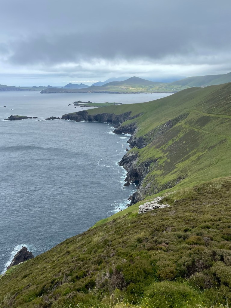
The weather held out for much of the morning but began to turn for the worse on our way back from An Cro Mor. Our loop took us around the windward side of the island where got a small taste of more adverse conditions. We could see fog clouds rolling in from Skellig Michael to the south and a light but driving rain began to soak our jackets. Time to deploy pack covers and hoods!
The end of the hike brought us back to the lee side of the island and the village, where we were just in time for a guided tour courtesy of the Irish government. We heard about the surprising number of island residents who became well-known authors with books describing their daily life and customs. In addition to the residents’ own reminiscences, there are accounts from several visitors who came regularly to study the island lifestyle and learn Gaelic from what was one of the few remaining communities of native speakers.
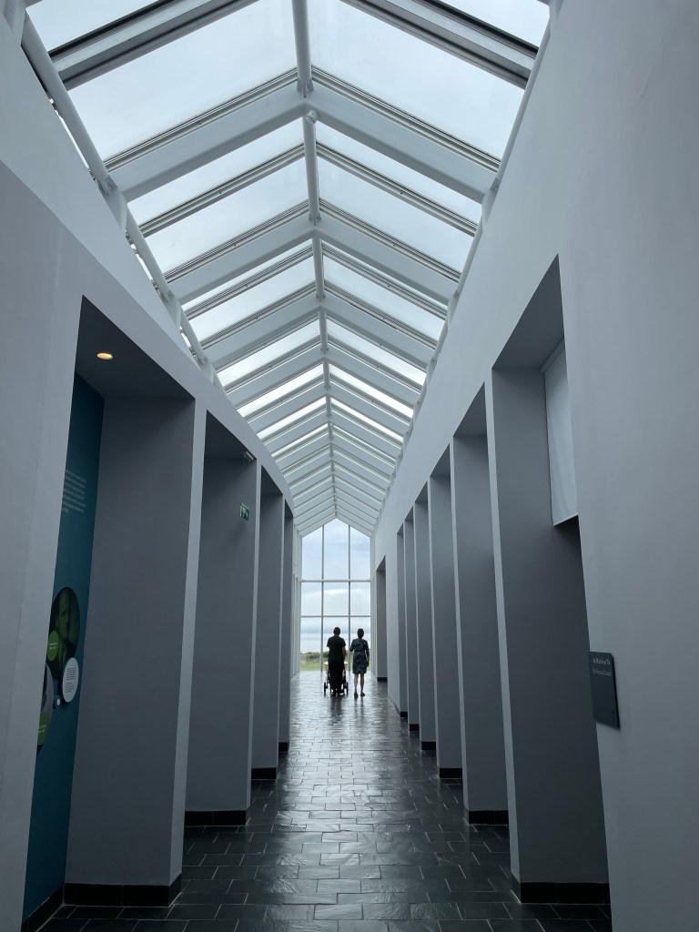
After a rougher homeward crossing than our morning voyage, we reached the mainland and headed straight to the recently reopened interpretive center. Unassuming on the outside, the museum is architecturally striking from within. The building has a central spine (aligned with that of Great Blasket) crossed by galleries, reminiscent of Ireland’s ancient Ogham script. The thoughtful and informative exhibits gave us a much deeper appreciation for the fortitude of the island residents who, despite the harshness of the environment, managed to live fulfilling lives with joyful moments. Conditions only deteriorated badly towards the end as many of the younger residents emigrated to Dublin and the United States. We were surprised and interested to learn that many of them came work mill jobs in Springfield and Holyoke MA, not far from where we live.
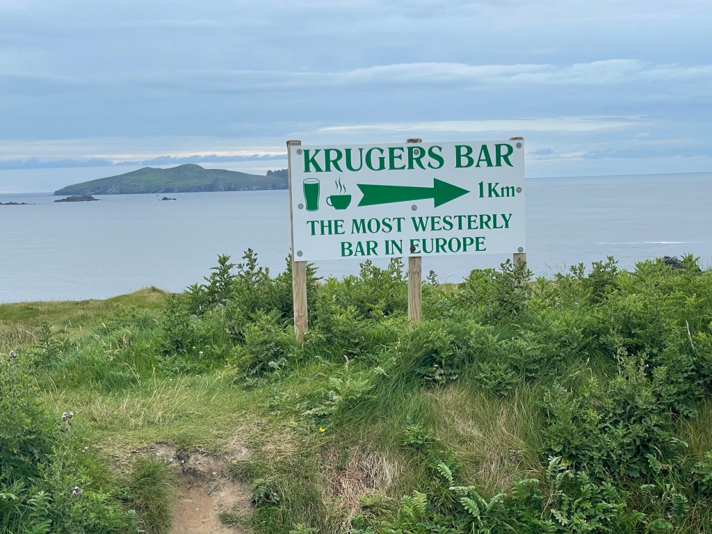
We ended the day with dinner at Kruger’s bar, advertised as the westernmost bar in Europe. (Fans of our blog may recall that we previously visited the northernmost brewery in Europe during our sojourn in Tromso, Norway.)