Aotearoa At Last!!

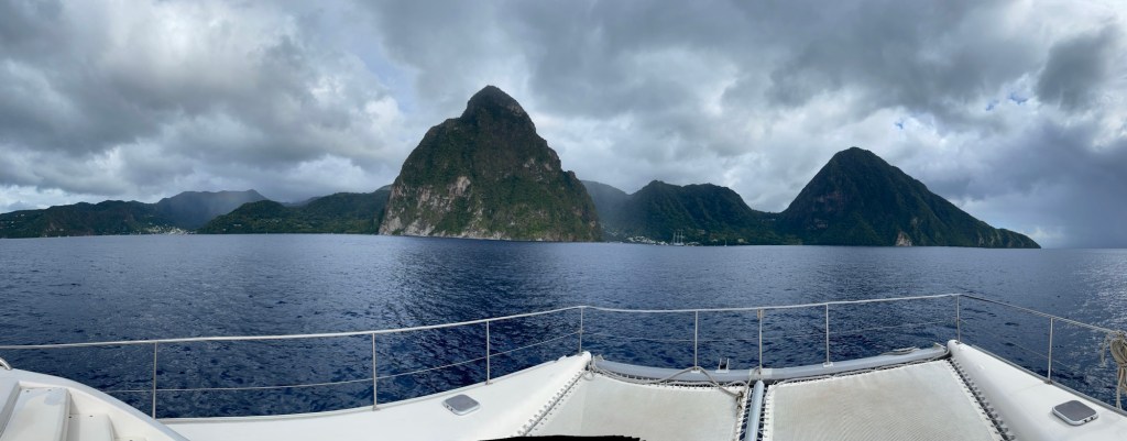
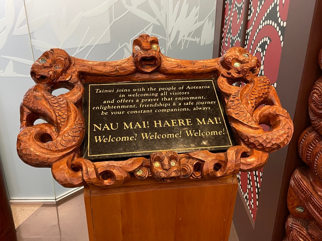
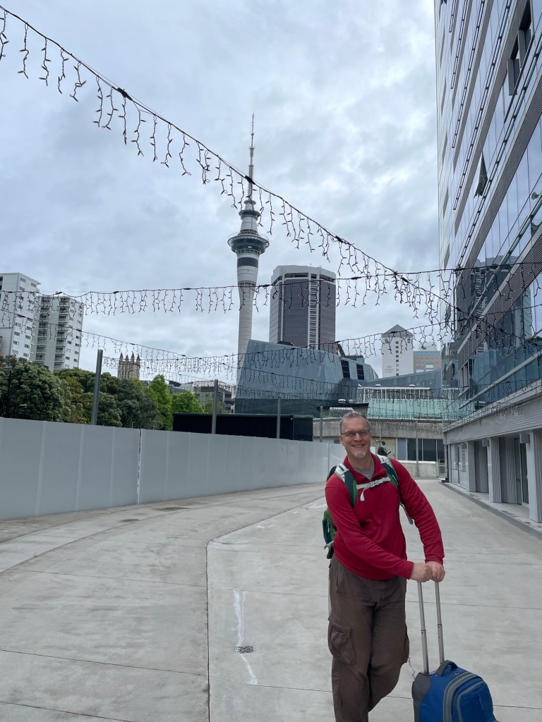
Susannah has been longing to visit New Zealand since before we got married, and with both of us on sabbatical at the same time this year we’re finally making it happen. After a remarkably easy flight across the Pacific, we touched down at Auckland International in cloudy yet balmy weather. The Maori people who lived here long before Europeans arrived call the land Aotearoa, and many other place names here come from their language. At the airport we were greeted with the sign shown above.

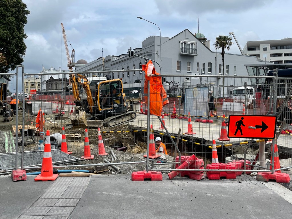
Taking a shuttle bus to the central business district (CBD), we set about finding our hotel and a few other necessities. To be honest, our first impressions of Auckland aren’t the most flattering. The city is in the midst of installing its first underground rail line, and the scale of this massive public works project meant that basically everywhere we wanted to go we encountered blockades and detours. Add this to the fact that the city is fairly hilly and the business district is seemingly constructed mostly out of concrete viaducts, and it seemed something of a challenge to get around at first. Well, maybe we’re exaggerating just a bit. We did eventually manage to find everything we were looking for, and spent the hours until our hotel room was available exploring an eclectic shopping district consisting of numerous small restaurants of every variety, alternating with thrift shops and record stores.

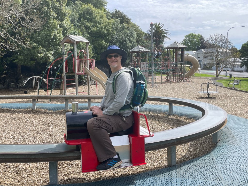
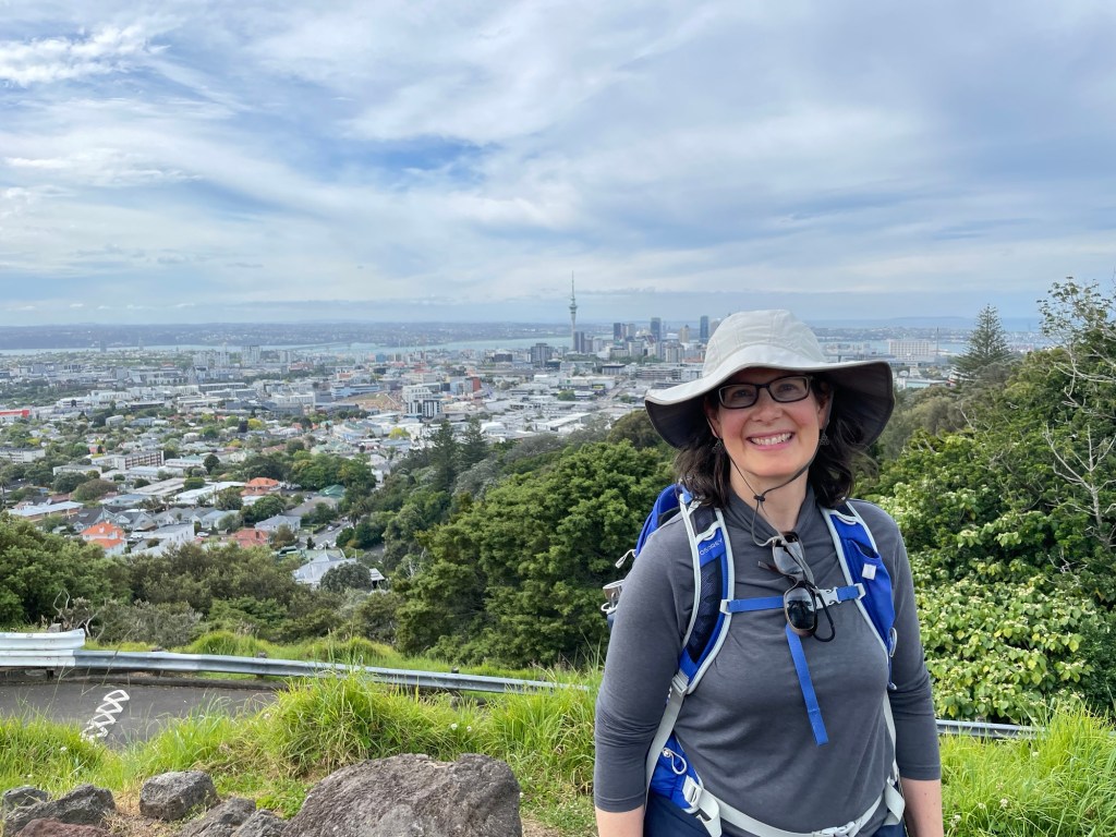
For the afternoon we planned something a little more ambitious and scenic. The park known today as Mt. Eden, or Maungawhau, lies within longish walking distance of our hotel, and we decided to head there. On the way, we passed a charming playground, which included among other toys this push-locomotive that traveled around on a circular metal track.

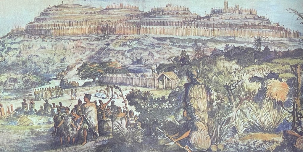
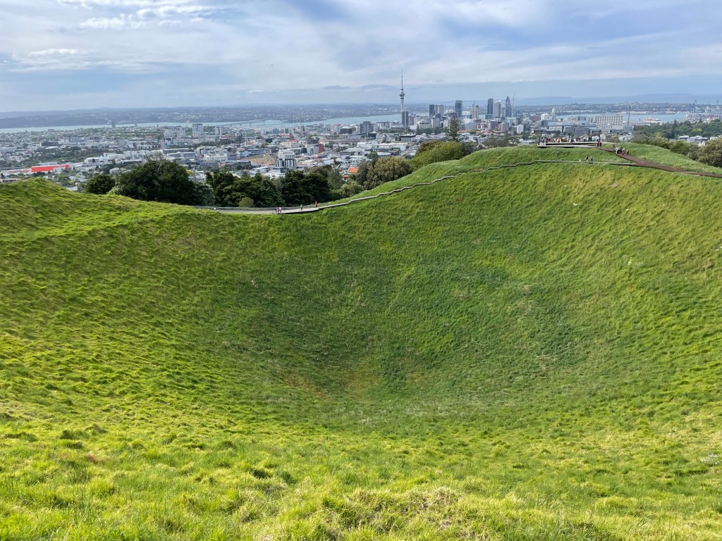
In pre-European times, Maungawhau was the largest Maori settlement in the Auckland area, basically a fortified hilltop village with commanding views of all the surrounding land. Today all remains of the settlement that can be seen are some grass-covered earthworks. The area remains sacred to the Maori, and the grassy bowl at the top of the extinct volcano is reserved for the earth spirit thought to reside there and marked as off-limits to visitors. Boardwalk paths circle its rim, and offer panoramic views, including towards the CBD.

We ended the day by retiring early to our hotel room with a dinner of Malaysian takeaway to rest and recharge for our first full day tomorrow.

Parents of the Caribbean

Arrr, mateys! Today our crew of scurvy dogs took to the sea – as a culmination of our vacation, we enjoyed a half-day boat trip (a literal 3-hour tour, though we didn’t get marooned on any desert islands). Thanks to Mystic Man Tours, we were set up on a luxurious catamaran called Cool Runnings with a very friendly crew. They kept us plied with glasses of their proprietary punch as we cruised smoothly along the coast. Note to self: the easiest way to get from point A to point B in St Lucia is almost always by water! In mere minutes, we covered a distance that would have required countless switchbacks and numerous ups and downs by land.

We sailed as far as Anse Cochon (yes, St Lucia also has a Bay of Pigs, but the namesake animal is no longer to be found in the wild – apparently the St Lucians are too fond of barbecue!) This cove was another noted spot for snorkeling so we spent some time seeing the underwater sights.

On the way back, we sailed farther from the land in the hope of seeing dolphins, turtles, or whales. No luck on that score, but it was still a treat to see from our new vantage point on the water all the landmarks we had visited by land during the previous week.

We wrapped up our day with a final sunset dinner at the Green Fig – we’re going to miss this view! Tomorrow morning, we bid a fond farewell to St Lucia.

Beaches Three

The original plan had been to take a restful morning given yesterday’s hike, but Susannah got to talking with some fellow guests who had walked to local beaches at both Anse Chastenet and Anse Mamin, so of course we had to try it too! Nick and Susannah were both pleased to discover that the potholed road to Anse Chastenet was much easier on foot than by car, albeit also sweatier in the morning heat. As an added bonus, it granted us our first opportunity to capture both Pitons in the same frame (see above).

Anse Chastenet and Anse Mamin are dominated by private resorts, but visitors are still free to stroll the sand. Anse Mamin is the more remote and quieter of the two, and is ornamented with interesting rock formations.

Anse Chastenet
Anse Mamin

Sugar Beach, situated between the two Pitons, was the only local cove that we hadn’t yet explored. It is said to have good snorkeling, so in the afternoon, off we went to check it out, with snorkels and fins and kids in tow. It, too, is dominated by a large and expensive resort. Like the others it allows beach access, but the parking lot provided for visitors is way up the hill and requires a long walk down the busy access road to reach the water. In the end, it was worth it because snorkeling was really good and we found a shady spot by the water to sit with our stuff.

We saw many underwater creatures, including a school of cuttlefish and, thanks to Rowan’s sharp eye, an octopus hiding in a rocky crevice.

The Ultimate Jungle Gym

Summit selfie!

Petit Piton has been calling to us since we first arrived on the island. It’s been in view almost the entire time we’ve been here, watching us like a guardian angel. Today was the day we answered its call.

Climbing Gros Piton was straightforward – you go to the trailhead and there are guides waiting to take you up. For Petit Piton, you have to find a guide and book them in advance. Luckily we had a lead on the best guide on the island thanks to a hand-painted sign Susannah spotted in Fond Gens Libre. Mervin the Mountain Goat was our man. We thought the picture of him hauling people up the mountain was just creative advertising – little did we know…

We met Mervin at 8 AM and headed to the trailhead with him. Petit Piton is 200 feet shorter than its larger sibling, but significantly steeper and the trails are similar lengths because they start at different elevations. For Gros Piton, we all had to sign full-page waivers before climbing. Ironically, this time we just walked past the sign below – no papers involved.

We call this post “The Ultimate Jungle Gym” because that’s what it was in a literal sense. We were under vegetation nearly the entire way and the jungle roots and branches were as much a part of the trail structure as the dirt and stones, forming handholds, footholds, and even natural ladders at times. In spots where no natural gripping points existed, the trail guides had attached ropes to serve instead – these worked equally well for going either up or down. This was a four-limbed adventure indeed, requiring use of both feet and hands nearly the whole time.

Towards the summit, we encountered several stretches of near-vertical climbing. Mervin’s assistance was especially useful here as he coached us on the best hand and foot placement, and even a few times helped pull Susannah up the last couple of feet. We all agreed that this was the toughest day hike we’ve ever done. (We encountered only two other groups during our trip, both still heading up as we came down. We heard of one other group who turned back at the first of the difficult rope climbs, and Mervin expressed his doubts whether the second group we passed would make it either.)

Through the “Rabbit Hole”

The summit was everything we had hoped and more. 360 degree panoramic views, plenty of room to sit and rest, and a bright clear day. Even Mount Gimie (St Lucia’s centrally-located highest peak), normally wrapped in clouds, lifted its veil and said hello. From here, we got our best view yet of Gros Piton, and we could see almost every place we had previously visited, from Castries in the north to Cape Moule-a-Chique in the south. We could even see our hotel building in Soufrière far below, and we waved to Rowan who was holding the fort there while pursuing their art. Too bad we didn’t bring binoculars!

The summit of Mount Gimie in view
Soufrière, with Castries in the distance
Southern tip of St Lucia

Going up was hard but incredibly rewarding. Going down was harder, but not really a choice. Like a ladder, it was easier and safer much of the time to descend the trail backwards, though it made for slow going. In the end, we made it down with little more than a few bumps and scratches.

Conveniently, a restaurant we had been hoping to try was right on our way home. Mervin couldn’t join us for lunch (because he had to head to his afternoon job driving the school bus), so we enjoyed restaurateur Martha’s special sauce on our own.

Susannah had somehow foreseen that we might be a bit sore after our morning “stroll”, and had arranged a family treat for us all in the afternoon. Here is the lovely view from the Green Fig’s on-site spa, where we all got full-body massages.

And for good measure, one more photo of the catch of the day!

Journey to the South

Although we arrived at the airport at the southern tip of St Lucia, we didn’t have time to explore it before heading to our lodging in Soufrière. Today we reversed that journey, heading south along the coast to see the sights we missed.

One such stop was the Balenbouche Estate, which turned out to be far more than we had expected. The property was originally a 2000-acre sugar plantation. Like others of its kind, it relied on a brutal system of enslavement when first established. After emancipation, it ran for a time using indentured workers but eventually stopped sugar production, and the mill fell into ruin.

As we arrived, we met Uta, the current owner, who was giving a personal tour of the house and remaining 75 acres of grounds. She herself has lived there for 40 years, and graciously showed us around the ruins of the sugar mill, telling stories of its history and how she has worked to breathe new life into the property. When her family bought the 180-year-old house, it was empty and run-down. They have worked to restore it and furnish it with period pieces. They have also erected and renovated buildings on the grounds using reclaimed structures and materials from elsewhere on the island. She now rents out some of these cottages to those interested in staying at a quiet retreat.

The old sugar mill has the robust feel of Victorian heavy industry yet now sits silently rusting in an overgrown jungle. The machinery used to crush and process the sugar cane is massive, with a 20-foot diameter water wheel that once powered the works. The water no longer flows through the feeder canal, the wooden mill race has rotted away, and a strangler fig is consuming what remains. Standing amidst the ruins felt like we had stepped into an Indiana Jones movie set.

The process of refining sugar cane involved boiling juice in large metal vats of progressively smaller size as the concentration increased. You can still see these around the property (and elsewhere in St Lucia) often repurposed as planters or garden features.

At the end of the tour, we took a stroll through the grounds as far as one of their small private beaches. The tide was high so we didn’t explore beyond the entrance to the cove.

Continuing south to the furthest tip of the island, we climbed the headland at Cape Moule-a-Chique and explored around its now-defunct lighthouse. Interestingly, all the tourist photos show the lighthouse as you might expect it to look, but we found the reality to be somewhat different with the light gone and its iron dome resting on the grass below. Victim of corrosion and metal fatigue? We don’t know. That didn’t stop us from enjoying the sweeping views to the north, including the Maria Islands nature reserve. Rowan has especially hoped to visit these islands because they house the nearly extinct St Lucian racer (snake) and whiptail lizard that live nowhere else, but alas, the reserve is no longer open to the public (presumably for the animals’ protection).

Before heading back to Soufrière, we took a short detour to see the Anse des Sables beach on the Atlantic coast. The trade winds blow steadily onto the eastern shore, making for heavier surf and a fantastic location for kite surfing. We enjoyed watching a very skilled rider zipping back and forth and catching big air off some of the waves.

We closed out the day with a tasting-menu dinner at a highly recommended restaurant. The presentation and atmosphere were lovely, but unfortunately the food was not completely to our taste. Can’t win ‘em all…

Nature Walks

St Lucia boasts a wide variety of plant life, including many species native to other places now making their home here. Much of this variety was on display at the Diamond Botanical Gardens, especially the subset with particularly showy flowers or foliage. The park is set on the grounds of a former estate and consists of a pleasant walk past many colorful plantings to the base of the namesake Diamond Falls. We share below just a few examples of the many blooms that line the path.

The stream that flows over the falls also springs from a source near the volcanic zone, and the minerals it carries can be seen coating the cliff behind the waterfall. Early colonists identified the waters as comparable to those at Europe’s healing spas, and accordingly built a set of baths around them. A few have been restored and we took the opportunity for another healing plunge – Susannah even joined in since there was no mud involved.

For lunch, we had long had our eye on a particular establishment not far from Soufrière. St Lucia is renowned for its chocolate cultivation, and the Rabot restaurant specializes in cuisine featuring this ingredient in many forms. As an appetizer, we were served a cocoa-balsamic dipping sauce, chocolate-infused butter, and bread sticks seeded with cacao nibs. In addition to numerous cacao-inspired entrees, they also offered shots of flavored iced chocolate, and a plethora of scrumptious chocolate desserts, of which we were happy to partake!

Not far from the restaurant lies Tet Paul Nature Trail, run by the community of Chateau Belaire. Strategically located between the two Pitons, the trail makes its way up a hillside (the last bit of which is called the Stairway to Heaven) before reaching a promontory with panoramic views. Besides the two Pitons we also caught our first glimpse of the mountains of St Vincent to the southwest.

We finally got a photo of Gros Piton!
Petit Piton and Sugar Bay

One of St Lucia’s usually brief rainstorms had set in as we were finishing our lunch, and the skies were fully overcast when we arrived at the trailhead. Our guide Gregoryanna suggested we wait to start our hike until the rain had eased up. But as you can see, by the time we reached the top, blue sky again prevailed and as a bonus, a beautiful rainbow awaited us.

Scuba and Sulfur in Soufrière

View of Soufrière from the south

Today we had planned all our activities within the Soufrière region, which we learned is a volcanic caldera (more on this later). After our early start the day before, we had an unscheduled morning with a late breakfast on the terrace.

At noon, Rowan and Nick had an appointment on the Soufrière beach. Rowan has always been interested in scuba diving and this was their chance to try it out. Scuba instructor Chester was efficient and professional, and knew just how to set us at ease. After a short lesson on safety, equipment, and critical hand signals, he had us in the water – literally immersion training! Of course, we didn’t go very deep (maybe 30 feet or so), but we cruised underwater along the reef for 45 minutes and saw lots of interesting aquatic life. There was a long-legged crab hiding under a rock, a hard-to-spot octopus prying open a shell, and a sea eel that Rowan got to hold after Chester picked it up (we wouldn’t have dared on our own). No pictures from the dive itself but we have them in our mind’s eye.

In other animal adventures, there are tiny lizards all over the rocks and walls around our hotel. Rowan identified them as the St Lucian anole, and actually caught one of them today. It skittered around our arms and shoulders before jumping off again, none the worse for wear.

After lunch, some of us went on another expedition to an attraction billed as a “drive-in volcano”. The site of St Lucia’s most recent eruption (dating to 1766), the area now appears as a barren landscape punctuated by bubbling mud pits and scented with wafting sulfurous fumes.

Although this particular spot is the most geologically active area, the entire town of Soufrière sits within the caldera – you can see the walls in the leading photo for this post. A portion also extends into the sea and our guide said that during particularly high tides, one of the mud pools develops geyser-like activity.

A small stream flows through the volcanic area, picking up minerals, sediment, and heat as it goes. A bit downstream, people have built a series of rock pools to capture the flow and allow bathing. Many consider the volcanic mud to offer health benefits and even anti-aging properties. We’re not sure how seriously to take this, but Nick and Ben couldn’t pass up the chance to lather themselves with hot mud just in case. The pool itself is filled with a sort of slurry that can be collected in the buckets provided. Susannah didn’t get wet, but had a great time taking photos as the action unfolded. The mud bathing seems popular with everyone – local residents outnumbered the tourists when we were there.

Twisty Mountain Paths

View from the Gros Piton summit

The Pitons are not just a beautiful backdrop – they’re also mountains that can be climbed. By all accounts, the taller Gros Piton is actually the easier of the two, so that’s where we decided to start. First, of course, we had to get there. We could have sworn that Google was trying to send us along a footpath behind an elementary school, which didn’t seem wise and, more to the point, was blocked by a parked car. So we recalibrated and found a way that involved a circuitous route that was about three times as long via many other small and twisty roads. On the plus side, we got to drive through the village of Choiseul, the hometown of one of Susannah’s former students. And we still arrived at the trailhead early enough to avoid most of the day’s heat.

All visitors to Gros Piton are assigned a guide for their hike. Ours was Kevin, and like nearly all of his cohort, he is a resident of the local community known as Fond Gens Libre (Valley of the Free People). We calculated that in his nine years on the job, Kevin has climbed the peak approximately 3000 times (not a typo). At four hours per climb, that qualifies him as an expert for sure! He began by showing us the route on a large papier-mache model, which we share with you below because somehow we never got a good photo of the real thing (darn those twisty roads). The model gives sense of the steepness if not the scale – the life size version is a bit bigger at 2600 feet.

The trail to the top was first laid out more than 200 years ago and used by valley residents for defensive purposes. Today it is well-maintained with rock paving and wooden handrails in many locations, yet still a tough climb especially in the heat (we were each required to carry at least 1.5L of water to stay sufficiently hydrated).

Most of the route is forested but there were several stopping points with views to sea. If the day had been clearer, we might have seen St Vincent, but the horizon was quite hazy.

Halfway up we had this view of Petit Piton from the south (the opposite of our perspective in Soufrière).

Views from the top were to the inland side only but still beautiful. The summit is covered with a rocky pile of boulders, which we learned was inhabited by a colony of mongooses (mongeese?). We heard them hissing at each other in their tunnels. While we were having a snack in the shade, one of the other guides lured them out with some cracker crumbs.

On our way up, we had noted a trail side stand offering homemade tropical fruit flavored ice cream among other enticements – boy were we glad to partake when we came down! Unfortunately they were out of the sour sop, but the banana, mango, and coconut were all excellent! Also on offer (but not purchased by us) were an assortment of t-shirts with slogans for everyone, including “I made it halfway up Gros Piton” and “Gros Piton kicked my ass”.

We asked Kevin to point us to the right road for the way home and discovered that we had missed the correct turn in the morning by less than 50m. The picture below shows a ford we passed through on our way back – we are really appreciating the high clearance of our Jimny.

For the afternoon, Rowan had been eagerly waiting for another opportunity to snorkel so we headed to Anse Chastenet beach. The route there included another twisty and rough road, which we crept along as slowly as possible on the trip out. (Interestingly, on the way home after being passed by a taxi bus going twice our speed, we discovered that the ride is actually smoother when you go faster.)

Anse Chastenet is a marine reserve with an area roped off for snorkeling and diving. The land around the cove is the private property of a pricy resort but the beach is public up to the high tide line. This area had many more fish than we had seen on our earlier snorkeling foray but the coral was similar. What really makes the snorkeling special here is the clarity of the water – you can see fine details even 30m down.

Back at the Green Fig, we enjoyed another sunset dinner at their terrace restaurant while listening to some live music.

Travels to the North

“Cricket” – our Suzuki Jimny

The island of St Lucia is just 27 miles from north to south. Our hotel is about one-third of the way up the west coast from the airport at the southern tip. Today our plan was to explore the northern regions as far as Pigeon Island. The distance is only about 18 miles as the crow flies, or twice that on the winding roads. That actually takes about an hour and a half under ideal conditions, so of course we made the journey in closer to 2.5 hours each way. Left-side driving, narrow lanes with side ditches, tight hairpin turns, and potholes – ‘nuff said! Nick gets a shout-out for his steadfast driving, as does “Cricket”, our wheels for the week.

The main road along the west side of the island doesn’t hug the coastline, but goes up and down between peaks and valleys, leading to some very scenic views as one descends into a town, such as the hamlet of Canaries pictured here.

After our long drive (and lots of St Lucia tourist traffic in Castries and Gros Islet), we finally arrived at Pigeon Island. It’s actually no longer an island since they built a causeway connecting it to the mainland. But it is a national landmark, and houses the historic Fort Rodney dating to the Revolutionary war era. While the British were busy dealing with pesky American colonists, the French and Spanish saw a golden opportunity to capture Jamaica, and with it, control of the West Indies. They built a fleet on the island of Martinique. Meanwhile, Admiral Rodney in command at Pigeon Island just to the south was tasked with keeping an eye on them. In 1782, the French sailed forth, Rodney gave chase, a fight ensued, and the British were victorious. That was perhaps the best moment for the Fort, which changed hands between the French and the British a total of 14 times over the years. Today, you can see the ruins of the fortifications along with some hefty cannons still in place along the batteries,

The best part of the park today is the views in all directions from the high point, Signal Peak.

If you squint, you might be able to make out the mountains of Martinique on the horizon

Friday night is supposedly Fish Fry night in Anse La Raye, one of the towns on our journey back south, but it turns out the season doesn’t start until next week. On a tip from a local, we had a delicious dinner at the Valelse Sports Bar and Soup Kitchen instead. Delicious food and friendly service made it another highlight of the day.

Back at the hotel, we found karaoke night well underway at the poolside bar, so we all took a turn at the mic (with Ben killing it!), and had a dip in the pool. A relaxing way to end a long day.

Soaking up Soufrière

Walking into town this morning, we met a local entrepreneur named Marvin whose slogan is “Maximum Chill“. We borrowed a bit of that vibe today as we slowly took our bearings and got to know our surroundings. The morning was a stroll through the streets of Soufrière in search of the local supermarket. This turned out to be on the opposite side of town, which took us on a route past a number of cheerfully decorated vending stands not yet open for business.

You may noticed the steepness of the seacoast here. In fact, they continue plunging downwards under the water as well, except that they are covered with coral and teeming with colorful fish. This means that even the unassuming cove at the end of the Soufrière town beach offers excellent snorkeling, and our main plan for the afternoon was to test out all the new snorkeling gear we brought along. Susannah was especially eager (?) to use her full-face snorkeling mask, given her intense love (ha!) of water sports. And guess what? It worked!!

We have some amazing underwater shots courtesy of Rowan, who spent several blissful hours in the water and put their new GoPro camera to good use.

We closed out the daylight with some shopping in town and finally took up Marvin’s offer of a maximum chill dinner at his new restaurant.