Christchurch by Foot

The Peace Bell, made from coins donated after the bombings of Hiroshima and Nagasaki. Gifted to cities and countries that have worked for world peace, there are 21 in existence. This one is in the Botanic Garden of Christchurch

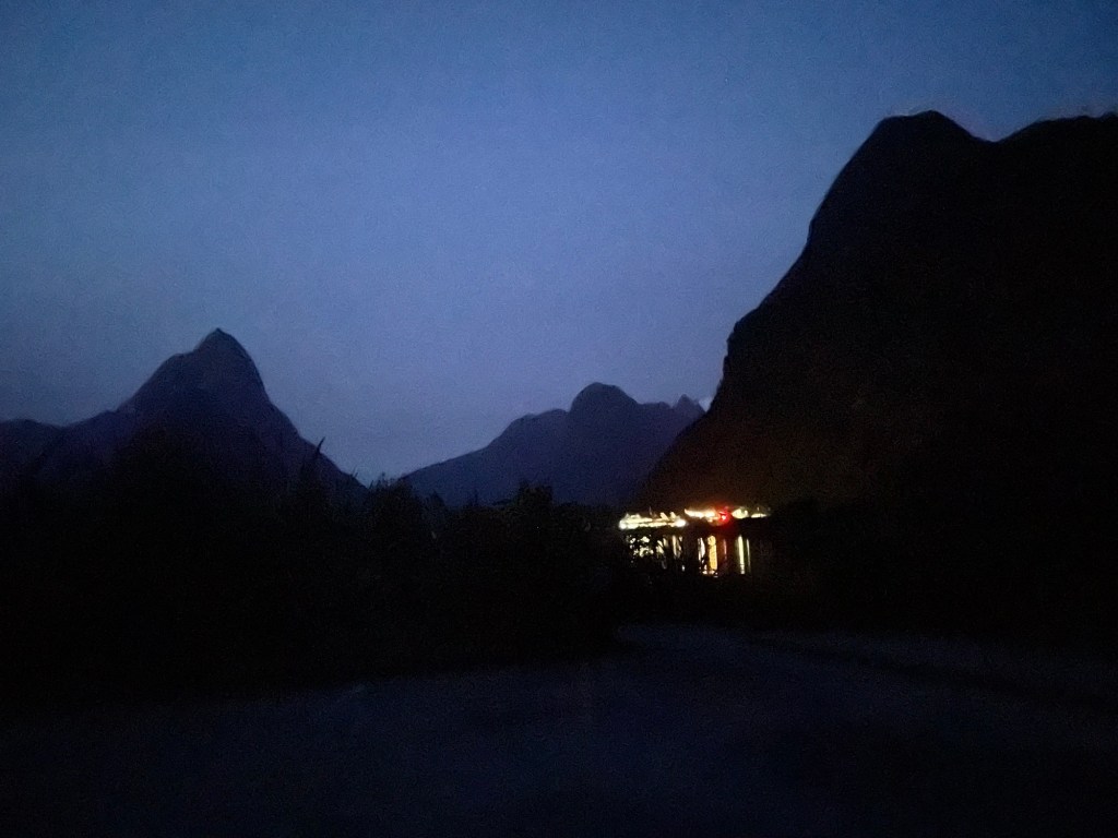
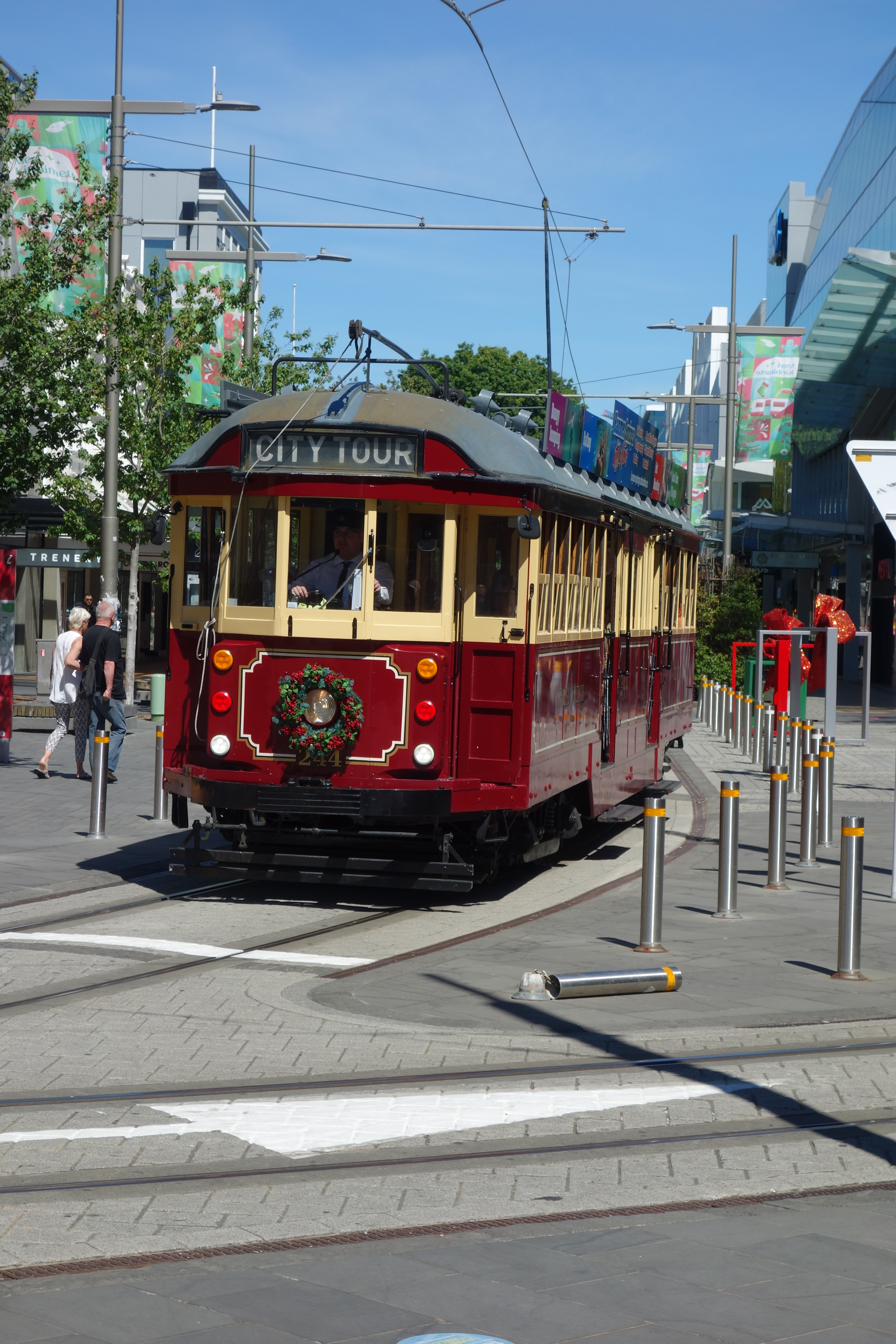
Today Susannah was busy all day attending her conference, so Nick set out to explore the city on foot. First on the agenda was a two-hour walking tour around the CBD. This area has been utterly transformed since a series of severe earthquakes hit the city in 2010-2011. It was the second of the four quakes on Feb. 11, 2011 that did the most damage. Although technically not as strong as the 2010 temblor, the epicenter strick much closer to the city center and liquefied much of the ground (a former swamp before being drained by settlers). Every building suffered some damage, and three quarters ultimately had to be pulled down. The iconic Anglican cathedral would have been cheaper to bulldoze and replace, but had such popular sentimental support that authorities decided to repair it. Unfortunately, the insurance payment was insufficient to complete the job, so it now stands only partly finished, waiting for more funding. Although it doesn’t look too bad in this photograph, what you cannot tell is that the gable end with the beautiful rose window facing the camera is just plywood with a poster glued on top.

Christchurch Cathedral, still under repair

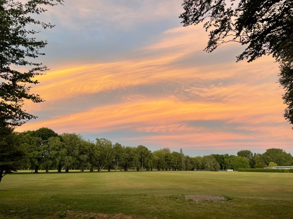
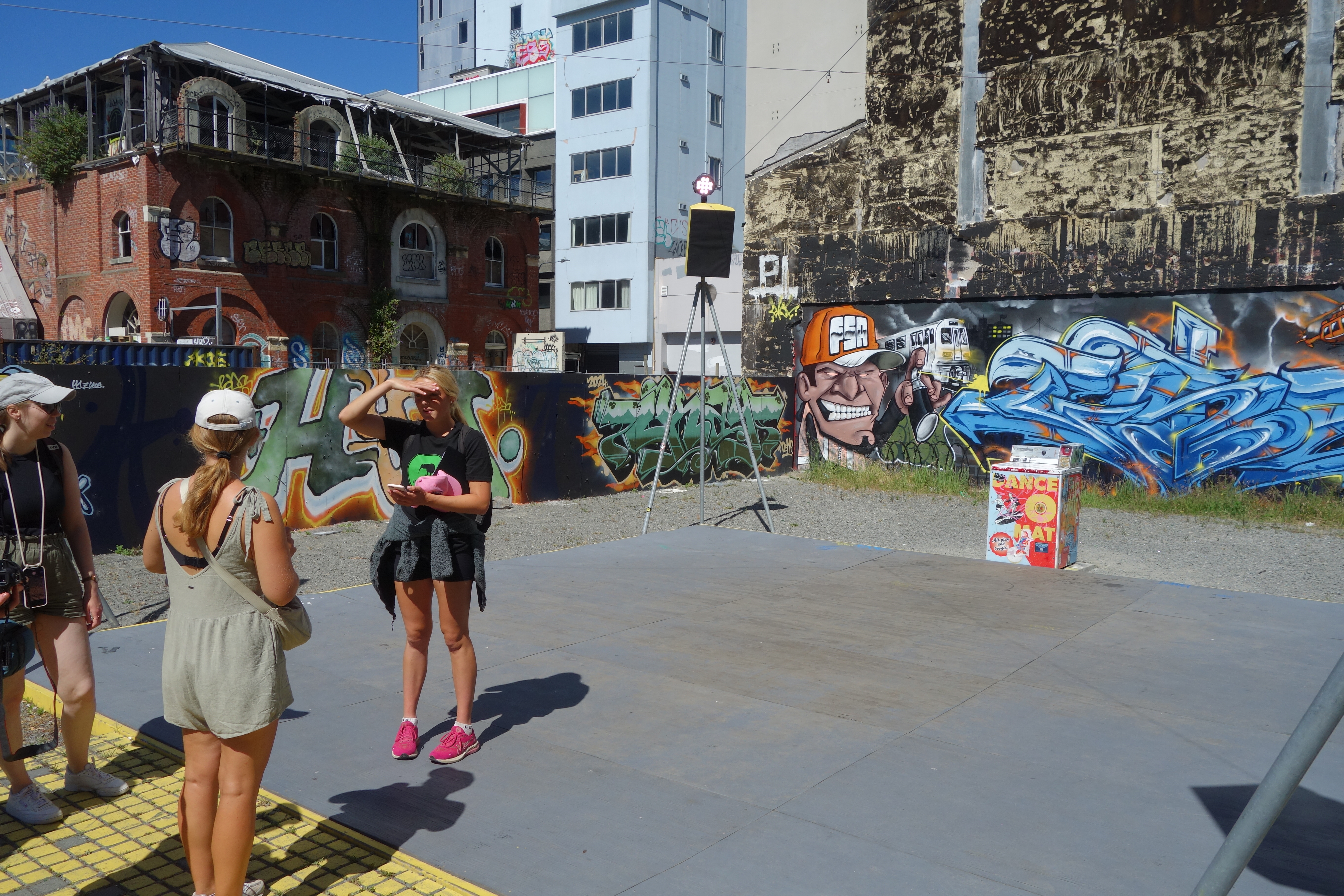
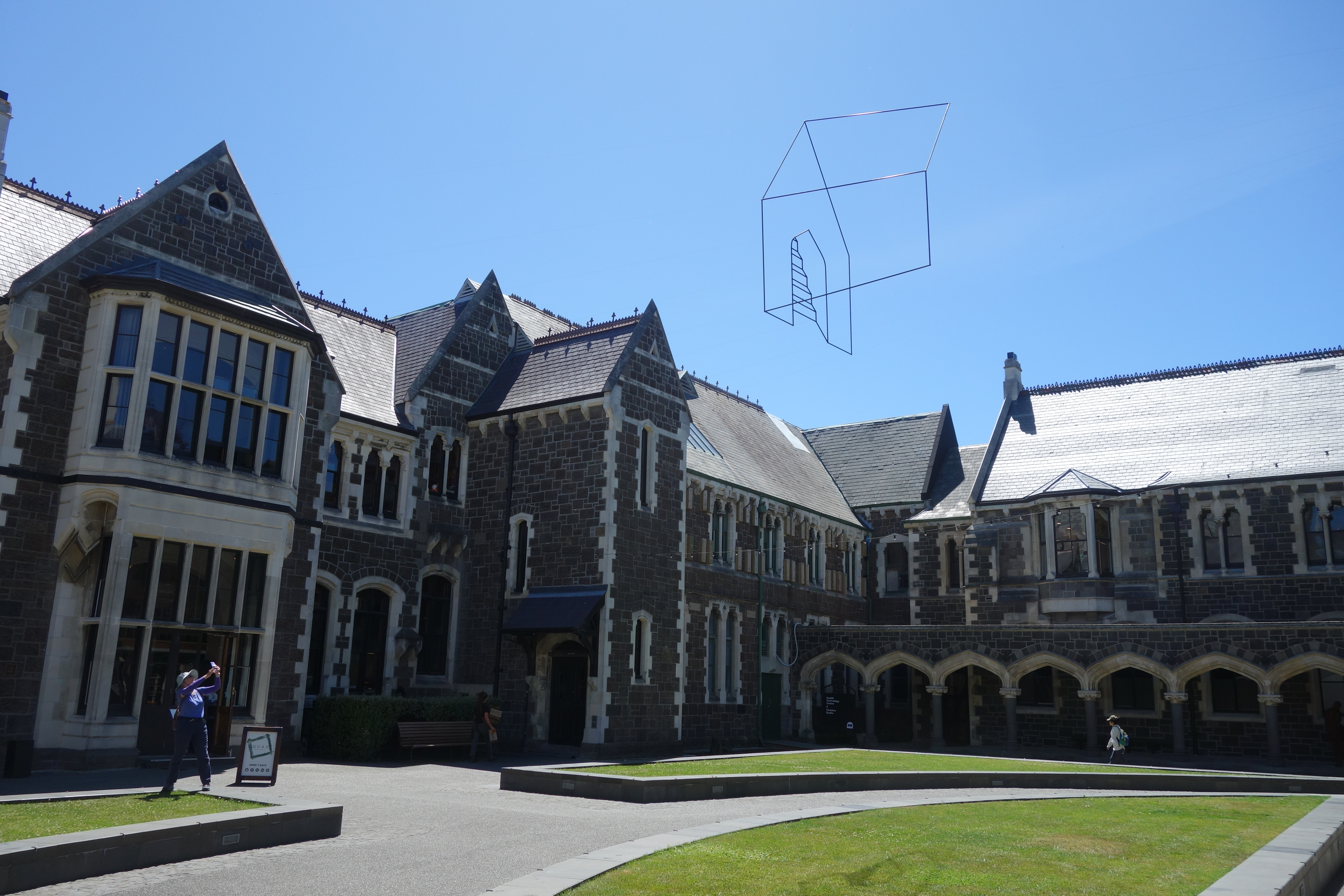
While much of the city has been built anew, they didn’t blindly replicate the previous design. The city is being redone with much more open space, which will eventually become parks and greenbelt. Smaller lots that are still awaiting redevelopment have been temporarily repurposed by the “gap filler” initiative into impromptu play areas. Many of the walls in the city have been covered with murals and other decorations, in an effort to keep up the spirits of the population as they faced the difficulties of rebuilding.

The “gap filler” movement has turned this empty lot into an open air dance floor. Passersby can connect their smartphone to the control unit, and have their music play through the speakers.
The CBD is encircled by trolley tracks, which operate entirely for tourists. They offer another way to see the city, if one doesn’t like walking tours.
The Avon river (Ōtakaro) flows past a memorial to the earthquake victims.
Punting on the River Avon
The Arts Center, a Gothic revival structure that originally housed Canterbury College (now the University of Canterbury, and relocated to the suburb of Ilam). The buildings were heavily damaged during the earthquake but have been mostly restored. (Can you spot the artwork in the sky?)
Some buildings still show damage from the earthquake: they are of too much historical or architectural importance to demolish, yet there is not yet enough funding for restoration

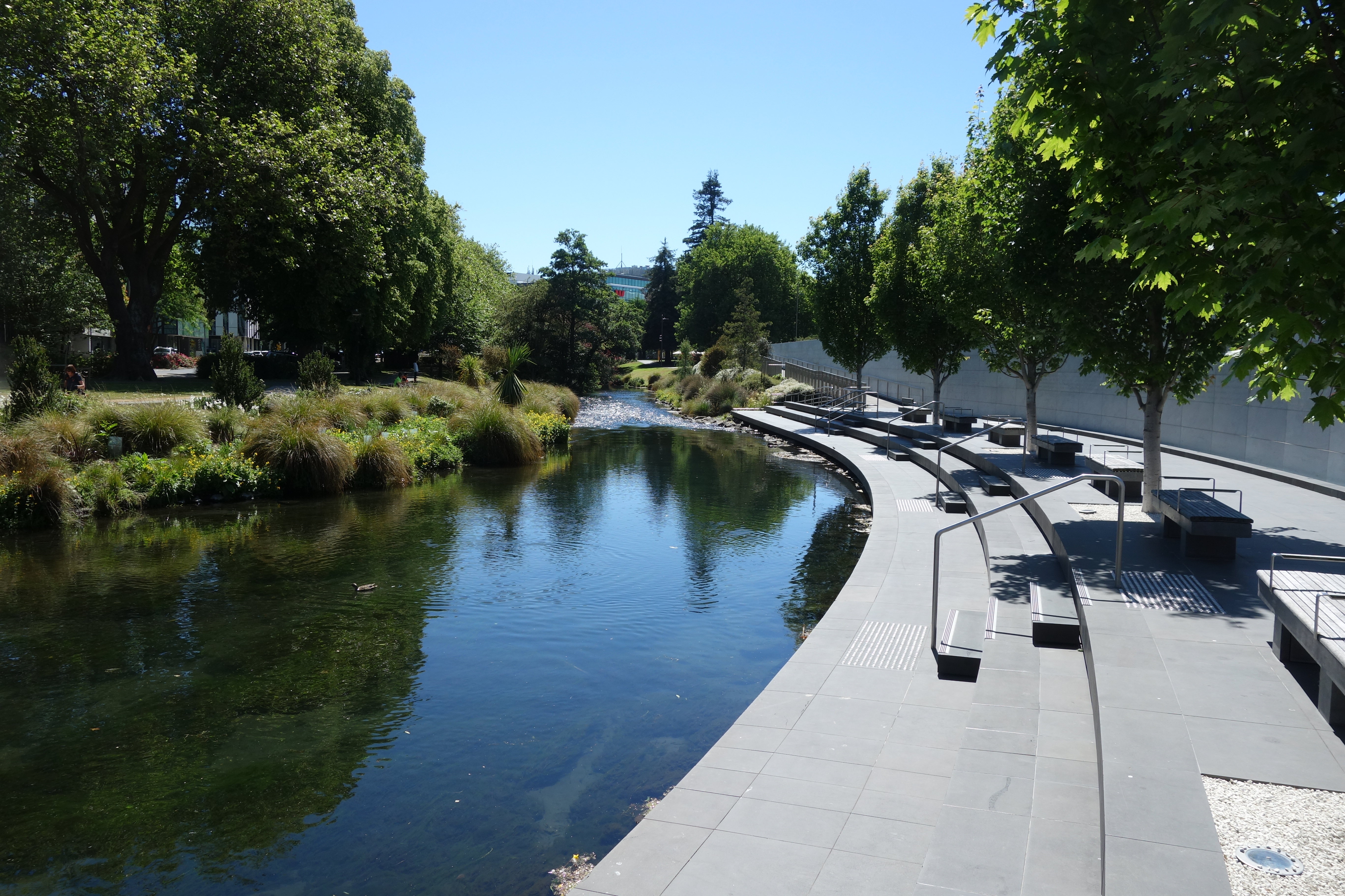
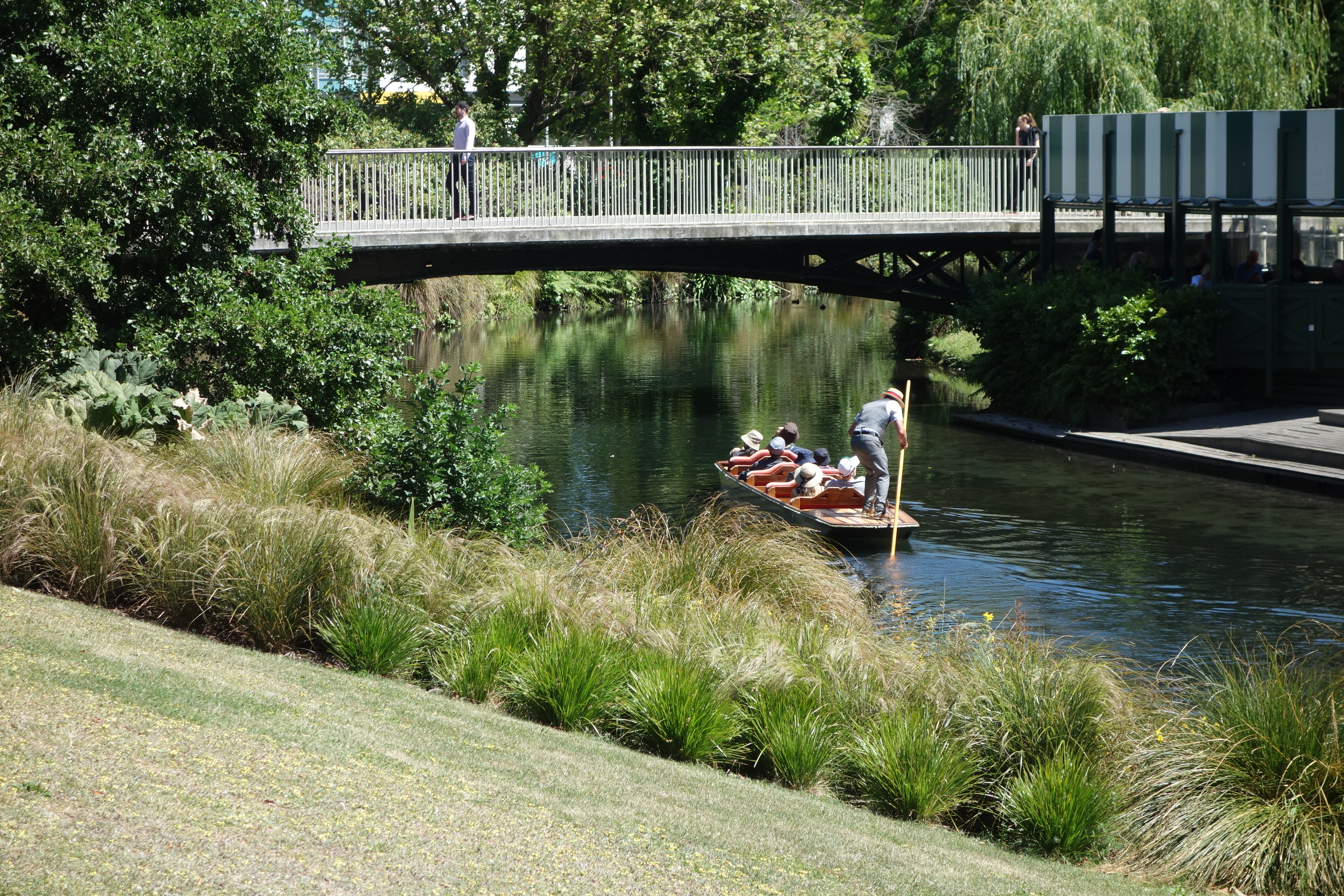
Deciding that one tour wasn’t enough, Nick joined a second in the afternoon, this time of the Botanic Garden. As it turned out, he was the only person who showed up, so ended up getting a personalized journey past all the guide’s favorite sights. She was knowledgeable on a variety of subjects and enthusiastically pointed out all sorts of unusual curiosities.

A native species of pigeon. This one was quite bold, and didn’t mind us getting close.
The flowers on this plant are a most unusual shade of blue.

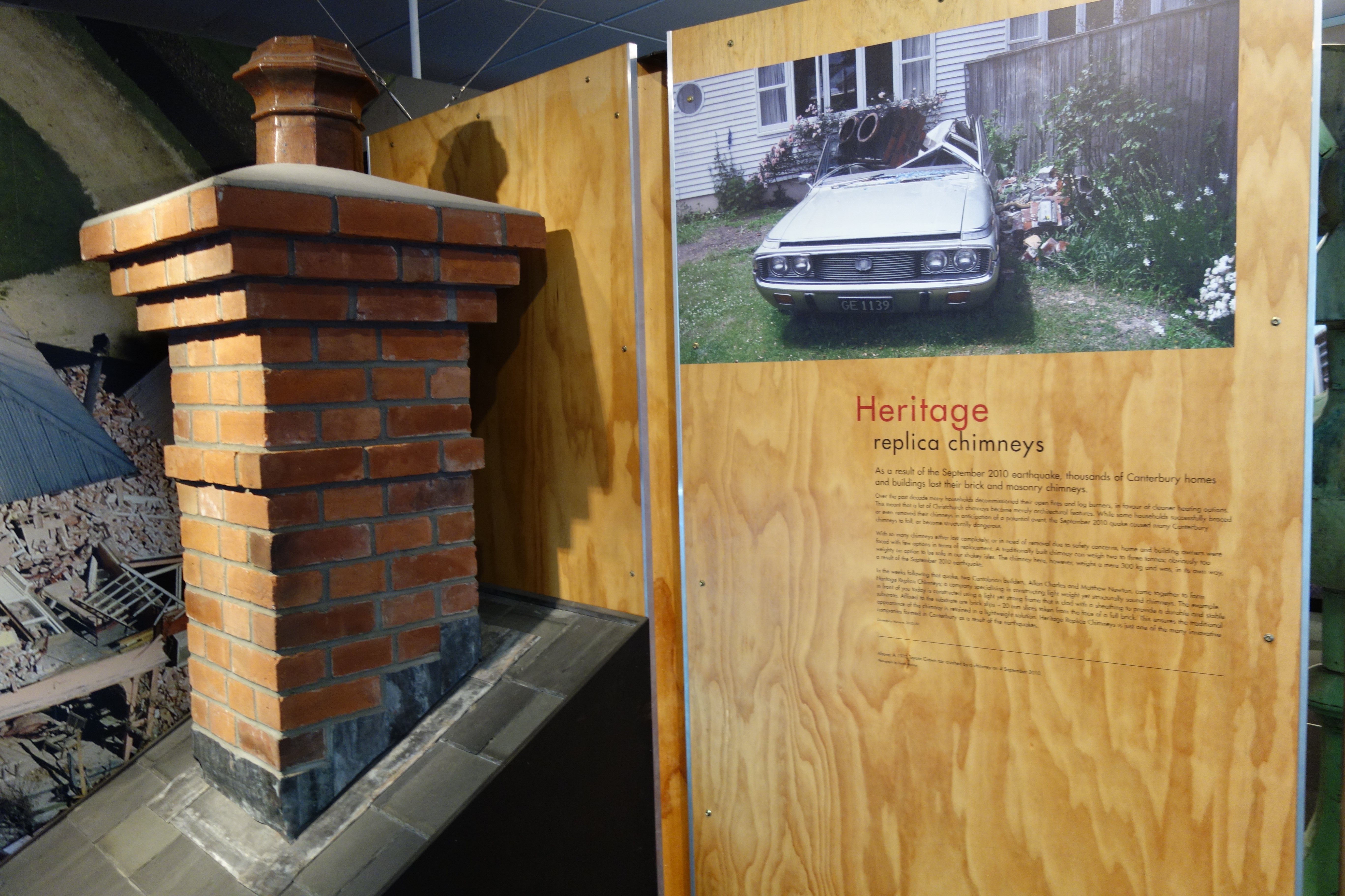
Nick’s last visit of the day was to Quake City, a museum that presents the story of the earthquakes and their aftermath. Besides audio and visual documentation of the events, there were also fascinating pieces of trivia. Did you know that it is possible to get a nonfunctional replica chimney installed on your house? Chimneys can weigh several tons, and many were knocked down by the shaking. Rather than rebuild as before, perching another giant boulder way up on the roof, many homeowners who wanted to restore the look of their homes in a safer manner opted for these replicas, which use brick veneer and other techniques to mimic the older look in a unit that weighs under 500 pounds. In general, all the reconstruction in the city must now meet stringent building codes. Most of the commercial buildings are on base isolation dampers, and scientists and engineers have been exploring ways to prevent soil liquefaction in the future.

Safer than the real thing

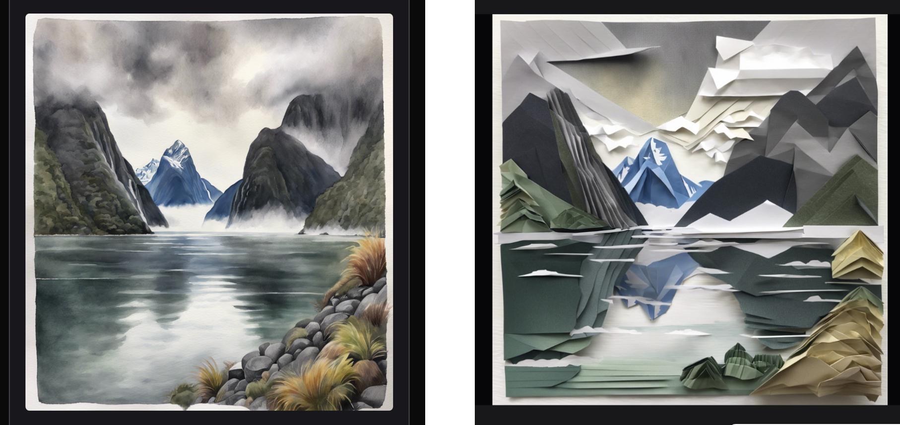
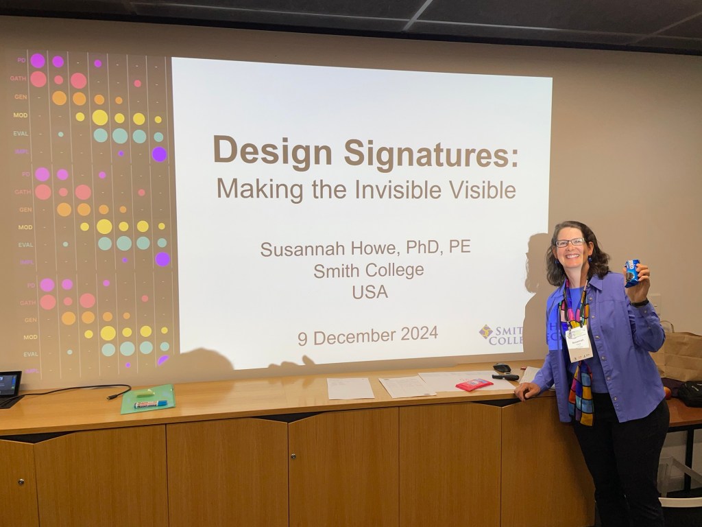
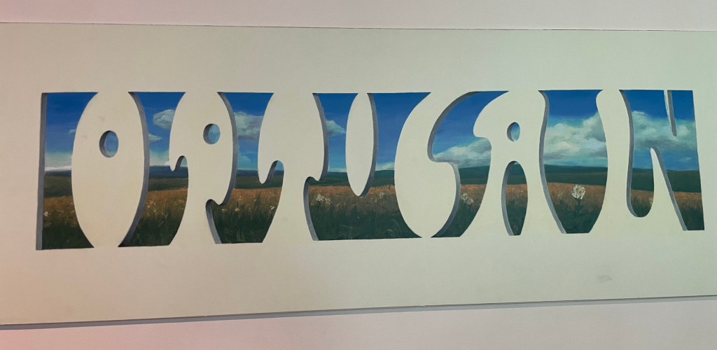
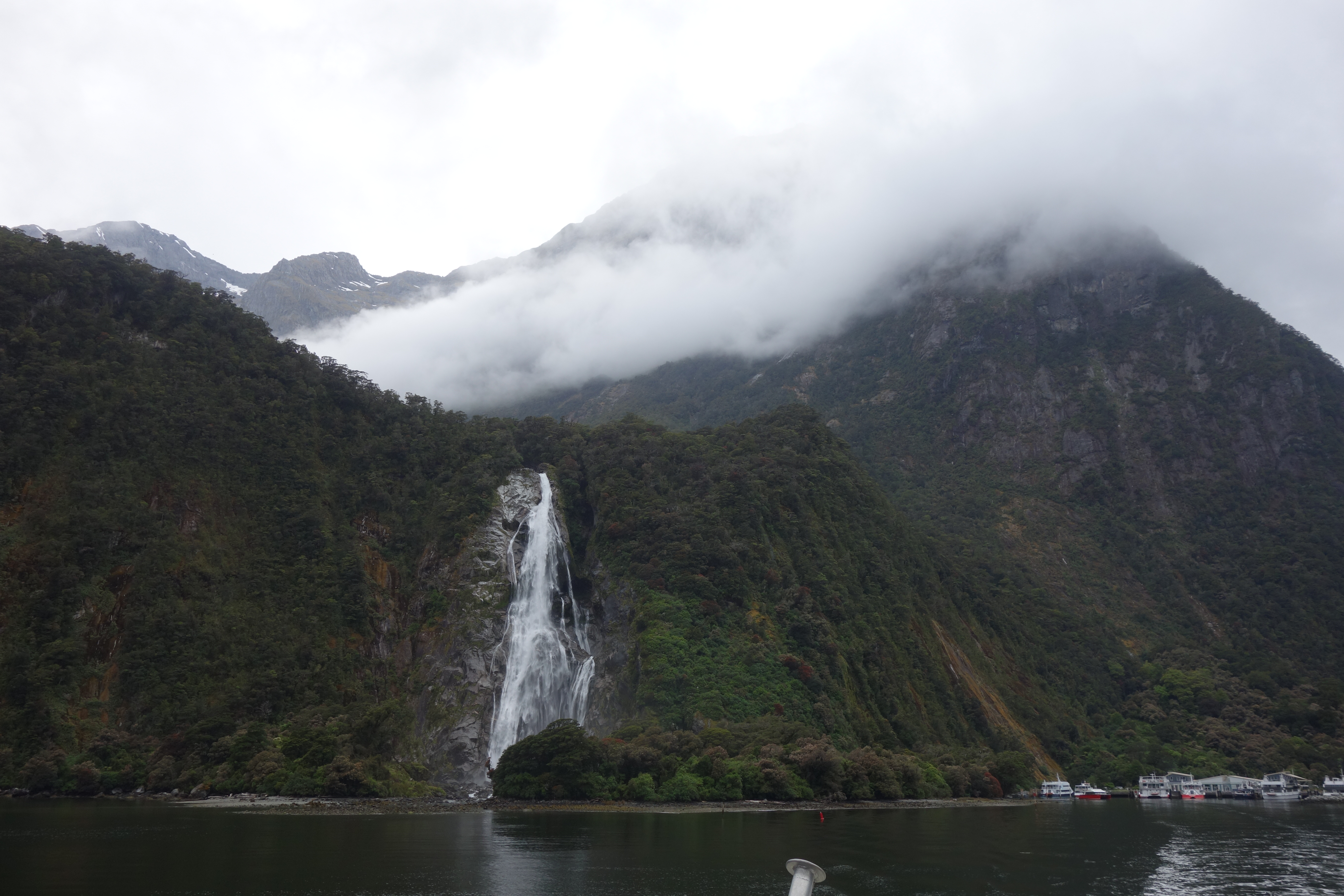
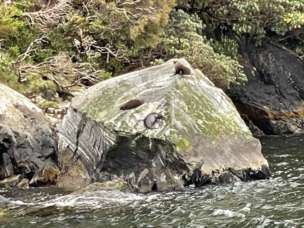
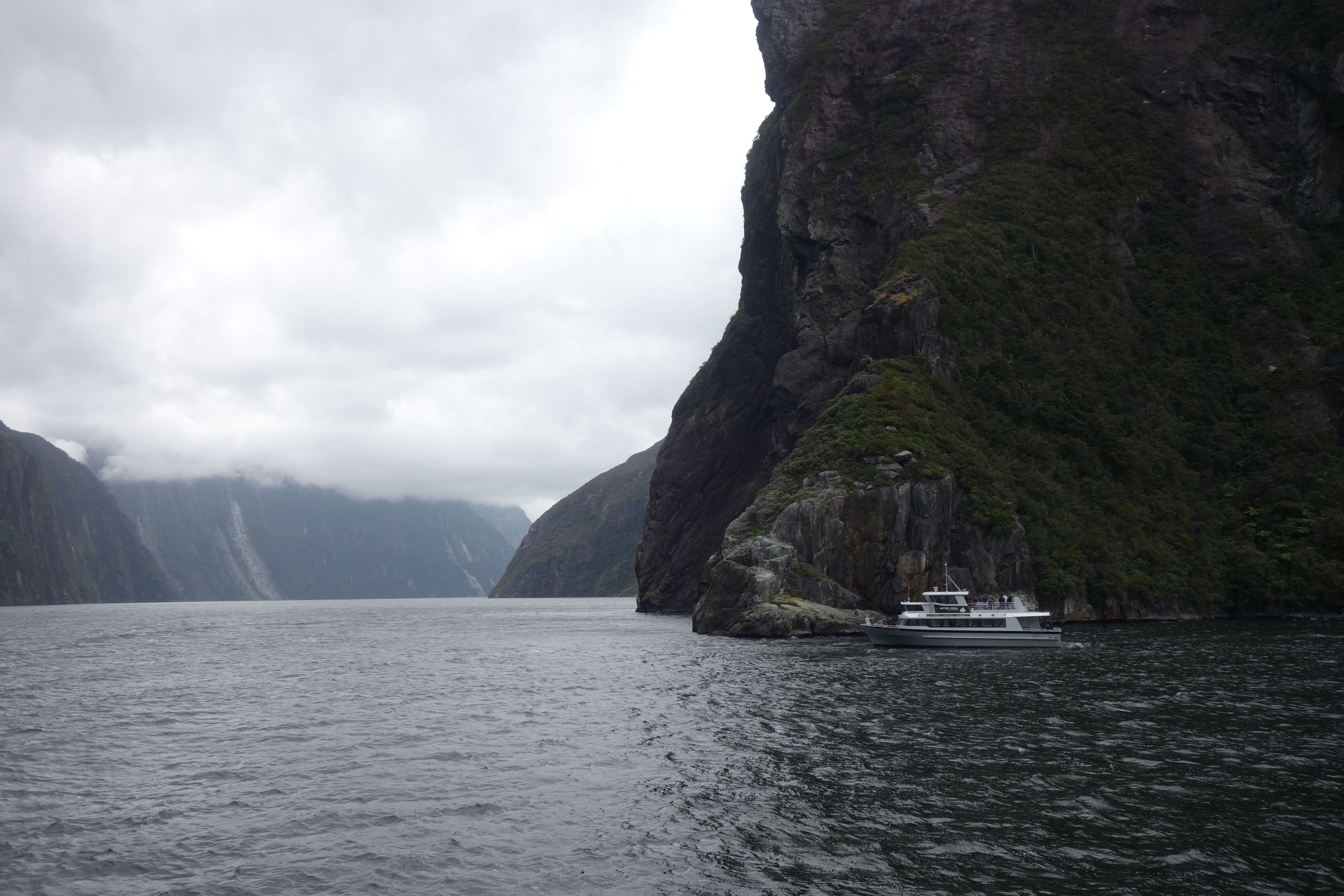
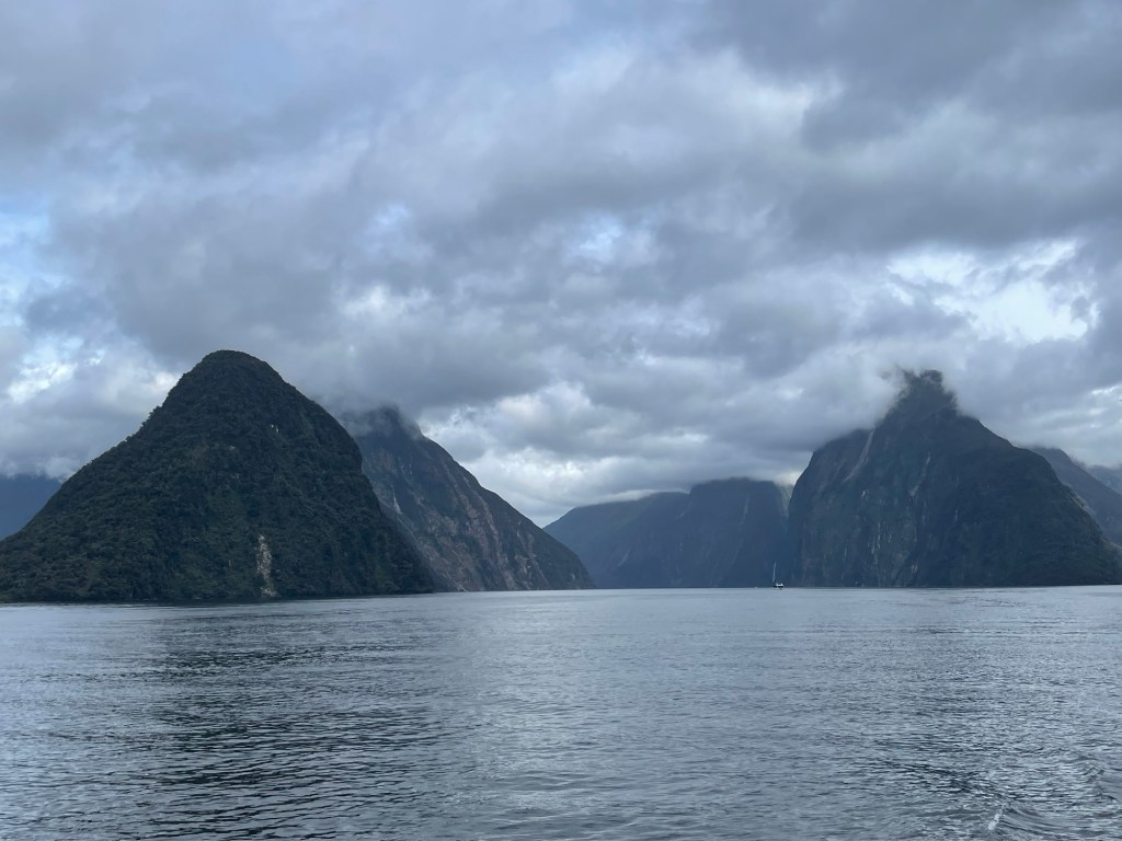
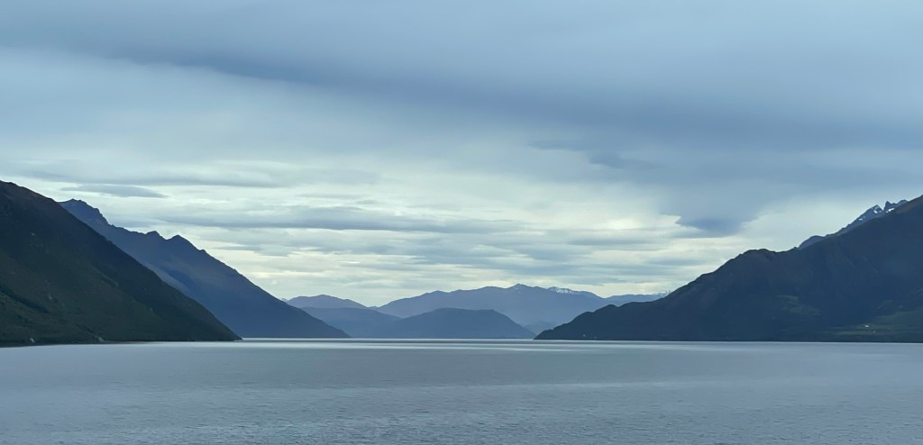
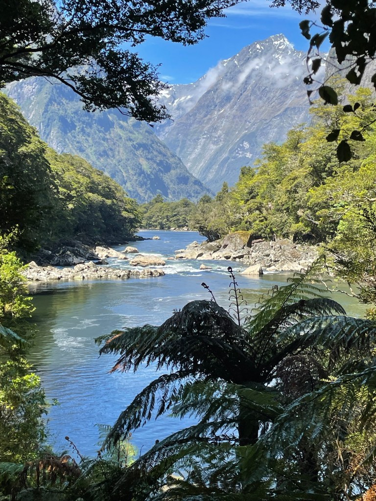
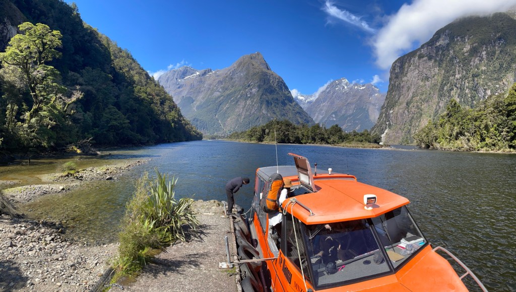
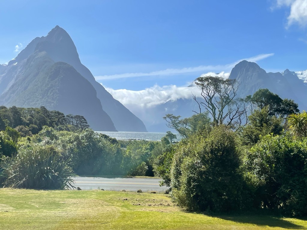
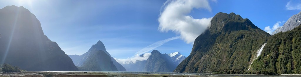
If you’re wondering about Susannah’s day, she attended some excellent sessions. One delved into new text-to-image technology. Assisted by AI, she generated some new images of Milford Sound, shown below. It’s a beautiful landscape, in person and digitally generated!

Design Signatures Down Under

Susannah’s conference began in earnest today. She presented a workshop on the Design Signatures research she has been doing in collaboration with a group of U.S. researchers. Participants were enthusiastic, generated a good discussion, and gave positive feedback afterwards. With this out of the way, the rest of the conference is smooth sailing.

Nick helped with logistics during Susannah’s presentation, then took advantage of the location at the University of Canterbury and spent part of the afternoon meeting with a professor in the computer science department who has similar (but not identical) research interests. Susannah and Nick met up in the evening to explore some of the restaurants in the neighborhood, and ended up getting peri-peri chicken at Nando’s. Although this is apparently an international chain, we’ve never seen one before and found the food quite delicious. And they had a roasted broccoli side dish — try finding that at your neighborhood McDonalds! For dessert, we sampled the “chewable good yogurt” at Hey! I Am Yogost. The one we tried was basically a combination of mango lassi with rice pudding, if you can imagine that — not surprisingly, Susannah loved it.

Not far from us is a small park called the Riccarton House & Bush. This was the site of the first European settler’s house in the area, and features a small patch of dense old-growth forest that shows what grew here before humans cut or burned everything else down. A small stream winds past the site, which is quite lovely, and they also have a small flower garden.

Riccarton Bush – the picture doesn’t show all the bird song around, but the birds love this predator-free area and sing out continuously.

We haven’t yet commented on the New Zealand architecture. Christchurch is mostly low one- or two-story buildings, often one very small lots or combined into little condo developments with small walled gardens/yards. The newer buildings tend towards a certain architectural style: intersecting masses clad in glass, stone, cedar, and corrugated steel, and very little in the way of decorative ornaments. Older buildings here borrow from English cottage vernacular, with more frills. The combination of the two styles is quite interesting.

Some of the houses we saw walking around our neighborhood.

Road Pies

Our late-night event of the previous day turned out to be something less than we had hoped. The Dark Sky Project offers midnight trips to the observatory, where trained guides lead a stargazing tour through the southern sky. Unfortunately the weather, which has been so friendly to us for most of the trip, chose not to cooperate on this night — we had near 100% cloud cover overhead. As a proxy, we were offered a “virtual” stargazing experience in the planetarium. Better than nothing, right? It covered some of the same ground as the tour we had taken earlier in the day, only in more detail with a very knowledgeable guide. We now know two different methods for finding polar south using the stars. We also learned about some of the Maori constellations, including one called the Eel, which stretches across half the sky, and which you can use to tell when the fish are in the right stage of their life cycle to be harvested based on what parts are visible above the horizon at a given time of the year. Orion, which appears upside-down in the southern hemisphere, is sometimes seen as a butterfly (pūrerehua). Alternately, the three stars of the belt are sometimes the base of Tautoru, the cookpot.

After our late night, we slept in as long as we could before checking out of our Airbnb and hitting the road. Christchurch was our destination, but along the way we made sure to stop for brunch at the Fairlie Bakehouse, another great recommendation from Alison. This modest-looking shop has become famous for their pies (see photo at top), and had a line out the door the whole time we were there. We sampled three of their wares: bacon and salmon, which is exactly what it sounds like; Christmas turkey, which included gravy and cranberry with maybe a hint of stuffing, and vegetarian, which included multiple vegetables and egg. All three were encased in a flaky pastry crust decorated to reveal what was inside. Delicious!

While in Christchurch, Susannah will be attending a conference on engineering education (AAEE2024) that was part of the motivator for this trip. So she headed off to the opening event while Nick spent some time planning solo activities for the next few days. Unlike most conferences, where the opening reception is nothing more than an event with hors d’oeuvres and perhaps some drinks, here they held a full traditional Mihi Whakatau (Maori welcome ceremony) for all the attendees, which included songs (Waiata) in Maori, one of which all the attendees sang together. Fortunately they had a chance to practice in advance, and there were enough ringers present to help with the pronunciation and tune.

Site of the conference welcoming ceremony, part of the Ara Institute of Canterbury

For dinner, we met up with Helena, a former student of Susannah’s who is now working in Christchurch. She selected an excellent taco restaurant, and we met her parents who were also visiting. On the way back to our lodging we passed by part of the Avon River (Ōtakaro) and through Hagley Park, where we saw some pretty sunset clouds.

Our lodging is conveniently located on one edge of Hagley Park

Dancing with the Stars: Tekapo Edition

We’re staying put in Tekapo for one more night, so we had the chance to get to know the area a bit more. After a hearty breakfast in town at The Greedy Cow (our last meal with Alison), we went for another stroll in the lakeshore park. It’s hard to capture the atmosphere here — the natural beauty seems particularly intense, almost spiritual. And then there’s the occasional odd sight, like a T. Rex strolling through the lupins.

One of the attractions in town is the Dark Sky Project, named after the initiative to control light pollution in the region. We took their tour, which is mostly a photography-free zone with the exceptions shown below. The first is a room where they have glowing scale models of the Sun, Alpha Centauri A and B, and a generic red giant star. We were invited to put our hands on them so that we could feel and hear the characteristic vibrations of each one (produced courtesy of computational modeling of their insides). The last stop on the tour was a demonstration of the historic Brashear Telescope, the actual device used by Percival Lowell in his observations of Mars in the late 1800s. Picture the astronomical telescope of the popular imagination sitting inside a dome: this is that instrument in the flesh (well, metal anyway). It was moved to New Zealand when light pollution around its U.S. home grew too strong. Unfortunately, they never found the funding to build a dome for it so it just sat in storage for a half century. Nowadays a modern reflecting telescope works just as well at a fraction of the cost, so this behemoth has become a museum piece. At least in that context, they were finally able to find the money to put it inside a proper dome again!

For the afternoon, we decided to hike to the observatory at the top of Mount John just on the edge of town. It was a gorgeous sunny day, and the path made switchbacks through a pine forest to climb the hill. At the top, the terrain was open and we had unlimited 360 degree views: the Southern Alps in the distant west, Lake Tekapo to the east and north, and the Mackenzie Plain to the south. A number of people were posing for photographs on a convenient rock, so Susannah took a turn. You can see Tekapo in the background, with the lakefront park we had explored in the morning just behind her shoulder.

Back down the hill, we made our way back to the Church of the Good Shepherd, where they were holding a service of participatory singing that was open to all. We could not resist the chance for a spiritual moment in this beautiful building. The music was mostly unfamiliar to us, but we enjoyed it all the same, and felt welcomed by the others who were there. And we taught the round Dona Nobis Pacem to the other congregants when it was our turn to share something.

We do have one more star-related event today, but since it won’t start until after midnight we’re going to close this entry here and save the rest for tomorrow.

By Hooker, By Cook

Today, we had lunch by a glacier! Or rather, the meltwater lake at its end, the glacier itself being much reduced. (You can see it as a low muddy wall in the rear of the picture above, at the far side of the lake. All of the glaciers here are a shadow of their former selves. We climbed over immense ridges of rubble that used to be the terminal moraines of these mountain glaciers. All the space behind them now occupied by water used to be filled with solid ice many stories tall. Decades of global warming have produced a predictable effect.

Tasman Glacier and Lake, the first of three glaciers that we saw today
Looking back down the valley from the top of the glacial moraine

We are in the heart of the Southern Alps, near the tallest peak in New Zealand: Aoraki / Mt. Cook. The dual name represents a combination of the Maori placename with the European designation, much as Denali and Mt. McKinley refer to the same peak in the United States. James Cook occupies a cultural place in New Zealand similar to Columbus in North America: some honor him for enabling the migration of colonists from Europe, while to others he is blameworthy for the same reason. Most of the signage we saw references both names without further comment.

Susannah and Alison at the start of the Hooker Valley Track

The Hooker Valley Track which we walked today travels about 5 km from the car park to the shores of Hooker Lake, one of the glacial meltwater lakes surrounding Aoraki. It is a very popular route, and we shared the trail with lots of other hikers who had come out to enjoy the warm and sunny day. The trail itself is fairly easy, without much elevation change. It crosses rushing meltwater streams on three large swing bridges. The meltwater itself carries finely powdered stone scraped off by the glaciers, so much so that it appears a silvery grey color as it flows. The lakes have a slight greenish tinge (“like a matcha latte,” said Alison).

After a pleasant hike, we reached the end of the trail where we planned to have lunch: Hooker Lake. The water has small icebergs in it, calved off the front of the glacier visible on the far side of the valley. We took a leisurely lunch by the shores of the lake, but unlike some of the other visitors, we did not choose to wade or swim in the chilly (3 degree Celsius) water.

Taramea (a.k.a. golden speargrass) by the Hooker River with Aoraki/Mt. Cook in the background

Much farther down the valley, the highway follows the shore of Lake Pukaki, a natural lake that was much enlarged by the addition of a hydropower dam. From there, we continued on to Lake Tekapo, which is the town we’ll be staying in for the next two nights. You know that a place is happy to see you when you are greeted on arrival by a rainbow. That one disappeared not long after the photo was taken, but then while we were having dinner a second rainbow appeared. Both arched over the lake, and the picturesquely located Church of the Good Shepherd on the shoreline. An attractive and recently completed pedestrian footbridge gives easy access to the chapel from the center of town.

Lake Pukaki

While exploring the lakeshore on foot we came across a placard advertising a free show put on by local storyteller Billy the Bard at dusk. Curious, we decided to check it out, and spent the next hour listening as he spun an entertainment blending local myths, scientific facts and astronomical education, with participatory singing and dancing. It was both entertaining and a fascinating piece of local color. By the end of his show the sun had gone down and the stars were out, and since attendance was by koha (gift or donation), we gladly made an offering in thanks.

Ohau Was the Ride

Today we rented bicycles again, with the intention of exploring part of the Alps to Ocean Cycle Trail. This is a 306 km route, starting in the mountains and ending on the Pacific shore. We only planned to do a small portion today, from Twizel as far as Lake Ohau to the west. Like our bike ride on the North Island, this is one of the country’s listed Great Rides. New Zealand has designated both Great Rides and Great Walks, and we’ve done at least a portion of each on both islands. The criteria include being accessible to an average hiker/bicyclist, and covering a type of terrain or experience that isn’t included in any of the other hikes or rides on the list.

We could have hired someone to shuttle us and our bikes to do a one-way ride, but in the end settled on an out-and-back. The route is mostly flat, so we were expecting fairly easy going, but it turned out that there is a pretty strong prevailing wind that was blowing against us on the outward leg. It made a noticeable difference, and we took turns riding in the lead and breaking the wind for each other. The landscape here is fairly open and flat, at least until you get to the mountains in the distance. It may be raining in Milford Sound right now, but we’re in a drier part of New Zealand at this point, with brown on all the hillsides instead of green. Likely we’re in the rain shadow of the Southern Alps.

Despite the aridity, there’s a fair amount of water flowing down from snowpack on the mountains themselves, which prompted the development of the various hydroelectric stations in the area. These are fed in turn by artificial canals, one of which ran parallel to our route for a large portion of the day. The water was an unreal shade of teal blue, fading to a deeper aquamarine at the edges — the pictures hardly do it justice. Although the canal was pretty enough, with its straight lines and sides landscaped to a certain uniform slope, the view was largely the same for much of the ride, without the variety that a natural watercourse would have offered.

We finally reached our destination at Lake Ohau, where we stopped for lunch. With the wind at our backs, the trip home was remarkably easy in comparison with the morning ride.

On the way up we had passed by some sort of facility in the canal, and thought it might be a fish farm. Passing by on our way home, we saw a man throwing scoops of something into the pools. When asked, he confirmed that it was a salmon farm. Each time he threw a scoop, scattering food across the pool, the surface would erupt with splashes and tailfins as the salmon snatched up their meals. A few opportunistic ducks also joined the frenzy.

We seem to have a thing with animals staring at us. Yesterday it was cows, today it was sheep. Susannah had intended to take a picture of them all taking shelter under the shade of a tree, but her approach on bicycle must have scared them because they all got up and moved away, looking back to see whether she might be a wolf there to eat them.

We managed to make it back to Twizel before the unreasonably early (4pm!) closure of the local ice cream shop. New Zealand has several local flavors that are not found elsewhere. In addition to various distinctive fruit sorbets, they serve a honey/caramel flavor called Hokey Pokey, and another with chocolate honeycomb bits called Gold Rush. They also tend to have chocolate sorbet on offer, much to Susannah’s delight.

Our Airbnb is a whole house this time, and a former student of Susannah’s happens to be traveling in New Zealand at the same time as us and arranged to visit. Alison joined us around dinner time, and we enjoyed a take-away meal outside in the lovely yard, accompanied by lots of conversation and swapping stories about our travels. We’re looking forward to hiking with her tomorrow.

Lord of the Rungs

Longtime followers of our travels will know that we love a good via ferrata, and as it happens the only one currently operating in New Zealand is located near Wanaka. WildWire is the company offering this experience, and their route has been dubbed the “Lord of the Rungs”. It follows the path of a fairly substantial stream as it tumbles down a steep cliff face, where it has carved out a rocky ravine into all sorts of interesting shapes. You can see the stream behind us in the opening picture, although the scale isn’t completely apparent at this distance, as you’ll see in some of the close-up photos below.

The one-way door. Past this point, the only way out is up. Our guide Fin gave us the thumbs up to proceed.
A group ahead of ours is traversing a rock face before crossing the first bridge.
A rock face traverse.
On the first bridge ourselves

If you’re just joining us, via ferrata roughly means “iron path”, and was originally developed during the first world war as a way of getting troops through steep mountainous regions without needing to train them in climbing techniques. Today, it has been rediscovered as a recreational opportunity, and allows people like us to climb in beautiful places that would otherwise require much more skill and probably younger bodies to boot. Besides rungs and other holds fastened directly into the rock face for climbing, it uses steel cables to ensure that slipping at the wrong moment doesn’t result in a fatal plunge. For safety, we are clipped into the cable or other anchor points by at least two connections at all times. Ironically, this means that we spend most of our time moving carabiners from one cable to the next, even though ideally if all goes well they are just a precaution that will never actually be used. In fact, none of the people in our group ever slipped off — although we did sometimes hang from the safety harness on purpose, just for the fun of it!

This gives a sense of what it feels like to look down. Notice how the water has polished the rock face behind the falls.
We climbed in a group with one other couple, who hailed from Ohio.
Can you see our car in the valley below? This is less than halfway up the course.
Hanging out by the falls
One of the last ascents
Completing the climb
View from the top
As we came in, a herd of cows was blocking the road and we had to wait for them to move out of the way. When we left, they all stared at us. Moo?

Including the hike back down, climbing the via ferrata took five and a half hours, so we still had some time in the afternoon. What’s a good follow-up activity to a waterfall climb? How about a lavender farm, that sounds like fun! The grounds were peaceful and fragrant, and we sampled a variety of lavender-infused foods at their gift shop and cafe.

Our final act of the day was the 140 km drive northeast to our next lodging in Twizel. This took us through brown rolling hills dotted with lupine blooms in a range of shades from almost white to dark indigo. Built in the 1960’s, Twizel was once intended as a temporary town to house workers building nearby hydroelectric facilities. It was slated to be bulldozed when they were finished twenty years later, but apparently the locals had become attached to living there and successfully lobbied to keep it standing. The town itself doesn’t get much respect in either of the guidebooks we have read, but so far we have found it to be very pleasant. Our Airbnb is an entire vacation house with all the amenities we might need (a washer AND a dryer, for example), and the business district is home to a number of restaurants that looked interesting. We settled on Mint Folk & Co. for dinner, where we shared a platter of grilled greens and these crispy chicken bao buns — mmm!

That Wanaka Day

Today we bid goodbye to Queenstown first thing in the morning and took to the roads in another hired car (also a white Kia Stonic, just like before). Our plan is to make our way in a northeasterly direction for the next few days, seeing sights along the way, until we hit Christchurch. So far so good: we saw a number of small but interesting attractions on the way to our lodgings for the night in Wanaka.

Our first stop was the Kawarau Gorge, where a suspension bridge has spanned the river since 1880 when it was built to service the gold mining industry. In 1988 the AJ Hackett Bungy Company began offering the world’s first commercial bungee jumping experience. There seems to be some slight linguistic conflict in the world of elasticized falling; Kiwis prefer “bungy” to the American “bungee”. Regardless of the spelling, hundreds of people per day flock to this site for the privilege of throwing themselves off the bridge. An even greater number, ourselves included, come to watch. Neither of us strongly considered participating, and at $320 a jump the price seemed a bit too steep. Conveniently, viewing was free!

The jump staff calibrate the length and stretchiness of the rope quite precisely to the weight of the jumper. It’s considered a perfect jump if the diver’s head and perhaps their shoulders dip into the water before the stretched cord hauls them back out again. After that they bounce a few more times, before being lowered into a tethered boat that waits below to receive them.

Look closely for the jumper in midair.
Toilets for all

Just a little up the gorge from the suspension bridge is another LotR filming site. This was used in the scene where the Fellowship passes through the Gates of Argonath while traveling on boats down the great river. Picture the two stone statues depicting ancient kings of Gondor on either side of the channel, added by the special effects team in postproduction.

On a tip from two of our fellow hikers we stopped for lunch a bit further on our drive at the Cardrona Hotel, a storied building originally built during the local gold rush. They had tasty food and a charming old-timey decor. Thanks to Lauren and Mike for a great recommendation!

Another Cardrona-area iconic spot is “Bradrona”, established in support of breast cancer research. We’re traveling light, so we had no extra bras to spare, but we got this picture instead. 🙂

Though we’re not big drinkers of hard liquor, when the world’s most southerly whiskey distillery lies right on your path, it makes sense to stop for a tasting. The Cardrona Distillery was established only recently, in 2015, so their whiskies are just now becoming ready for sale. In the meantime, they have also developed a number of clear spirits and liqueurs. We had a nice conversation with the host, and tasted multiple different offerings including their gin and a quince cordial. Susannah’s favorite was the butterscotch liqueur, while Nick preferred the Full Flight whiskey.

After all of these stops along the way, we finally arrived at our destination of the day, the town of Wanaka. While it has many attractions, the one we were most eager to see was Puzzling World, a sort of museum that combines illusions, oddities, and a life-size outdoor maze. We had a grand time taking it all in, and successfully completed the maze’s difficult challenge in under an hour.

Even the bathrooms include an illusion. Can you spot the non-Roman?

The city of Wanaka itself lies next to its eponymous lake. It’s something of a smaller sibling to Queenstown, offering a similar range of outdoor activities and a lakefront surrounded by mountains. It feels a bit more relaxed and less bustling than Queenstown. With more space between mountain and lake there is room for pleasant residential districts studded with beautiful architect-designed homes. Our Airbnb is located in one of these areas, and from there we were able to walk into town along the path that rings the lake. A warm breeze was whipping across the lake, and the clouds above the Southern Alps on the other side made fascinating patterns.

Lots of lovely flowers are in bloom

Bird of the day: The Southern Crested Grebe! We didn’t expect to have a significant bird sighting today, but on our walk into town we passed a nesting site for this endangered bird (only about 1000 left in the wild). The birds spend all their time on the water or in the air, being unable to walk on land. They build floating nests out of sticks to raise their young. As part of a restoration effort, these nesting platforms give them a head start in a safe location. It seems to be working; we saw many grebes in and around the platforms, and observed this pair working together to raise a family. The one swimming toward the nest has a fresh bunch of sticks in his beak.

The Hand That Nurtures (public art on the waterfront)

Perhaps Wanaka’s most famous inhabitant is not a person at all, but a tree that has become Instagram-famous. Identified with the hashtag #thatwanakatree, it stands in the lake all by itself, several meters from the shore. Believed to have grown from a willow fencepost planted in 1930, the tree was the subject of an award-winning photograph and now attracts hordes of tourists who want their own pictures — we saw several dozen just while we were there. It has been captured in all seasons and in all sorts of lighting, and is probably the most photographed tree in New Zealand. Its location on the other side of the bay made it a convenient destination point for our walk.

After all that walking, we had worked up a decent appetite, and we were pleased to discover the Big Fig restaurant, which offers “Slow-cooked food served fast.” They have an appealingly simple business model: they offer a buffet of delicious dishes to choose from, and customers may pick any combination they wish. The size of the plate determines both the number of selections available (4, 5, or 6) and the price. Because the food was all so good, it almost didn’t matter what picks we made. So clever, so tasty, and so fast!

Farewell to Fiordland (Milford Track Day 5)

Our last morning in Fiordland National Park dawned once more with clouds obscuring the upper slopes of the mountains. This is not a complaint: to have experienced four consecutive days without rain in a place where it rains more often than not is nearly unheard of. We’ll take a little cloud! All of the hiking groups on either side of our window saw much more rain than we did, and without clear skies the views from Mackinnon Pass would have been impossible to see. Sometimes when the rain is particularly intense, sections of trail become submerged and hikers have to move through water as deep as waist level. All of the hikers in our group felt extremely fortunate for the weather we experienced.

Most people who come to see Milford Sound do so by boat, and this morning our group joined them. Boarding the MV Sinbad, we took to the waters once again for a roundtrip cruise out as far as the mouth of the sound and back again. Along the way our boat tour guide told us details about the geology, history, and biology of the sound. Since it had not rained in four days, many of the waterfalls that sometimes decorate the cliff faces were not running, but there were still a few to see. We also glimpsed dolphin fins as they surfaced to breathe, and a trio of fur seals sunning themselves on a rock.

Lady Bowen Falls provides drinking water and power for the port facilities.
Stirling Falls; legend claims that its mists will restore lost youth. (Do we look younger?)
Tour boat included for scale.
One of two places in the world where you can see a glacier, a rain forest, and a fjord all in one picture.
Mitre Peak is once again lost in the clouds

Following our boat tour, we all boarded our bus for the long trip back to Queenstown. The route passes through the Homer Tunnel before turning south, passing the landing where we began our trip, and retracing our path home. The Homer Tunnel was finished in the 1950’s in conjunction with the opening of the park, and was a difficult project. Besides contending with avalanches that killed several of those working on site, the miners discovered that the tunnel was filling rapidly with water as they dug due to its downward slant. In response, the dimensions were decreased so that they could finish the bore and allow water to drain. There had been a plan to widen it to the full original width after the fact, but as of our trip today it is still a one-lane tunnel nearly a mile long.

We stopped in the same rest stop for lunch as we had on the way out, and saw another busload of hikers and guides heading out on their own trek. We fear they are facing much wetter weather than we had.

Moa statues at the rest stop (photo from our first day)
Lake Wakatipu on the road back to Queenstown

We made it back to Queenstown without further incident and began the process of saying goodbye to our comrades of the last four days. We are especially grateful to our guides Bridgette, Harry, Sabrina, and Sophie from Ultimate Hikes, who led us with good cheer and skill, and seemed to have boundless energy. We struck up many friendships during the trip, and it was a pleasure to see familiar faces about the town as we ventured out in the evening. A toast to the Milford Track and those we shared it with; we had the most magnificent time.

Friends from the hike took our picture as they passed by on the waterfront

To the Sound (Milford Track Day 4)

The last day of hiking is the longest (13 miles) so we woke early again to make a timely start.  Once more, a cloud ceiling had formed overnight halfway up the fjord walls and stayed put until mid-day.  This section of trail is forested and undulates gently up and down.  It follows the Arthur River to Sandfly Point at the head of Milford Sound.  Due to the mist and the trees, the fjord walls were often out of sight, leaving bridges and waterfalls as the major sights of the trail, alongside the occasional massive boulder or gnarled tree trunk.

The Milford Track includes enough different  styles and span lengths of bridges to warm the heart of any civil engineer.  Some of them are rated for only a single crosser at a time, while others allow for many more.  We most enjoyed the “swing bridges”, that typically cross the largest spans.  They live up to their name, swaying back and forth as you cross, and with several people crossing at once, the unpredictable lurching makes it hard to stay upright.  One of the longest bridges crosses the Arthur River just downstream of the Boatshed, which was used to house the vessels that ferried hikers across in the days before the bridge was built.  These days it serves as a trail shelter – in fact, the trail goes right through it!

One of the topics of conversation on the trail is which waterfall is each person’s favorite.  Besides Sutherland Falls, the other major contender is Mackay Falls, which we saw today.  The two namesakes were actually exploring the region together, and Mackay claimed the first large waterfall they found.  Biding his time, Sutherland ended up with the larger of the two, but not everyone finds it the most aesthetic.  

A neat side feature near the base of Mackay Falls is Bell Rock, so-called because of the shape of the cavity carved inside it.  It is unassuming from the outside, seemingly no larger than countless other crannies in the large rocks alongside the trail.  If you take the time to crawl inside, you’ll find a surprisingly large hollow within, with plenty of room for a group of people to stand together inside.  Legend has it that the record for most occupants stands at 29, but we’re not sure we believe it.

A tight squeeze
Standing up inside

Bird of the day: the sandfly.  Sticklers may object that this is not a bird at all, but they fly, they are ever-present, and there are certainly a lot of them in this region.  A Māori legend tells that they were released here by a goddess lest the land be so perfect that the humans would never leave it.  Warned in advance, we had armed ourselves with repellant oil and mesh head covers just in case.  We used the former liberally and the latter not at all. Actually, the sandflies are not too troublesome as long as you keep moving, so we mostly contended with them at rest stops.

By lunchtime the mist had dried up and we had sunny blue skies again.  Our lunch spot was the field of river rocks at the base of Giant’s Gate Falls, where a stream bursts through a cloven rock face and tumbles into an icy cold pool.  The spray from the falls deters the sand flies, enabling us to have a lovely and unpestered lunch break “on the rocks”.

During the final leg of the track, we could finally see tall mountains around us again as we skirted the shores of Lake Ada.  A short section overlooking the lake was the last to be completed, hacked out of the cliff face in the 1890s by Irish miners using hand tools and dynamite.  Finally reaching the terminal marker at Sandfly Point, we celebrated with tea and cookies. 

Hewn out of the cliff face

Getting to Milford Landing from the trail’s and required another short boat trip, which we made in several small groups. Since the landing at Milford Sound is part of Fiordland National Park, there are no hotels or private homes except for two facilities that predate the park’s formation in the 1950s. We therefore felt like royalty, being allowed to stay at the Mitre Lodge, one of the two grandfathered establishments. It is run solely for hikers of the Milford Track, and our room’s window featured an iconic view of Mitre Peak presiding over the Sound. Supposedly the most photographed mountain in New Zealand, Mitre Peak is rarely witnessed as we saw it today, without a shroud of mist obscuring its steep sides.

The boat from Sandfly Point
Mitre Peak on left, with Footstool in front. Milford Sound is to the right, with low clouds.
Panoramic view from the shoreline
View from the lodge common room
At night, venturing forth to see the glow worms. Lights of the landing visible center right.