Up and Over (Milford Track Day 3)

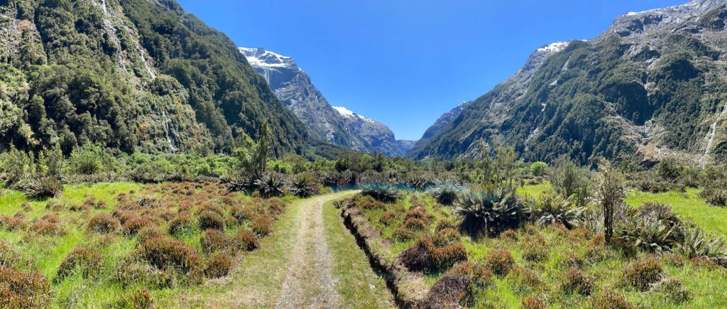
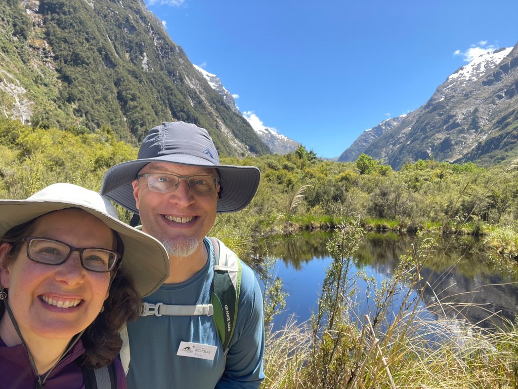
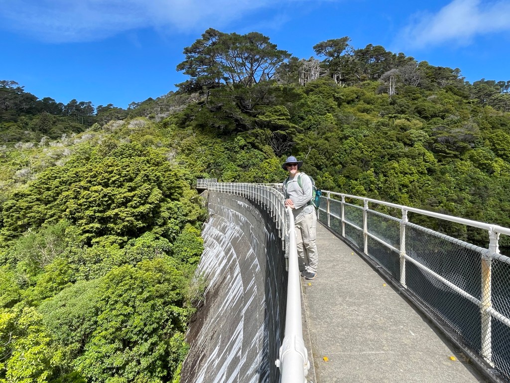
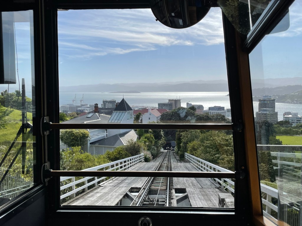
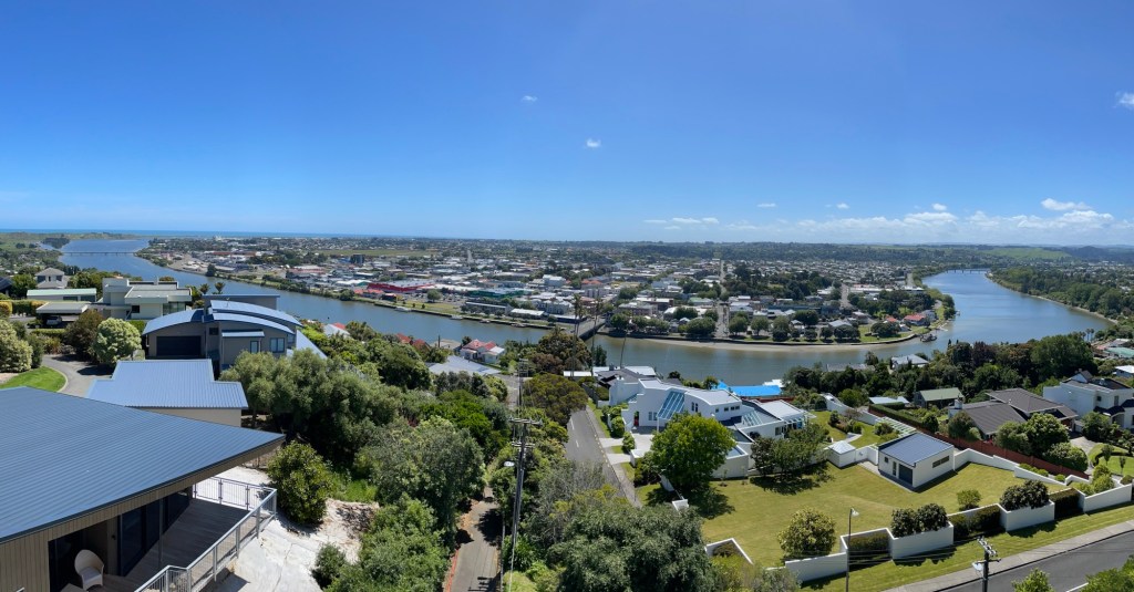
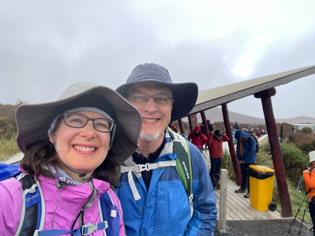
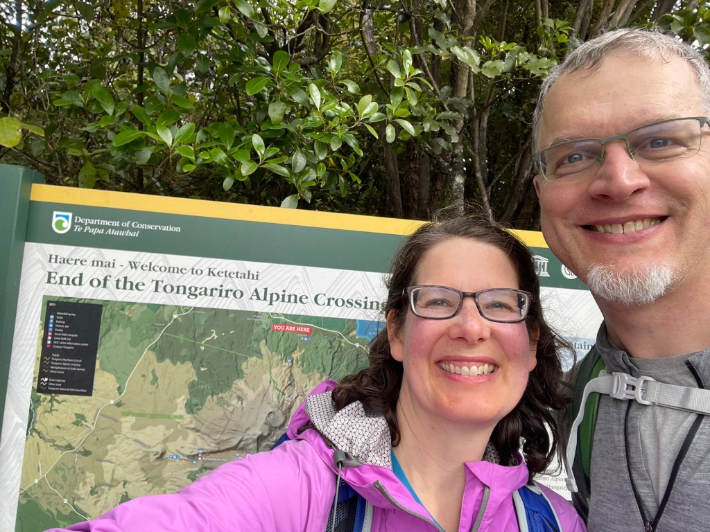
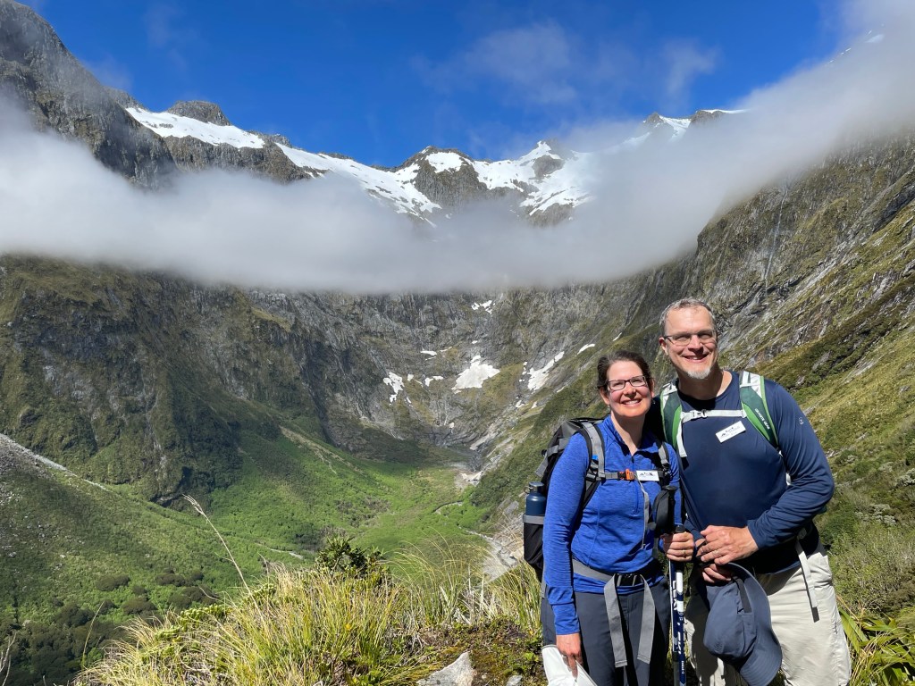
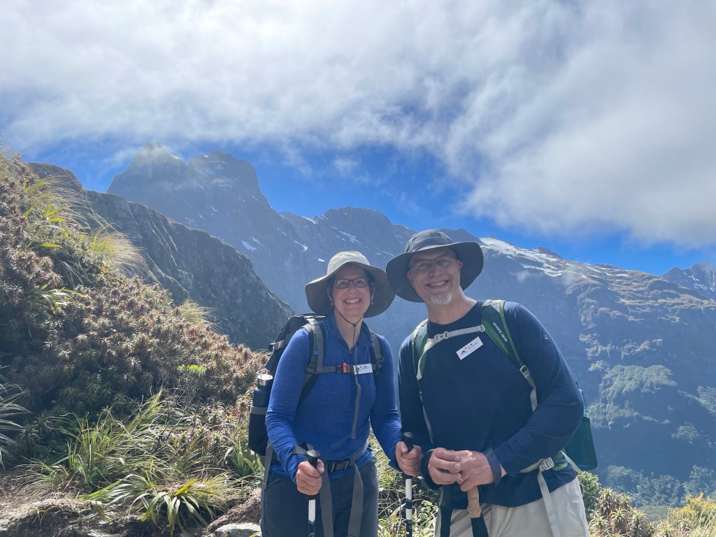
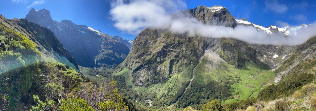
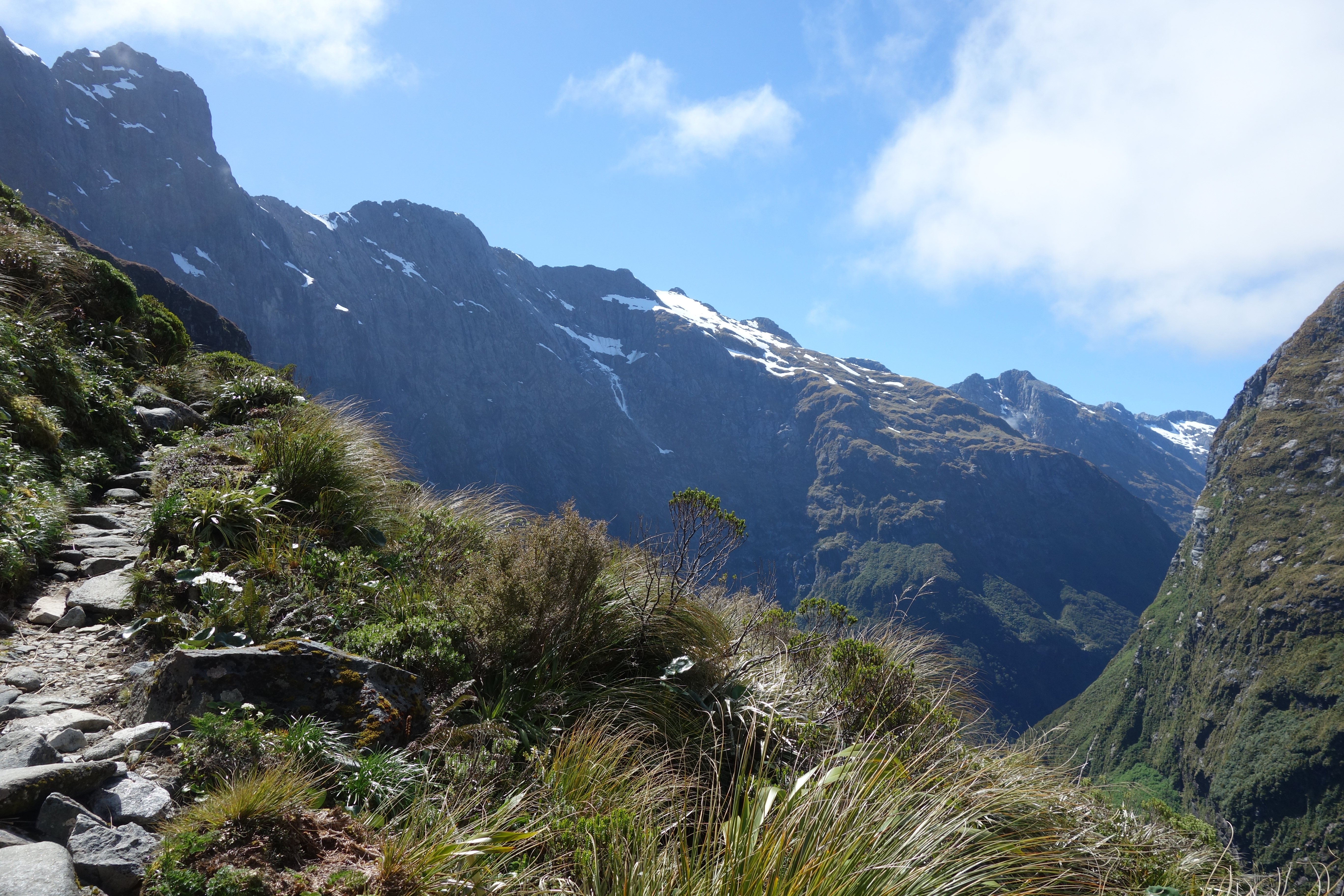
An unusual feature of the Milford Track is that nearly all the elevation change is concentrated on the third day.  Whereas we spent yesterday hiking up the Clinton River along the mostly flat bottom of the valley, and will spend tomorrow hiking down the Arthur River along the mostly flat bottom of the adjacent valley, today we crossed the ridge between them at the Mackinnon Pass.  The overall distance is a bit less than the day before (roughly 9 miles), but the total elevation change is about a mile – first 700m up, then 900m down on the other side.  In poor weather, we imagine it can be a pretty miserable passage, but fortunately, we were blessed with clear blue skies and open vistas.

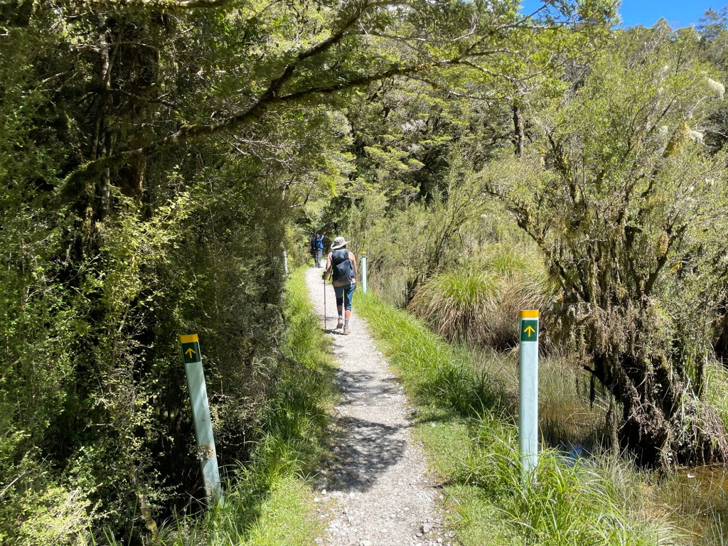
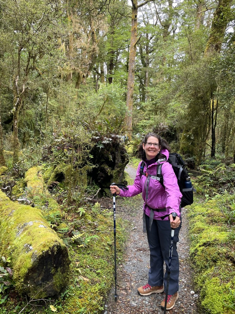
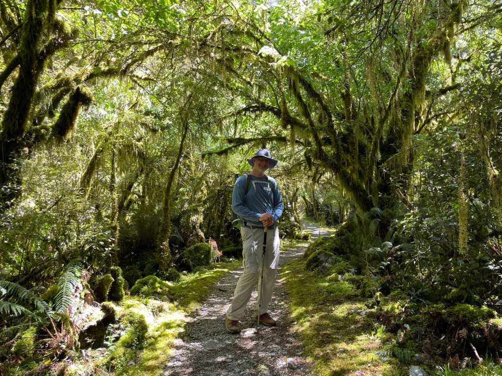
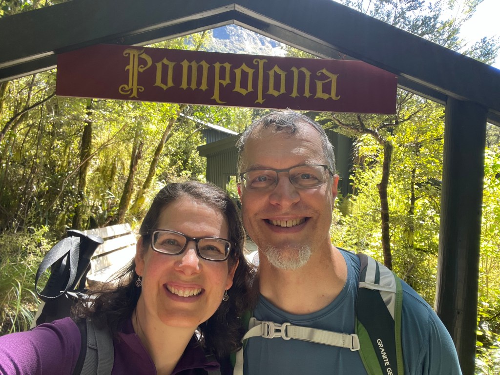
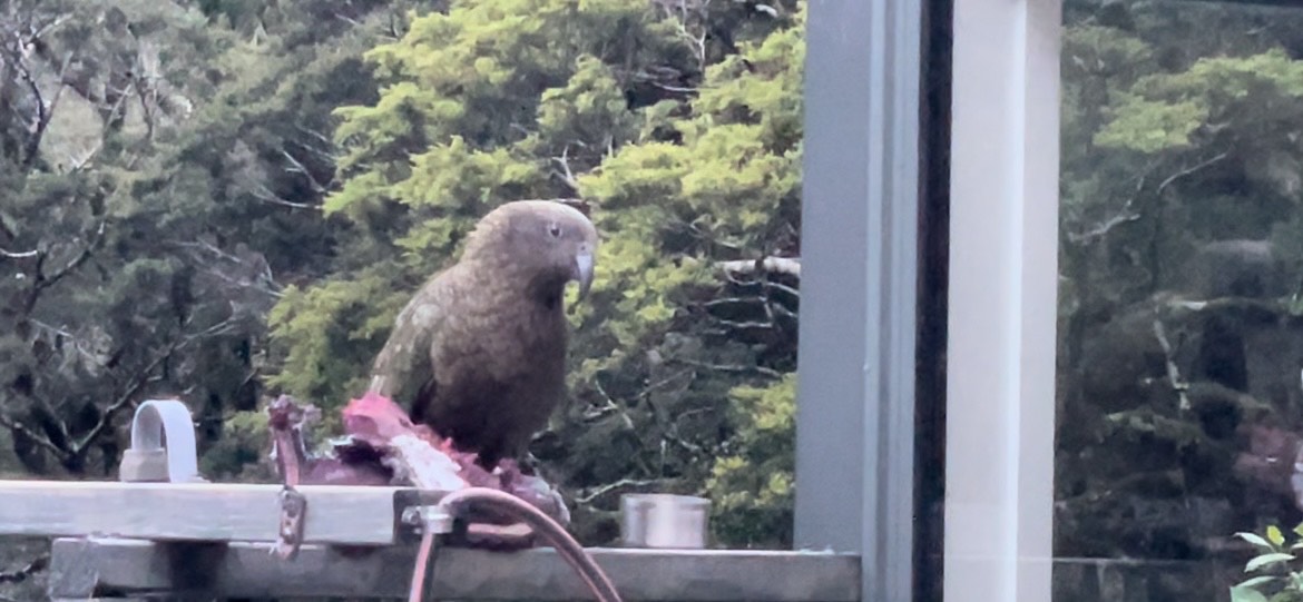
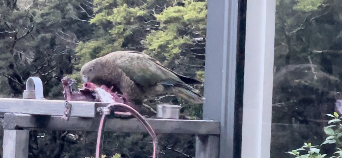
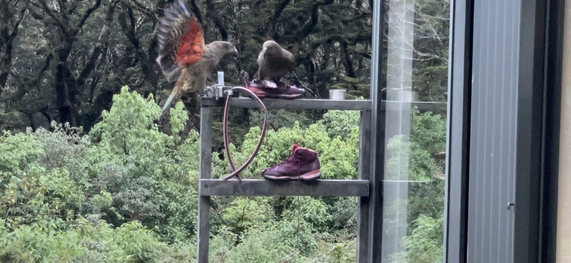
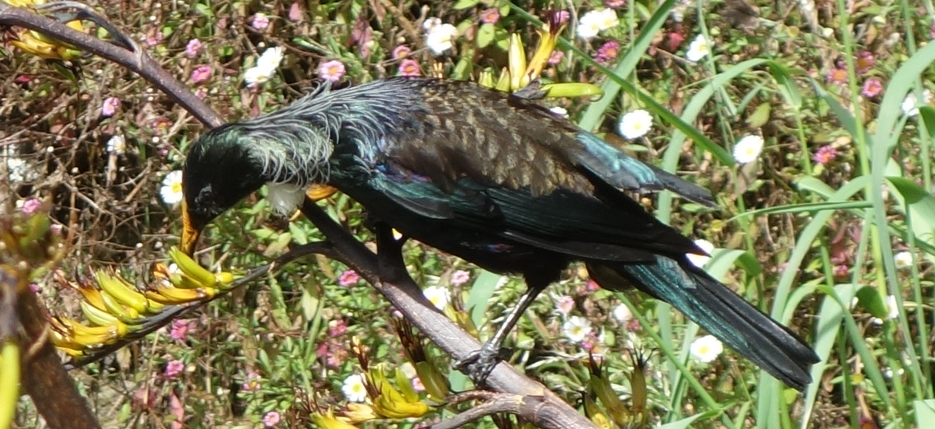
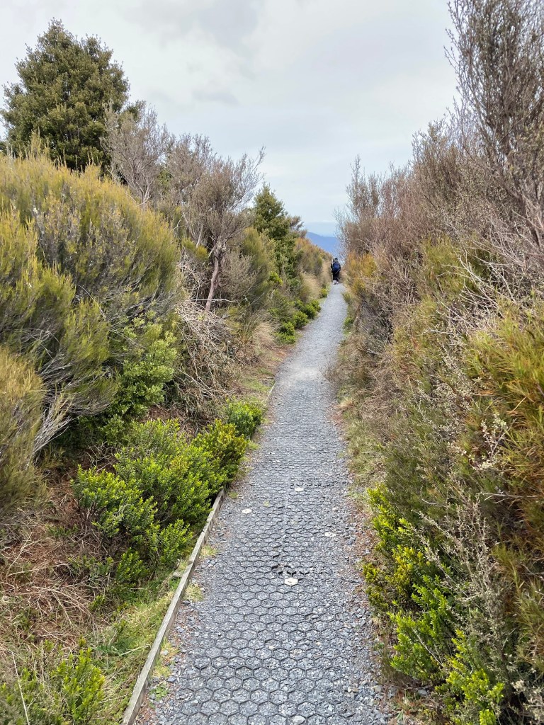
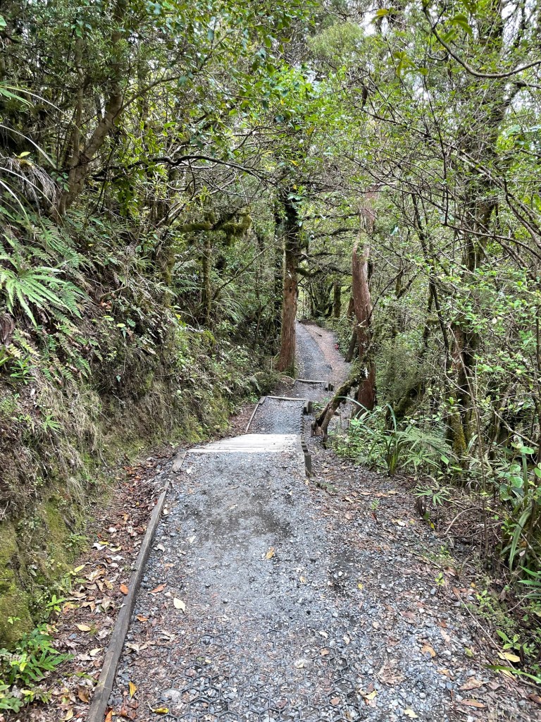
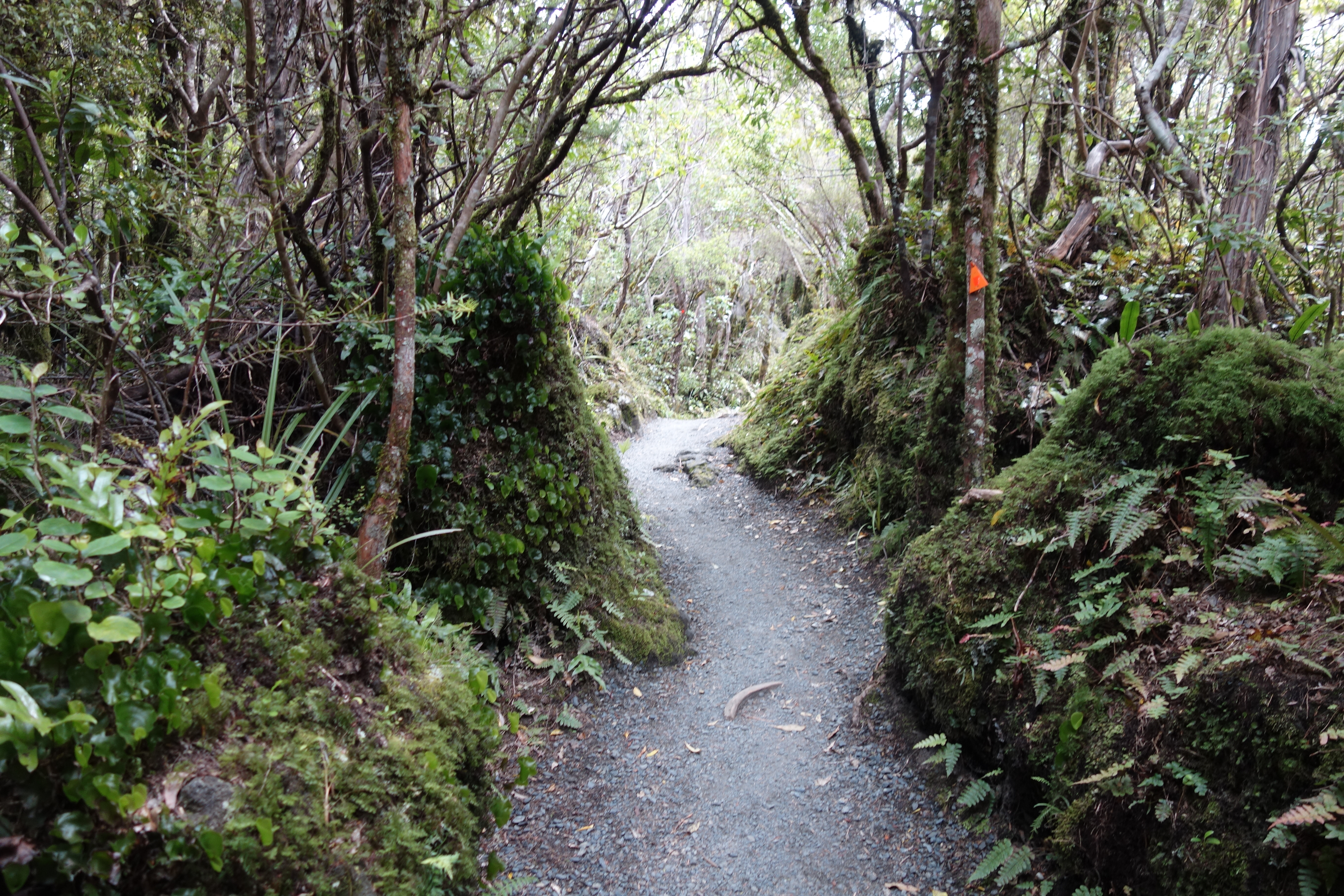
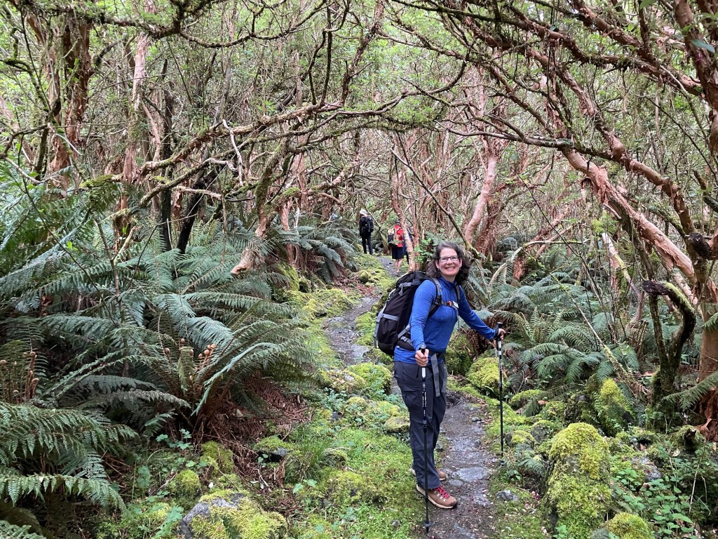
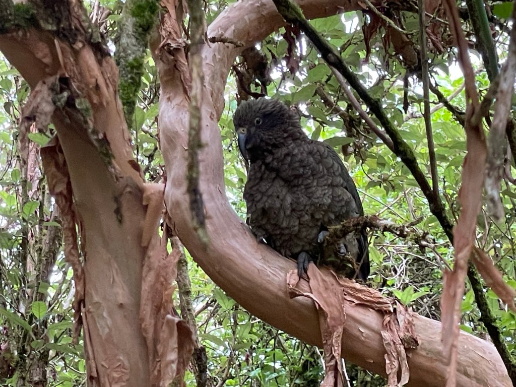
The morning mists had yet to burn off when we departed Pompolona Lodge at 7:30 AM, and for the first few hours, we couldn’t see all the way to the tops of the cliffs above us.  The trail rose gradually at first, through scrub forest and fuchsia tunnels — that’s tunnels formed by fuchsia trees, not actually red ones. Most of them had flowered earlier in the spring, and the petals still covered the ground in places. In one such thicket we came across an adult kea who eyed us suspiciously from his (her?) perch.

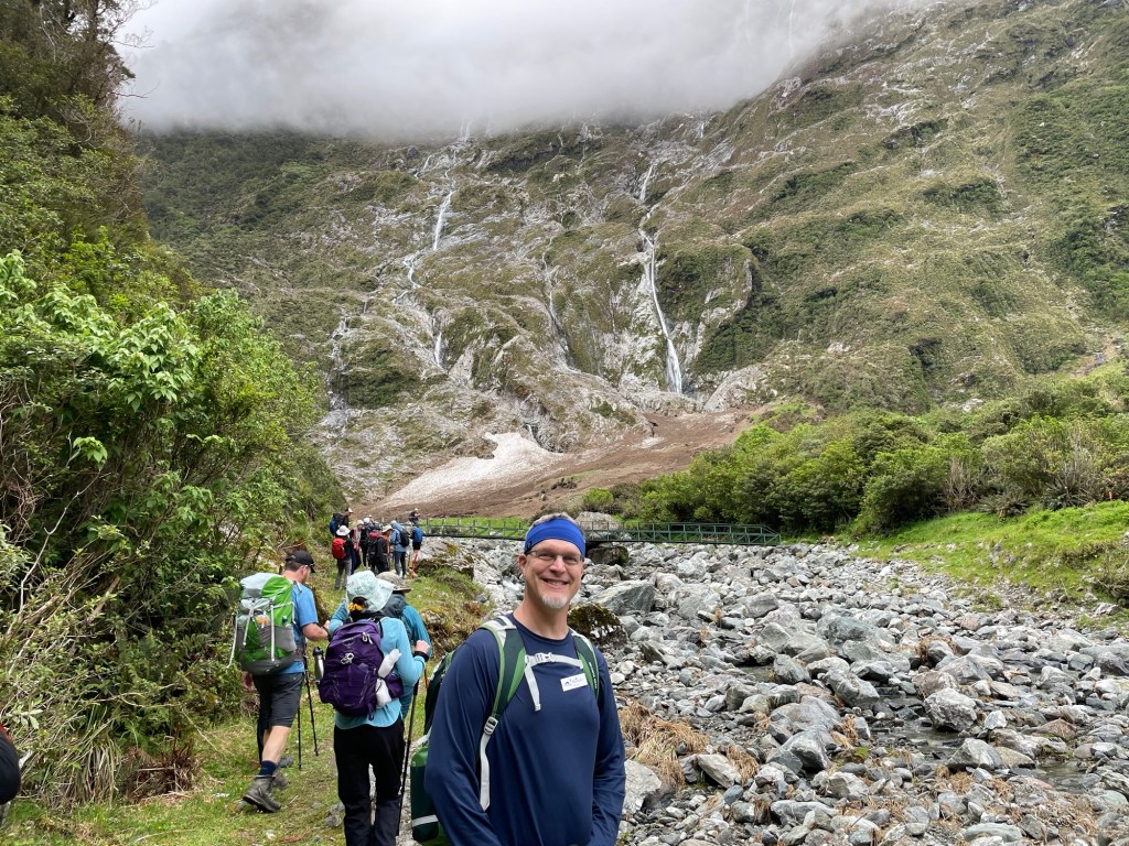
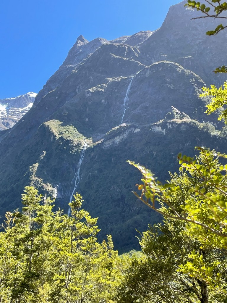
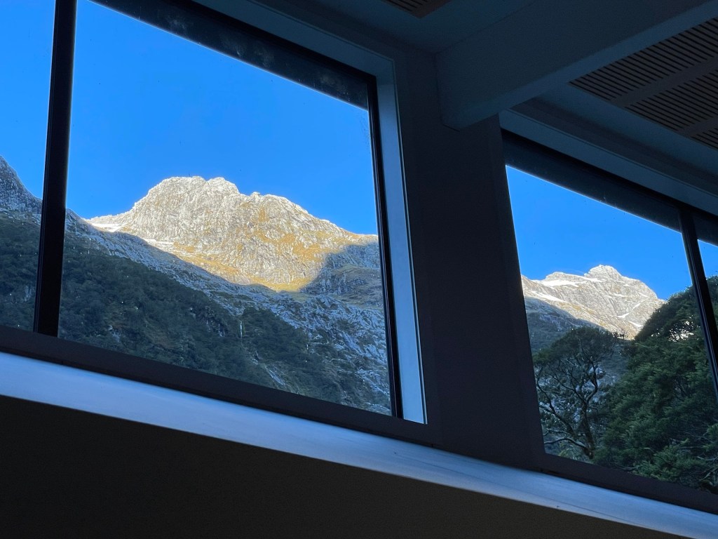
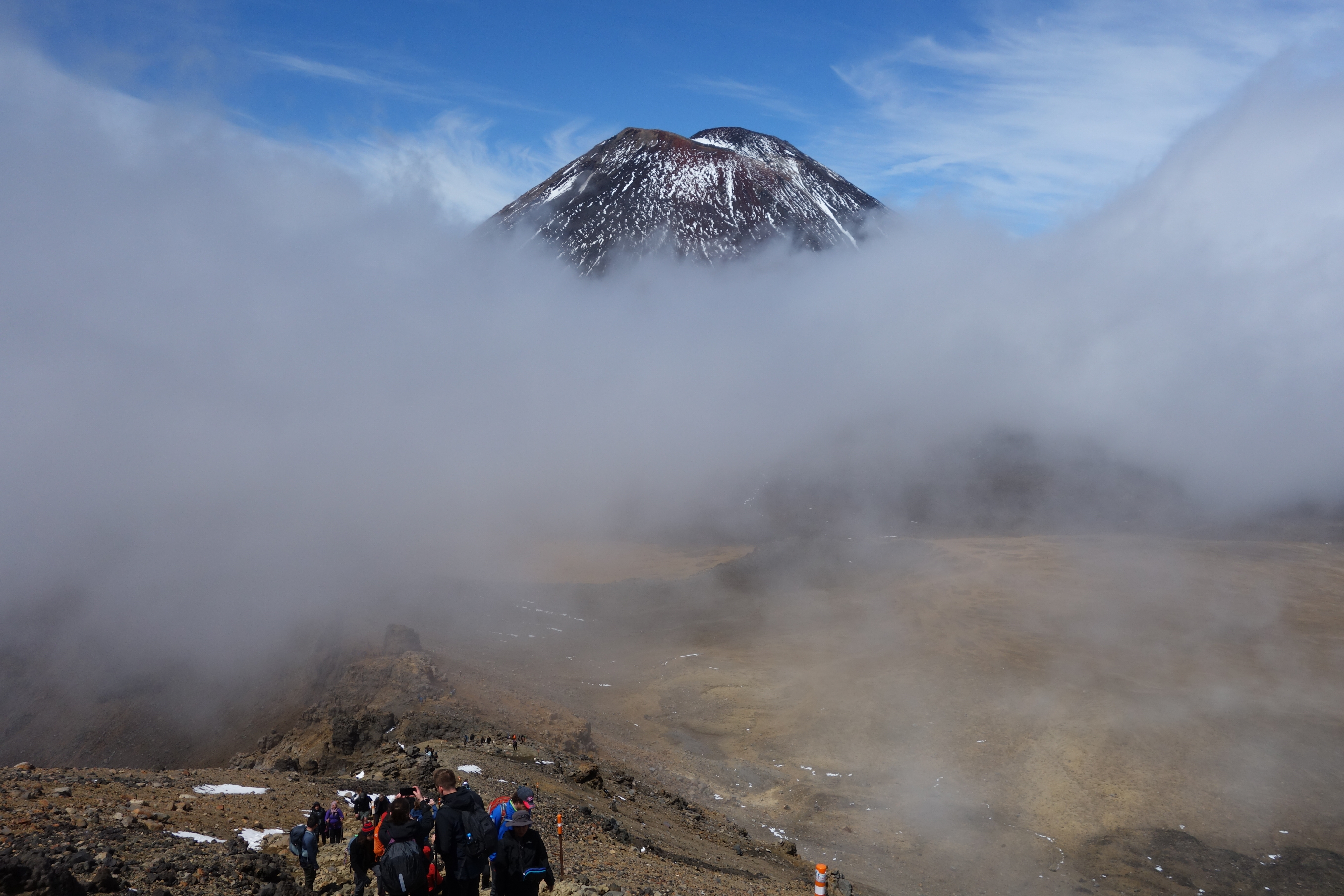
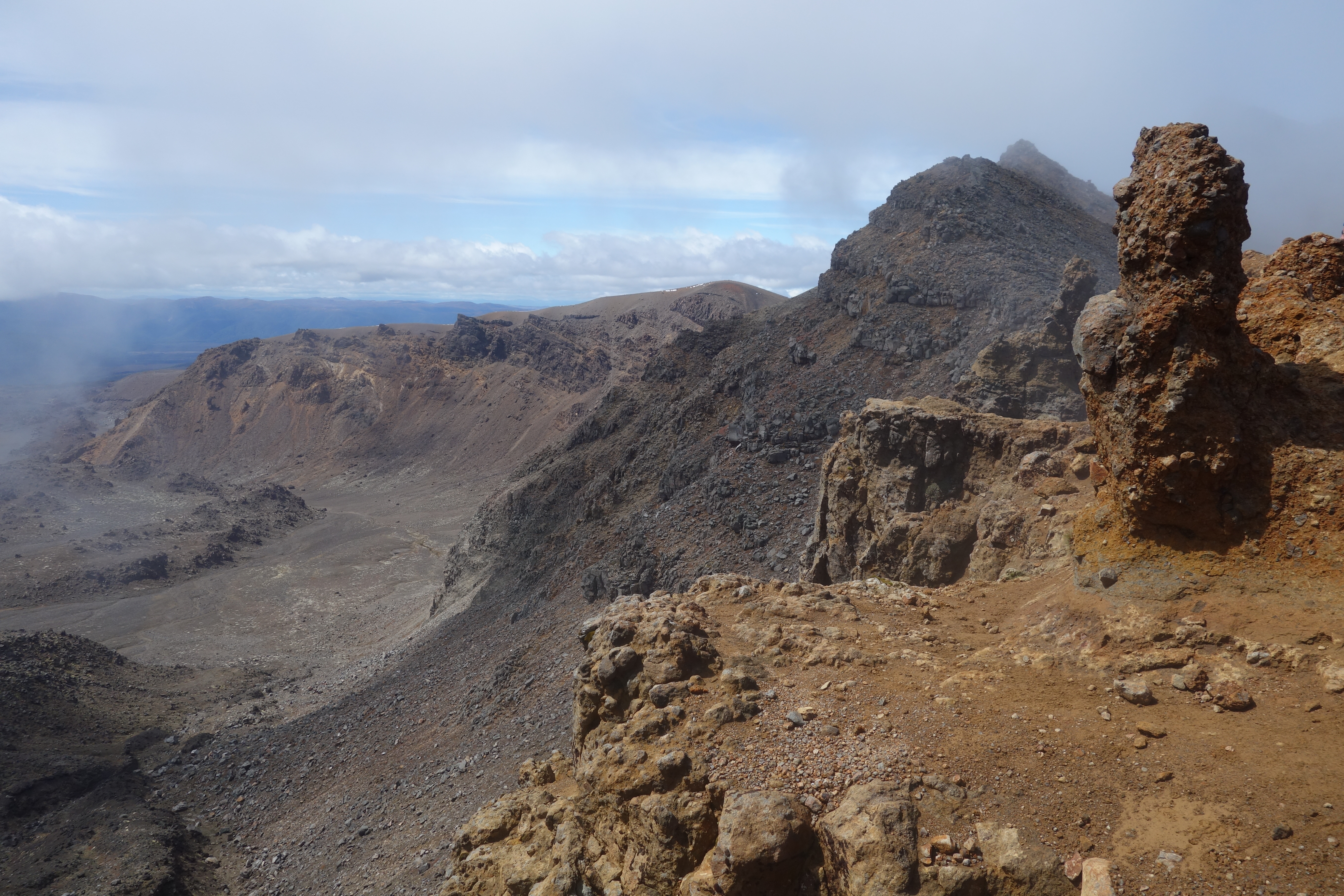
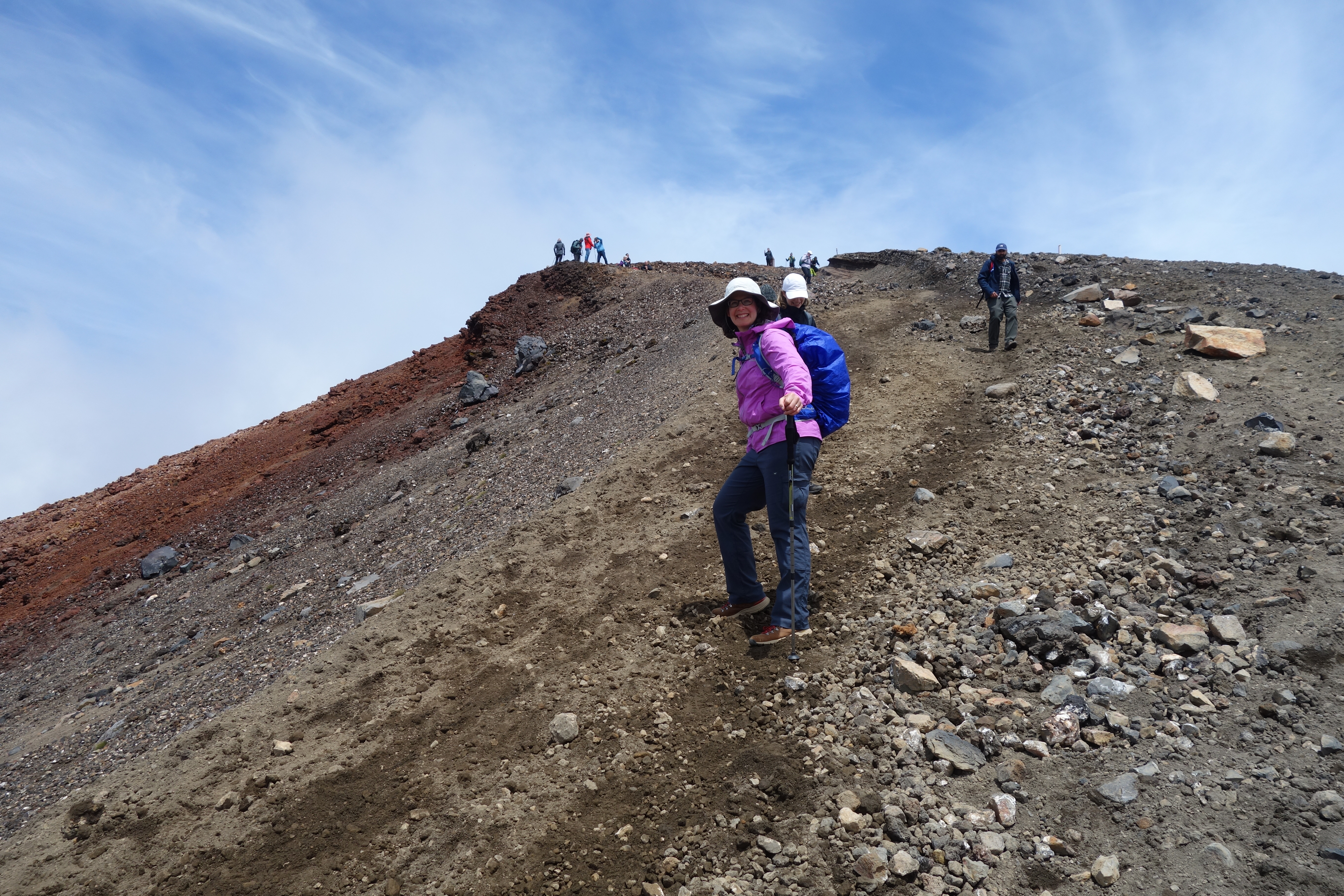
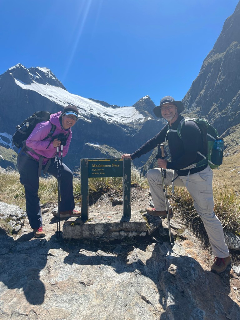
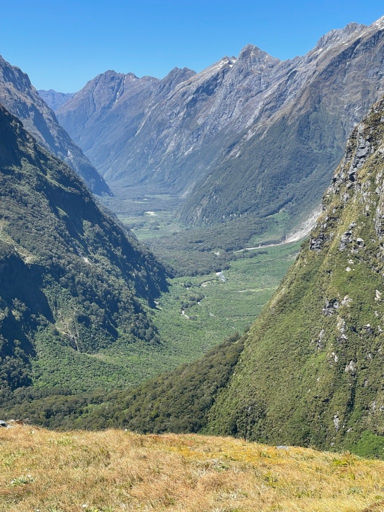
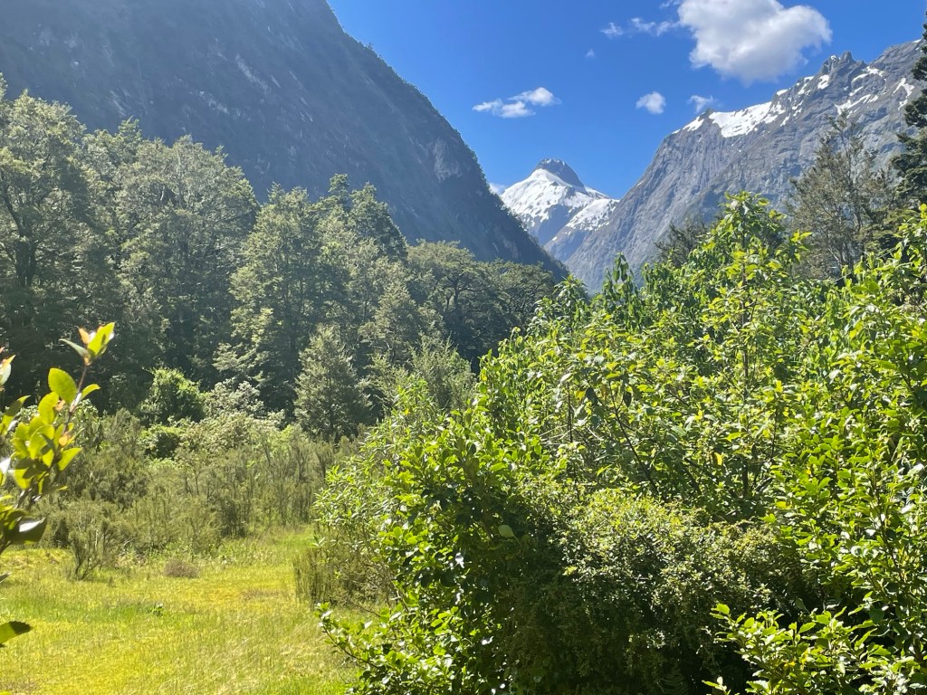
As we gained more height, we could gauge how far we still had to go by the height of the cliff walls on either side. Then the mists finally began to part, and we discovered that the mountains were twice as tall as we had originally been able to see! After a while, we cleared the forest zone, and began to get long views across and down the valley.  From there, it wasn’t too far to the saddle point, where stands a stone monument to Quintin Mackinnon.  Not far from this point is a cliff one of our guides called “the 12-second drop”.  A back of the envelope calculation suggests that the bottom must be more than 700 meters below.  (We steered clear of that way down!)

Stone memorial on left; 12-second cliff on right

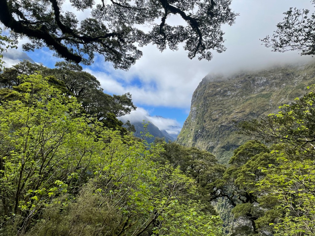
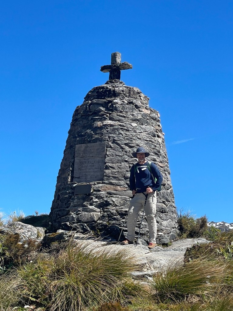
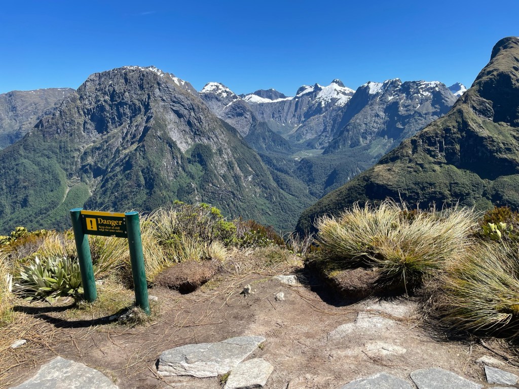
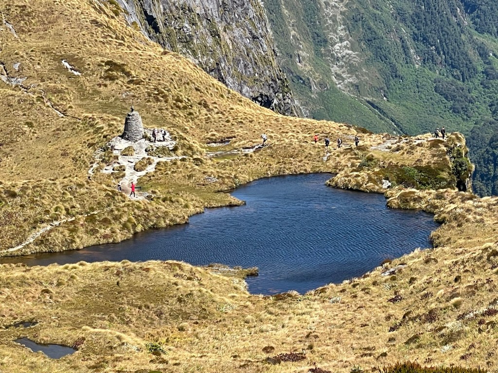
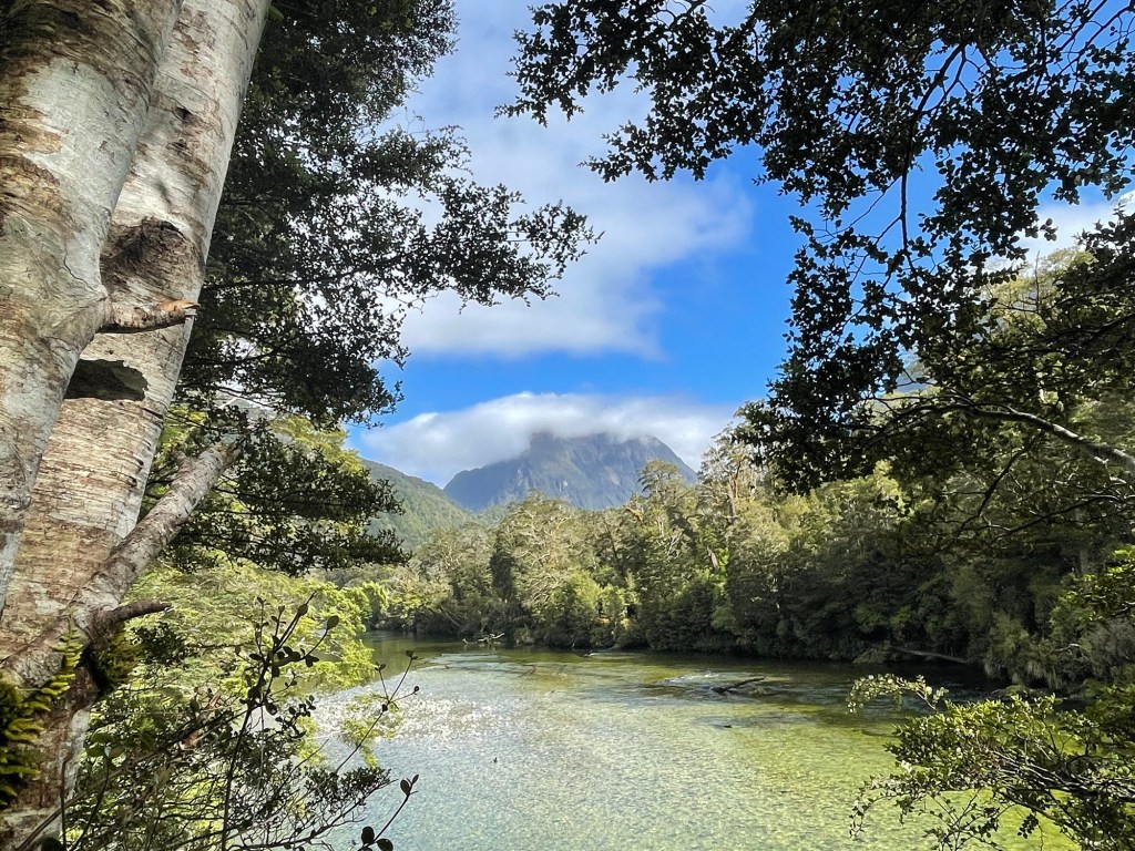
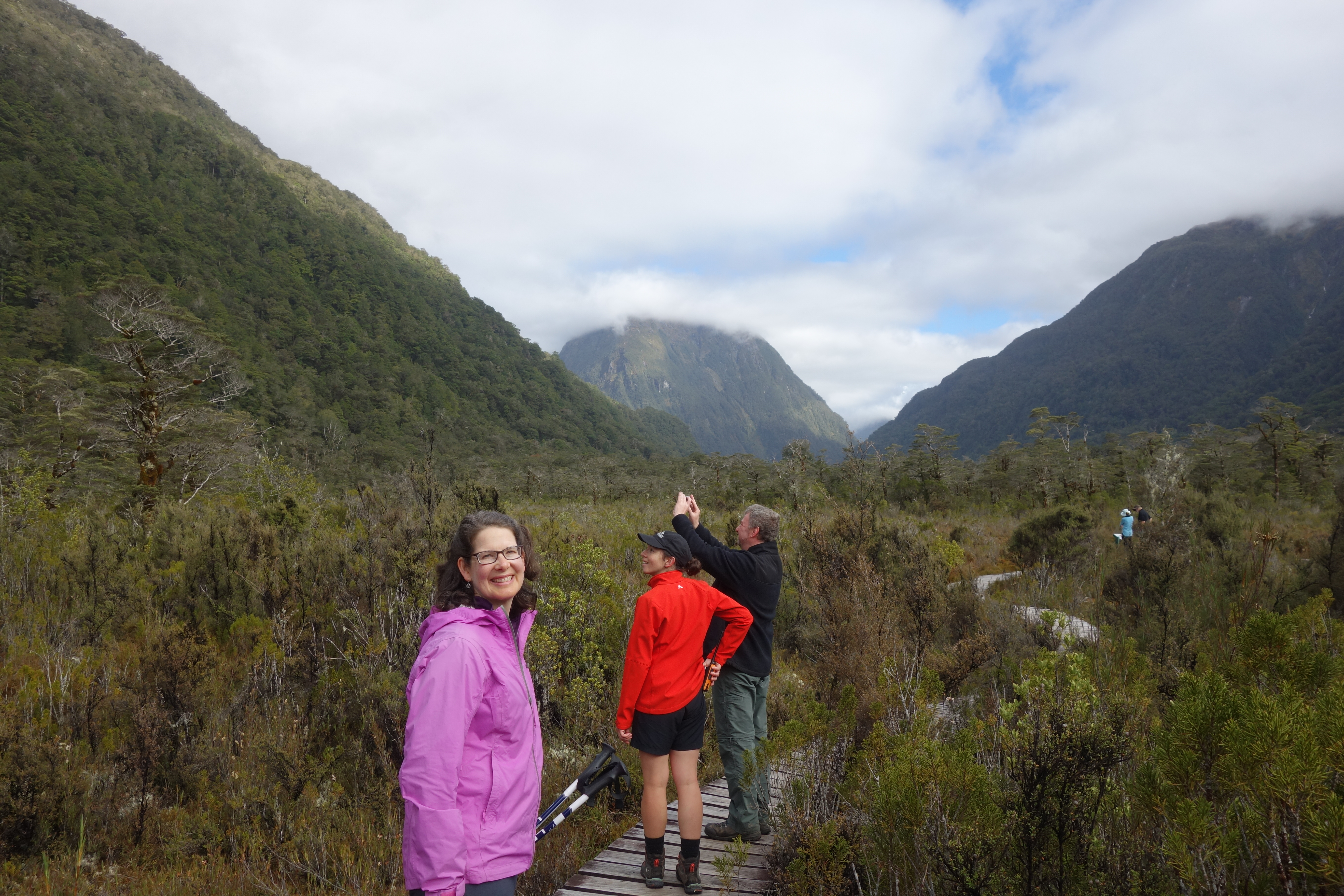
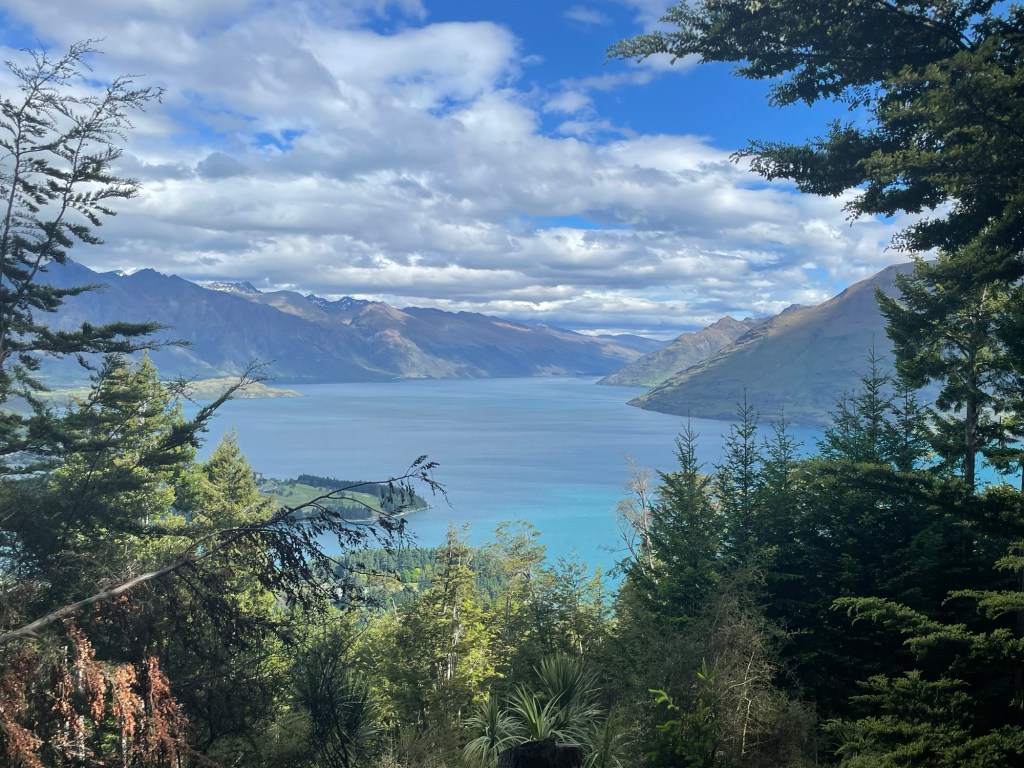
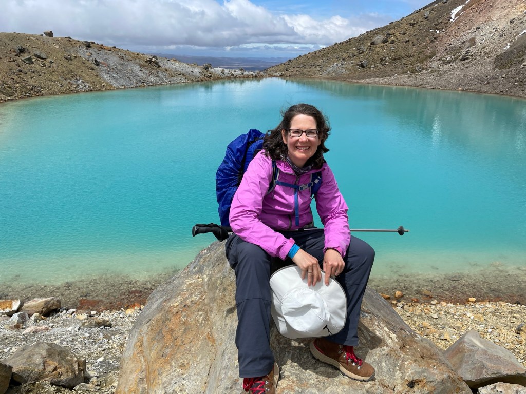
The track at the pass follows the ridgeline for some distance with views of distant peaks reflected picturesquely in tiny mountain tarns.  We could really see in every direction; the pictures hardly do justice to the scale and grandeur of the scene. The weather was so pleasant that we all eschewed the shelter at the top and ate our lunches al fresco on the rocks — something that basically never happens, according to our guides. We could have stayed at the top for hours, but after lunch with a view of the valley we had left below us, we reluctantly strapped on our packs and began the trip down the other side.

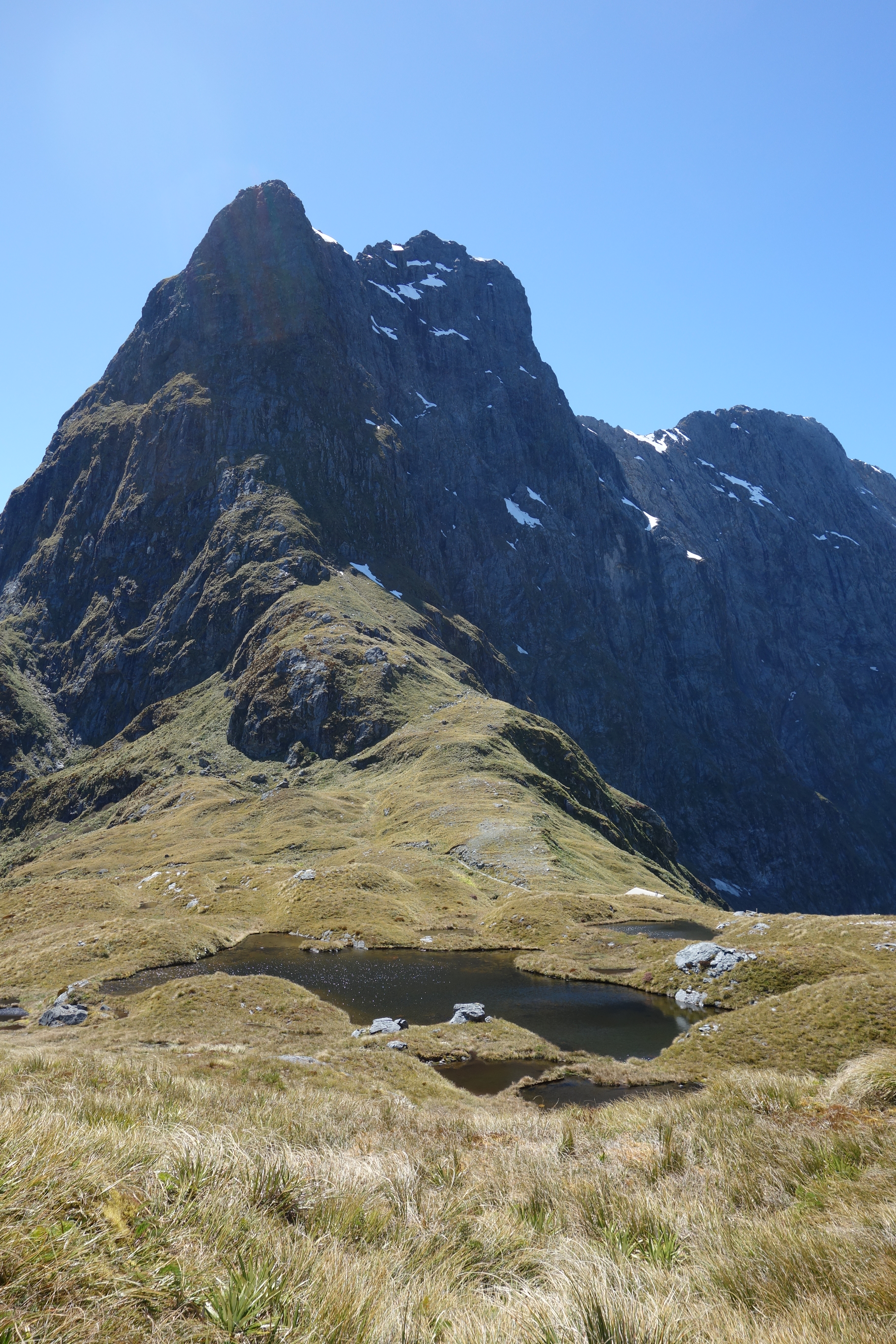
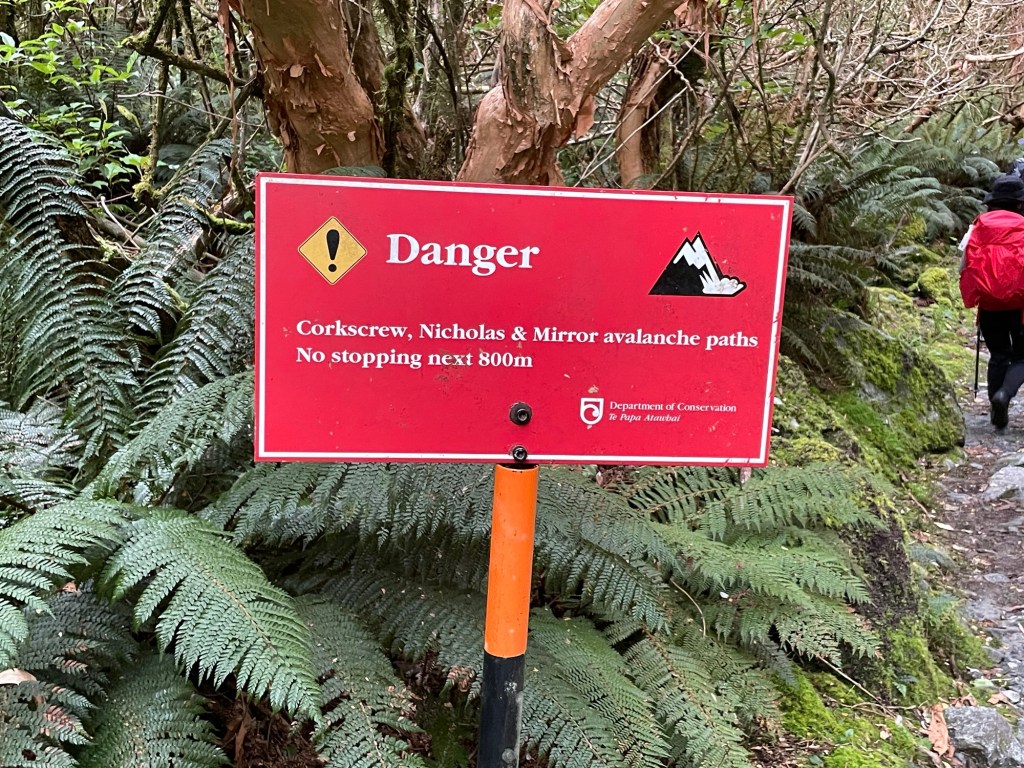
With snowpack still massed on the upper heights of some peaks, and the warming spring sunshine beating down, avalanches are a very real possibility.  In fact, we heard or saw four of them today – fortunately at some distance.  In the afternoon, our guides directed us to take an alternate path down, so as to avoid an area judged as particularly high risk.

Avalanche in progress

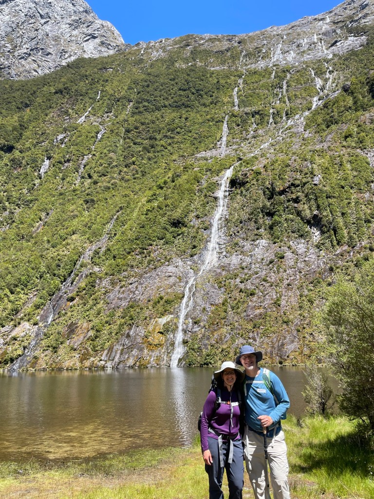
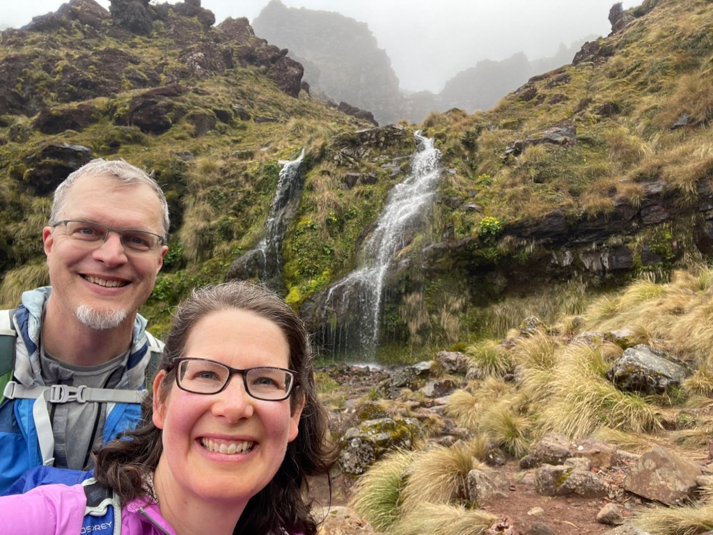
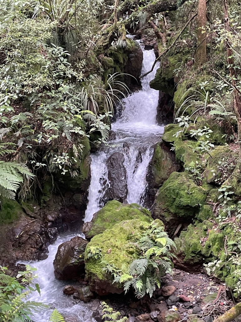
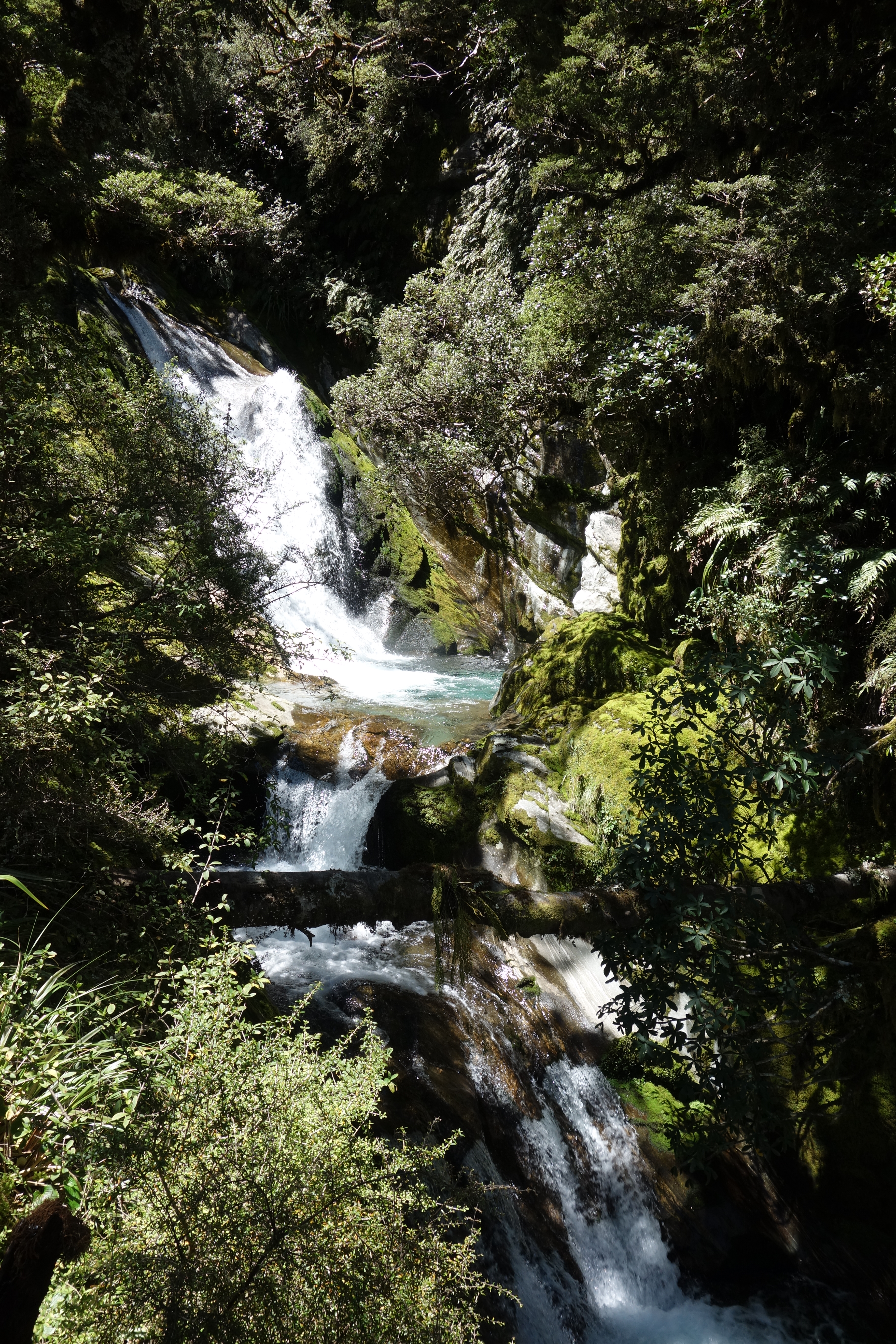
The trail on the way down now follows by the Anderson Cascades, a seemingly endless series of chutes, pools, and cataracts.  Each time we thought we’d seen the best part, we would descend a little to find yet another wonder.  We soon found ourselves saying “But wait, there’s more!” over and over, and though we lost count of the number, but there must have been dozens of levels, one beautiful glen after another.  The trail originally bypassed this wonder, but was rerouted after the cascades were discovered and now follow it via a set of staircases and walkways.

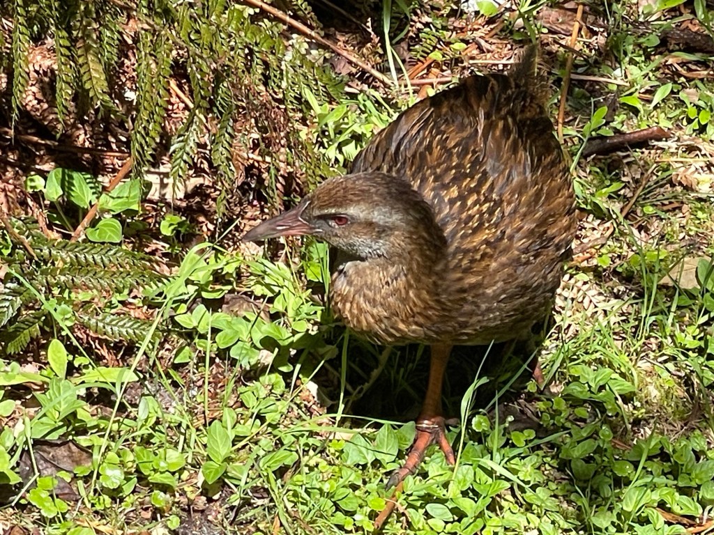
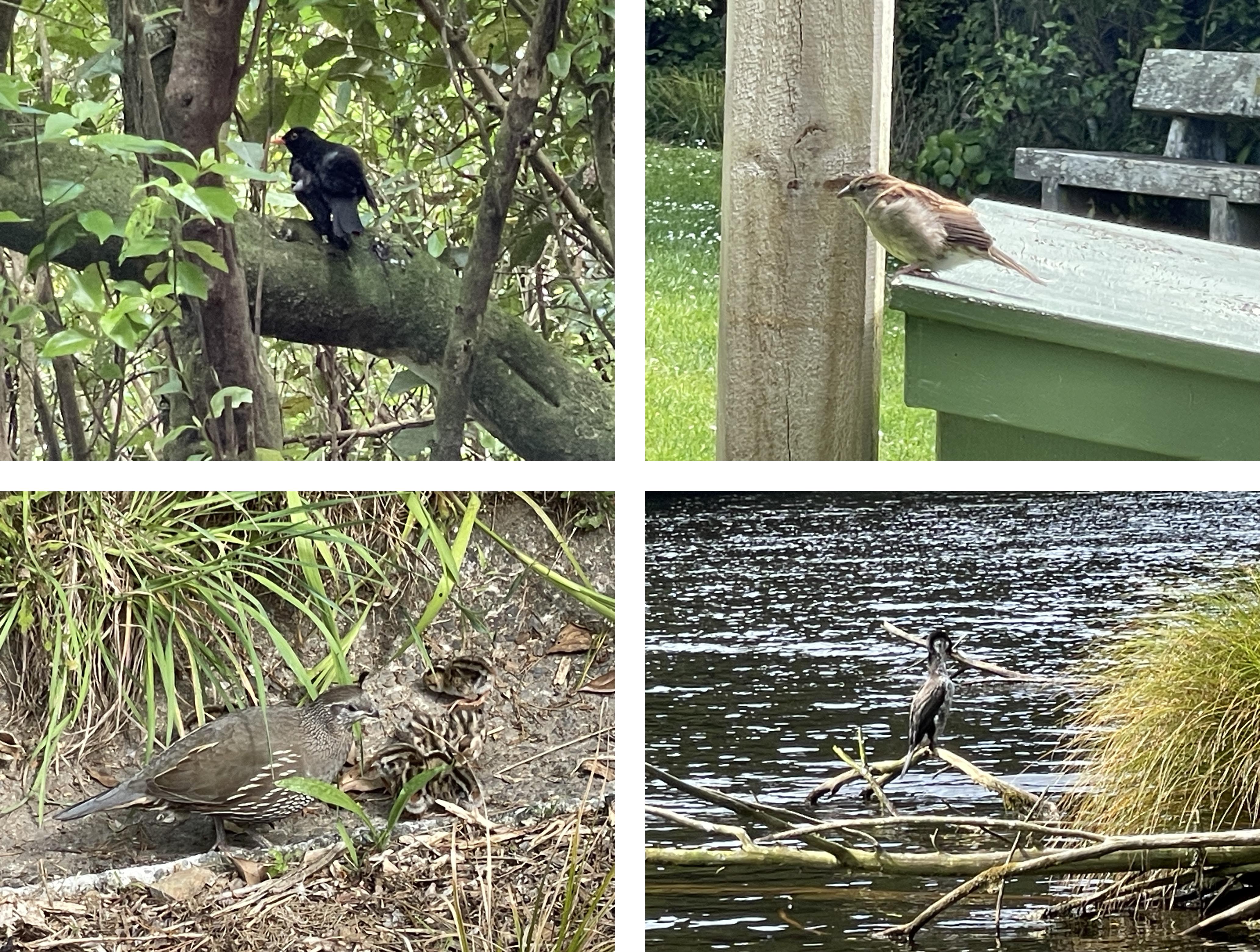
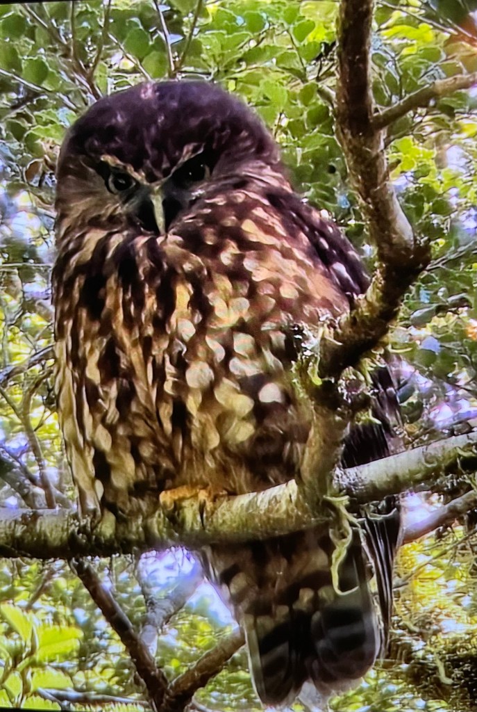
Bird of the day: just below the cascades, we noticed that one of our fellow hikers had pulled off the trail and was looking up in the trees.  It turns out he had spotted a Morepork, New Zealand’s only native owl, and a bird we hadn’t expected to get to see.  Some of the guides have never actually seen one in the wild. It kindly posed for this photograph, unruffled by the gesticulating hikers below.

Credit to Dave and his new Samsung phone, which did a better job then our cameras

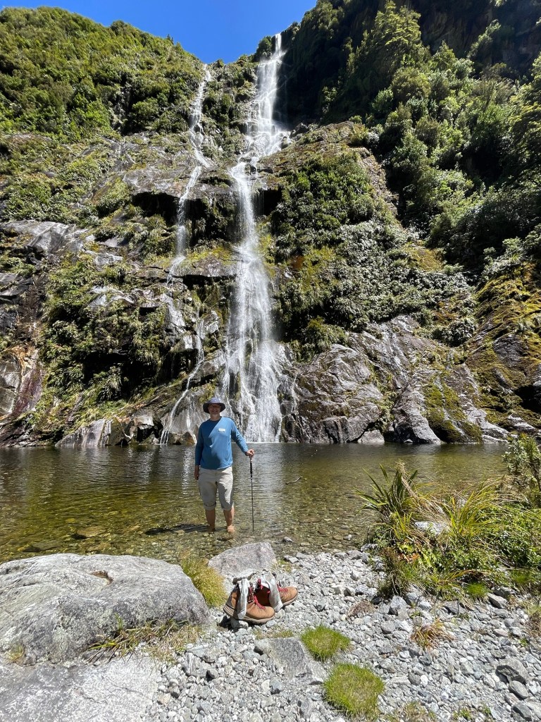
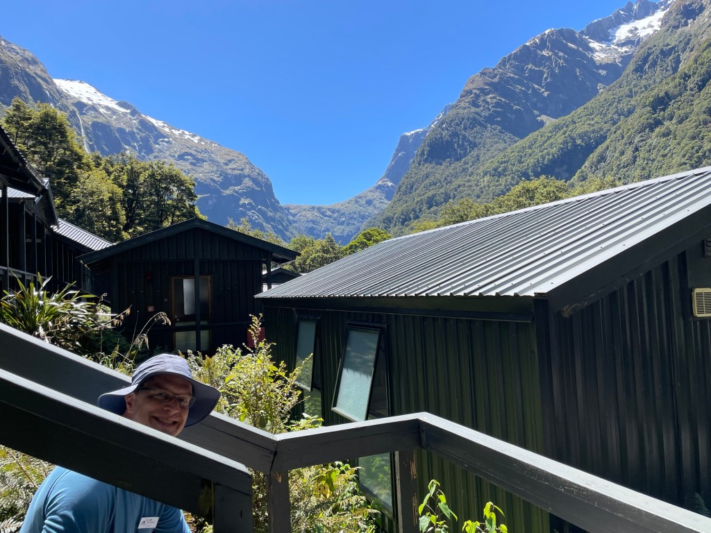
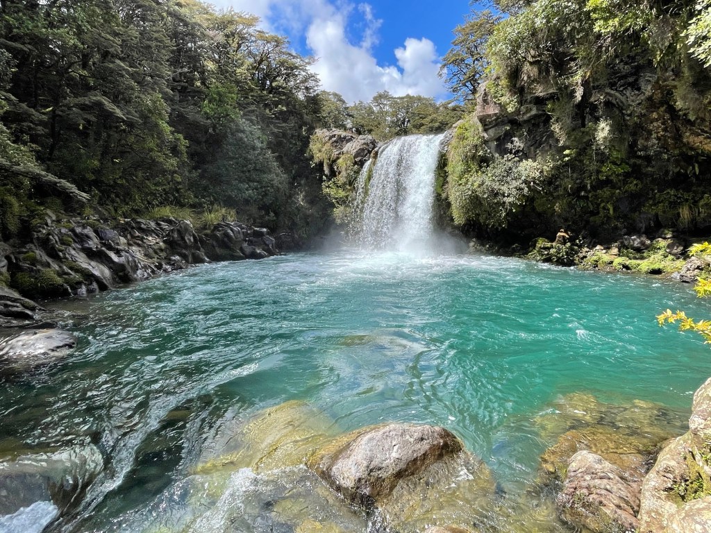
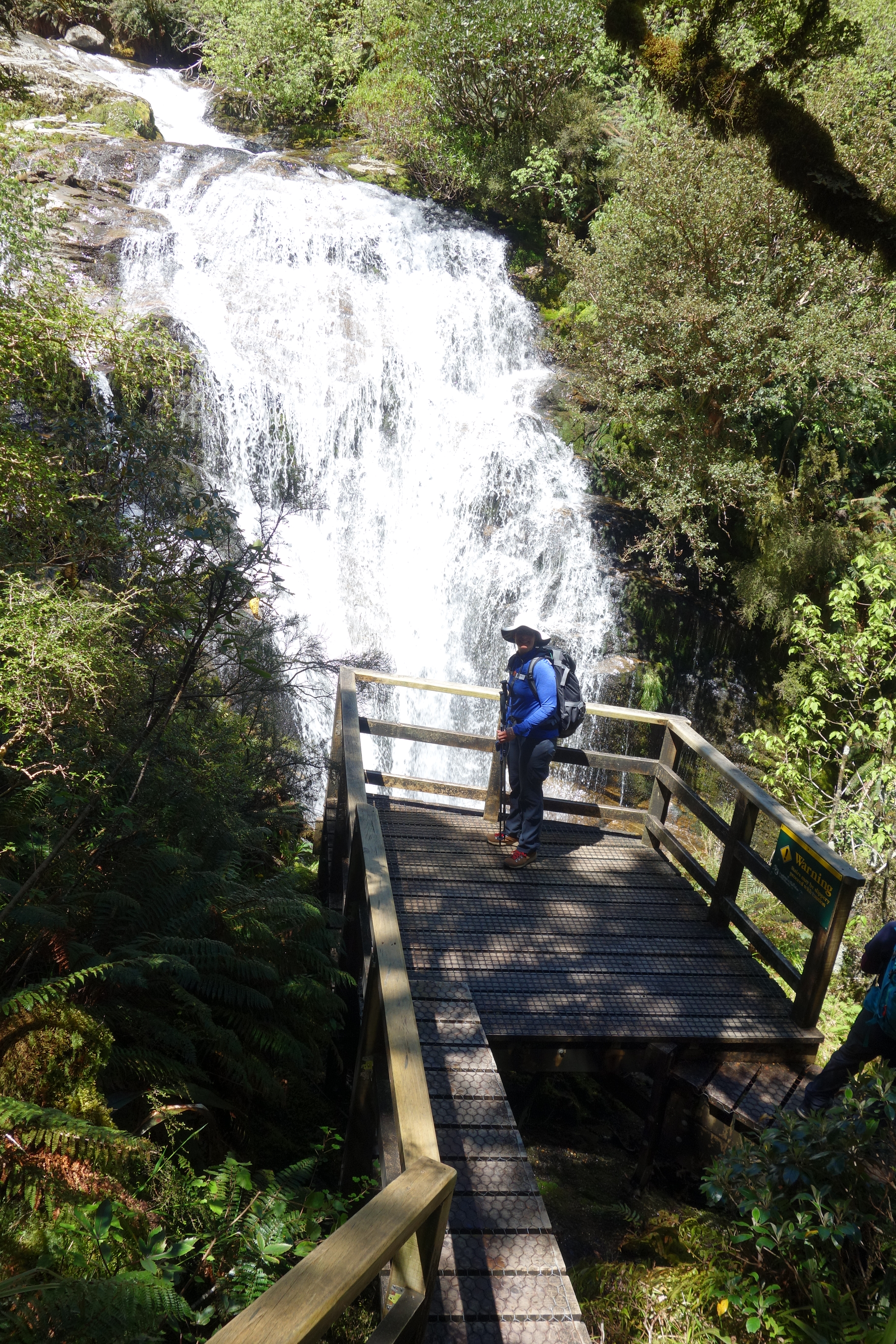
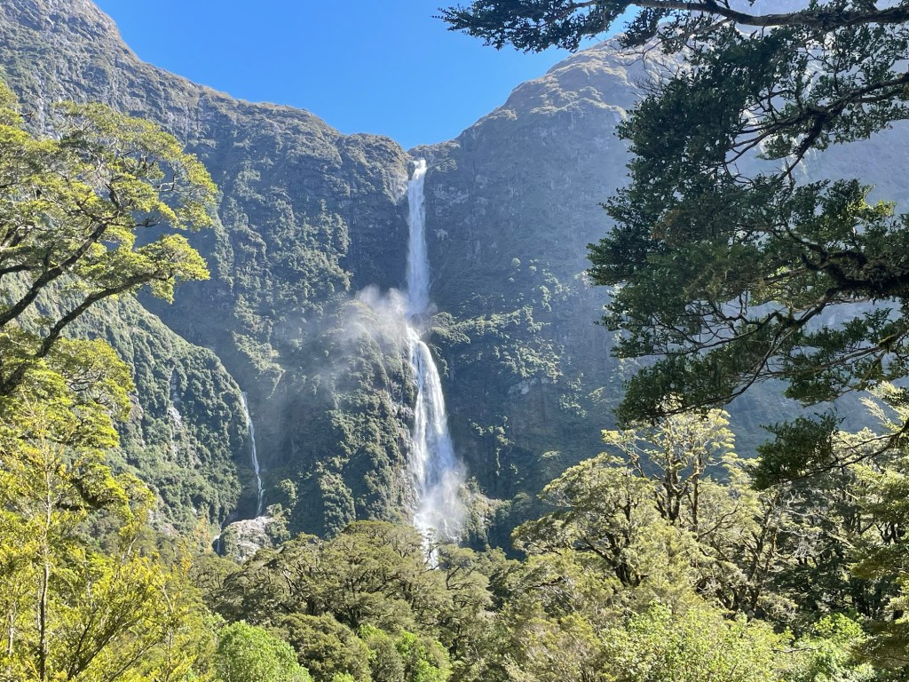
Our main trek of 9 miles landed us at Quinton Lodge by about 3:30 PM, tired yet happy, and – fortunately – in enough time to take the optional side quest to Sutherland Falls.  Heeding the advice of our guides – “put your bag down, but don’t sit down” – we dropped our bags in our room and set off on this track.  Without quite meaning to, we’ve now managed to see the tallest waterfalls on both islands in New Zealand.

Lady of Snows, seen from our doorstep in Quintin Lodge.

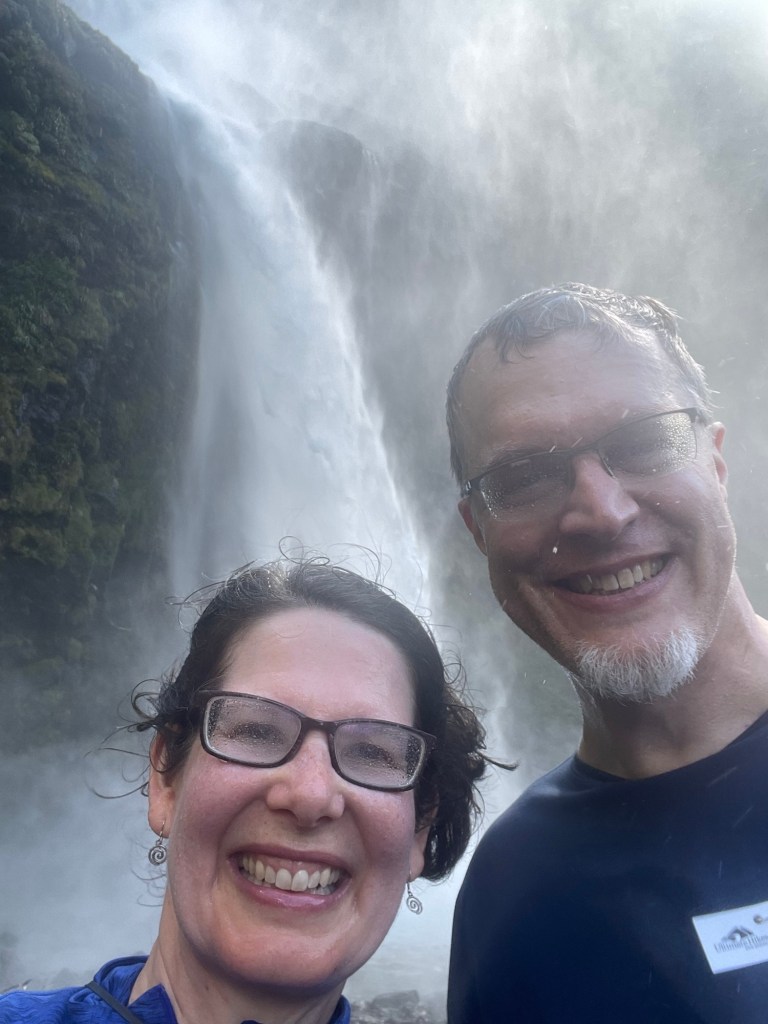
At 580 meters, Sutherland Falls is the highest of all.  Its European discoverer and namesake is Donald Sutherland, who was responsible for creating in 1880 the seaward leg of the Milford Track, connecting Quintin Lodge and Milford Sound.  The waterfall is spectacular when seen from a distance.  Standing near the base of the falls is a somewhat raw experience: with the breeze blowing off bottom, laced with flying spray, it feels something like standing in a Nor’easter.  Meanwhile, the thundering water sounds like a jet engine at close range.  Thoroughly wet and satisfied, we reversed course and returned to the lodge, adding three more miles to our total for the day.

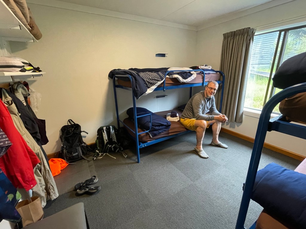
Although our previous hikes had prepared us fairly well for this day, we were still moving a bit gingerly about the lodge that evening. We were far from the only people doing what was jokingly termed the “Milford shuffle.”

Forest Bathing, with Mountains (Milford Track Day 2)

The lodges on the Milford Track have an unusual sort of alarm clock – the generators that provide power turn off every night at 10 pm and only resume at 6:45 the following morning.  If you leave your bedroom light-switch on, then the light will wake you as soon as the generators kick in, which conveniently leaves just enough time to get dressed before heading to the common room for lunch assembly and breakfast.  What is lunch assembly, you ask?  An array of ingredients spread across several tables so every hiker can fix a sandwich to their liking.

After the rain of the day before, the dawn promised a sunny day ahead and everyone in our group was eager to hit the trail.  We had to pace ourselves at the start because the bridge across the Clinton River had a max capacity of 10 people at a time.  They call it a swing bridge, which is a good name; as people walked, it swayed and lurched back and forth, somewhat unpredictably.

The trail in this 10-mile section is a delight to walk along: level, smooth gravel nearly all the way, following the riverbank.  For this, we have partly the glacier to thank, for carving out such a broad flat valley 18,000 years ago.  Some credit also goes to Quintin Mackinnon, who laid out this section in 1888 for the reward of 40 pounds, plus expenses.  Truly the highest view-to-effort ratio of any hike we’ve ever taken!

Mount Sentinel and the Clinton River

Several hikers in our group the night before had mentioned forest bathing, the Japanese concept of seeking rejuvenation in nature.  We certainly felt the truth of that today.  The bush here is gorgeous, dripping in green with moss covering seemingly every service.  No real surprise there: the region gets over 7.2 meters of rainfall annually and more than 200 rainy days in calendar year.  Statistics like these made us appreciate the increasingly sunny weather we were experiencing.

All throughout the day, we knew we were surrounded by mountains.  Our path led us up the fjord to a branching point presided over by Mount Sentinel.  Following the left branch brought us within reach of Mackinnon pass, which we will cross tomorrow.  Before lunch, we were mostly in forest and the trees allowed us only occasional glimpses of the cliffs looming on either side.  In the afternoon, however, we reached more open country and could really take in the grandeur of these mountains.  We hope you can see a bit of their beauty in the photos.

In previewing the day’s walk the evening before, our guides had described several opportunities for additional walking characterized as “side quests”, that visited sites and features near the path but not directly on it.  The first of these was a wetland, specifically a bog or a mire, meaning that the moisture comes from rain water rather than a stream.  The star attraction here was the sundew, a carnivorous plant that captures and eats the local sandflies (more on these later).  The next two quests led to small lakes created by avalanche activity and fed by melt water coming down the cliff faces from snowfields on high.  These rivulets leap down the rock face in a series of small jumps, so while they look from a distance like a single long waterfall, in reality they might better be characterized as vertical streams. In winter, snowslides follow the same routes down the face. The lakes at the bottom are called “avalanche impact tarns” because they sit in a depression that has been hammered out by repeated pounding of ice and snow from above.

Sundew, a carnivorous wetland plant (red blossoms)
Hidden Lake
Prairie Lake

Our room for the night is at Pompolona Lodge, named for “a sort of fried scone” once made by the first trail guide.  Fittingly, fresh baked scones and tea were waiting for us when we arrived.  The lodge is spacious and airy, with clerestory windows allowing views of the mountains high above.  It has a number of welcome amenities, including some that seem to be standard in all of overnight lodges: a guest laundry and drying room.  If you’ve never heard of the latter, a drying room is a clothes dryer as a walk-in freezer is to an ice chest.  To help the drying process along, this particular laundry included hand-cranked mangles to wring out your newly-washed clothes, which we both put to good use.

View from the door of our room
View from dinner

Bird of the day: The Kea, or alpine parrot, is a clever bird, sometimes too clever – they’re often said to be equivalent in intelligence to a 3-year-old human.  Keas are attracted by novelty and are a local hazard in the lodge where we stayed: any equipment or clothing outside might be torn to pieces by their curious beaks.  The lodge staff have left a decoy set of hiking boots nailed to the porch railing and a gang of adolescent keas flew in and worked industriously at pulling one boot to shreds.

Bonus bird of the day: The Whio (pronounced fee-oh) is a “whitewater duck”. Found only on river rapids, they paddle constantly to keep position in the flowing water. We saw a group of five or so birds fishing for lunch in one of the rapids along the trail; we’re pretty sure they were Whio.

The Finest Walk in the World (Milford Track Day 1)

Today begins the first day of our journey on the Milford Track, recognized locally, if not internationally, as “the finest walk in the world”.  Coincidentally, it is also the date of Thanksgiving in the U.S., though our friends and family won’t be celebrating until tomorrow (their time).  This is definitely the most different way of celebrating the holiday that we’ve experienced.  We’re traveling in a guided group, which means that the tour group staff take care of transportation, lodging, and food, which is delightful!  There are very few Americans in our group, which seems predominantly composed of Kiwis, Aussies, and East Asians.

Pile of packs en route to Milford Track

Getting to the starting point of the hike takes most of a day; the straight line distance is not too far, but by road, the bus travels around three sides of a square.  Even that doesn’t get us all the way there, so after a long bus ride we all climbed into a boat for the remainder of the trip to the northern tip of Lake Te Anau.  We boarded at Te Anau Downs, about halfway up the eastern side of the lake, and voyaged through the fog all the way to Glade Landing at the northern tip. Lake Te Anau is the second largest lake in New Zealand by surface area but because it is deeper, it holds the most water.  Unlike Lake Taupo, which is a volcanic caldera, this one was carved out by glaciers.  We’re on the edge of Fjordlands National Park, fabled for its steep cliffs, snowy peaks, and majestic sounds, and on a clear day the views would be magnificent.  We didn’t see much of anything today thanks to the low cloud cover, fog, and steady rain.  But the forecast is for more sun in the days to come, and this way we got to test out all our rain gear right up front!  The lodges all have specially-designed heated drying rooms for wet clothing and gear, so we can always start each day perfectly dry.

After all the travel by road and boat, we had only a one mile hike to reach the first lodge, so we’re not feeling the burn yet.  We did see our first wild ground bird, a weka, which scampered across our path. At first glance we took it for a rabbit but quickly realized it was something else entirely.  Another detail: as we all disembarked from the boat, we had step in tubs of sanitizer and also dip our pole tips to prevent the spread of didymo to the pristine watershed.  (We’re told that the stream water on this trip is currently clean enough to drink, and the trail managers aim to keep it that way.)

Our stop for tonight was Glade House, a lodge first built around the turn of the 20th century on a grassy meadow beside the Clinton River.  This is the third instantiation of the lodge, the first two having succumbed to fire.  As one sees it now, the large central common room is surrounded by a warren of bunkhouses, private cabins, and other service rooms.  It offers many amenities, including tea at 4 pm, a bar that opens at 5, and dinner service at 6.  There is also a host of board games, a guitar, and a piano for common use.  Susannah took a stab at some of the available sheet music, with great joy. They also have a small museum, containing memorabilia and historical photos from early days of the track. In one of the books on hand around the lodge, we came across a rather ominous-sounding poem.

The three-course dinner we had that evening could have been served in any high-end restaurant.  There were three main dish options, but the slow-cooked venison with cranberries in a red wine reduction was the star.  After dinner, the guides held a group introduction and ran through the details of the next day’s hike.  (We’ll reveal them in the next installment.)  While we were meeting, the clouds finally broke and the sun came out, bathing in golden light all the peaks we hadn’t previously been able to see. What joy!

Bird of the day: the Weka. Although we were chuffed to see our first, we soon learned that they are fairly common, and they tend to hang around lodges and lunch spots.  They move a bit like chickens and are around the same size but are much more fearless – the Kiwis call them “cheeky”.  We once saw one steal a bag of snacks off the lap of one of the unwary hikers in our group and drag it off into the bush before she could react.  One even pecked at Nick’s boot, presumably to see if it might taste good.

Hopping South

Early this morning we said goodbye to Wellington, caught the bus to the airport, and boarded a plane for the South Island. While in the airport we ran into a few lifesize emissaries from Weta Workshops, who must have been there to see us off.

Coming in for a landing at Queenstown, we could sense a difference in the landscape — while the New Zealand we have seen so far is rugged and gorgeous, what we have seen so far of the south is built on a different scale. Huge mountains and rambling blue lakes that seem to go on and on. Wow!

We had time to go for a walk after checking in at our hotel, and found a nice footpath around the edge of a point that has been turned into a park. Beautiful scenery isn’t equally distributed around the world, and Queenstown certainly got more than the usual share. There are mountains in basically every direction, and lake in nearly as many. The weather is just about perfect. No wonder the place attracts so many outdoor enthusiasts. It feels comparable to some Colorado outdoor adventure towns, only with a lot more water. Near the end of our walk, we passed a hockey rink, which seems to support a local team as well as various amateur leagues.

We only had a short time for our walk before we were due at the orientation meeting for the five-day hiking trip to Milford Sound that begins tomorrow. There will be 48 of us on the journey, and the organizers want to make sure that we’re all properly outfitted and prepared. Unfortunately, we won’t have any cell connectivity while we’re on it, so these blog updates will be on hold until we get back. Never fear, we promise to return with lots of photos and stories to share!

Following the orientation meeting we still had quite a bit of daylight left, so we decided to get some altitude and see how that improved the view. There’s a gondola that carries riders to one of the heights above town, and also a hiking trail. Guess which one we chose? Besides the gondola, our trail crossed paths several times with a mountain biking route, and also shared the slope with an overhead zipline. So the soundtrack for our walk was the whoops of the riders and the metallic buzz of their trolley hitches.

At the top of the mountain there is a whole complex of outdoor sporting activities centered around the gondola station. From bungee jumping to mountain luge (not the icy kind; this is a much tamer activity involving wheeled coasters on a sloping concrete track), there were many diversions available. In fact, the whole of Queenstown seems to be focused on offering as many outdoor-focused adrenaline boosts as possible. If you want to bungee jump, paraglide, jet boat, or anything else to get your heart pounding, Queenstown is your place. Our planned hiking trek seems rather quaint by comparison. In any case, the view from the deck at the gondola port was pretty incredible, and unlike all the other things on offer, it was free.

Sometimes a panorama flattens the scenery. In this triptych above we offer three views taken from nearly the same position, covering nearly 180 degrees of view.
It’s a very steep drop down to the town below. Note the bungee jumping terminal just above and to the left of the top gondola car. (Actually, they spell it “bungy” here.)

For the fun of it (and to save time), we decided to ride the gondola on the trip down. The gondola has had several upgrades over the years. From the red two-person red pods of the early years, to larger four person cars later on, it has recently been upgraded to the spacious 10-person cabins that we rode down in.

We had dinner at Madame Woo’s, which was recommended by both our guidebooks. The food was delicious and the setting, at outdoor tables just off the town square, placed us squarely in the goings-on of this bustling adventure city.

Now we’re off to pack for our hiking trek – see you in 5 days!

All Creatures, Great and Small

One of the great attractions in Wellington, of course, is the Weta Workshop. This is the special effects studio made famous by the Lord of the Rings movies, which has gone on to work on a number of other different projects and franchises since then. They have also branched out into other types of specialty work. For example, if you happen to want a life-size King Kong statue for your backyard (that’s about thirty feet tall, in case you’re curious), then they’re the company that can fix you up.

Since the Weta studio is located in Miramar, a part of Wellington far from the CBD, they run a shuttle service to take you there. Along the way, our guide pointed out movie-related sites, including movie theaters and some of the other Weta facilities, such as giant soundproof stages and the world’s largest bluescreen. We also passed by some of the mansions on Mount Victoria, which are built on such a steep hillside that they have installed private gondolas for access. (Maybe they’re the people who can afford to buy the life-sized King Kong statues?)

The Weta tour is entertaining and informative. They gave us a close-up look at a number of original movie props, including the Witch-King of Angmar (that’s the head Nazgul) in full regalia. Unfortunately they don’t allow any pictures in that section of the tour, so being law-abiding citizens we have nothing to show you from it. The pictures we do have are from the latter half of the tour where they were allowed, and from some of the displays in the gift shop and lobby area.

(No touching Gandalf’s hat!)

A feature of the tour that was particularly interesting: they included several Weta model-builders at work, who showed off their work and explained it to us. The second of these had us all try our hand at sculpting with aluminum foil, which is apparently a very versatile medium and used by the professionals for some of their work. We didn’t have the time to try anything too fancy, but did put together somewhat recognizable versions of a turtle and a dragon head.

Here’s how to make a bird
Working on the head

As a good-bye gift they took our picture with a fancy camera rig and some borrowed movie props, and dropped us into one of several predesigned backgrounds.

For the afternoon we visited a nature restoration project called Zealandia in Wellington. The goal of this preserve is to restore its condition to something as close as possible to what New Zealand was like before the introduction of exotic species by Europeans. Obviously, they cannot replace species that have gone extinct, but through careful work they have brought back many that were locally extinct or critically endangered. They have also worked to bring in as many native plants as possible, so that the animals have access to the habitat for which they were evolved. The result is a vibrant and beautiful outdoor environment. We felt a little like we had walked into a real-life Jurassic Park — except without any man-eating animals.

When we say “animals” we mostly mean birds. There were only two species of mammals in New Zealand prior to its discovery by Europeans; both are bats. There are some lizards, and insects of course, but birds had diversified to fill most of the ecological niches available on the island. Although the largest (the moa) are now gone, along with many others, quite a few species still remain. The air of the sanctuary was filled with birdcalls at all times, and nature photographers with scary-big camera lenses stalk the trails. We are far from professional, but still managed to bag a few photos ourselves.

A tuatara

On the way home we took the cable car together. After a stroll back through the city past the famous splash-bucket fountain on Cuba Street, we had a delicious dinner at the Ethiopian restaurant downstairs from our lodging. We wish we had one of these at home! Dessert (back at the excellent gelato place from the night before) was ube+coconut flavored vegan ice cream and cookie, which was a hit with Susannah. Ube is a type of yam native to the Philippines. Yes, it’s really that purple!

Walking Wellington

We spent today exploring Wellington on foot. Literally so, in the case of the photo above — the Wellington Museum has a large room carpeted with an aerial map of the city. Nick is standing in the middle of the central business district, roughly where our lodging is located.

Susannah began the day with an early morning trip up the Wellington Cable Car to see the city from up high. The Cable Car is New Zealand’s only running funicular railway, providing service from the central business district to the suburb of Kelburn up the hill. At the top, there is a small but informative Cable Car Museum, including previous cable car models and even a Lego display of the current cable car route.

We reunited for an official mid-morning walking tour of the city. Our guide was a longtime resident, and shared her personal reminiscences as well as the official tour information. We began at the waterfront near the Te Papa national museum, worked our way through the central business district to the houses of Parliament, and finally ended at Old St. Paul’s Cathedral, a wooden structure that looks rather modest on the outside but has beautiful wooden timber vaulting reminiscent of a ship’s hull hidden within.

As part of the tour we saw several maps of the Wellington Harbor, including the carpet shown in the lead image, as well as this diorama showing the shipping lanes and navigation lights. The harbor shoreline has changed greatly over the years, remade both by human activity (mostly infill near the port) and nature (uplift caused by earthquakes). The city sits on a major fault zone, and the last major quake shifted some areas along the plate boundary by more than 40 feet.

We learned about some of the women who played a significant role in NZ history. We liked this sculpture of Katherine Mansfield, a celebrated writer. The words laser cut into steel are taken from her journals and short stories. We also learned about Kate Sheppard, a suffragette who biked around the country collecting signatures for the petition to allow women to vote.  In the end she got over 30,000, around 3% of the population at that time. Some of the walk signals at crosswalks feature her silhouette, a move that is intended to encourage people to vote.

In the afternoon we visited Te Papa, the national museum. They had recently installed an exhibit on the disastrous Gallipoli campaign of World War I, in which soldiers from New Zealand and Australia played a significant role. The exhibit featured larger-than-life models of some of the combatants, rendered in exquisite detail by Peter Jackson’s special effects studio Weta Workshop. The displays were paired with the actual words of the depicted subjects.

View from the terrace at Te Papa.

The museum also featured exhibits on aspects of Maori culture, including a large room focused on the waka (so-called war canoes, although they were also used for peaceful transport).

As a final act for the day, we wanted to climb Mount Victoria for another on-high view of the city. The hill forms part of Wellington’s green belt of parks that surround the CBD, and sites within it were used for filming several scenes from the LotR movies. It is hard to believe that images of a fantasy world could be shot so close to a modern city, yet the park did have a wild feel to it that would be unusual in the U.S.

After dinner at a pizza restaurant that used homemade sourdough for their crust (another fine recommendation from Rowan’s friend), we rounded off our meal by tasting some of the unusual flavors on sale at our corner gelateria.

NZ Road Trip

Doesn’t everyone like a road trip? Today we packed up and headed south to Wellington, at the southern tip of the North Island. The first part of our journey passed once more through the Tongariro National Park, which is actually quite large. We said goodbye to Lake Taupo for the last time and began our drive with a large loop around the volcanic range that we had just crossed the day before. The roadside in this region is lined with shrubs bearing bright yellow flowers. We learned later that this is Scotch broom, which is considered invasive, but it sure looks cheerful at this time of the year.

Mount Doom is not the only location from the LotR movies shot in the park. Not far from our route was the Tawhai Falls, now also known as Gollum’s Pool after its cinematic cameo. Indeed, while we visited, there was a steady line of people waiting to take pictures in front of it in crouched position like an apprentice Andy Serkis. Even without actors, it is quite a lovely site.

After a morning’s travel on a winding road through hugely scenic (but hard to photograph) farmland and river valley, we stopped about halfway through the drive in the seaside town of Whanganui for lunch and a chance to stretch our legs. The Yellow House Cafe where we ate offered a number of interesting dishes, including this quinoa porridge topped with thinly sliced apple and a scoop of mango sorbet.

The city of Whanganui has a number of attractions dating to the early 20th century, including a trolley museum we didn’t visit. (You can ride the trolley on an extremely short semicircular track that stretches for about half a block.) Instead we headed for the suburb of Durie Hill across the river, which is serviced by a unique form of public transit: an underground elevator. (Well, unique in New Zealand anyway; apparently there is one other such installation in Lisbon, Portugal.) The elevator is accessed via a tunnel at the base of the hill; walking it takes you eventually to the base level, where you ring a bell for the operator and wait about a minute until the lift arrives. We paid our $2 fare and rode to the top. On the way, the operator told us that many people use the service to commute to work, and children ride it to school in the morning along with their bicycles. Who knew? The construction of the elevator was associated with the the planned development of a “garden city” suburb at the top of the hill, an early example of successful urban planning. You can see the top of the elevator in the photo below. It’s the orange tower, and houses the machinery (mostly original) that makes the lift run.

Not far from the elevator’s upper station is a stone tower built as a memorial to the 500-odd men from the area slain during World War I. We climbed the 176 steps to the observation platform at the top, which offers panoramic views of the city below. Apparently the “lover’s locks” fad has reached New Zealand, because the safety cage around the platform was studded with small padlocks.

One final sight in Whanganui was this silver sphere installed on the riverfront. The city has a lot of interesting public artwork, and is apparently a popular place for artists too.

After several more hours drive we finally reached Wellington, where we turned in our rental car. The studio apartment we are staying in is right in the center of the city, surrounded by great restaurants. On the recommendation of a friend of Rowan’s who is a Wellington local, we ate at Mr. Go’s, an Asian fusion cafe that offers tapas-style dishes and also creatively-named cocktails served in fanciful vessels. We were tempted by the “Prayers of the Soulless” but in the end settled on the “Grandpa Shark,” which included spiced rum and passionfruit juice. For the record, it was delicious.

The Mountain Says Yes

The Tongariro Alpine Crossing is widely known as New Zealand’s best one-day hike, but on any given day it may also be its worst: the weather can be uncooperative in all sorts of ways, including temperature, wind, precipitation, and low visibility. When the weather is bad, the hike closes and nobody goes through. So we were understandably nervous given that our schedule allowed only one open day to attempt the crossing — if the mountain said no, we wouldn’t be able to go. Two days ago it was impassable for rain, wind, and visibility; yesterday the weather was iffy all day. This morning the weather was relatively calm and dry, with visibility forecast to improve throughout the day. The mountain said yes!

Tongariro National Park is New Zealand’s oldest, established in 1887 — five years after Yellowstone in the United States. It is also known for its role in the Lord of the Rings movies; multiple scenes were shot here, including the climactic moments with Sam and Frodo on Mount Doom. The volcano last erupted in 2012 (on Susannah’s birthday, of all dates!), spewing rocks high into the air from Te Maari crater. We passed by the pit left where one had landed; it was several meters across. On our own hike, things seemed mostly quiet aside from some steaming fumaroles. We did hear a loud boom at one point that had us looking around nervously, but saw and heard no other activity.

We were up before 6 am so as to get a timely start. The trail crosses from one side of the Tongariro range to the other, and is about 20 km long. Most people park on the northeast side and hire a shuttle service to bring them to the trailhead on the southwest side, so that the hike takes them back to their cars. The trail is extremely popular: around 150,000 people hike it each year. Given the limited number of days when the trail is open, that means potentially a thousand or more hikers on any given day. It certainly felt at times more like a mass migration than a wilderness hike — for the first half of the day it was rare not to see any other hikers, and many times we could see groups of 20 or more at once. With so many people it is inevitable that some will be less prepared than others. Although we were dressed in good outdoor gear and had brought plenty of warm clothing, we saw others dressed in cotton sweats and sneakers. The trail managers have posted a number of helpful signs on the mountain to help ward off trouble, encouraging people to turn back if they are feeling tired early on, or if the weather looks bad. We appreciated the irony of the sign below; despite the appearance of the trail ahead we knew that the forecast predicted that the mist would soon lift. And sure enough it did, finally clearing enough to reveal the summit of Mt. Ngauruhoe to our south.

The trail is mostly single track, but not long after the start there was a short side path we opted to follow in order to see the Soda Springs.

By the time we reached the South Crater, the mist had mostly cleared. Before it did, the flat surface of the crater felt a little like the surface of Mars, with reddish-orange soil scattered with small rocks. From the South Crater we ascended a ridge studded with hoodoos and got our first view into the valleys beyond.

From there, we hit the steepest part of the trail, continuing up past patches of snow until we reached a ridge where many people seemed to be resting. When we got there, we had our first view of the Red Crater, where we too stopped for lunch. This crater is one of the youngest on the volcano. Its deep red color comes from a combination of iron in the rocks and extreme heating.

From our lunch spot it was just a short walk to the high point of the trail at 1868 meters, before a very slippery descent down the other side towards the Emerald Lakes. We were very thankful to have poles, though Susannah still managed to end up on her backside once during the descent. The Emerald Lakes are an iconic view in New Zealand, even featuring on their international postage stamps. (Do you like our photo better?)

Continuing on across the North Crater, we witnessed this impressive double sunbow. Seems like a good omen! Looking backwards, we had a fine view of the Red Crater and Ngauruhoe behind it, before ascending the crater rim to reach the edge of Blue Lake.

Shortly after Blue Lake we climbed over a pass and opened up a new vista to the north. That’s Lake Taupo in the distance, with the smaller Lake Rotoaira in front of it. Our kayak trip the day before was on the north (farther) shore of Lake Taupo; as it happens, that day we also took a picture of Mount Tongariro from the lake.

The trail down from Tongariro descends over 1100 meters. At the start we were in an alpine zone, with only short hardy plants growing low to the ground. As we continued, a brushy zone grew up around us, and then rather suddenly we found ourselves in a bush forest again, with tall trees, many ferns, and moss on seemingly every surface. Soon we were following a rushing mountain stream. Despite its beauty, signposts told us that several times in recent history, the valley had seen deadly lahars pouring down it — mixtures of mud, water, and rock that smother everything in their path. Fortunately, none decided to visit today.

We made it to the end! The hot tub at our B&B is waiting for us…

Lake Taupō Pursuits

Last week we went kayaking and switched to bike riding in the afternoon. Today we did the same thing in reverse. The two activities make a nice combination because they use different muscle groups. In the morning, we wanted to try out the two e-bikes that came with our Airbnb rental, so we took a nice easy ride on the lakeshore path. It’s shared with pedestrians so you can’t ride too fast, and it offers beautiful views across the water.

After returning the e-bikes and checking out of our room, we spent the rest of the morning in Taupo picking up a few pieces of gear needed for our big hike tomorrow, then had lunch at a place that offered a variety of meals built around savory waffles — a surprisingly good idea. Finding that we had a bit of time left before our afternoon kayaking tour, we checked out the local municipal park. It had once been a geothermal spa, even boasting a large geyser. The heat has moved elsewhere today but it still offers picturesque views of the Waikato River. We were not too far upstream of Huka Falls, and lots of very stern signs warned boaters to pull out of the river before reaching the point of no return.

Fortunately, our own kayaking plans for the afternoon didn’t involve going anywhere near dangerous waterfalls. After a short drive along the shores of the lake to nearby Acacia Bay, we left our rental car in possibly the most panoramic parking spot we’ve yet to come across.

Our group of six kayakers turned out to be all Americans, even the guide. Unlike the trip to Whangamata (Donut Island), where we used sit-on-top kayaks, this time we had sit-in models with spray skirts to keep the water out. It was a good thing too, because the wind was blowing up some pretty big waves that sometimes washed over the top. In fact, the water became so rough as we rounded a point into an upwind stretch that the guide made the call not to continue further — a good idea since one of the other boats in our group was struggling a bit with the conditions. Instead we beached the kayaks and continued a bit farther on foot until we reached a small harbor where we had hot drinks and muffins.

On the way back our guide told us some Maori stories about the local landscape. One centered around a mountain that was said to be a pregnant woman lying on her back.

Back in our car, we hit the road headed toward our next lodging in Turangi. We stopped for dinner on the way out of town at the Two Mile Bay Yacht Club, a lakefront restaurant that seemed a favorite with locals and recommended by our Airbnb host. The place was hopping — almost all the tables were full, a singer was playing live music, the view was stupendous, and the sun lit everything up in gold. We both ordered “toasties”, which turns out to be a grilled sandwich something like a panini.

One other fun detail about the restaurant: in the parking lot was this truck full of dogs. They were very well trained, never leaving the bed of the truck, and would happily greet anyone who happened to walk by. Perhaps they enjoyed the whole scene as much as we did!

The drive to Turangi along the lakeshore was perfectly timed with the setting sun. Ahhhh…

Puzzled in Taupo?

Today we pulled up stakes in Rotorua and made our way south to Taupo, on the shores of the eponymous lake. The weather was a bit iffy, with sun one moment and rain the next (or even hail at one point!) so we didn’t plan any big outdoor activities. Fortunately for us, the sun was out as we drove past Huka Falls, where the outflow from Lake Taupo flows through a natural flume before falling into the basin below. The flow is impressive, but the color is even more striking.

For lunch we followed a recommendation in our guidebook and sought out a cafe/art studio called L’Arte. Besides excellent food, they offered eclectic artworks such as this concrete mosaic sofa and ceramic flowers. (We declined to test the comfort of the sofa cushions, since it had just rained and they were still wet.) Even the bathrooms were done up in style!

After checking in at our lodging, we were looking for an afternoon activity that wouldn’t get rained out. A brochure at the information center caught Susannah’s eye, and we booked time in an escape room. Called “The Hunting Lodge,” it was their hardest challenge puzzle, with three rooms, and centered on a gruesome murder. We managed to solve the main puzzle, but not the advanced level (to date, apparently nobody has).

The weather had improved by the time our escape room was finished, so we followed up with a scavenger hunt set up by the same company. It served as a good excuse to explore the central part of the city on foot, as we looked for a number of interesting landmarks guided by enigmatic rhyming clues.

Finally, we had dinner at the Crafty Trout, an eclectic place known for brewing, fly fishing, and wood-fired pizza. The chicken, cashew and apricot pie was unusual but quite tasty!