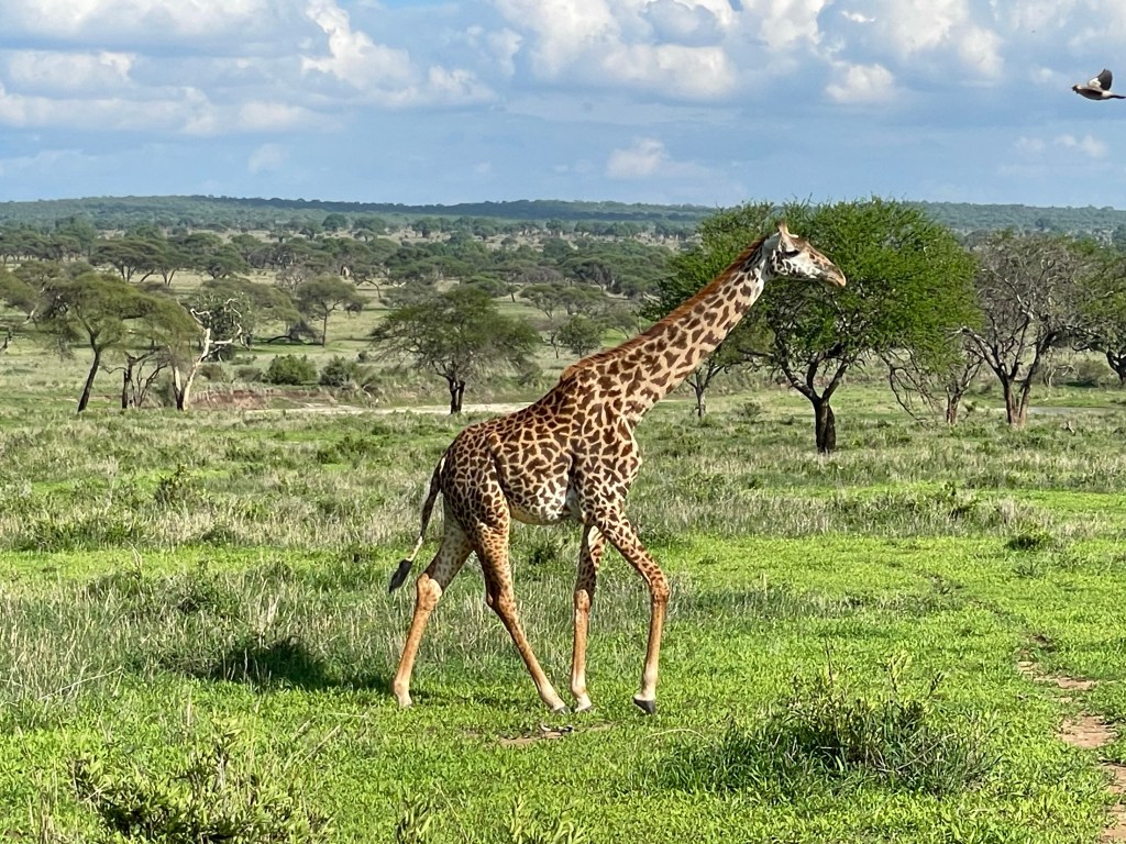
Hooray for giraffes, the national animal of Tanzania
This trip has been a long time coming, having been postponed twice because of the pandemic. But we’ve finally made it to Tanzania in celebration of several milestone birthdays. We’re a party of 9, being joined by Nick’s sister Kate with her family, and organized by Nick’s mom.
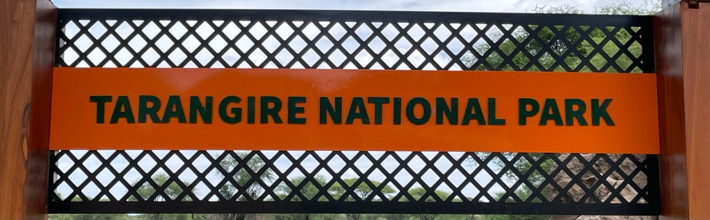
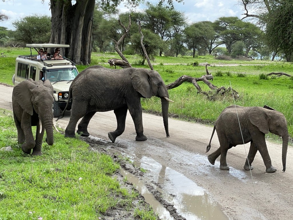
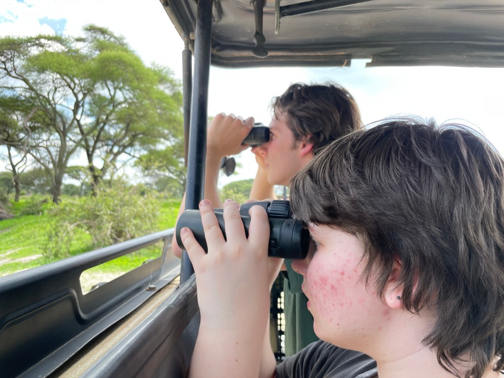
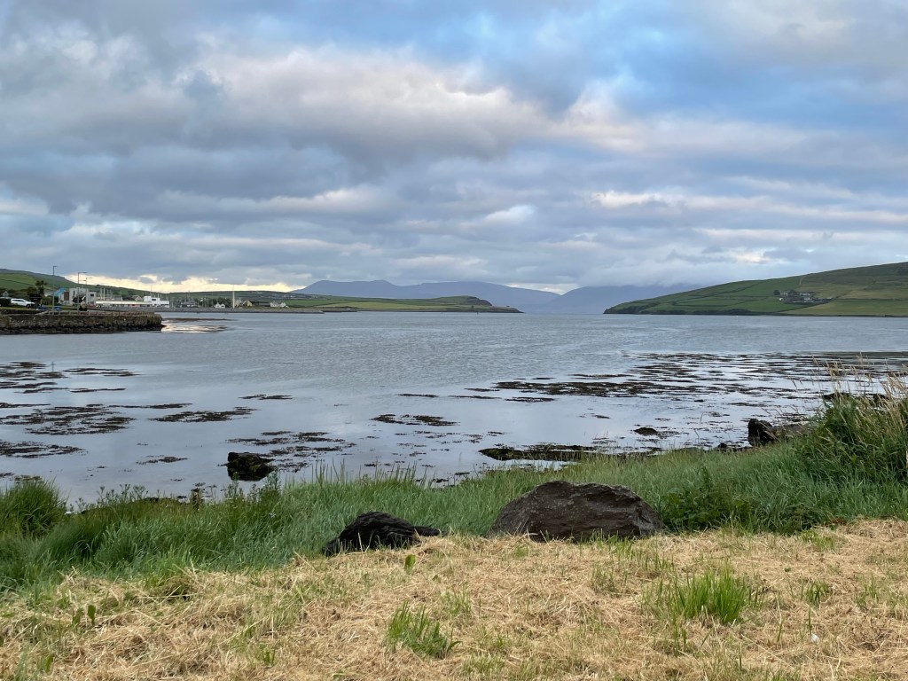
After more than 24 hours of travel, we touched down at Kilimanjaro International Airport and made our way to Arusha for some much needed rest on horizontal beds. The next morningwe boarded two Land Cruisers for the trip to Tarangire National Park. We spent the day scouting for animals with much success – we’ll let the pictures below do the talking.
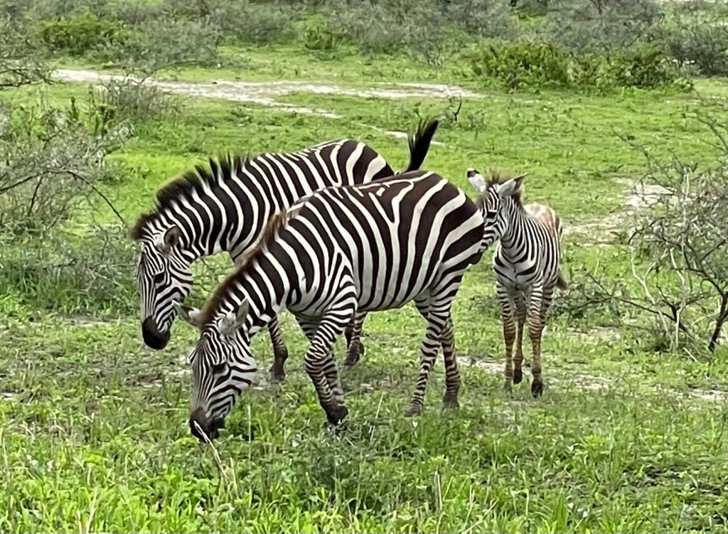
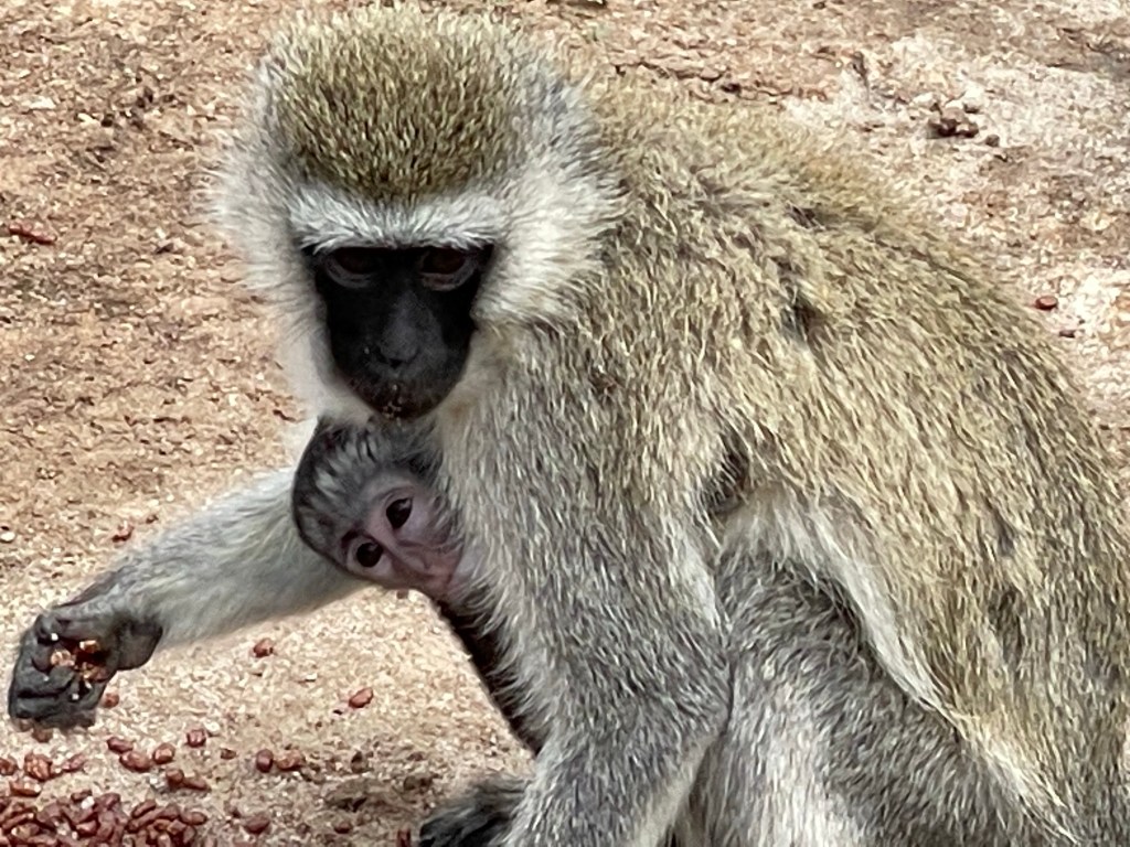
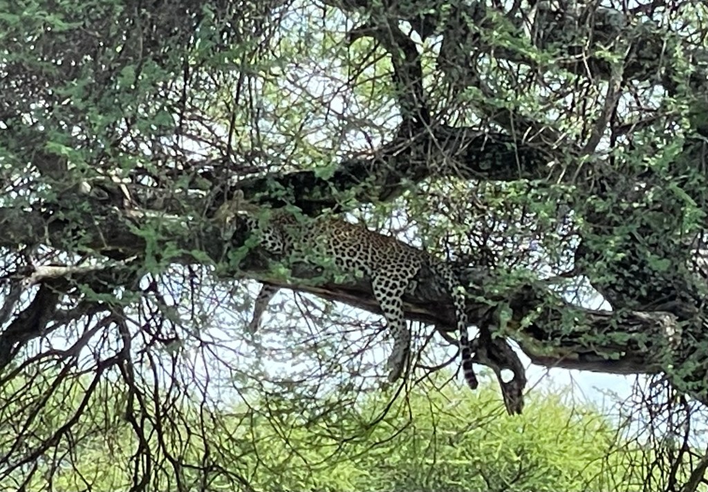
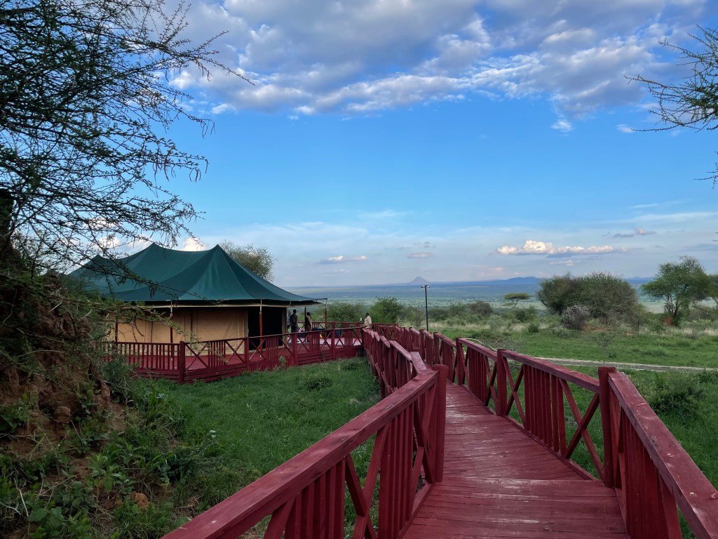
Zebras were some of the first animals we sawAnd monkeys too, in the parking lot by the park entranceSoon after entering we saw our first elephants up close. Note the good views from the pop-up roof on the vehicle.Here’s the view from inside our vehicleOstriches are good parents – one leads the brood of chicks and the other follows behind.Perhaps our rarest sight of the day was this leopard napping in a tree.We ended the day at the truly luxurious Acacia Tarangire Camp with separate pavilions for rooms, lounge, and dining.
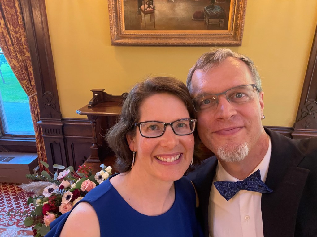
A weekend trip to Saratoga Springs for the wedding of a former student and friend also provided time for some sightseeing, so we decided to share this special one-off post about the trip.
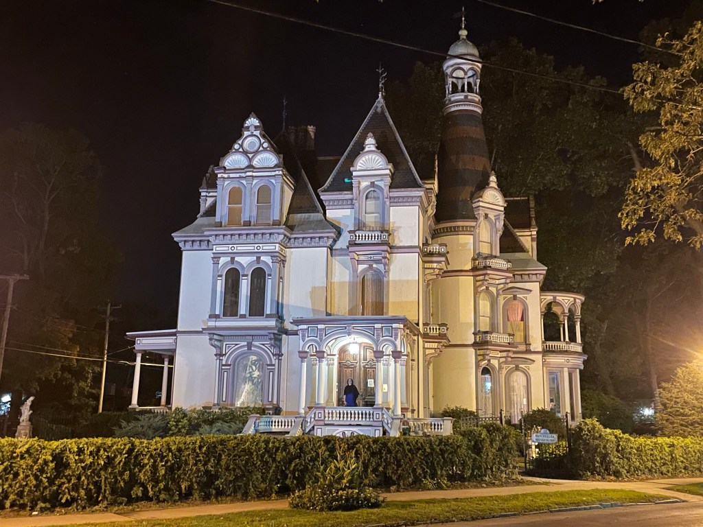
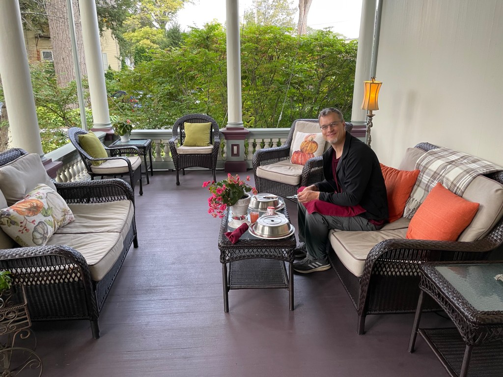
Susannah found us accommodations at a restored mansion from the Gilded Age known as the Batcheller Mansion Inn. Originally built for a local politician and judge, the house fell on hard times and (we imagine) was a rather classic “haunted house” for several decades before being restored in the 1970’s. Today it boasts many fine rooms open to guests, including a generous open air porch where we ate our morning breakfast.
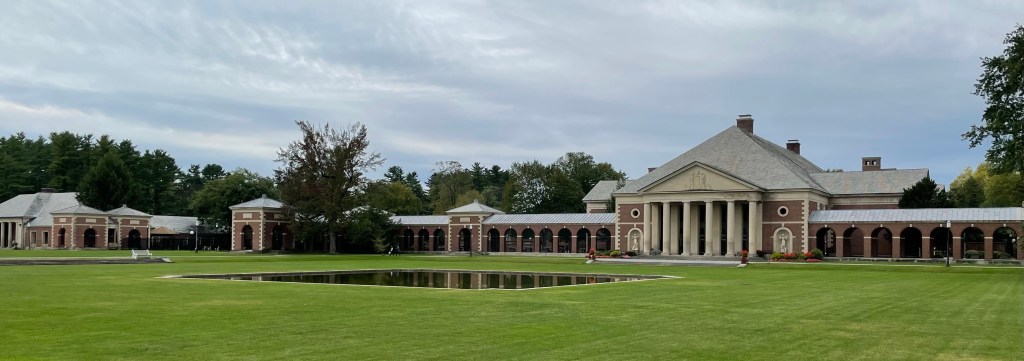
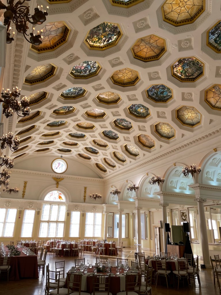
The memorable wedding itself took place at the Canfield Casino, within Congress Park in the middle of town. Built to tempt the rich and fortunate who flocked here a century ago, the building boasts ornate decorations including stained glass medallions in the coffered roof. Although its gambling days are long gone, it is still much in demand as a event space. Wandering its beautiful rooms while dressed for the festivities, we could feel the echos of the long-vanished glitterati.
Although we have visited the town of Saratoga Springs several times before, we had never been to the eponymous state park nearby. In search of a place to go hiking, Susannah suggested that we explore it the next day. As it turns out, it offers far more than a simple walk through the woods.
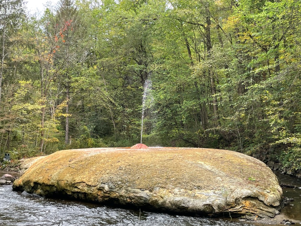
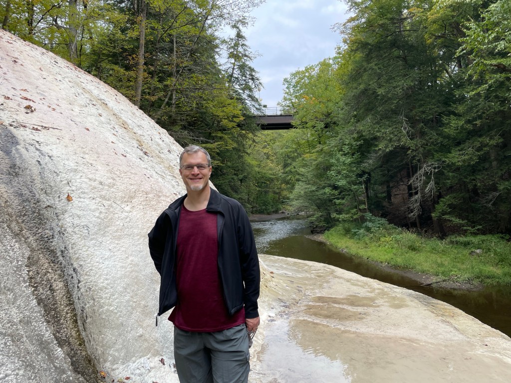
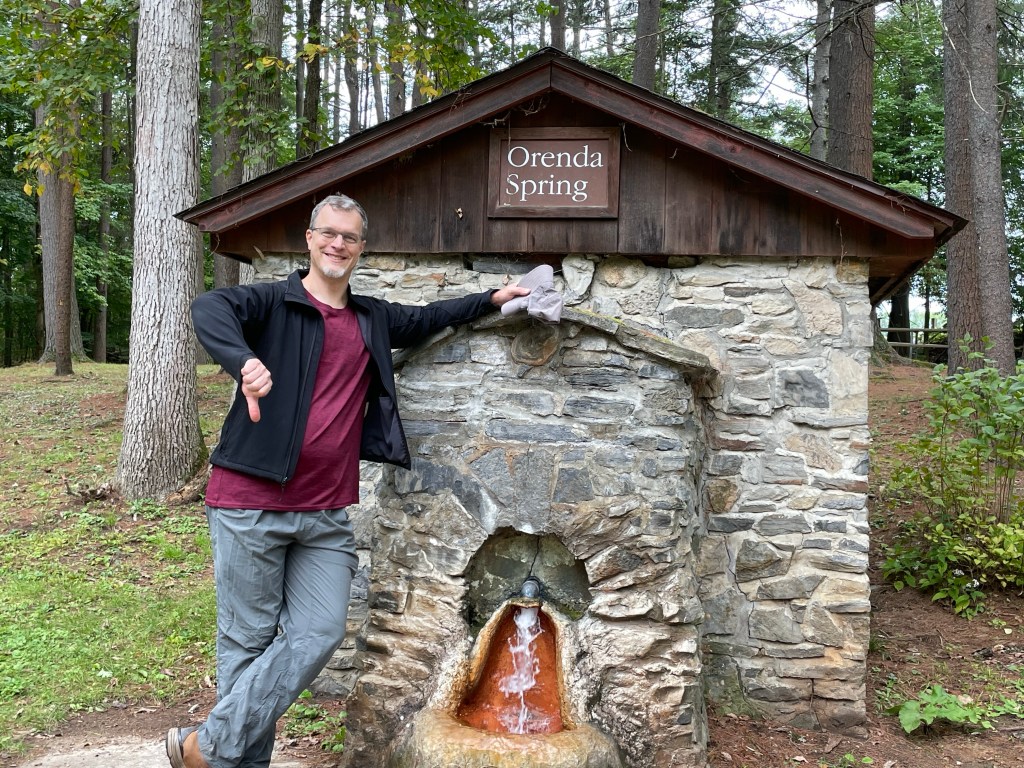
Scattered throughout the park are numerous outlets where water escapes from the limestone formations deep below. Each is unique, with different mineral compositions – some are tasty, some are not. (Most of them fall in the latter category, it seems!) Nearly all are carbonated and most leave mineral deposits as they flow away from their source. The most dramatic spring in the park is the geologically misnamed Geyser Spring, which fountains up from an island in the middle of Geyser Creek. Despite the moniker, it is a cold spring like all the others in this region, emerging from the ground at 55 degrees Fahrenheit year-round. The pressure behind its fountain is entirely natural, driven by underground carbon dioxide.
Geyser SpringTufa deposit below Orenda SpringNot one of the tasty ones!
As we learned from the friendly guide of a tour that we happened upon, the entire area was briefly industrialized by companies harvesting the underground gas. This lasted until their operations grew so large as to disrupt the springs, thereby angering the wealthy spa clientele who liked to come up from New York City for their baths (“the Saratoga Cure”). The upshot was the creation of the state park, which protected the land and put an end to the drilling.
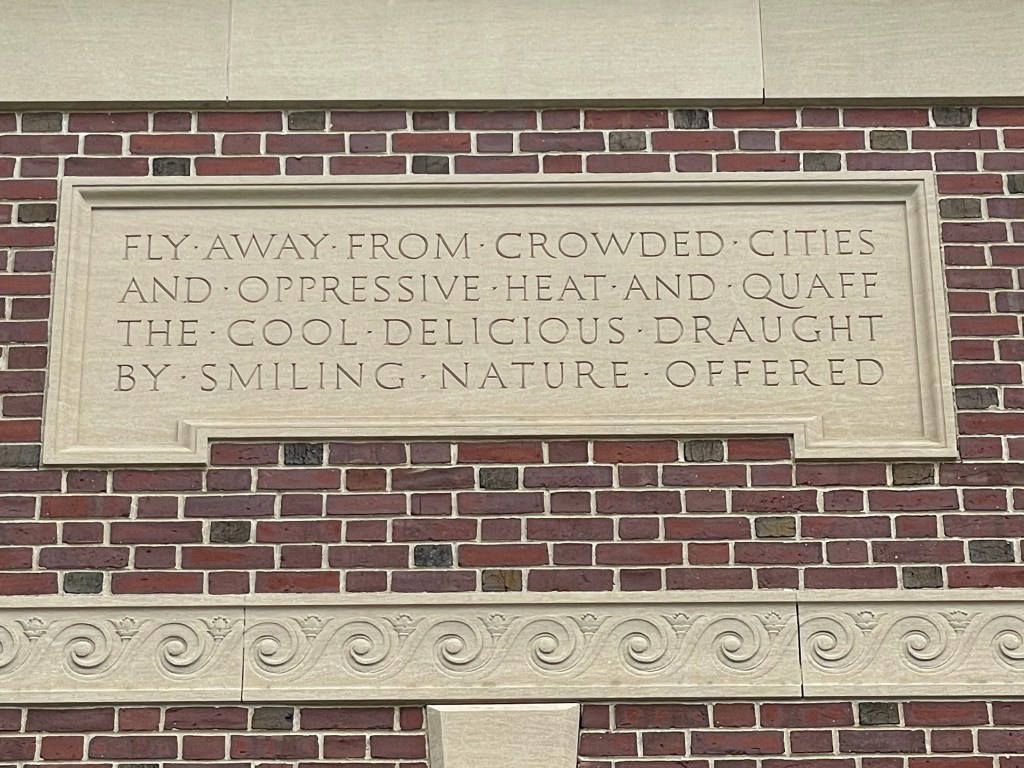
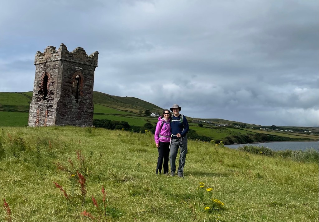
One portion of the hike took us past the Roosevelt Baths, still in operation, whose grandiose architecture (seen in lead photo) is adorned with rather overheated lines from a local poet. The main buildings are augmented with covered arcades, allowing visitors to exercise in the fresh air regardless of the weather.
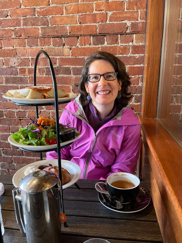
After finishing our hike, we headed south to the nearby town of Ballston Spa, once equal in popularity to Saratoga Springs. We had a most delightful three-tiered lunch at the Whistling Kettle – highly recommended!
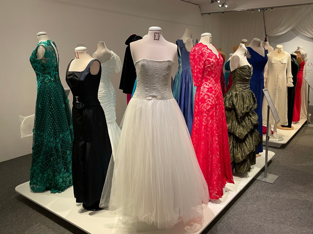
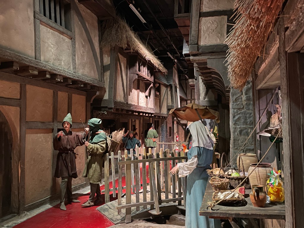
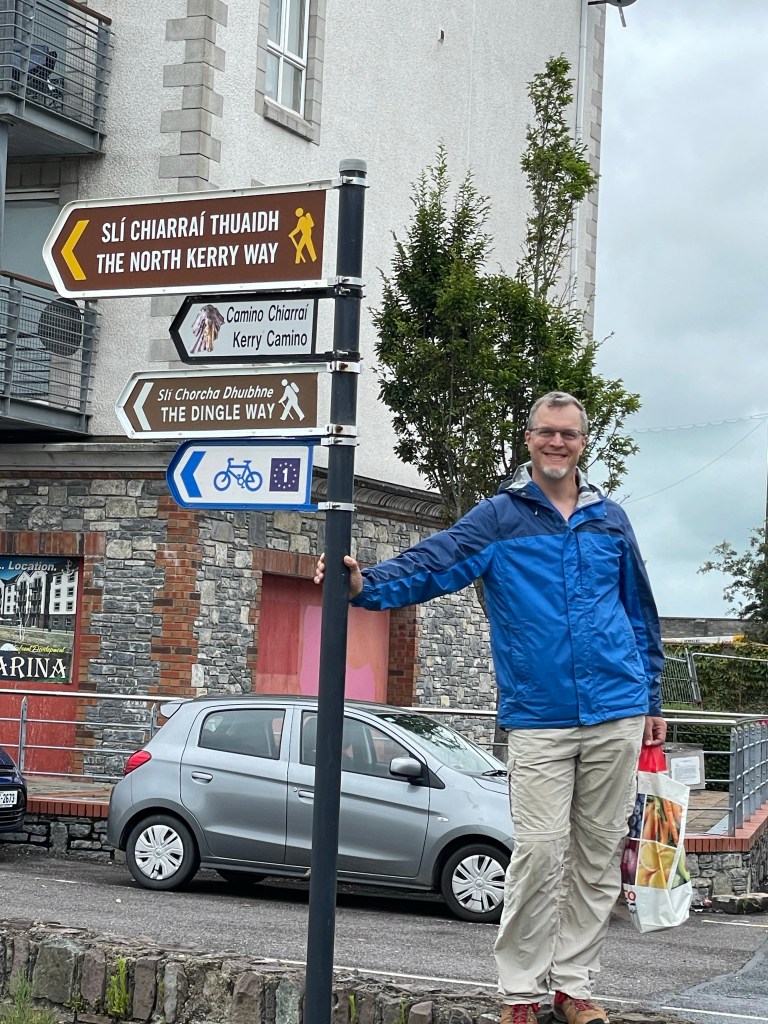
Our last two days in Ireland involved a lot of travel with a few highlights along the way, of course. The bus from Cloghane only runs on Fridays, so we took a taxi for the first leg to Camp (another stop on the Dingle Way). From there we caught the bus back to Tralee, where we were looking forward to visiting the Kerry County Museum. It’s an eclectic museum, with a variety of exhibits. One unusual subject is a collection of dresses from the international Rose of Tralee pageant, held yearly since the 1950s.
A large portion of the museum is dedicated to historical exhibits, including local figures of interest and a timeline of developmental periods from the Stone Age onward in Kerry. Its most famous installation is a walk-through recreation of the streets of medieval Tralee, complete with sounds and smells. Well done and fun to visit!
Just to cap off our Dingle Way experience, we located the start/end point of the trail in Tralee had a picnic lunch there overlooking the canal.
As we were heading to the bus station to depart Tralee, we noticed crews setting up a large event space and installing road barriers – apparently the victorious Kerry footballers were headed to Tralee later that day for a celebratory parade! Their motorcade, complete with police escort, passed us on the road out of town.
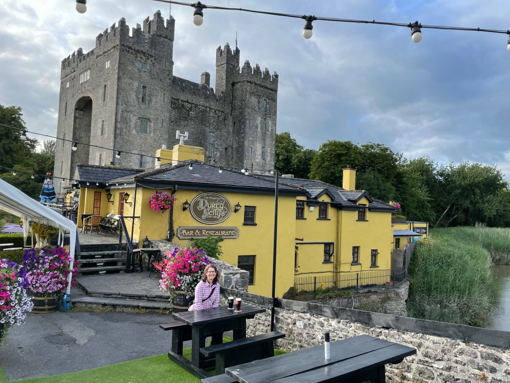
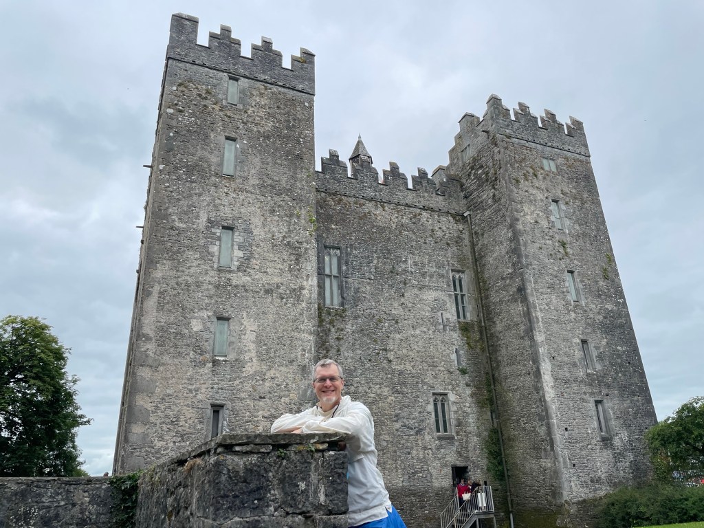
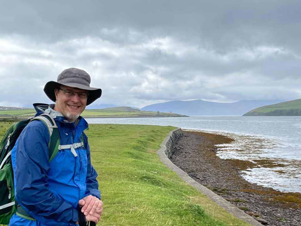
For our last night, we stayed in Bunratty to be near the airport. Although we came here last week for the medieval feast, we hadn’t had time for a proper visit. We ate dinner this time at Durty Nelly’s, the village inn just outside the castle, which has been in business since 1620. (See lead photo above.)
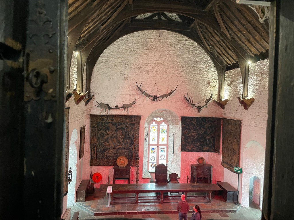
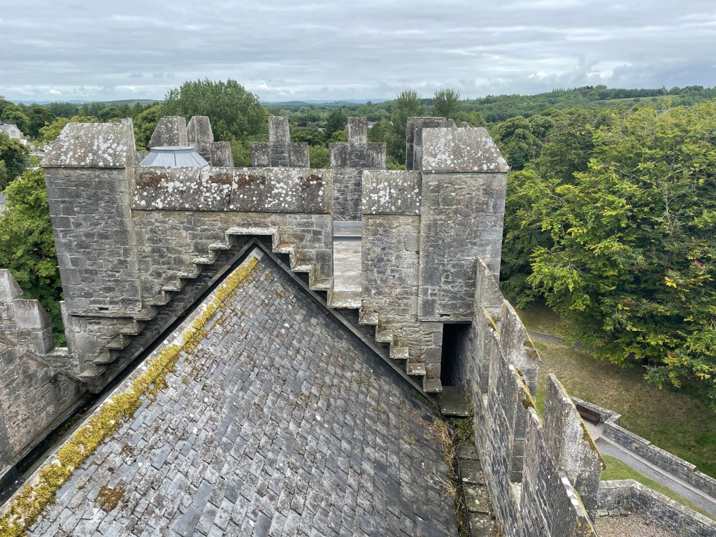
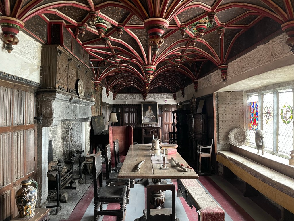
The next morning we had two hours to explore the castle and adjacent folk park. The park includes relocated and recreated historical buildings from around the local region, which gave a sense of life at different social strata. The castle itself was the highlight of the visit. Restored from a roofless ruin in the 1950s, it has been furnished with period items and is open to the public for exploration. The fortress is a delightful warren of nooks and crannies, and seemed to welcome guests to discover its secrets.
Great Hall seen from the lord’s chamberRestored roof!South Solarium for noble guests
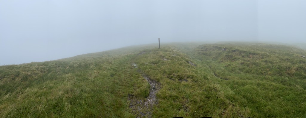
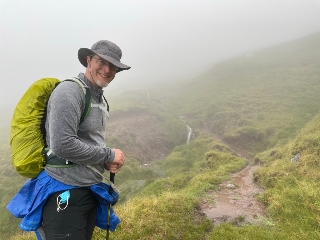
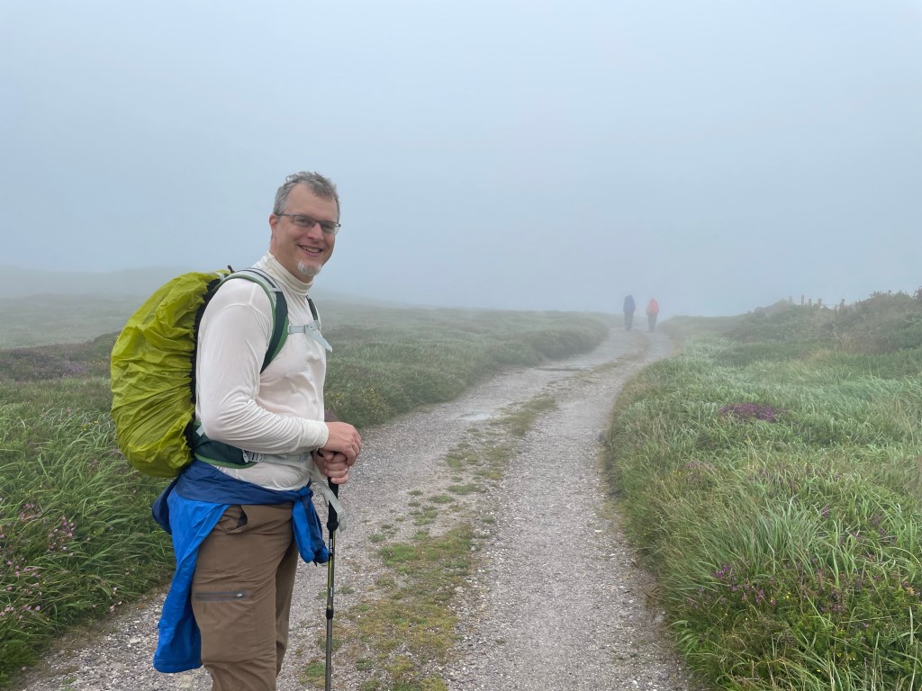
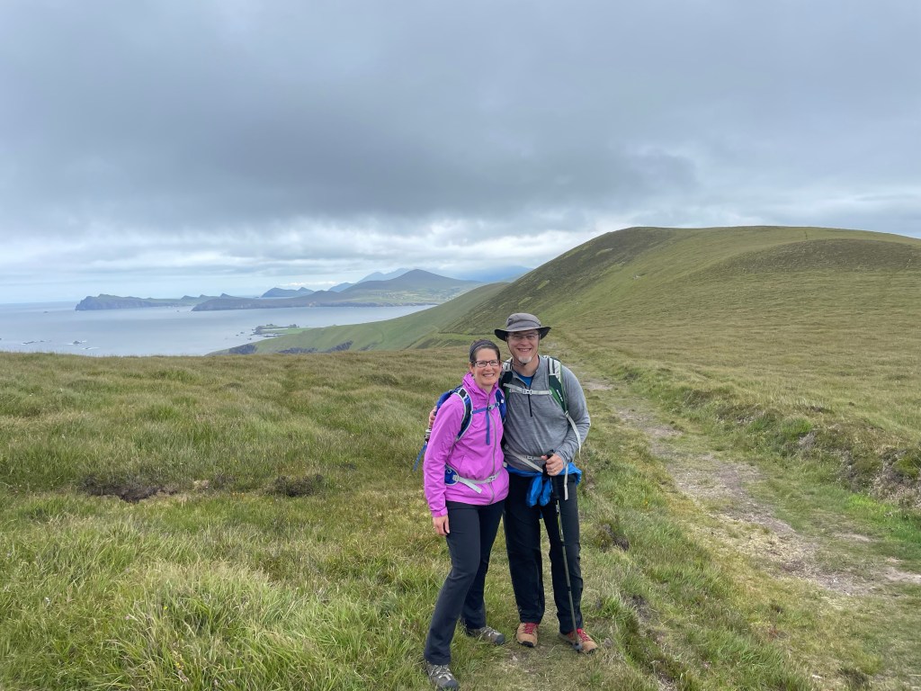
We had doubts whether today’s hike was going to happen at all. Our route would take us over the shoulder of Mt. Brandon, the highest point of our trip and the farthest from a road. It had rained steadily through the night and the mountain was fogged in when we woke. The locals say the trail is dangerous in a dense fog because one can lose the path and there are perilous cliffs by the sea edge. So we made up our minds not to go: safety first.
Two hours later, after finishing breakfast and packing, the situation had changed. The fog had lifted somewhat, and the forecast was for a strong breeze that would prevent it from settling in hard. The locals thought we would be ok and the other through-hikers at our B&B had already set off. So we quickly adjusted our packing, left our suitcases for transport, and hit the trail again!
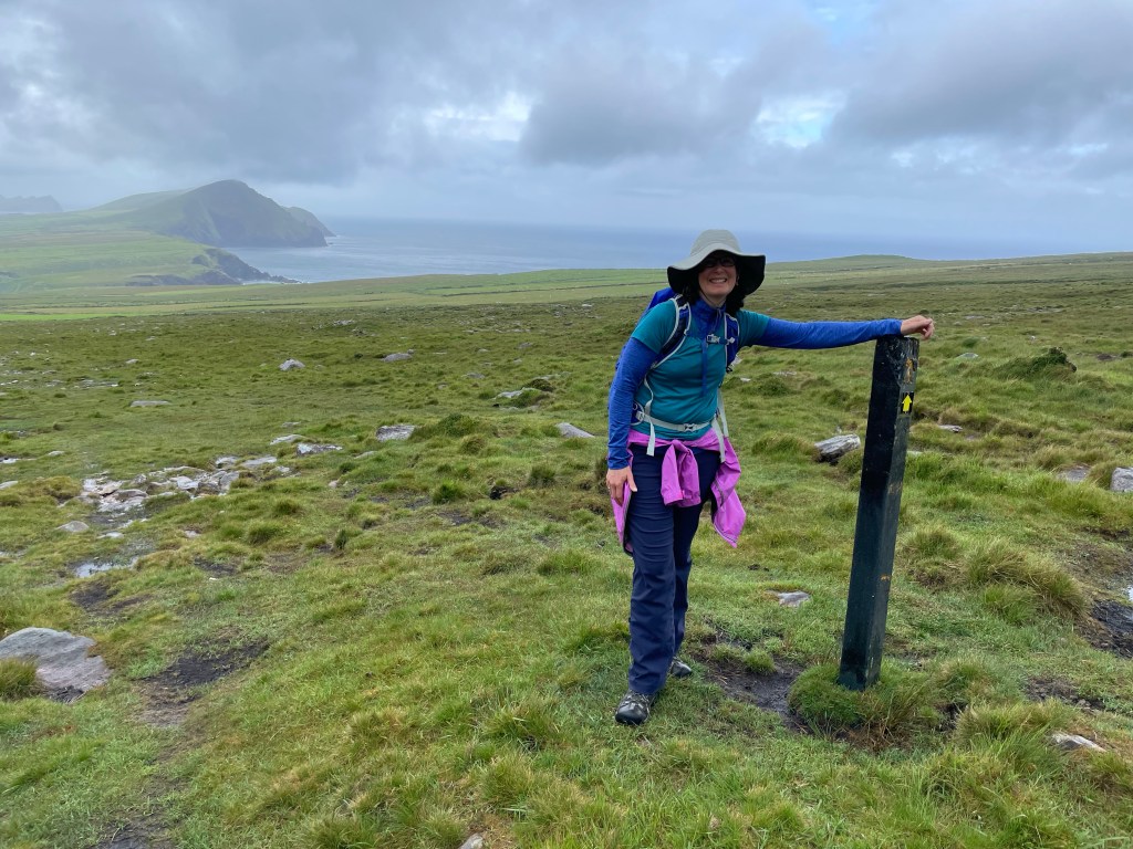
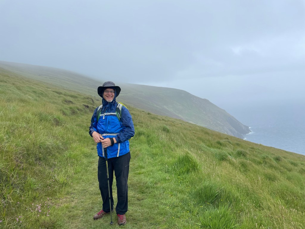
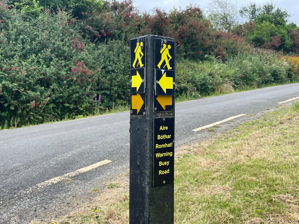
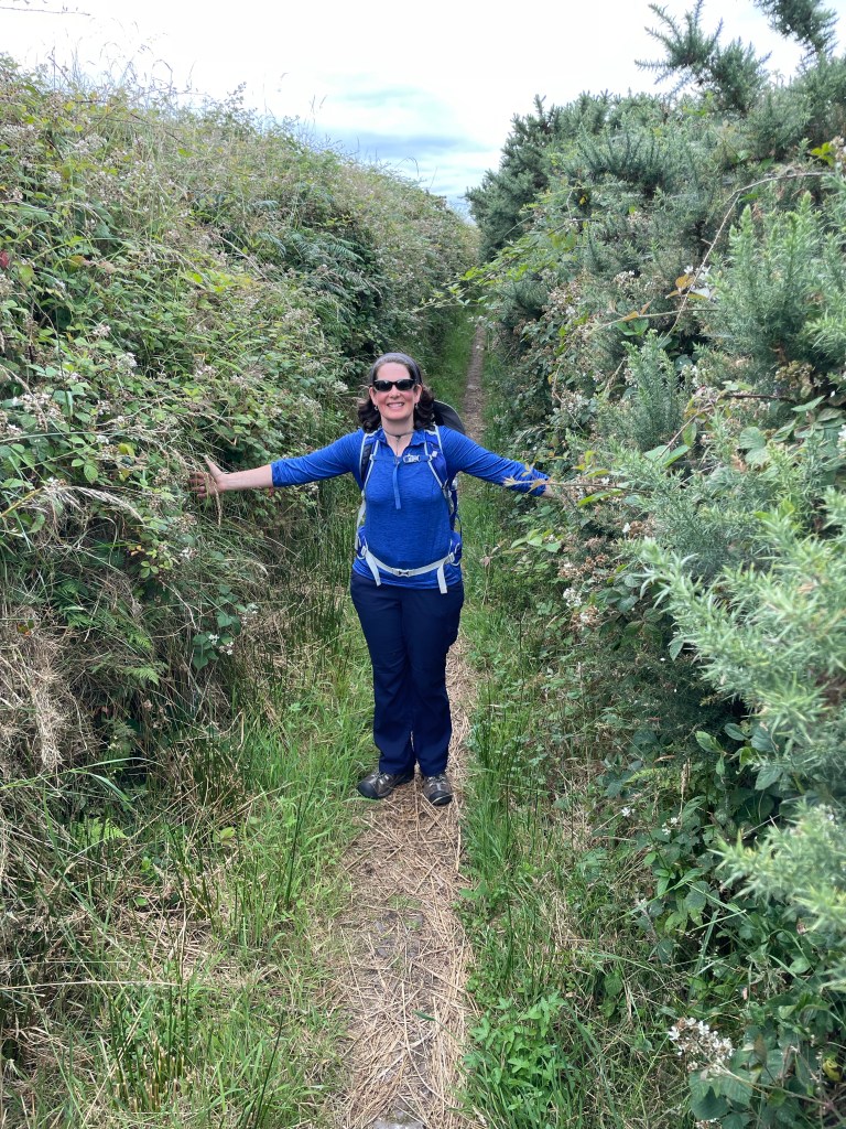
Unlike most previous sections of the Dingle Way, which had been either road or well-trodden paths, the stretch up Mt. Brandon crossed open hillside marked only by meandering and misleading sheep paths. Our only way of staying on track was to search for the periodic signposts bearing the Dingle Way marker. (We’ve come to think of the cheerful hiker icon atop these poles as The Dingle Man, our loyal friend and guide.) These were spaced perhaps 150 meters apart at first, and as we moved higher, the fog closed in so we could barely discern the next one ahead. In fact, in the highest reaches, the trail caretakers added fluorescent markers to the posts to aid in visibility or used solid white stakes spaced closer together.
Can you spot the marker ahead?
Fog aside, the hardest thing about the climb was the fact that it had rained steadily for hours before and the entire mountainside was a series of streams and waterfalls. At times there were no dry places to step and we both had a squelch in our socks before we were halfway up. Would you believe, we were actually having a great time? 🙂
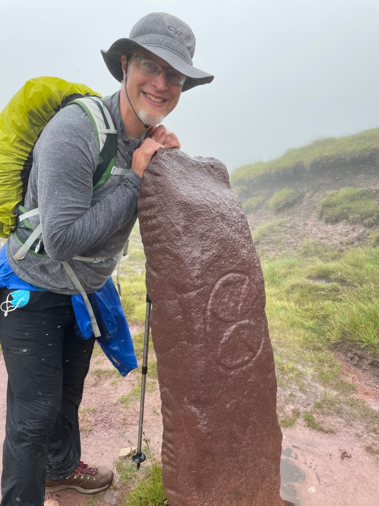
We counted 54 marker posts in all on the way up, the last at the ridge line which was also marked with a low stone wall. Just on the far side of the wall stood the second Ogham stone of our trip, this one clearly marked with a Celtic cross and writing that we’re told reads “Ronan the Priest, son of Comgan”. We took a picture but didn’t linger because the wind and rain were pretty fierce at this exposed location.
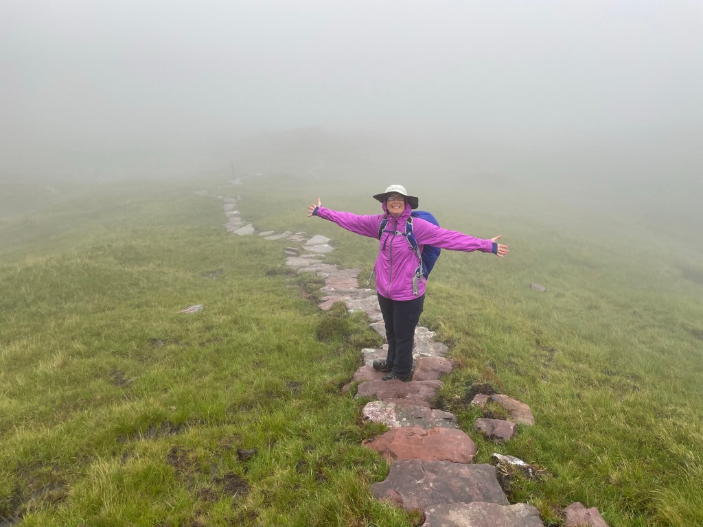
Several sources had warned that the trail down the other side was very steep and slippery in wet weather. Imagine our relief when we discovered a long stone staircase covering the entire length of the steep descent. (Apparently, these stairs have only been added within the past year – and they make a huge difference!)
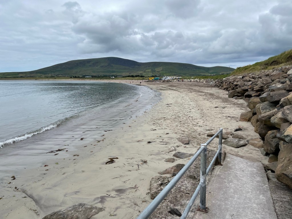
The stairs-turned-rocky trail transformed in time to a gravel path, which we followed for several more kilometers down the rest of the mountain. As the weather gradually improved, we even could see the bay below. We reached Murphy’s pier side pub in Brandon just in time for the start of the All-Ireland Football Final, pitting Kerry against Galway. Now you may be thinking, as we were, that you know what football means in Europe. So we grabbed some food and beer and an outdoor table where we could see the TV screen, and readied ourselves for a good game of soccer. Picture our surprise when different players kept picking up the ball in their hands while other players tried to tackle them. Turns out, Irish football is a lot like hurling, only with a soccer ball and no sticks. Who knew? Kerry took the day, so we count ourselves as a good luck charm for the local team of the places we visit.
The football game is on the TV through the window. Go Kerry!!
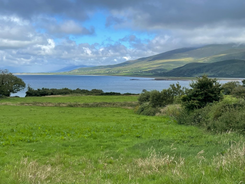
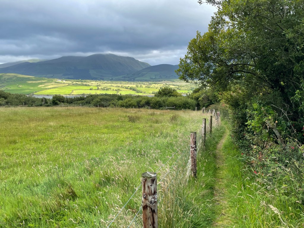
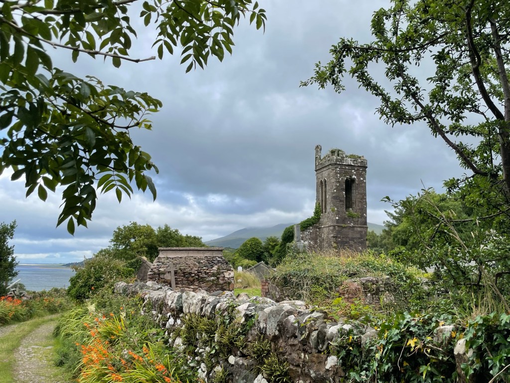
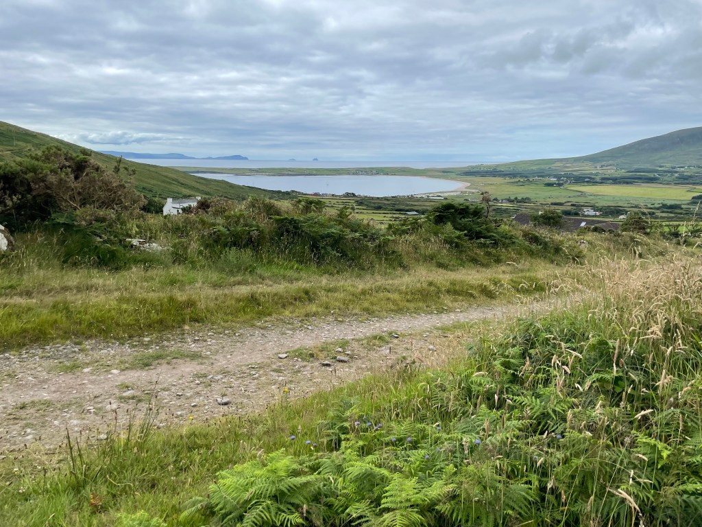
Even on our last day, the Dingle Way continues to surprise us with new ways to charm. Coming down the hillside into Cloghane on our final leg, we hiked beside a row of fantastically gnarled holly trees planted by a brook, passed a fairy garden adorned with offerings, and finally came upon a churchyard with a silent and ivy-covered belfry.
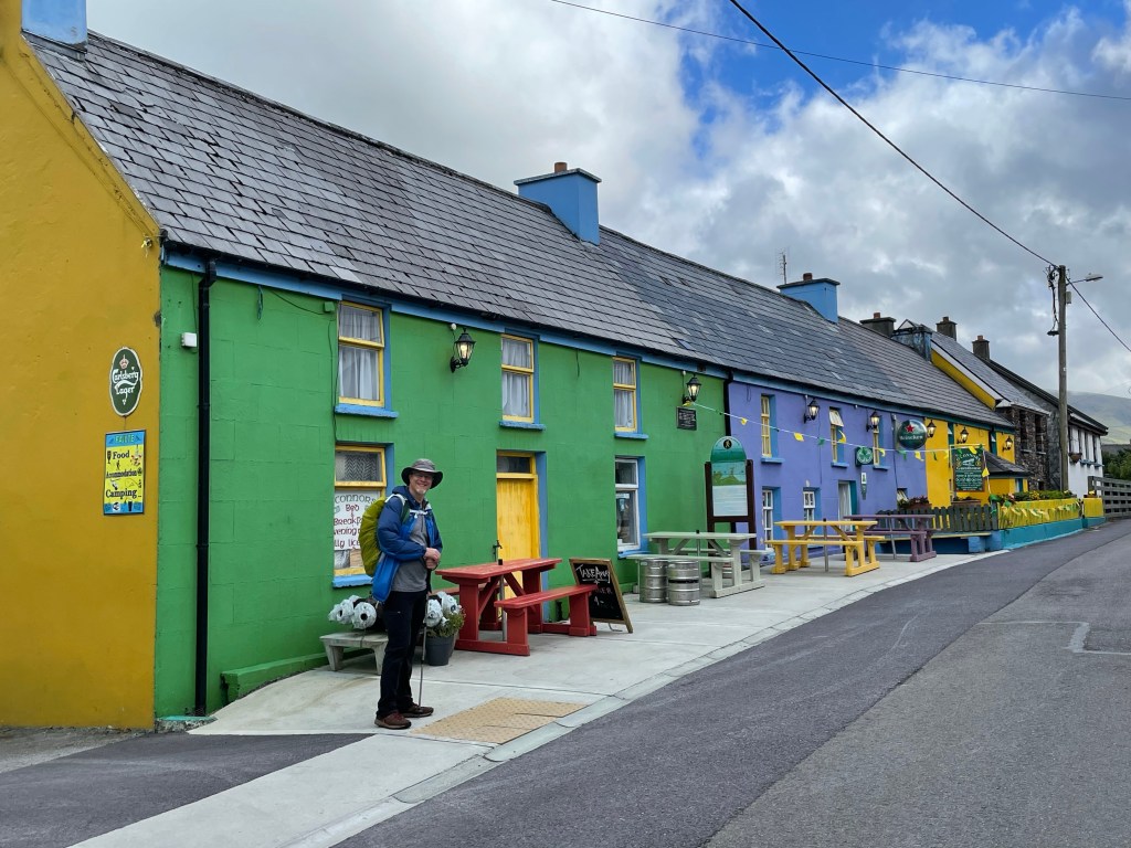
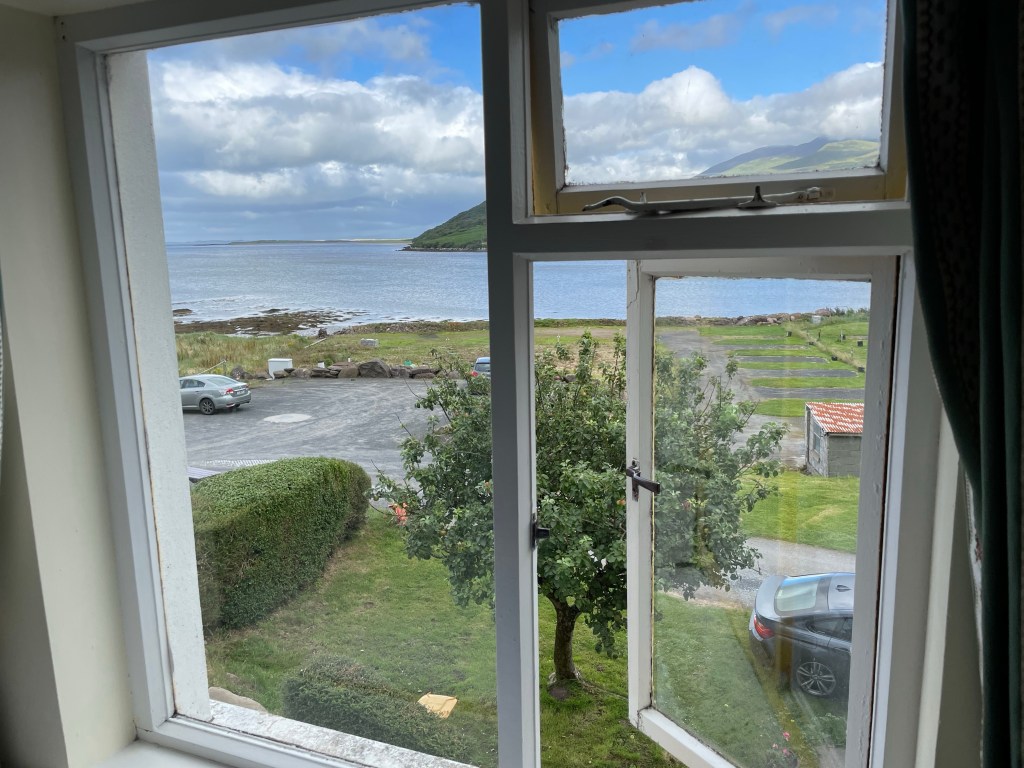
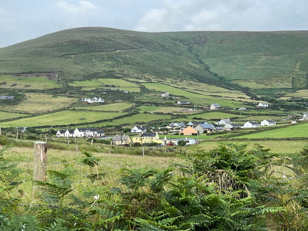
Our lodging in Cloghane is reminiscent of the colorful buildings in Dingle, and from our window we can see the bay that we spent the afternoon hiking alongside. This marks the third and final segment of our Dingle Way trek. Tomorrow we trade our hiking boots for buses as we bid a fond farewell to County Kerry.
Today has taught us why there are so many beautiful flowers in Ireland, not to mention green grass growing on footpaths. Simply put: it rains a lot. We actually had relatively few moments of soaking rain, but the air was generally wet and foggy throughout the day. To use a term we were fond of during grad school at Cornell, it was “ithacating” through most of the day – there’s probably a good Irish word for it too!
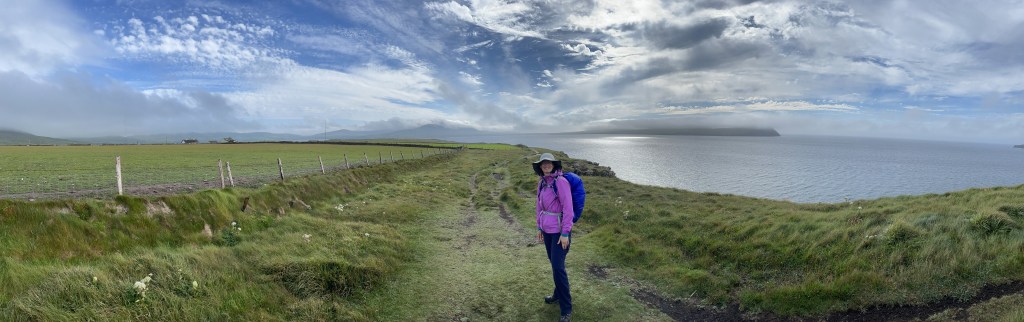
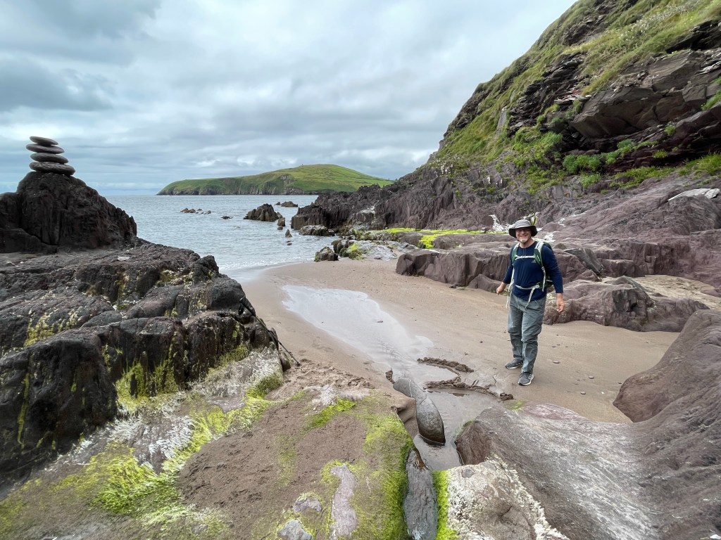
Today was not a day for grand vistas and sweeping views, but instead for seeing things up close and in detail. (Watch out underfoot.)
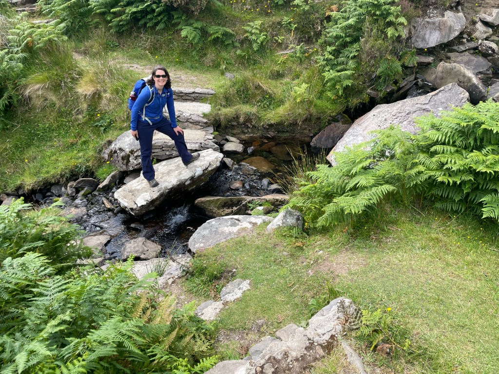
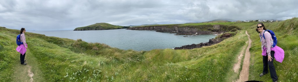
Fortunately, this was appropriate for the landscape through which we were traveling: mostly flat with archeological sites taking the fore. This was our longest hiking day and we made it even longer through some voluntary detours, but they were well worth it.
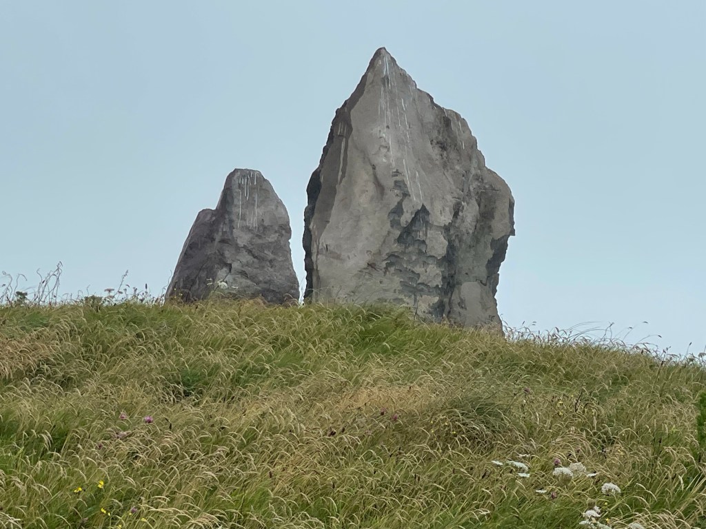
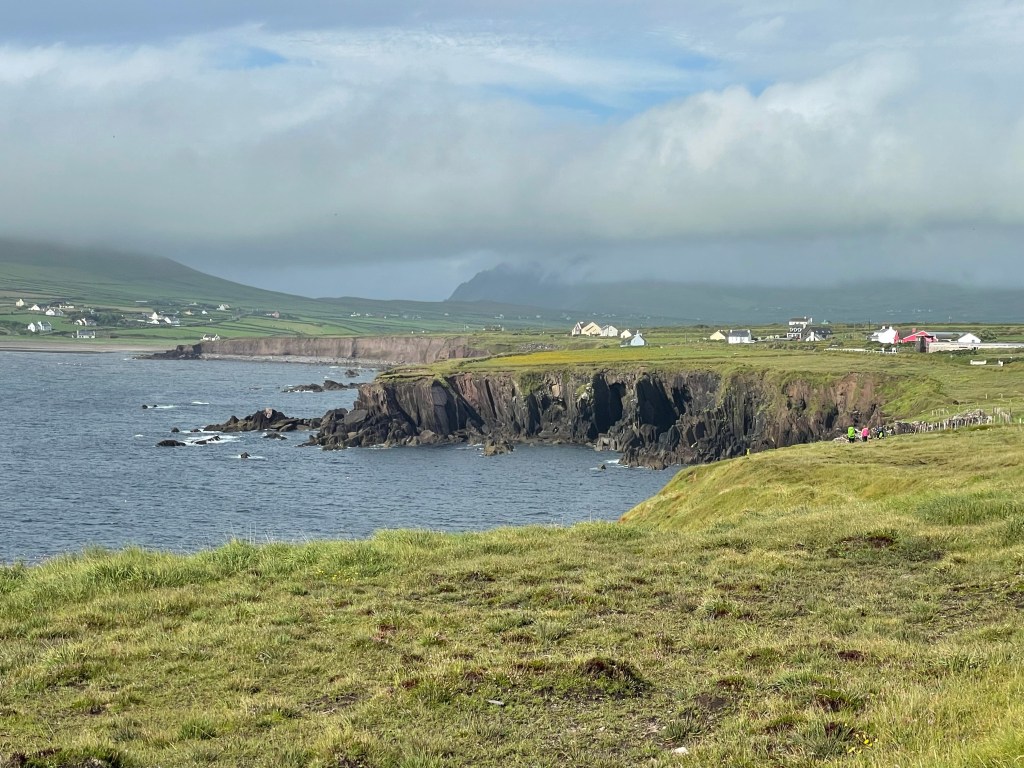
Striking north from Dunquin, we hit the northern coast of the peninsula at Smerwick harbor, a sizable bay along whose shores we were to spend several hours traveling. Although much of the first part was a beach walk, it was intersected by a finger of land jutting out into the water, at the end of which was our first ancient site. Several standing stones watch over the bay here and at least one of them is marked with the Ogham script of the early Irish people.
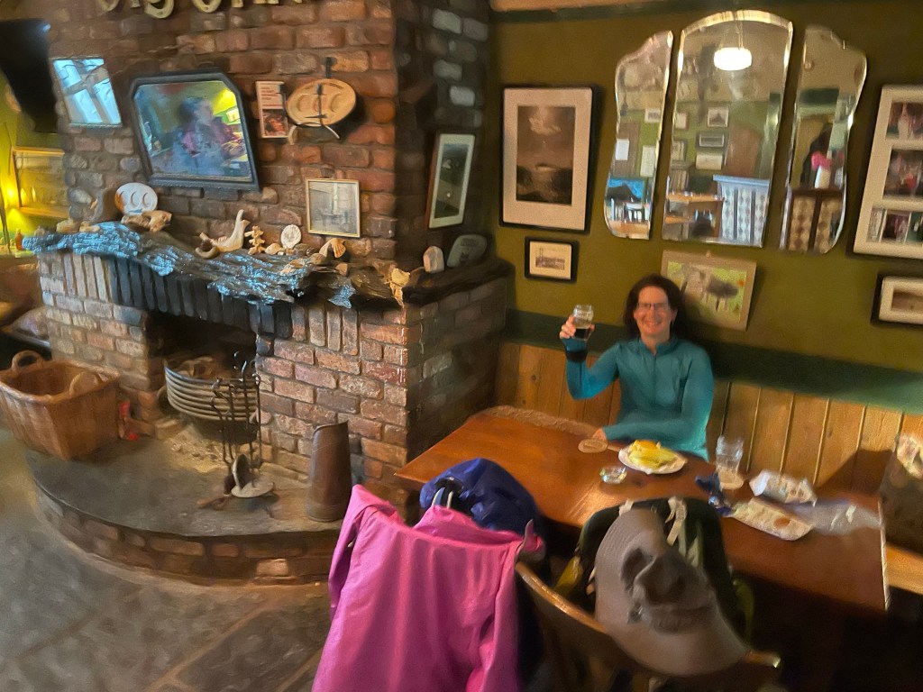
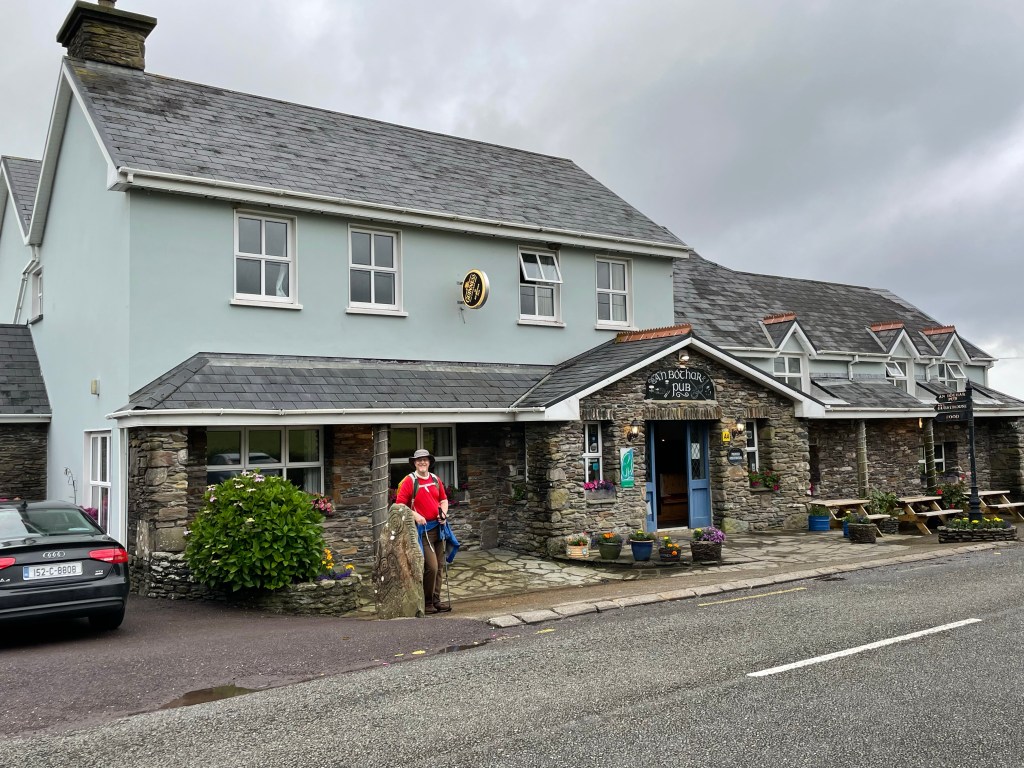
Shortly after the standing stones, we took our first planned detour with two destinations in mind: the West Kerry Brewery and the ruins of an early monastic community. The brew pub was warm and snug, and we sat by the fireplace for beer and some snacks to fortify ourselves for the ruins.
(Slightly blurry – camera lens was still wet)
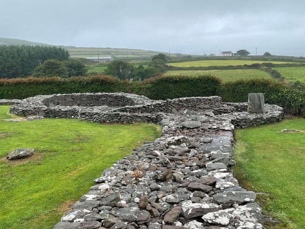
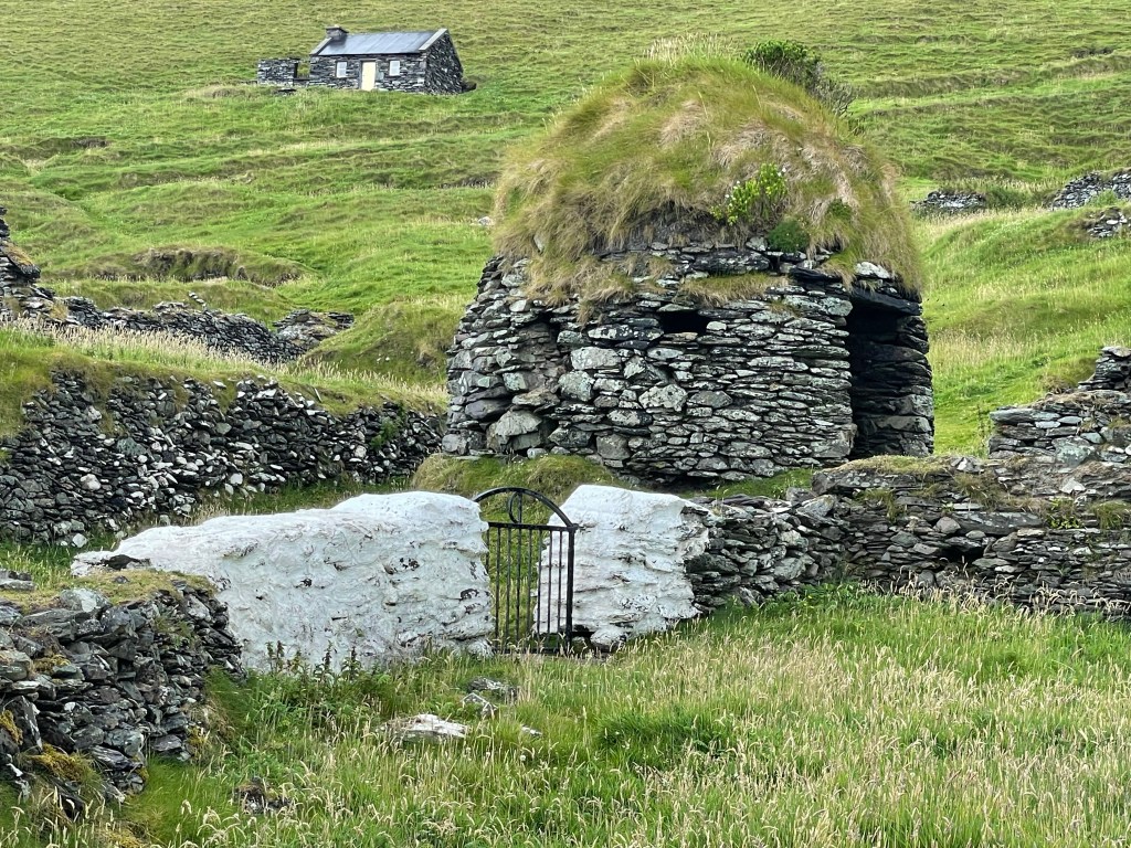
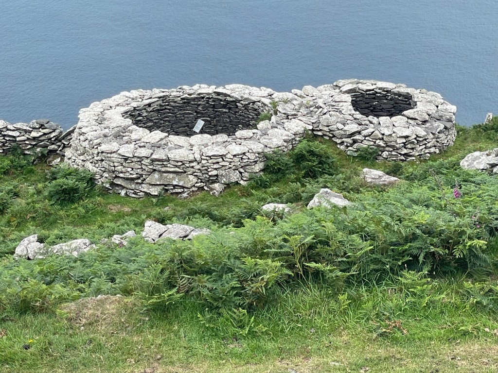
The monastic ruins are just foundations at this point, but the layout of the buildings is clear: many dry stone beehive huts and other structures. There’s also an early example of a Celtic cross carved on a standing stone.
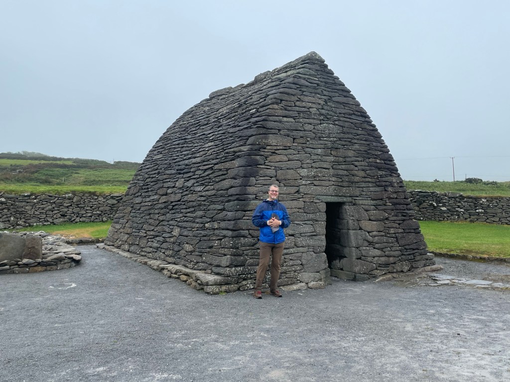
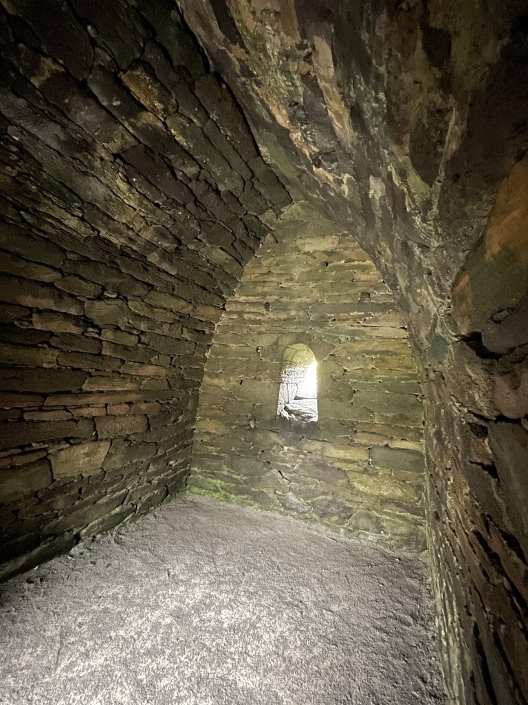
After returning to the coast and traversing another stretch of beach, we took our second planned detour of the day. This one ran along a busy road but was well worth it. The Gallarus Oratory is widely considered the finest example of dry stone masonry in all of Ireland. Probably 1300 years old, it has withstood the centuries without any mortar to support its walls or corbel-vaulted ceiling. We happened to arrive during a burst of rain, so we took shelter inside, as people have probably done for ages.
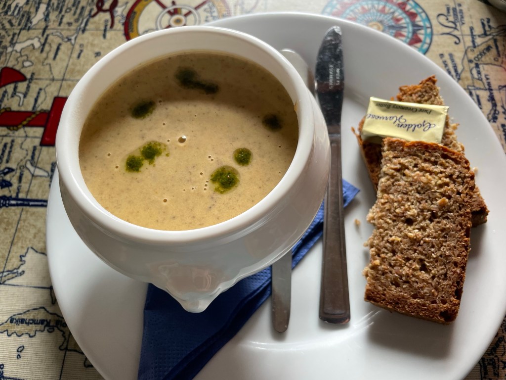
We made it to the hamlet of Ballydavid, but after 16 wet miles, our spirits were flagging a bit. A friendly local pointed us to the pub that served food and we ordered the soup of the day. Just what we had been craving: rich, hearty, hot!
The best mushroom soup ever!
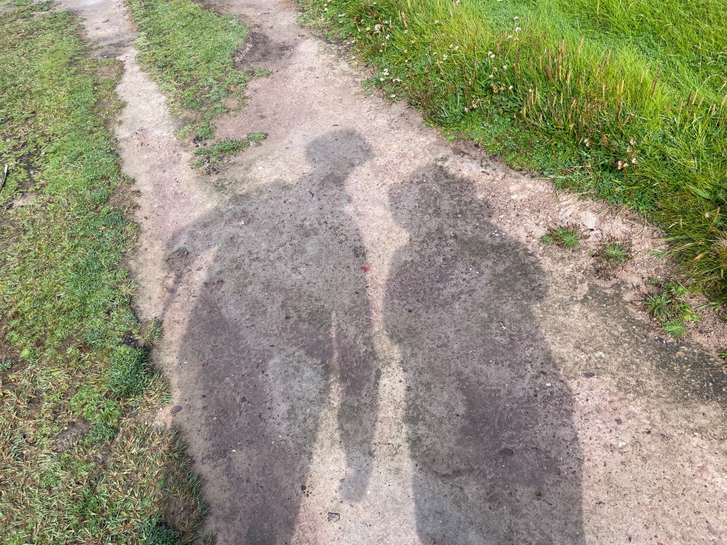
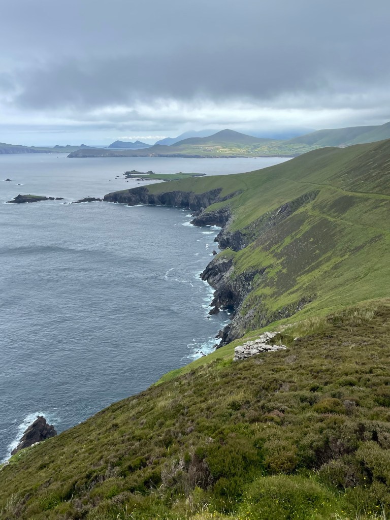
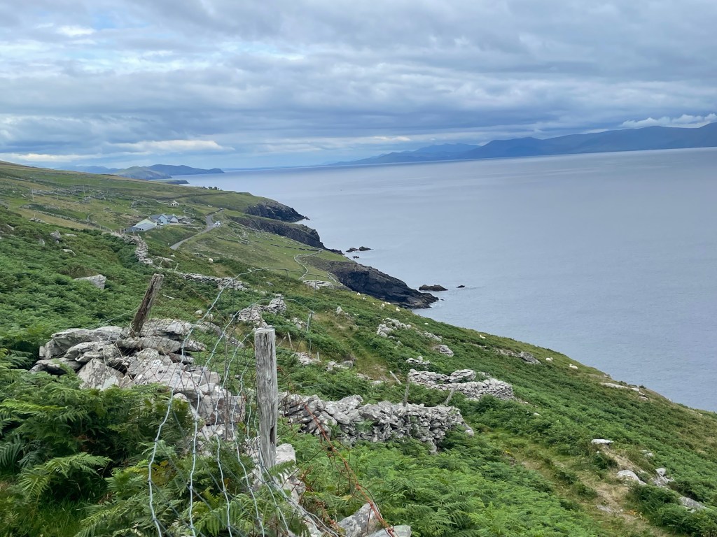
As an added bonus, the time spent in the pub meant that the one stretch of sunshine and blue skies during the whole day coincided with the cliff walk to Feohanagh – perfect timing! We were finally able to see some of the longer range views in this part of the Dingle peninsula.
First time we’ve seen our shadows today
The clouds rolled in again soon after and the last few miles were a bit of a trudge through soggy ground but we reached our lodgings with plenty of light remaining. We were thrilled to find a spacious room, a hot shower, delicious food, and live music to boot.
After yesterday’s trek, we were up for something a bit lighter. Two ferry companies offer service to Great Blasket Island, once the westernmost inhabited island in Europe, now devoid of permanent residents since 1954. We didn’t know much about it before today, but it sounded like an interesting place to visit and an opportunity for scenic (and not too lengthy) hike.
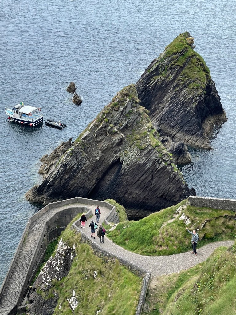
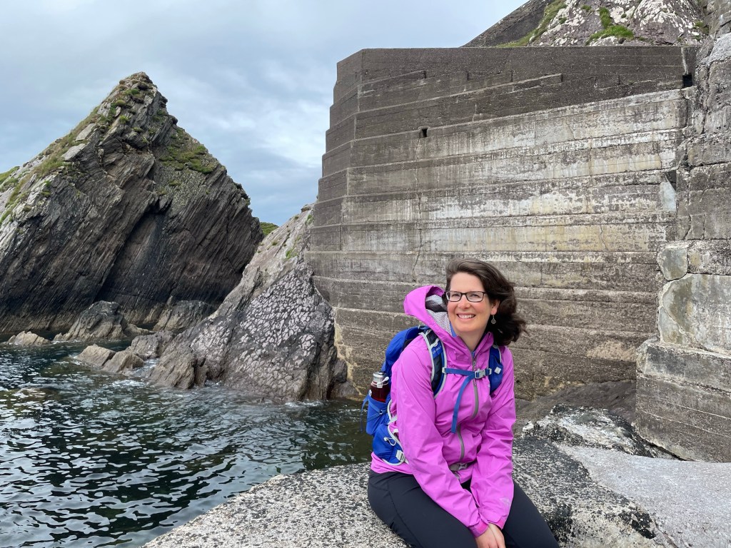
Getting to the island is not always easy or even possible. The pier at Dunquin looks quite improbable at first glance, with the access path snaking crazily down a cliffside toward a pair of jagged rocks. In the old days, the island residents were sometimes cut off from the mainland for months at a time due to bad weather. In our case, the ferries ran today, but were predicting no service for tomorrow or the next several days.
Beware of cliff divers (by the Dunquin Pier)A feat of concrete!
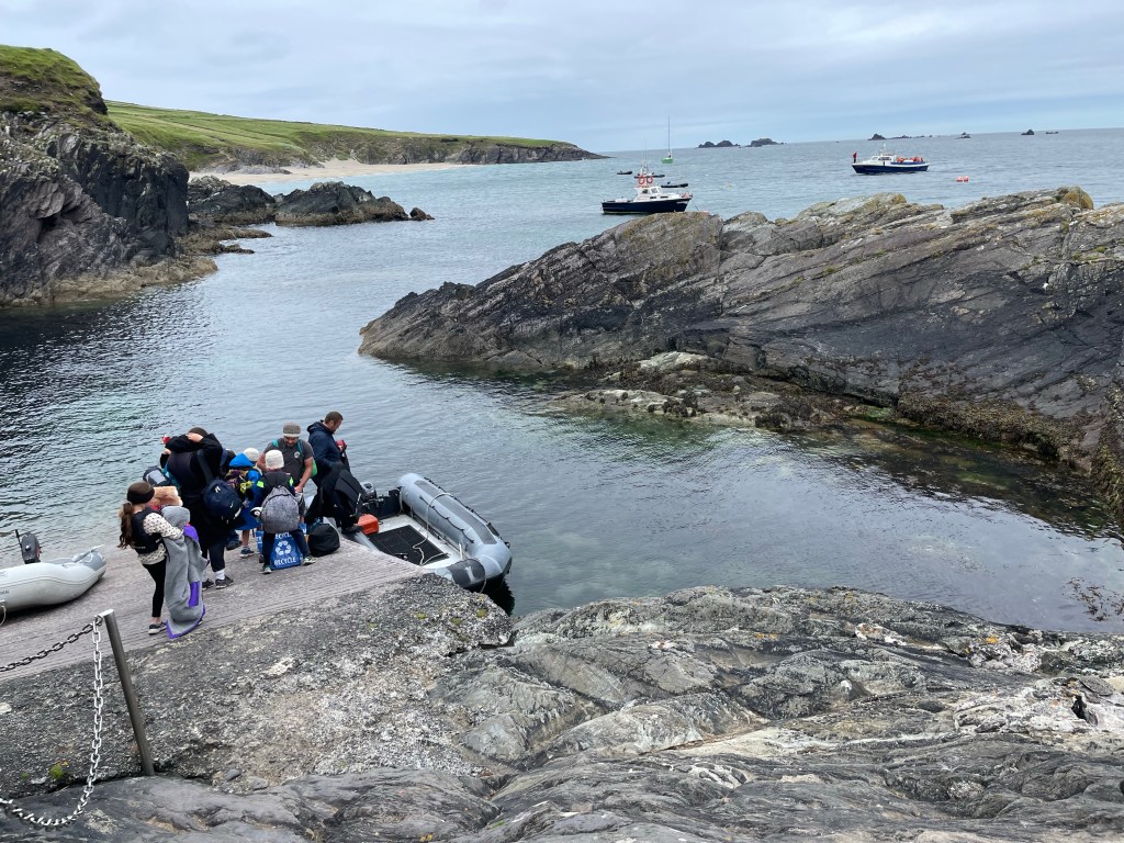
The passage is three km across and the primitive landing on the island can only be reached by smaller boats, so each ferry tows an inflatable Zodiac behind it for disembarking. (Note that Great Blasket is the largest of the six Blasket Islands, and is described by our guidebook as the “least inaccessible”.)
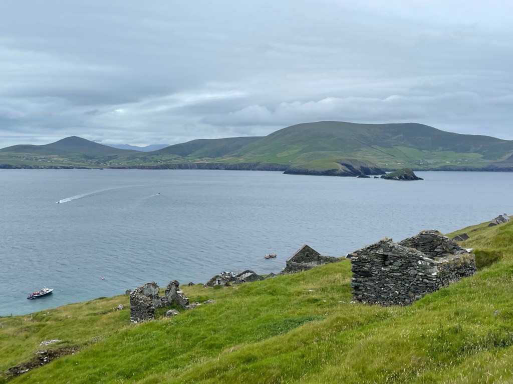
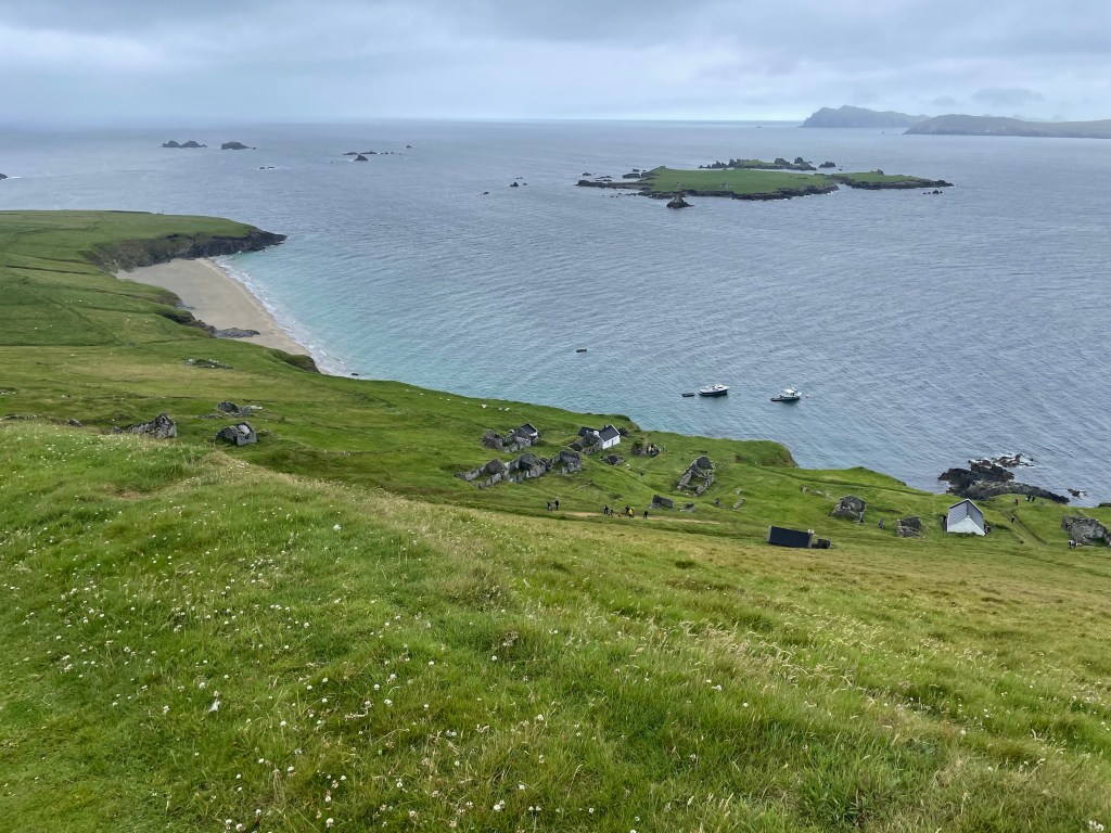
Once landed, one can explore the ruins of the old village. Many of their islanders dismantled and took their roofs with them when they evacuated, but the stone walls are mostly still standing. A few structures have been maintained or restored for the tourist trade – in fact, we learned it is possible to stay overnight on the island by renting one of the remaining intact buildings.
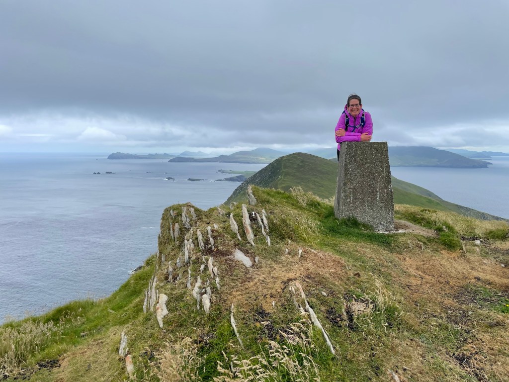
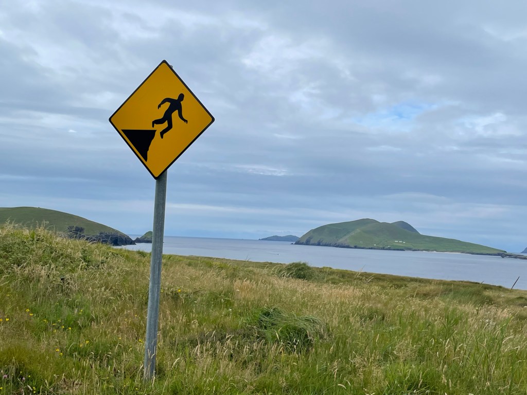
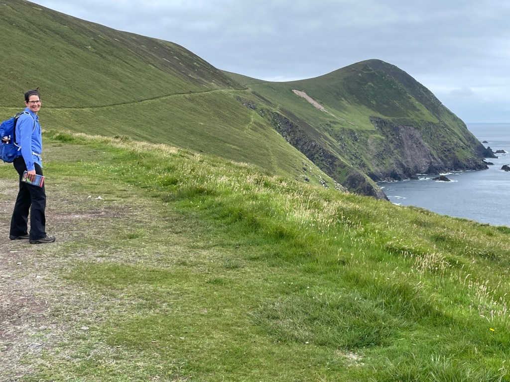
The island itself is a long ridge, about 6 km long and 1 km wide, with the village at the northeast end. We planned a hike that made a loop from the village, with a long stem extending down the spine of the island. The paths are grassy terraces cut laboriously into the slope of the island; they are readily visible and easy to follow. We hiked up to the high point of the island, called An Cro Mor (elev. 292m). The lead picture for day shows Susannah at the summit.
The island residents (180 at peak population) had names for hundreds of places and features, such as rocks, inlets, reefs, etc.; the intersection between the loop and the stem trail was known satirically as the “traffic lights” (in Irish Gaelic, of course).
At the traffic lights!
The weather held out for much of the morning but began to turn for the worse on our way back from An Cro Mor. Our loop took us around the windward side of the island where got a small taste of more adverse conditions. We could see fog clouds rolling in from Skellig Michael to the south and a light but driving rain began to soak our jackets. Time to deploy pack covers and hoods!
The end of the hike brought us back to the lee side of the island and the village, where we were just in time for a guided tour courtesy of the Irish government. We heard about the surprising number of island residents who became well-known authors with books describing their daily life and customs. In addition to the residents’ own reminiscences, there are accounts from several visitors who came regularly to study the island lifestyle and learn Gaelic from what was one of the few remaining communities of native speakers.
Great Blasket village and beach
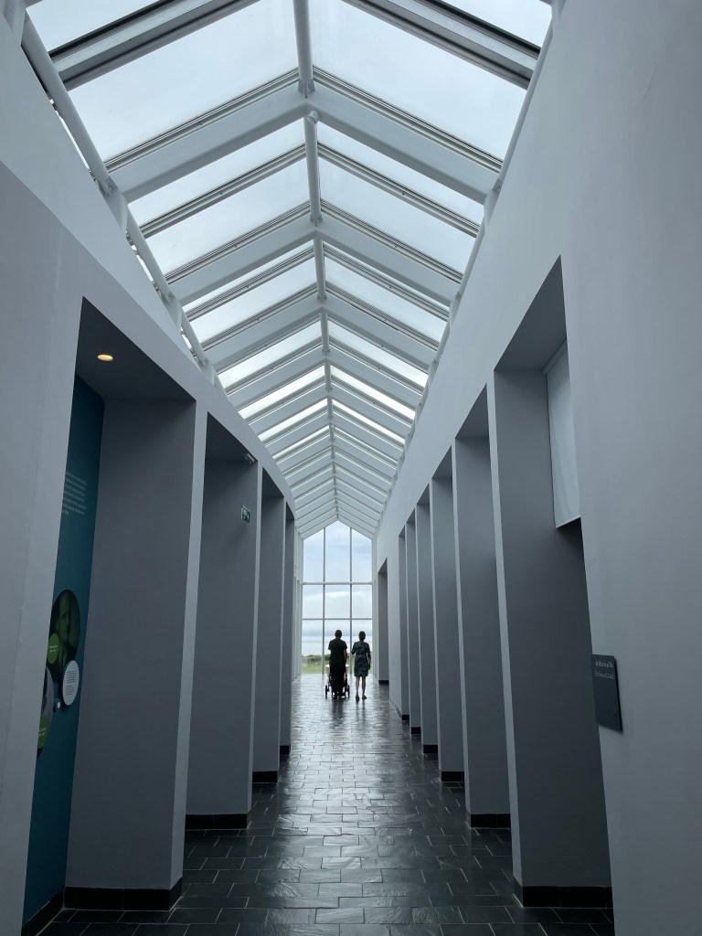
After a rougher homeward crossing than our morning voyage, we reached the mainland and headed straight to the recently reopened interpretive center. Unassuming on the outside, the museum is architecturally striking from within. The building has a central spine (aligned with that of Great Blasket) crossed by galleries, reminiscent of Ireland’s ancient Ogham script. The thoughtful and informative exhibits gave us a much deeper appreciation for the fortitude of the island residents who, despite the harshness of the environment, managed to live fulfilling lives with joyful moments. Conditions only deteriorated badly towards the end as many of the younger residents emigrated to Dublin and the United States. We were surprised and interested to learn that many of them came work mill jobs in Springfield and Holyoke MA, not far from where we live.
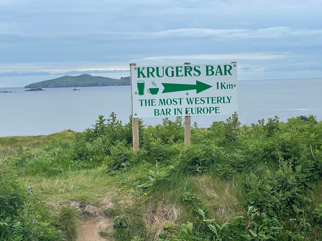
We ended the day with dinner at Kruger’s bar, advertised as the westernmost bar in Europe. (Fans of our blog may recall that we previously visited the northernmost brewery in Europe during our sojourn in Tromso, Norway.)
The village center of Dunquin. Kruger’s bar is the low yellow building in the middle; our B&B is the white building just left of it.
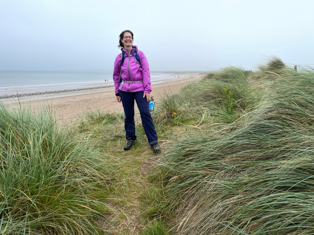
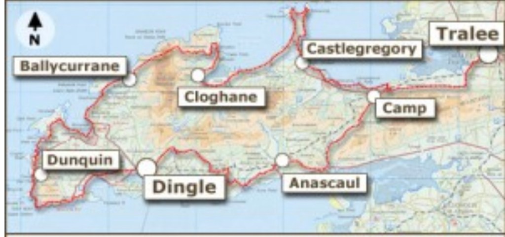
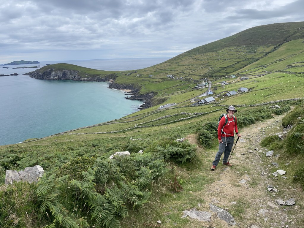
Today we began our first steps on the trail that had inspired our trip: the Dingle Way (shown above). We’re doing about a third of the trail, comprising the westernmost segments, from Dingle to Cloghane. Today’s leg was projected to be 14 miles and traversed a surprising variety of terrain types: motorways, country lanes, rocky and grassy footpaths through pastures, and a long segment of beach. We show below pictures along the route in approximate order.
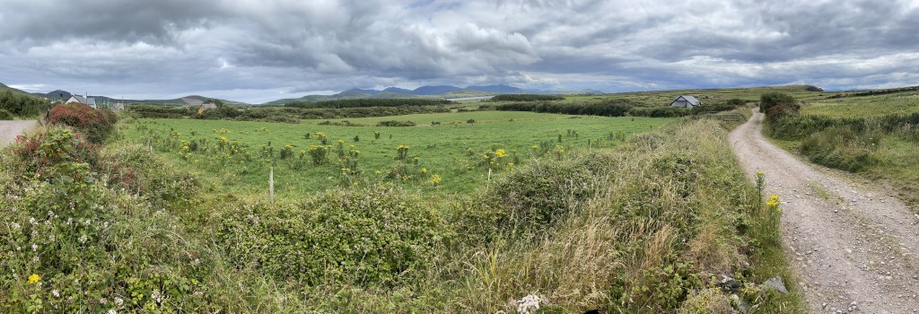
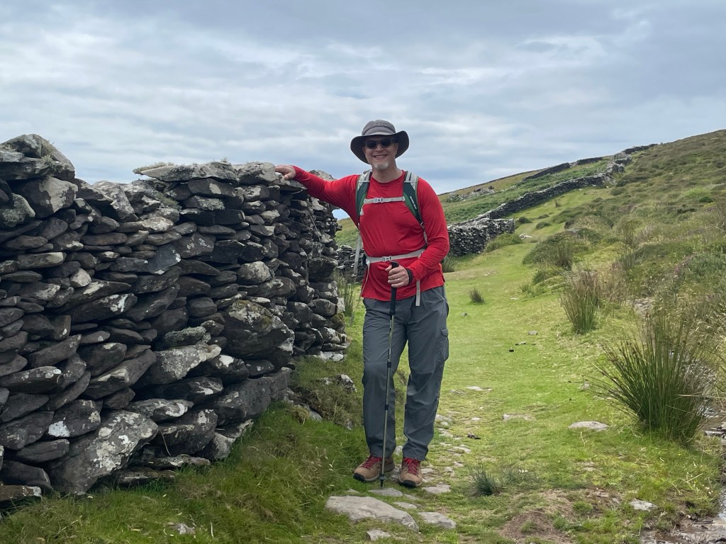
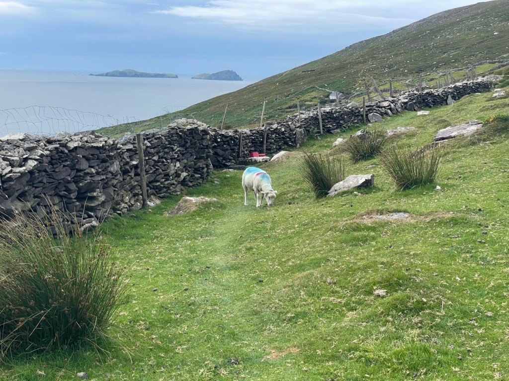
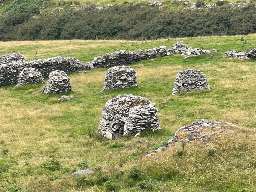
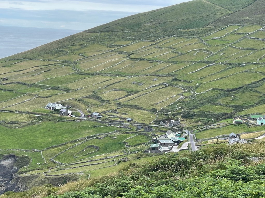
We joined the trail on the west side of Dingle not far from the local whiskey distillery.For the early morning we were on paved roads, stepping into the hedgerows whenever cars came by in either direction.We had a guidebook, but found the actual trail markers were more reliable.Leaving the road, the path climbs a hill for a view of Ventry harbor before descending into the village. The general store/post office there has an excellent assortment of salads – and fresh-baked cake!Ventry harbor is ringed by a 2-mile long beach, which the trail follows. We had to cross two small foot bridges where streams flowed over the sand. At times, the lush plant growth encroaches on the trail – watch out for blackthorns!This panorama gives a sense of the countryside in the lowlands after Ventry.The latter half of our day was on steeper land sloping sharply down to the water’s edge as we traversed the slopes of Mount Eagle and rounded Slea Head on the southwest corner of the peninsula.We encountered some pretty epic dry stone walls in this region, reminding Nick of the class he took last summer. More stone wall and a sheep blocking the path. We took a detour so as not to disturb her. Turns out walls aren’t the only things people built from stone. These dry stone beehive huts, built for unknown reasons hundreds of years ago, were all over this part of the trail. Most are in disrepair or have fallen down.Our guidebook said there was supposed to be an intact example of a beehive hut near the trail. Did we miss it? We spent nearly an hour backtracking and searching, but in the end these were the best preserved ones we saw close by. The biggest stream crossing along the slope.Looking back, you can see more of County Kerry (the Iveragh penisula) across the sound.Looking forward, the Blasket Islands began to come into view as we rounded the corner of the peninsula. Weather permitting, Great Blasket in the center is our destination for tomorrow.You can see here the crazy quilt patchwork of fields on the mountainside. Can you find the field-within-a-field?We finally began descending after we rounded Slea Head. (Apparently a scene from The Last Jedi was shot on Dunmore Head, the promontory visible in the upper left of this picture.)The village of Dunquin at last! A hot shower and generous roast chicken dinner were waiting for us at our B&B.
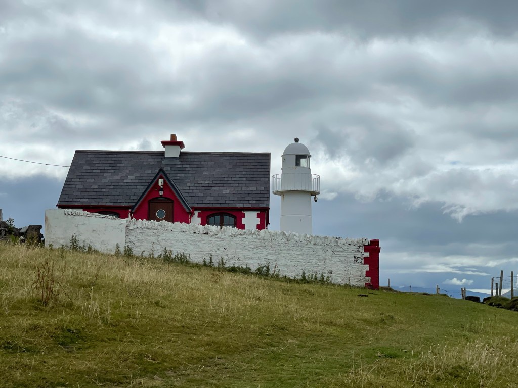
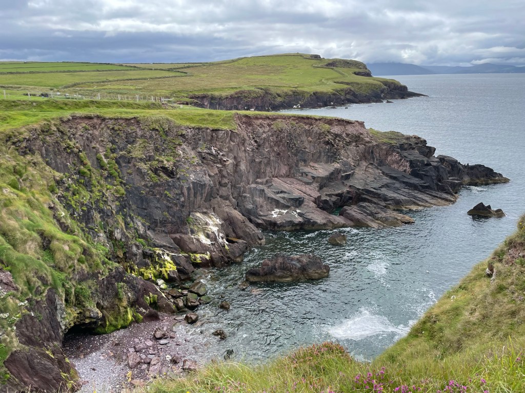
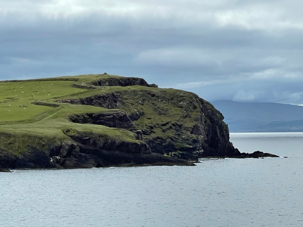
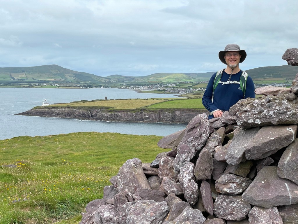
We thought we would start our day in Dingle with a short local walk. We saw a small tower short way down the coast, and our B&B host recommended it as good destination for a pleasant walk and also noted there was a lighthouse a little further along. The route didn’t show up in any guidebooks or lists of local hiking trails, so we asked at the tourist office and they gave us directions and said it might take an hour. Well, we took the path and it was lovely but… the trail didn’t stop at the lighthouse – so neither did we! A scenic cliff walk beckoned so we grabbed it with both feet, so to speak, for the next three hours. What an unexpected treat! From the next headland we were afforded commanding views up and down the coast, including (finally) a good shot of Dingle town in a single frame.
A simple walk – at first…Hussy’s Folly – the tower that inspired our walkDingle LighthouseThe rugged coastline – we went to the far headlandCloseup of the path up the far headland – note the cairn at the very topView from the headland cairn back toward Dingle Town (far distance) – note the lighthouse and tower (near distance)
On the way back, we stopped at the beach below the village of Beenbawn where we had seen a few brave souls swimming earlier. You couldn’t have paid Susannah to go in the water (60 degrees and windy!?) but the lovely building sand beckoned to Nick, who happily dug in.
Beenbawn Beach
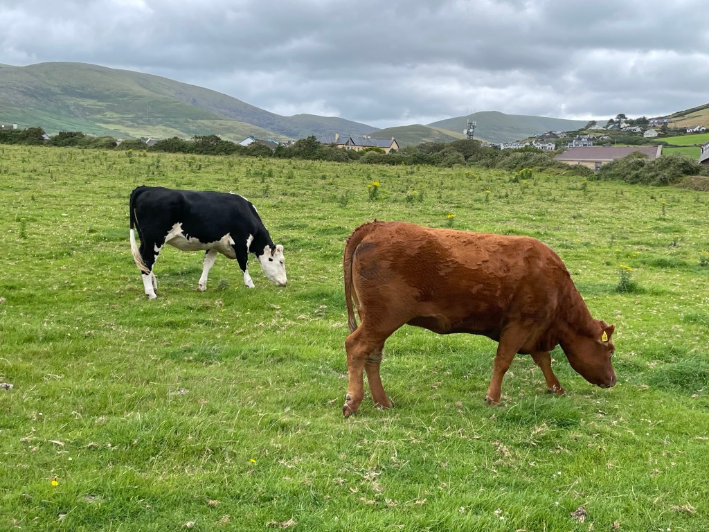
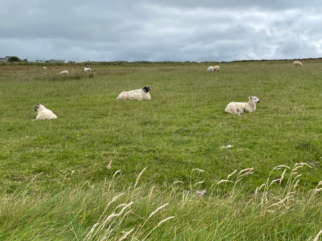
On the path, we were kept company by a number of four-footed companions – we are in Ireland after all! In fact, the trail went through their fields, so we often had to cross over stiles – and also watch underfoot!
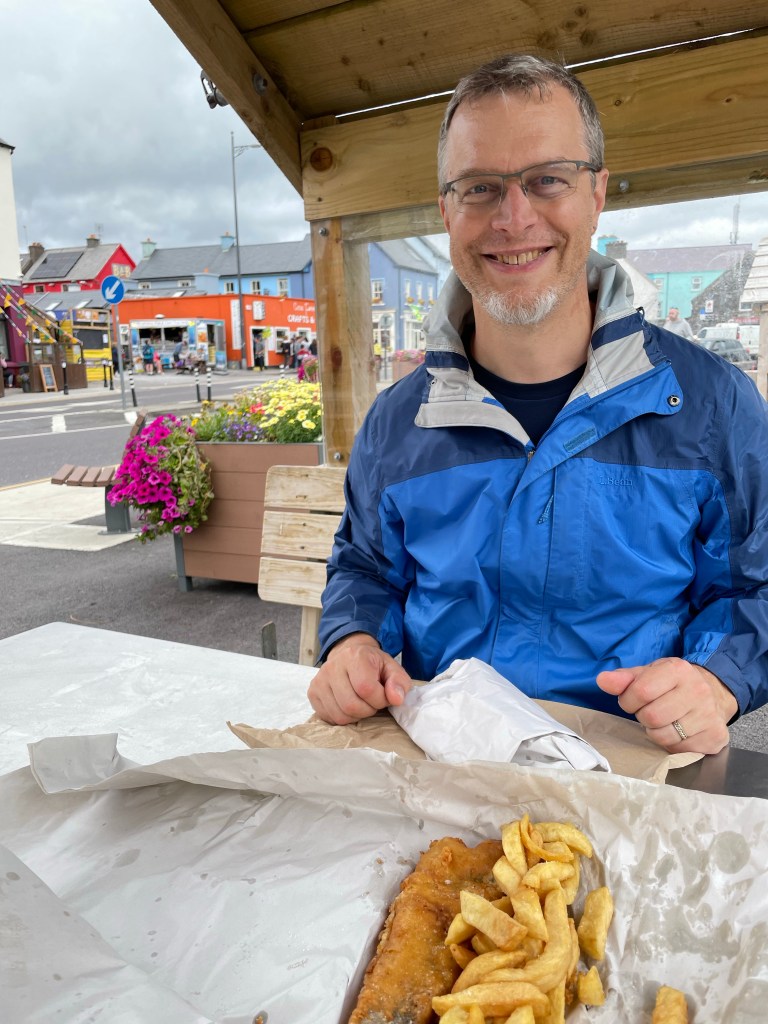
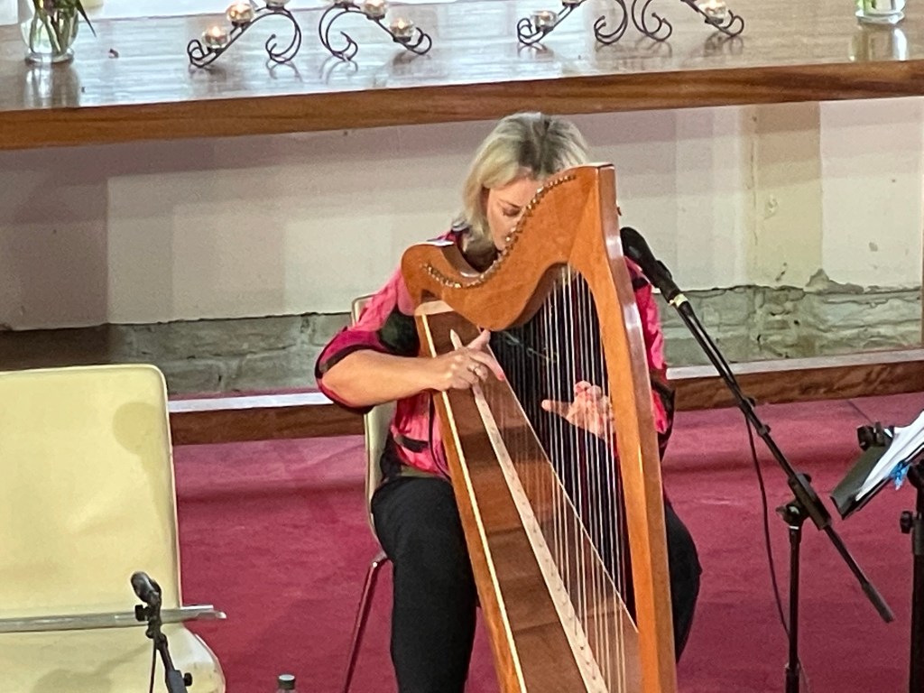
Back in town, we spent the afternoon exploring Dingle’s many shops and dining al fresco. Dinner was take-away from a fish-and-chips joint with about a decade’s worth of “Best of Ireland” awards displayed on its front wall – the hake was indeed delicious! We didn’t linger over the meal because we had tickets to a concert of Irish music held in a local church. Rather than one group, the evening featured performances by several artists. Our favorites were the harp and the uilleann pipes.
We left our hotel by the stairwell
And made our way through County Clare well
Off to County Kerry
By bus and not by ferry
Today was our Limerick farewell!
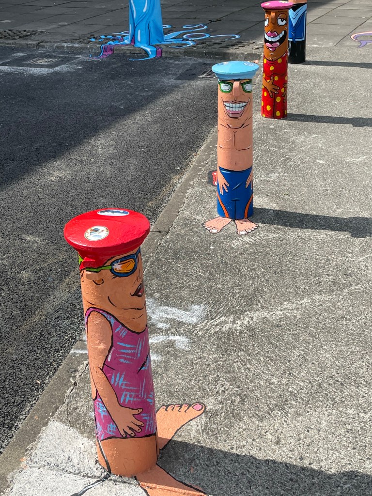
We didn’t spend much time in Limerick this morning, but wanted to show several cute pictures of bollards we took earlier on our trip.
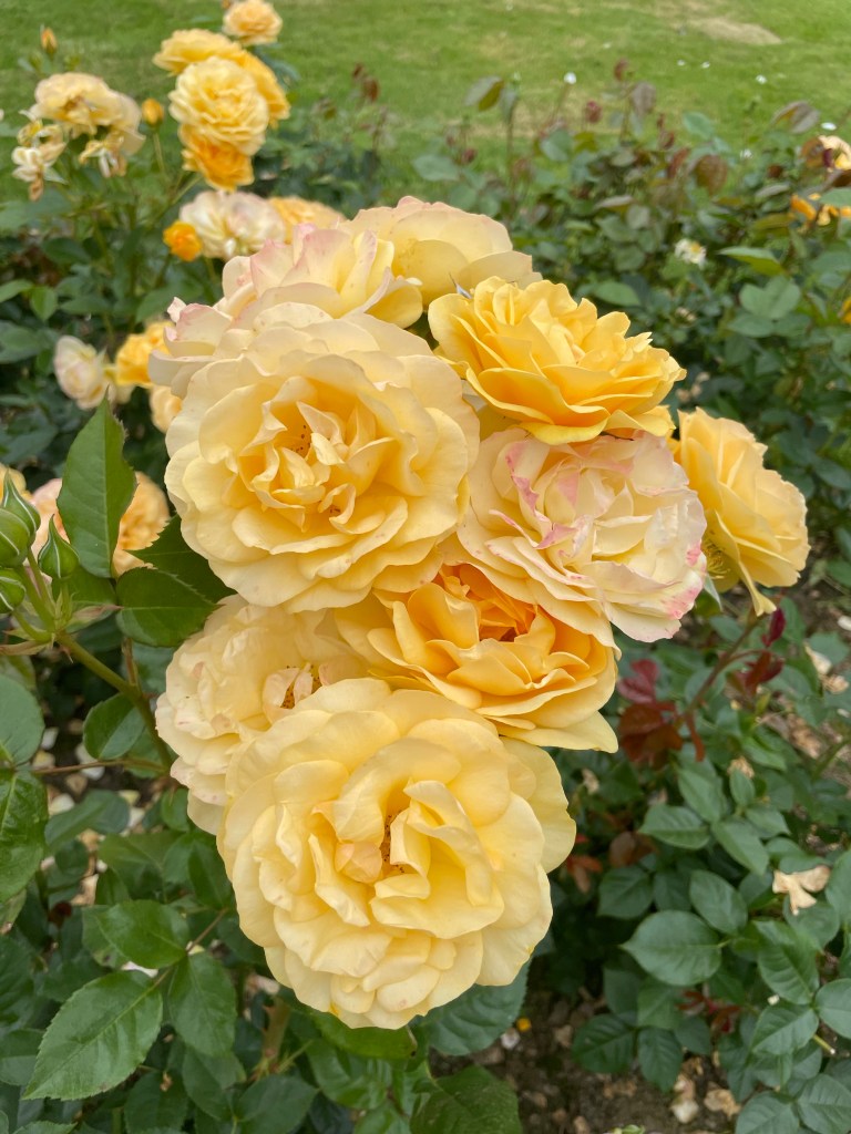
In all honesty, we spent much of the day traveling – either in buses or waiting for buses. We missed our intended connection in Tralee by a few minutes due to traffic along the way. The time was not wasted, however, as we took the opportunity to pick up lunch and check out the tourist office in preparation for our visit on the return leg when we would have a longer visit. We ate our food in the public rose garden, which had an extensive collection of different varieties of roses in full bloom.
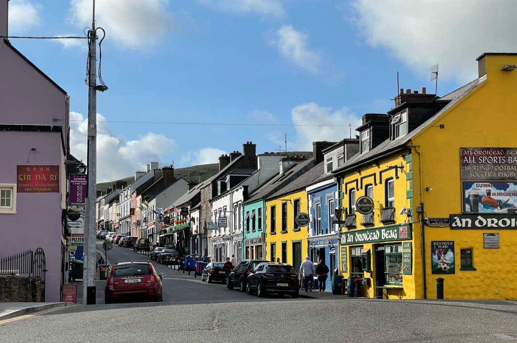
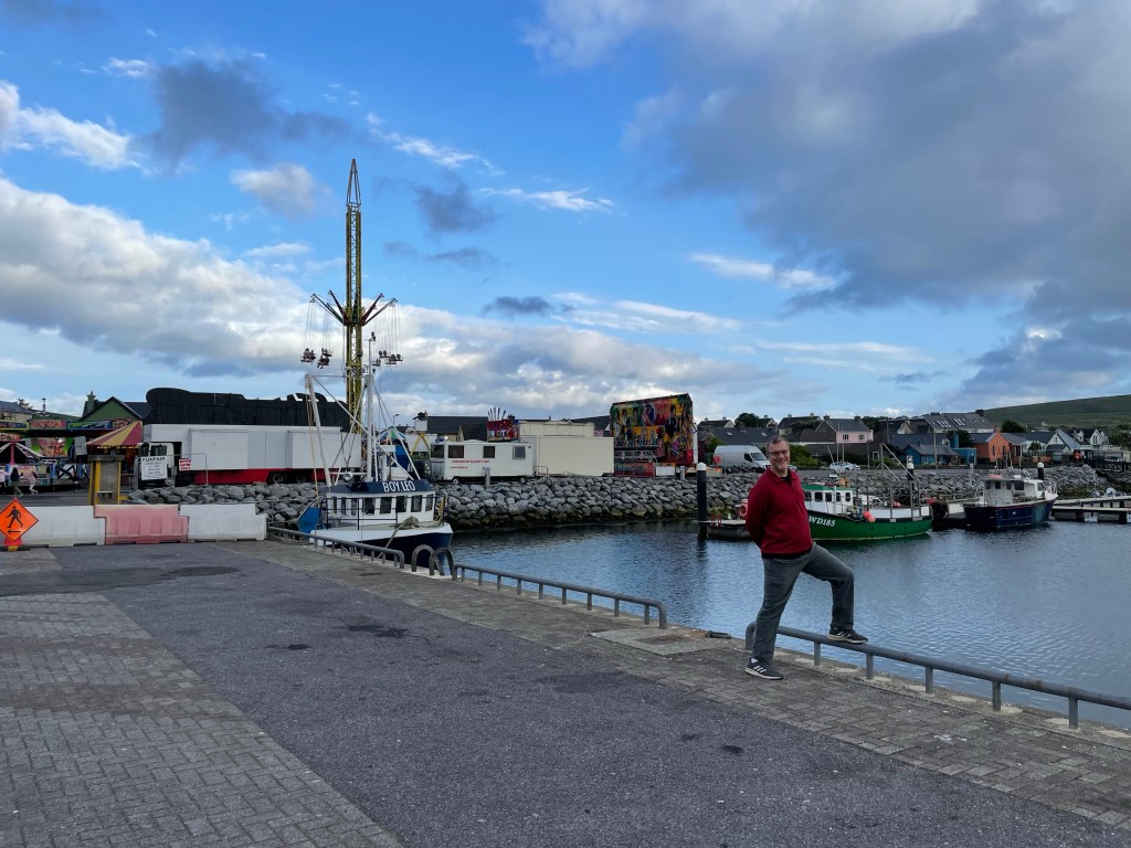
Our second bus ride took us to Dingle in the late afternoon, which still allowed us plenty of time for exploration. Dingle is the largest town in the Dingle peninsula and has the feel of a resort destination with lots of shops, bars, and restaurants that cater to visitors. We can see why people love it – it lies next to a sizable natural harbor and is sheltered by photogenic highlands on all sides. The town itself features cheerfully painted row houses (shown at the top of this post) and a daily fair by the waterfront, as well as live music in multiple venues nightly.
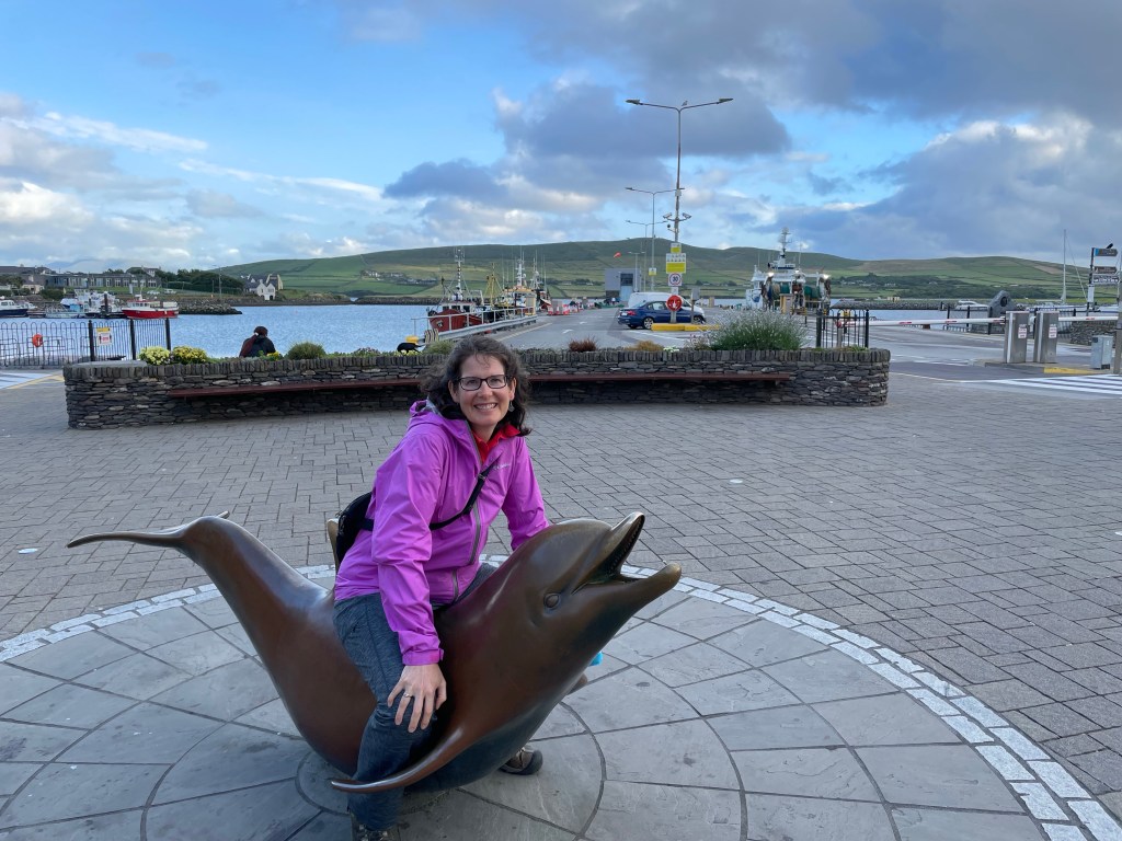
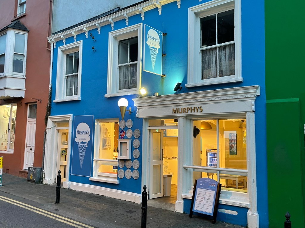
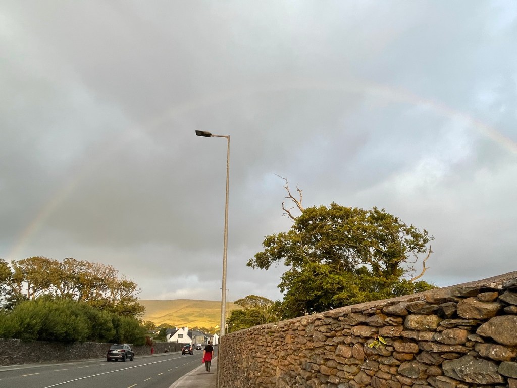
The dolphin statue that Susannah is sitting on commemorates a friendly dolphin that used to live in the harbor and greet the passing boats. We also include here a picture of an ice cream parlor with tempting and unusual flavors featuring local agricultural products. We tried the Irish Brown Bread, Chocolate Whiskey, and Dingle Gin. Delish! While exploring the town on foot, we happened to be in the right position to see the rays of the setting sun catch the local moisture in the clouds. They say that rainbows in Ireland can lead to Leprechaun’s gold – this one, fittingly, seemed to guide us to the ice cream shop!
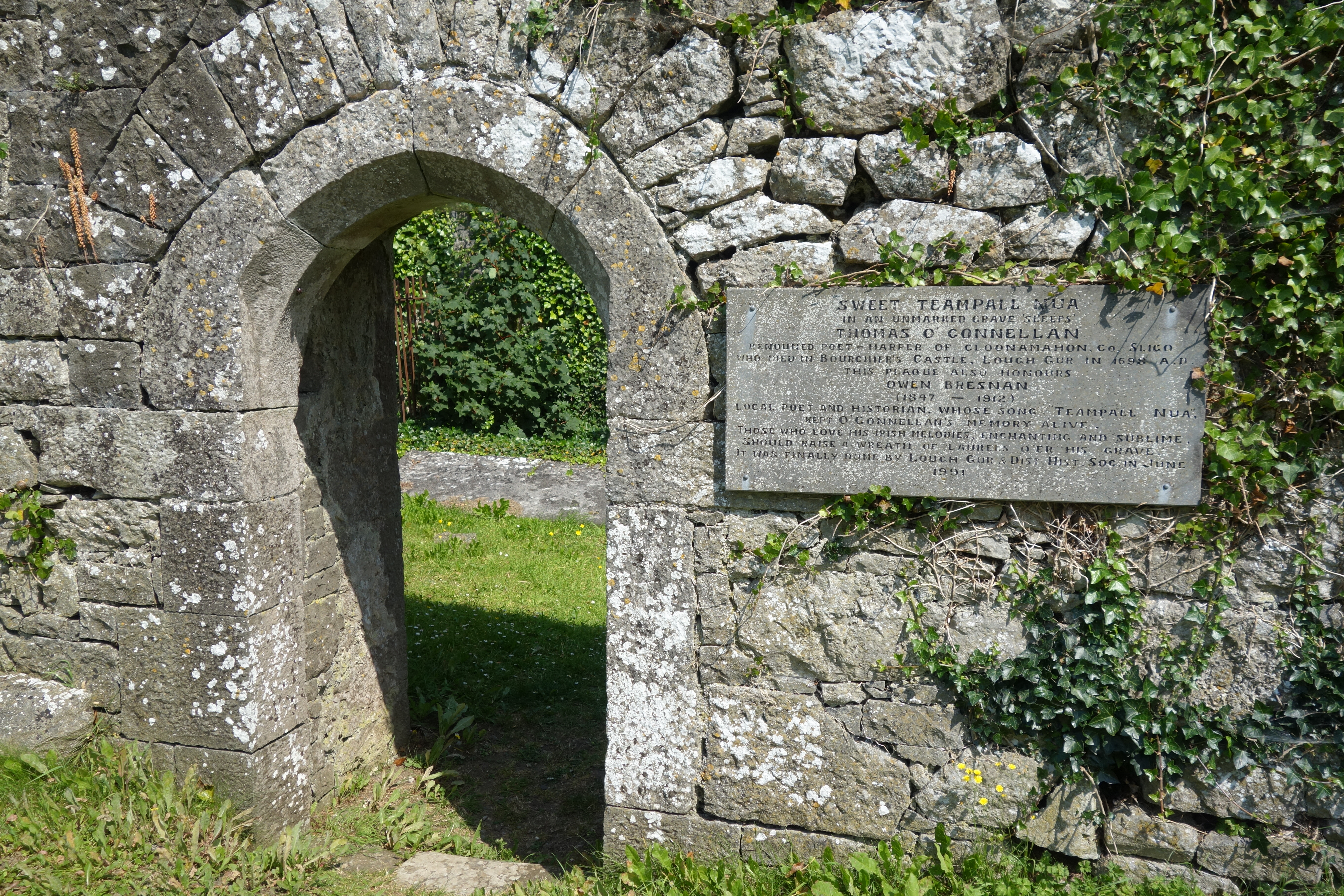
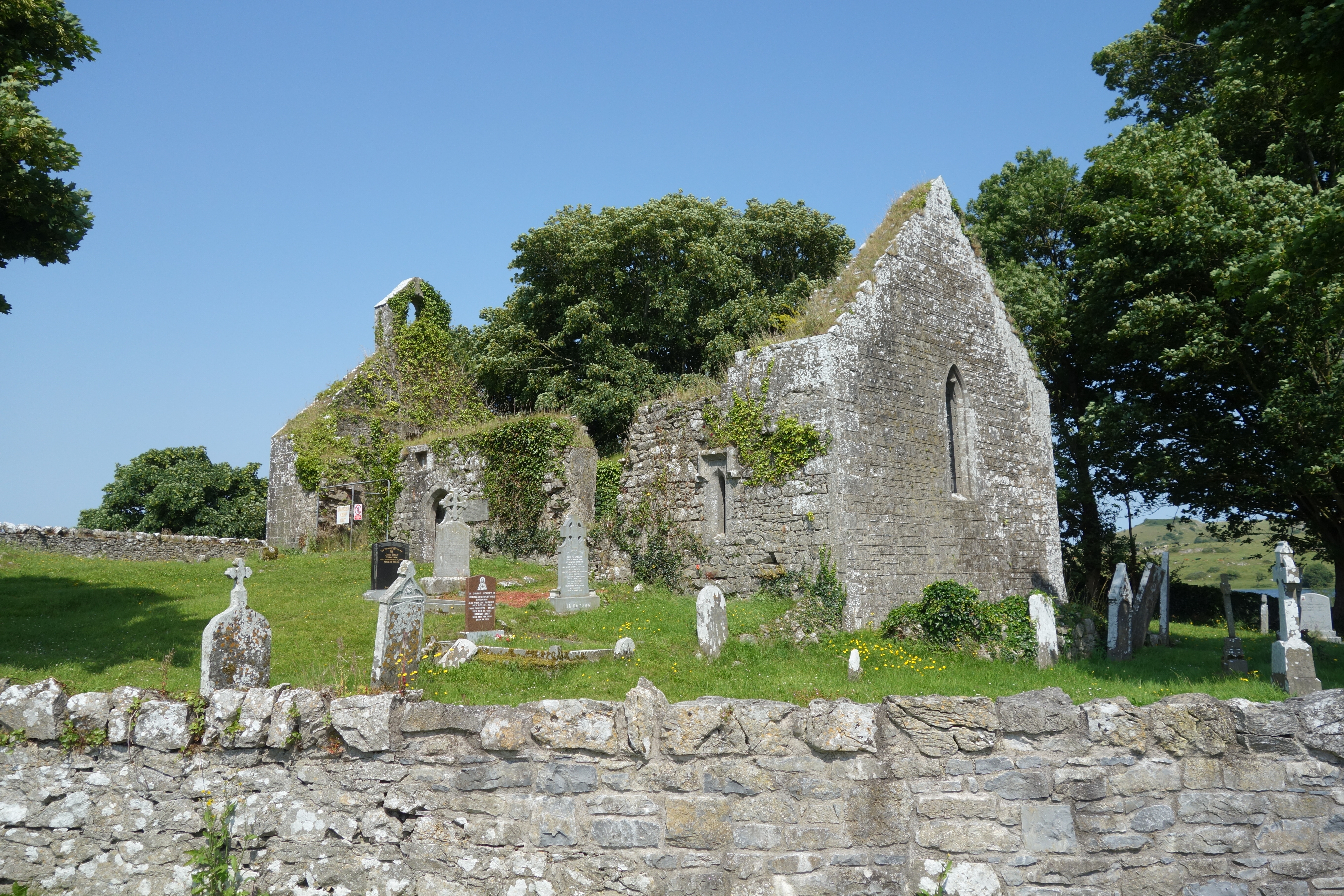
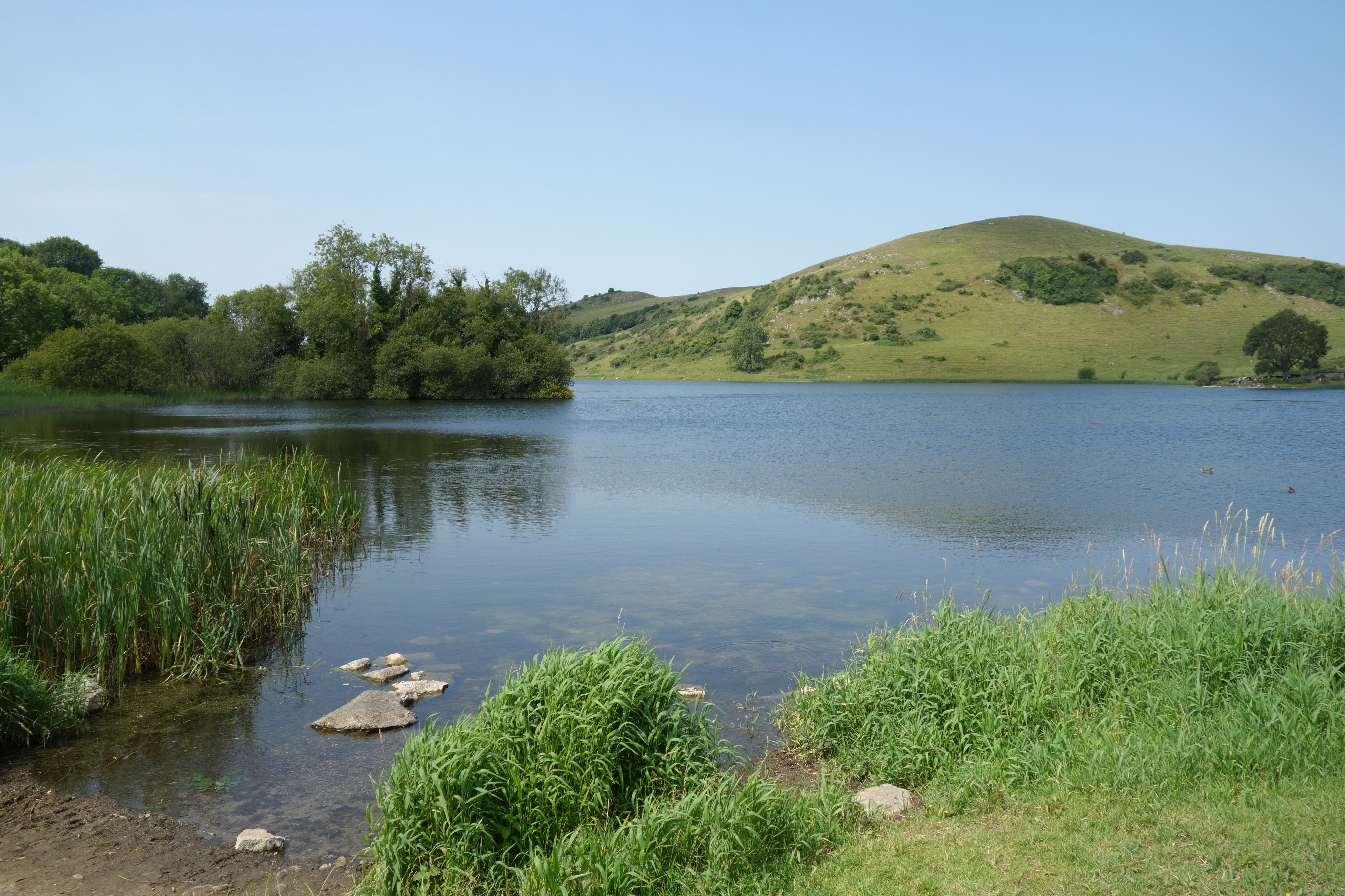
Today, Nick set off to Lough Gur
Where he saw limestone boulders galore
Susannah sat through
Conference day number two
That eve had a banquet in store
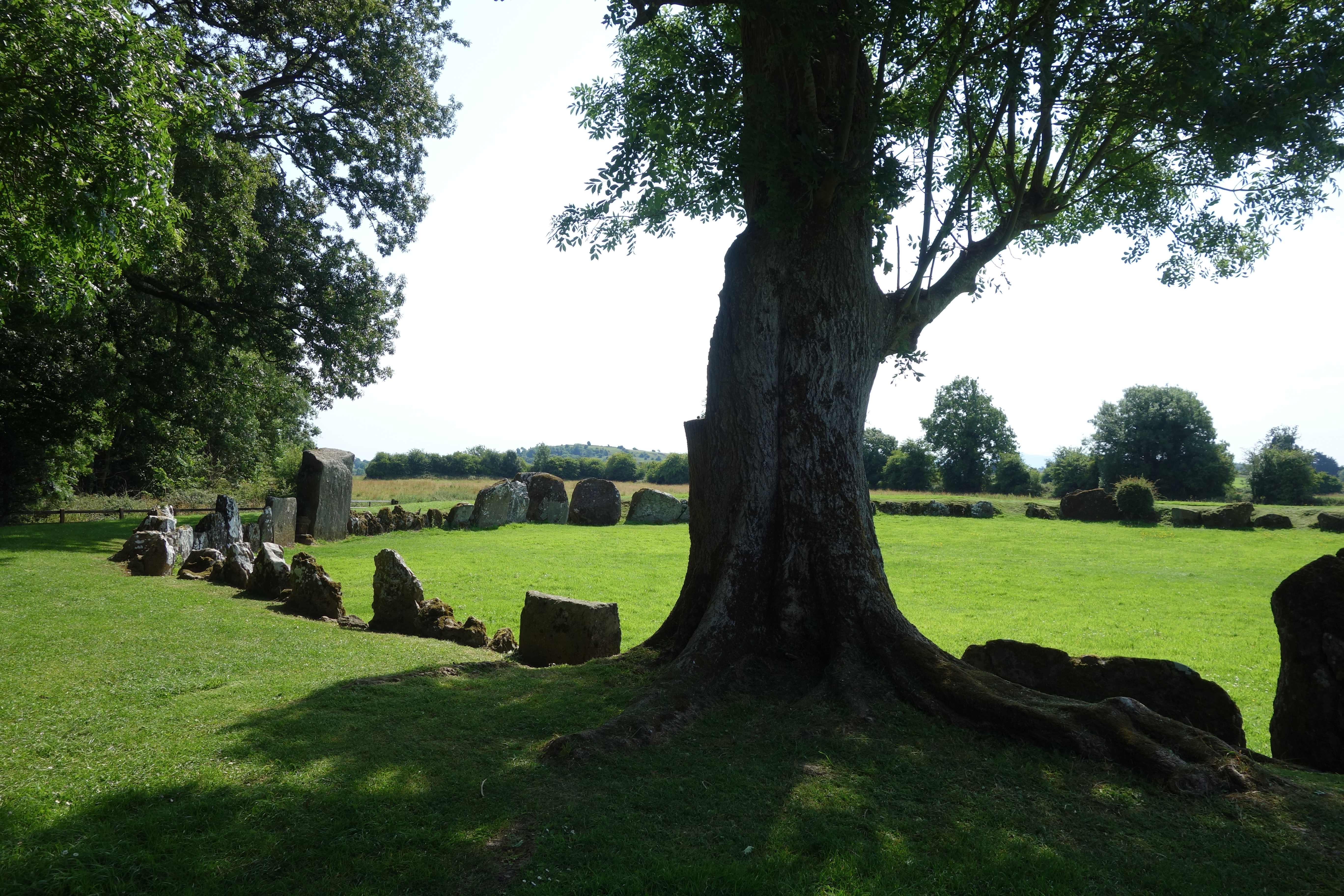
Actually, Susannah’s conference was far more fun than the verse above lets on, including a memorable keynote talk by her colleague Marie. But the eventfulness prize of the day goes to Nick, who ventured by bus and by foot to the Stone Age ruins around Lough Gur. These include the largest stone circle in Ireland, which sits right off the local motorway. The region seems to have been a hotbed of ancient times, with a plethora of Neolithic and early medieval sites situated around a picturesque lake surrounded by knobby hills studded with cows. They are spread over quite an area so you need to either bring a car or be willing to hike a bit. Fortunately the day was good for walking and there was plenty of time.
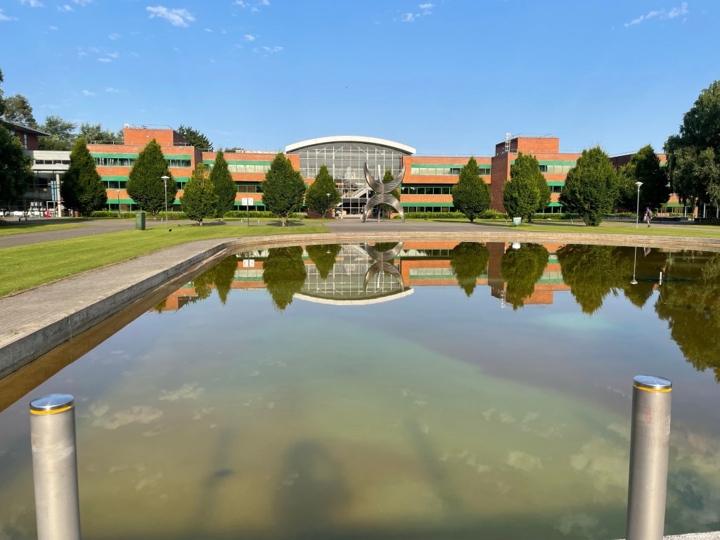
University of Limerick Business School: conference location
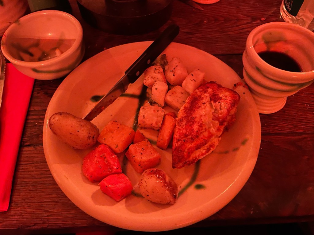
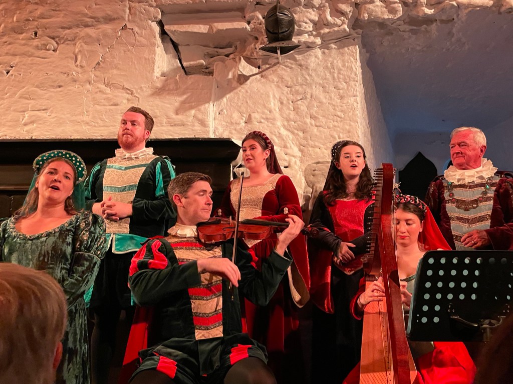
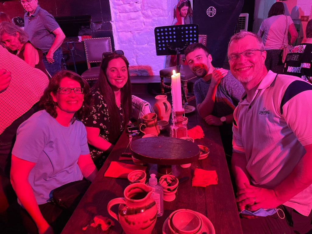
The evening had a treat in store: a medieval-inspired banquet in the genuine 15th century Bunratty Castle just north of Limerick. The evening festivities were hosted by a company of performers in costume who played music and sang beautifully in addition to serving us our meal. We were especially fortunate to be seated beside a woman who had years ago performed as the harpist with the company and was able to share all the inside scoop. The food came in four “removes” (courses) and was supplemented by plentiful mead and wine. Leaving aside the historical accuracy, the music was great, the food was tasty, and the setting was quite charming; we thoroughly enjoyed ourselves.
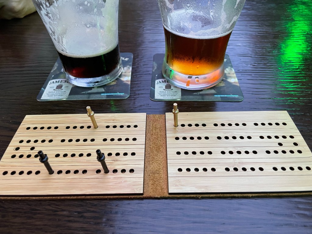
Back in Limerick, we capped off the night with pints in our local pub and a cut-throat game of cribbage.