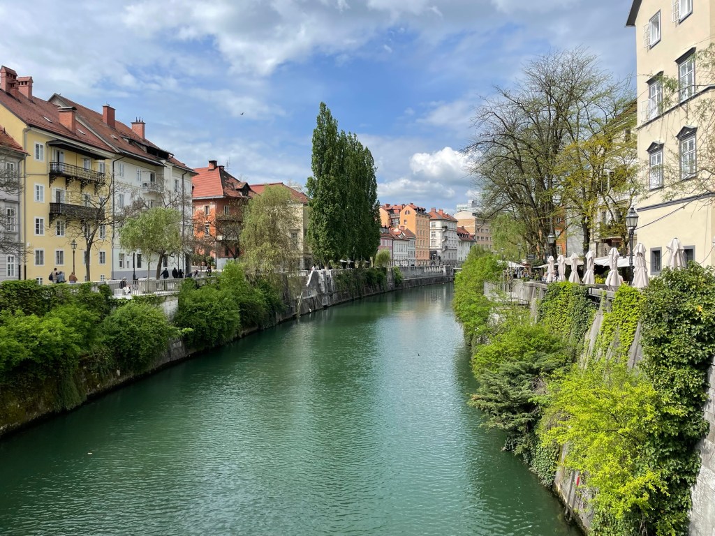
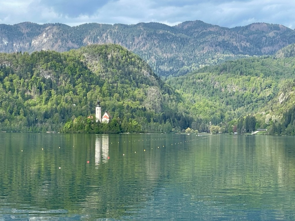
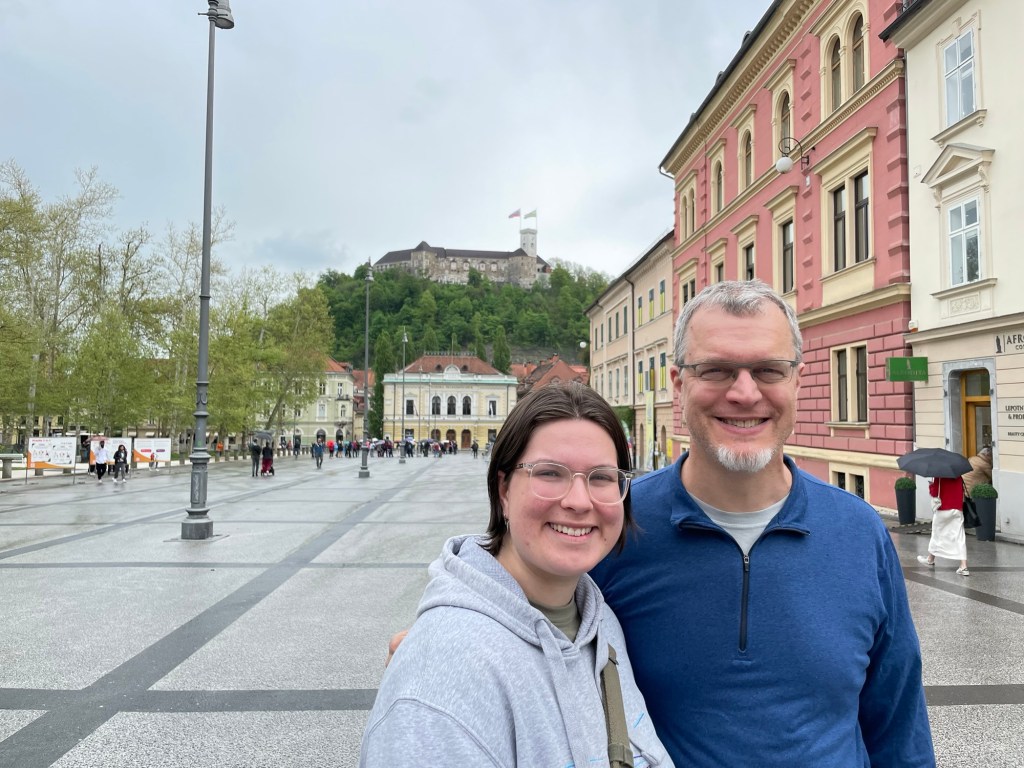
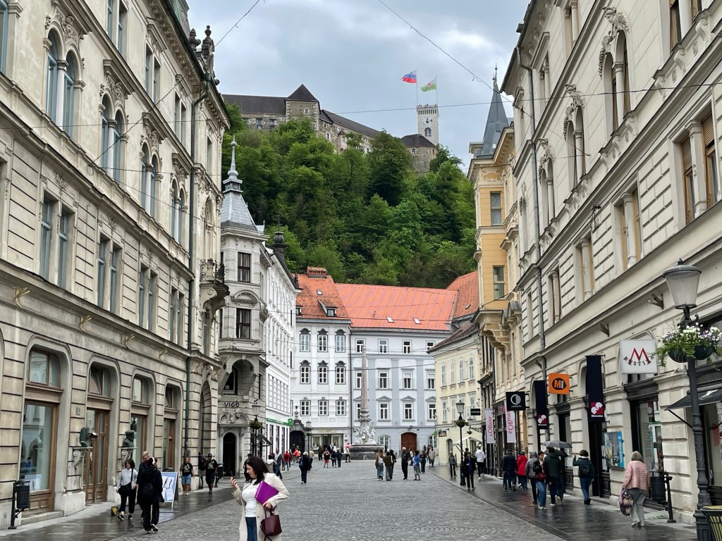
After a final morning walk around Lake Bled, we bid a reluctant farewell to its town and hit the road en route to Slovenia’s capital, Ljubljana. Rowan had previously visited the city with their study abroad group, and was able to guide us to their favorite sites and experiences. Although the castle that stands at the high point of the city looks picturesque from a distance, apparently there’s not much to see inside. Most of the interesting sights are instead centered around the river below.
Rowing course on Lake Bled – at the far end there are stands for spectatorsCongress Square in Ljubljana – our starting point in the cityThe Ljubljanica River runs through the old city
Ljubljana is known as the city of dragons due to a tradition that Jason (of Argonauts fame) came here in antiquity and slew one of the beasts. Over time, the association changed and the dragon came to be seen as the defender of the city. Dragons are celebrated in all the souvenir shops of the city, and have even been celebrated in the architecture: one of the city’s river crossings features four of the beasts in bronze, perched atop the bridge abutments.
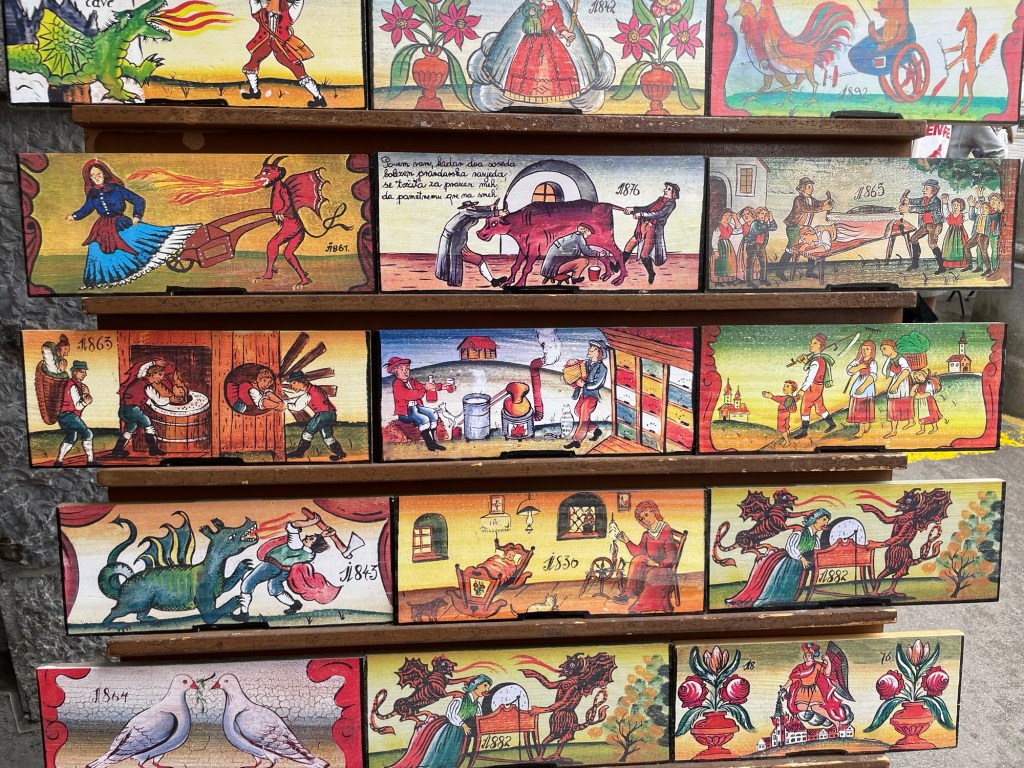
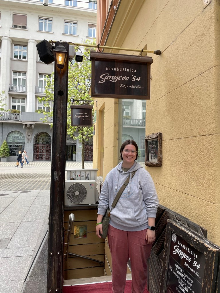
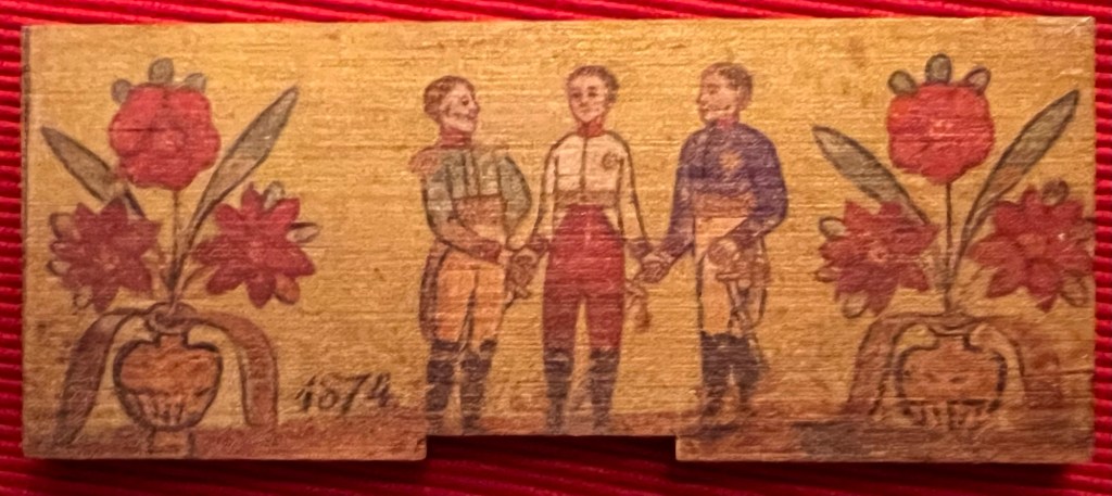
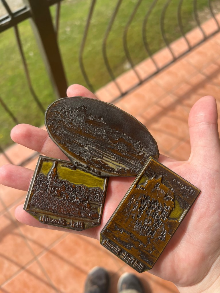
We include here a few other pictures from our visit. In a riverfront stall we came across this display of replica souvenir bee boards, which we photographed to make up for yesterday’s lack. (Alas, we still have no image of the “Snail chasing Tailors”!) On Rowan’s recommendation we also visited the popular restaurant Sarajevo ’84, which specializes in ćevapčići, a dish of grilled fingerlike meatballs served on pita-like bread, often with a soft cheese.
We could only stay in Ljubljana through mid-afternoon, as we still had further driving ahead of us to reach our lodgings for the night in Rovinj, Croatia. The route passes not far from the Italian border, and somewhat on a whim we decided to make a detour in order to see a bit of the city of Trieste. In hindsight this was not the wisest of plans; the roads around Trieste proved to be a lot like those around New York City — confusing, inconsistently marked, and arranged in such a way that any mistakes are very hard to correct. So in the end, we did see a bit of Trieste — only from the distant heights above the city as we drove along a highway filled with trucks, rather than strolling around the grand canal after popping briefly into the city center, as we had fondly imagined. Live and learn. In the end we crossed three international borders during our trip — from Slovenia into Italy, Italy back to Slovenia, and then from Slovenia into Croatia. Sadly, nobody stamps passports any more when you cross borders in Europe these days — good for efficiency, less good for sentimental collectibles.
Border station heading into Croatia
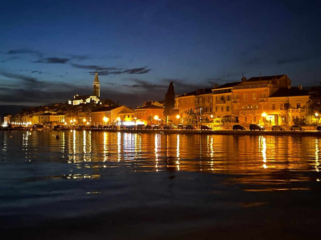
When we finally arrived in Rovinj, our host Francesca had to meet us at a parking lot outside the old city because cars are not allowed anywhere near the street where we are staying. She kindly brought an electric cart to help shuttle our luggage, and off we went. Our rooms overlook the marina, and are located on the street next door, with access to the sea via an arched alleyway. We had dinner at one of the waterfront restaurants, across from the old city center with its tall tower. After dinner we wandered around for a bit until it began to get dark. Tomorrow, our real exploration of the city will begin.
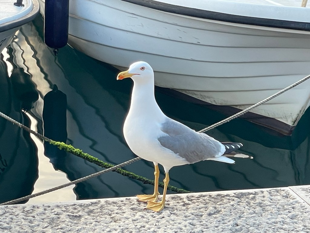
View from our living room windowOur address on Carera UlicaOur local gateway to the AdriaticPricey but delicious dinner along the waterfront – and the restaurant even has its own wine label!Bird of the day – we’re by the sea, after all!
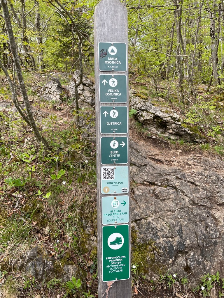
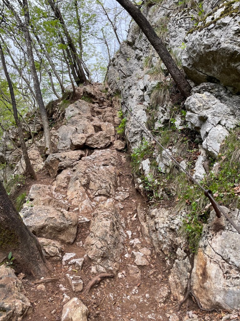
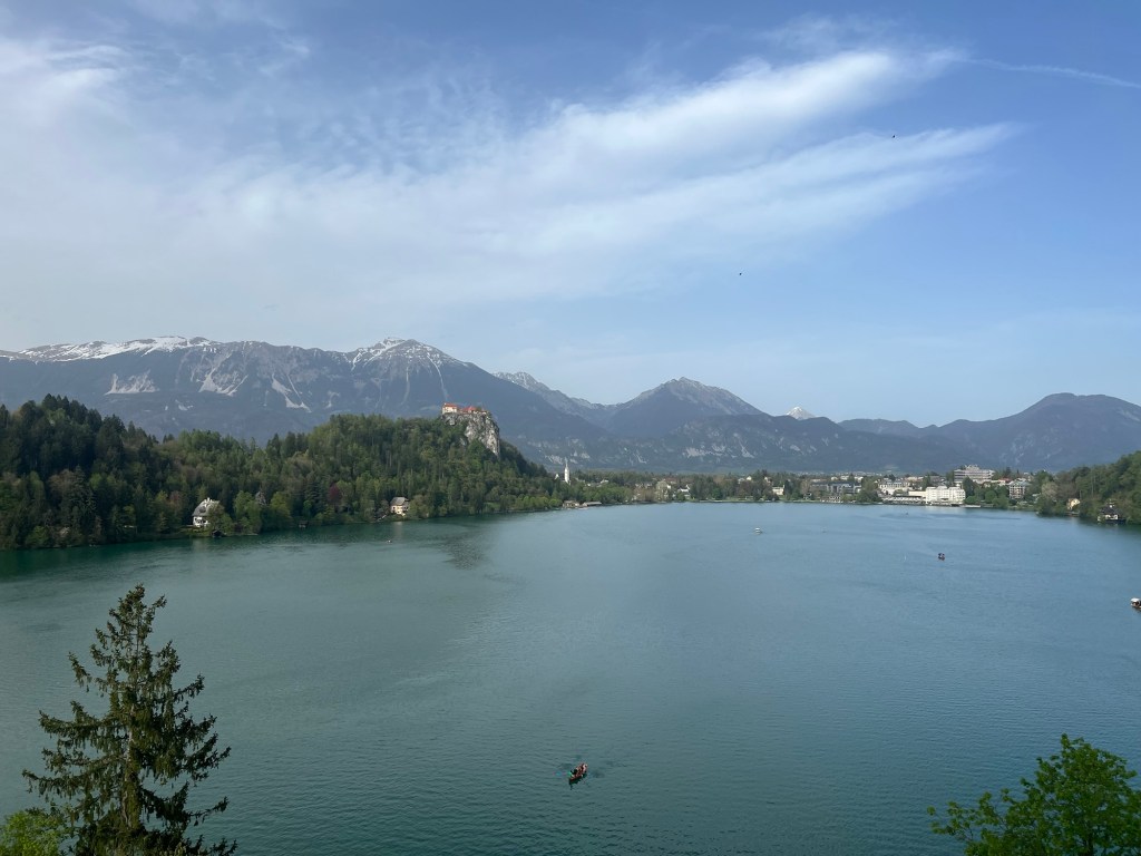
Today we planned a more relaxed pace than yesterday’s blitz of all the main Bled attractions. We decided to visit some of the local museums in the surrounding towns, focusing on aspects of life in times past. But before all that we did take time for a small morning hike up one of the hills at the end of the lake, just to see everything from another viewpoint. We actually ended up at two different lookouts, since we originally missed the turnoff for our intended destination (Ojstrica) and instead found ourselves at Mala Osojnica. With sharper eyes out on the way down, we found the missed trail and climbed Ojstrica as well. Which view do you like the best?
Bled Island from Mala OsojnicaMore view from Mala OsojnicaThe view from OjstricaGood thing we brought our hiking boots – would be hard to imagine doing this hike in slippers!The trail we missed on the way up, much easier to find as we descended
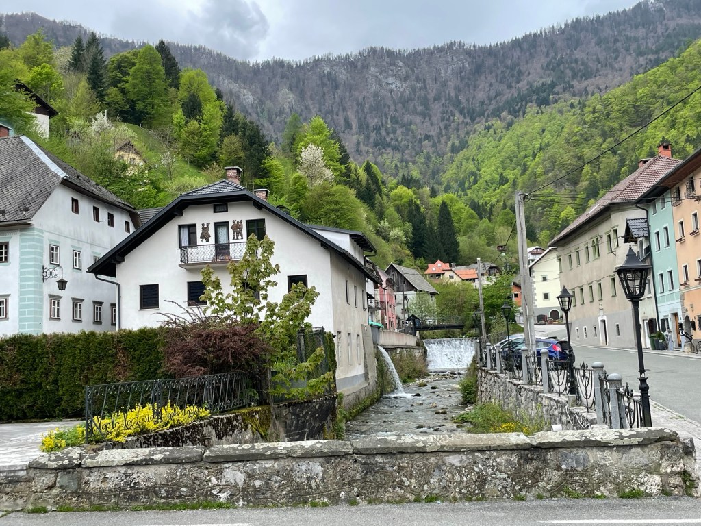
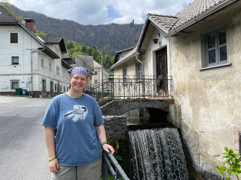
Taking once more to our rental car, we set out for the village of Kropa, which had long been at the center of the local iron mining industry. The buildings here are clustered closely around a fast-moving mountain stream, which provided power for the smelting and ore processing operations. The importance of mining gave those involved with the trade special rights by royal charter, and allowed for a relatively prosperous middle class to grow up in the region. Even within this area of relative freedom there was a pecking order, of course. The prosperous iron traders owned the houses, living on the upper stories while the ground floor was given over to business. The smelters were a step down in rank, and those who worked as blacksmiths were at the bottom of the social ladder, forced into shared accommodations where each family was allocated just a single table for living space, and had to use a shared kitchen.
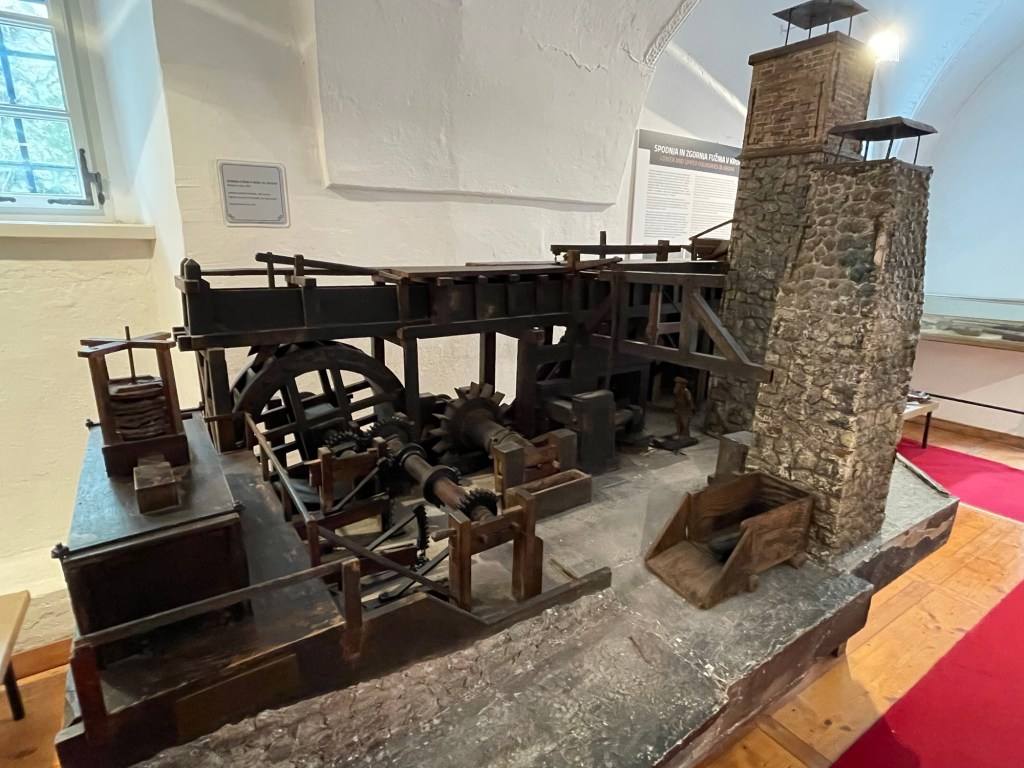
Inside one of the buildings in Kropa we found a museum (not without difficulty since it was hardly advertised from the outside) dedicated to the local history of ironworking. Iron goods were traded southwards into Italy, helping to support the needs of the Venetian navy. Over time, the area became particularly known for producing nails of high quality, used for everything from boots to railroad ties. They were produced in a wide range of standard sizes, with defined prices for each. A skilled smith could make as many as 2000 nails per day.
Diorama showing early iron smeltingA more advanced smelting operation with a blast furnace
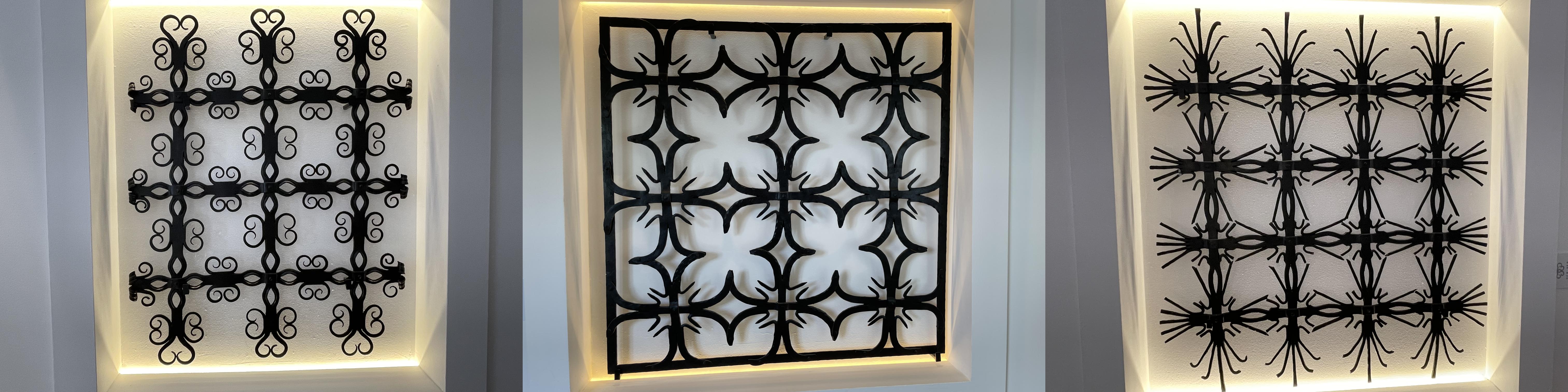
The iron trade collapsed in the mid-1800s as the local ore deposits ran out and the beech forests (used to make charcoal) were all cut down. The ironworking knowledge rooted in the area began to die out. However, efforts to establish a new specialization in ornamental and artistic ironwork have borne fruit, and now artists from the area are known for working in the medium.
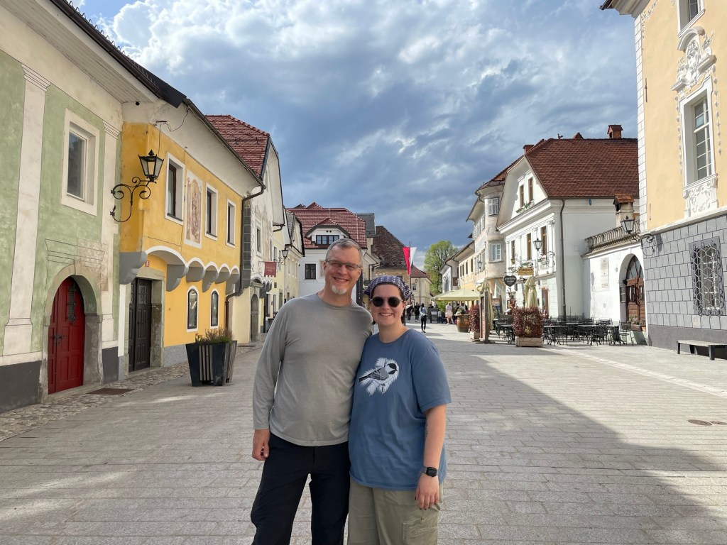
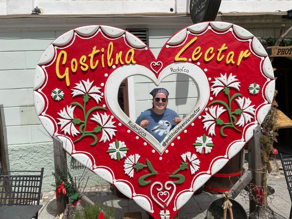
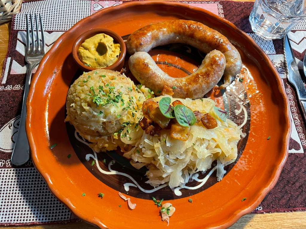
Leaving Kropa behind, we made our way via winding roads to the market town of Radovljica. The town square here featured old houses decorated with frescoes, featuring both religious themes and trompe l’oeil. They were a little faded, which along with the grandly proportioned yet oddly empty village hall gave the impression that the town’s best days were perhaps behind it. That didn’t stop us from enjoying a delicious meal of local specialties, including sausage, sauerkraut, and potatoes. The food and decor would be at home in any Alpine country, and the restaurant played music by a polka band all through our lunch.
Photo op outside the lunch restaurant, also known for its gingerbread heart-shaped cookies
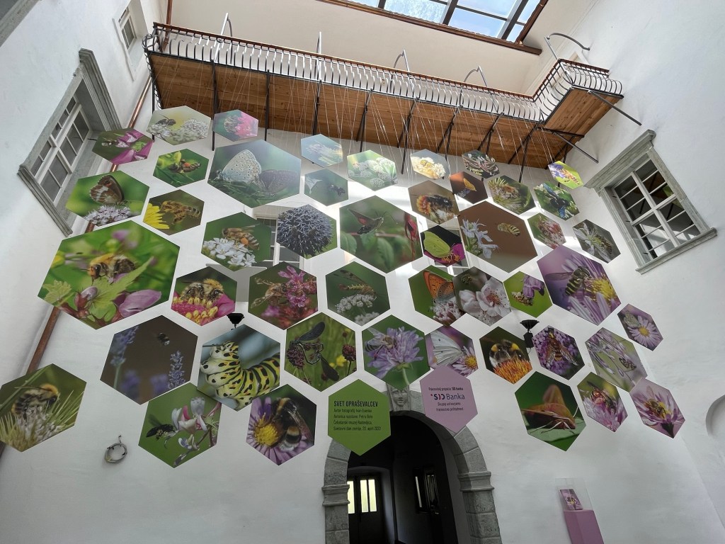
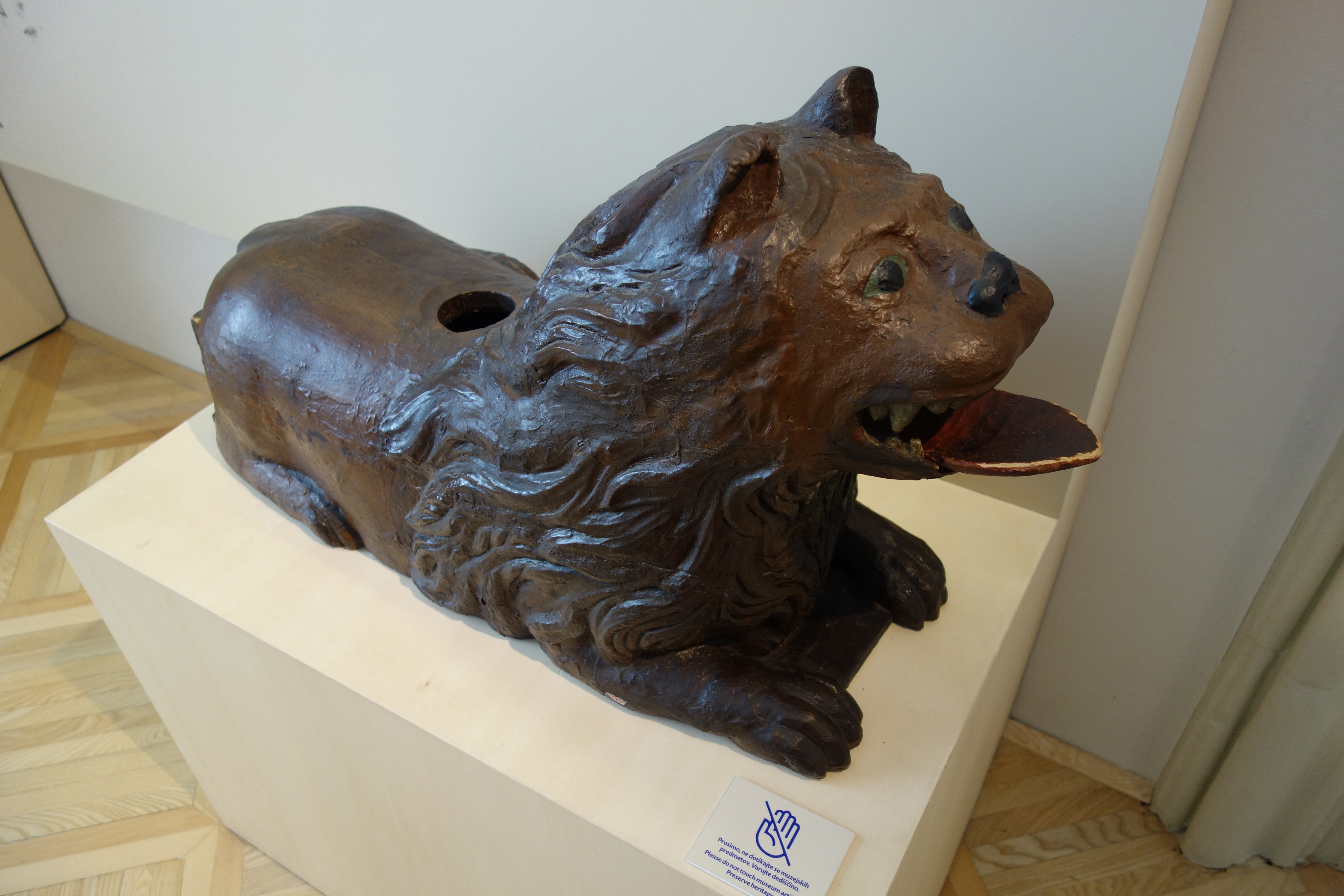
The main attraction we were here to see was the Museum of Apiculture. Beekeeping is a local specialty, based on the Carniolan honeybee, a biddable local subspecies. The hives here are kept in flat boxes that can be stacked on top of and next to each other. To help the bees to identify their homes amongst all the neighboring hives, a tradition has developed of installing artistic bee boards for the front of the hives. These are covered with painted scenes, often whimsical, sometimes depicting historical events or scenes from fairy tales. Nick’s favorite was “A snail chasing tailors,” featuring a giant snail pursuing a man with shears up a tree — sadly we did not get a picture of this one. (We would love to hear the story behind it!) Below you can see another sample depicting the 1815 “holy alliance” between Russia, Prussia, and Austria. Much rarer are hives disguised as sculpture, such as the lion we saw in the museum. Bees fly out through the hole in its back, and possibly also through the open mouth.
We close out today’s entry with a few bonus pictures featuring items we thought might be of interest.
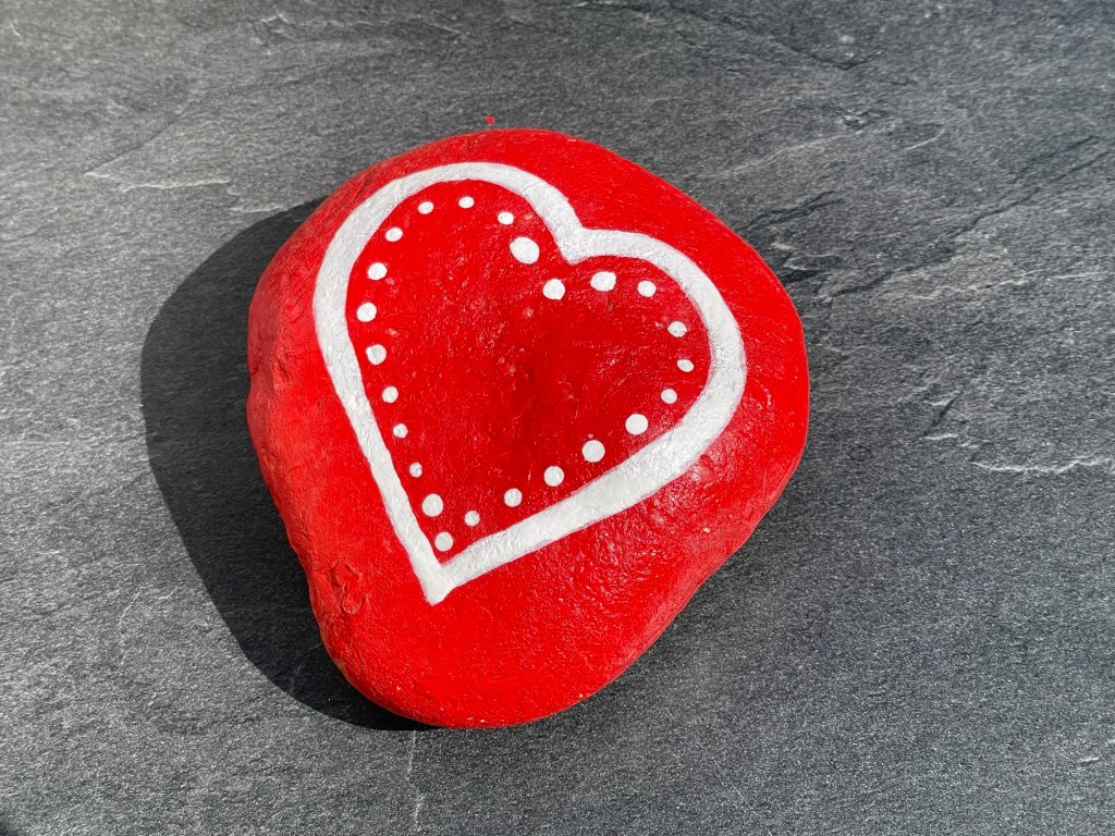
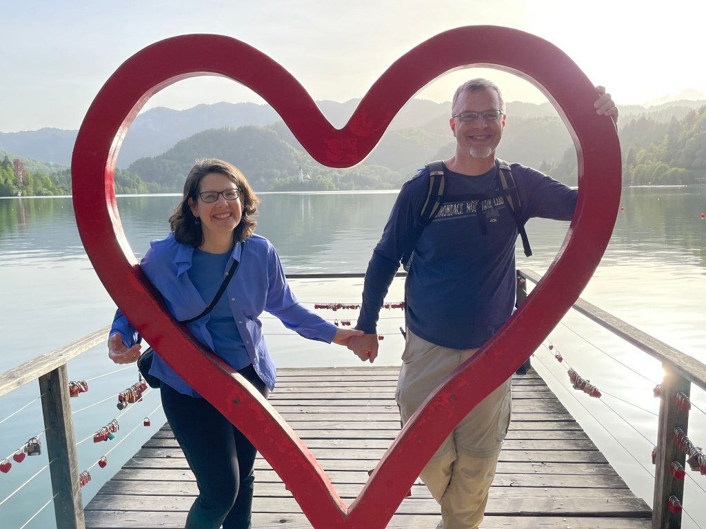
Hearts abound in Slovenia, typically in red. The English word “love” is part of the country’s name, and is often highlighted in a different color on signs.Rowan’s elderflower lemonade from dinner. Slovenia lemonade is not very sweet and often seems to feature additional flavors mixed in. (Note the red and white hearts again)Snail of the day — we found this fellow clinging to our car windshield in the morning. (Lucky thing we’re not tailors!)
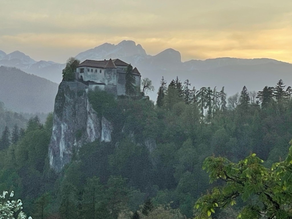
After our castle-view dinner yesterday, we continued our drive into the evening to arrive in the town of Bled after dark. Although we could see Bled’s eponymous castle lit up by floodlights from the window of our lodging, we didn’t truly get a sense of the place until dawn the following morning. It perches on a rocky bluff, overlooking the lake and the town below.
Bled Castle seen from our balcony
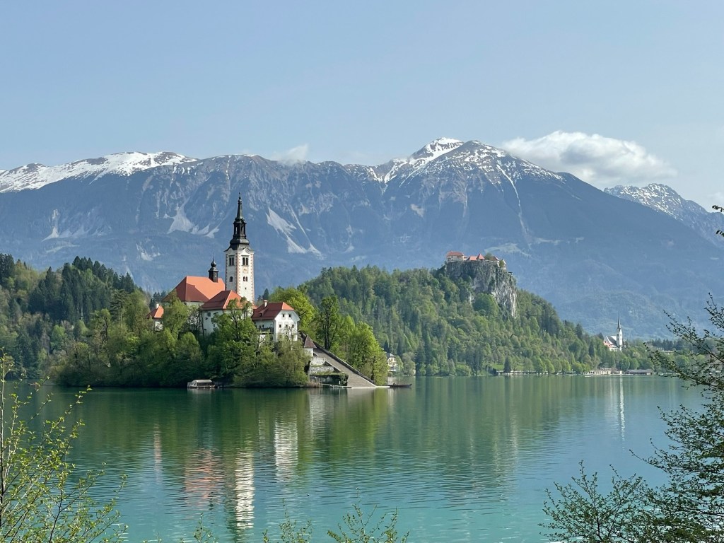
Bled is blessed with a combination of natural beauty and manmade enhancements that blend seamlessly into a harmonious whole. Archaeological excavations reveal that it has been drawing visitors for millennia, offering a valley of fertile flat land with the castle mount in the center to provide both early warning and a place of safety in case of threat. The island that rises from the lake also attracted visitors, with evidence that it was a site for pagan gatherings in early days. Since the spread of Christianity it has served as a pilgrimage site sacred to St. Mary. You can see the layout of the region in the bronze relief map below. The town lies at the bottom end of the lake, the castle is to the right, and the island lies at the top. Behind it all, the foothills of the Julian Alps keep silent watch.
With the promise of a bright and balmy day, Nick & Susannah decided to go for a jog around the lake first thing in the morning. This proved to be a popular choice, as we saw many other runners. There are paths running the full way around, and each new stretch offered different views that demanded to be photographed, so that we made slower progress than we had intended.
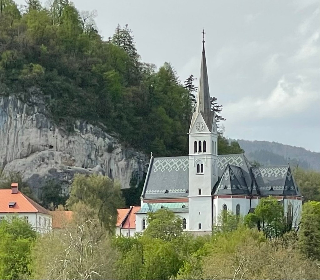
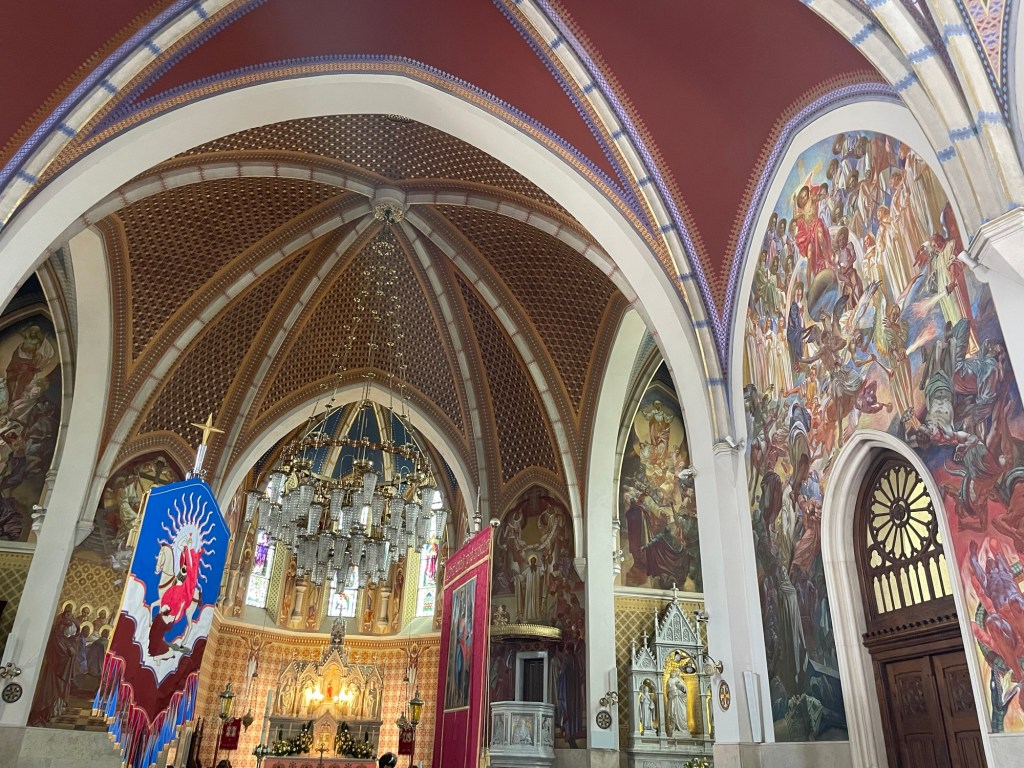
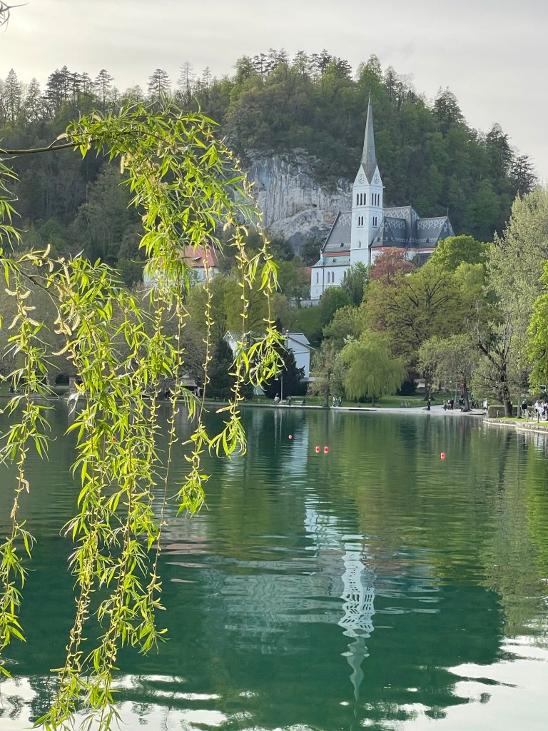
After breakfast at our lodging, we set out to see the first of the town’s famous landmarks: Blejski Grad, a.k.a. Bled Castle. Along the way we passed by St. Martin’s church, a fine specimen of local religious architecture with an intricately patterned slate roof. Although the windows are decorated with stained glass, the real stars of the interior decor are the many colorful frescoes that cover the walls. Among other themes, they depicted each of the phrases from the Lord’s Prayer. The aisles also held colorful banners suspended from poles.
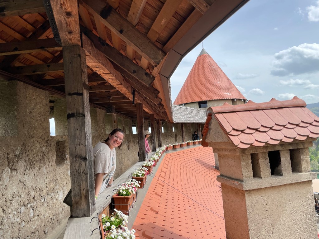
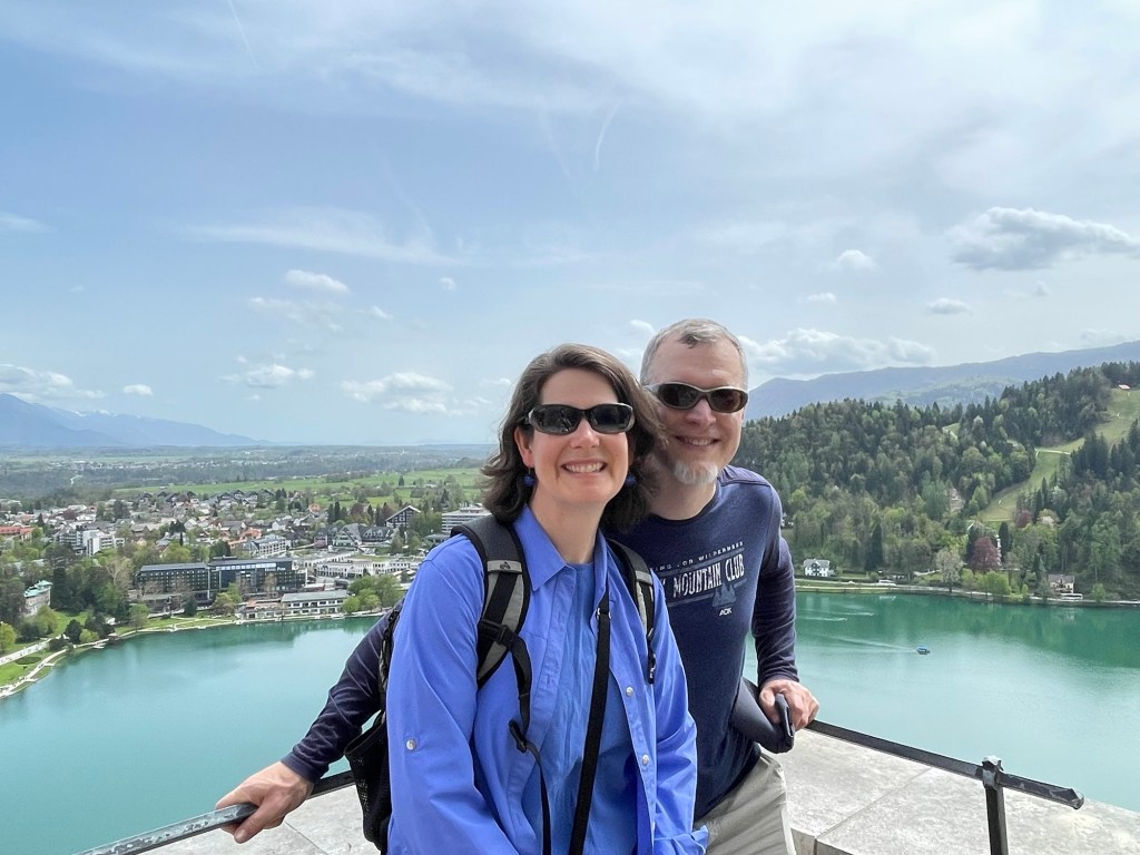
From the church, a short but steep hike brought us to the castle gates. Although there have been fortified settlements on the promontory since prehistory, credit for the building of Bled Castle in 1011 goes to Bishop Albuin of Brixen, who had had been granted feudal ownership of the region seven years prior and wished to consolidate his holdings. His success is attested to by the fact that the bishop’s successors continued to rule over the area for the next eight centuries. The castle was remodeled multiple times over that period; the current incarnation is in the Baroque style with some modern embellishments. The views remain fantastic in all directions, but particularly out over the lake.
Can you find Nick in this picture?Read below for more about the boats on this lake…
Unlike Predjama Castle, at Bled there has been little attempt to portray the lives lived by former inhabitants. Rather, the buildings have been adapted as a sort of combination museum and mini-mall, with a restaurant, cafe, and several small businesses. Our favorite was the print shop, which offered replicas of famous early works published in Slovenian, in addition to bookmarks, woodcuts, and other items. The printer there was very friendly, and at our special request shared with us a few of the older worn-out plates that had been retired from active use.
First book printed in the Slovenian language
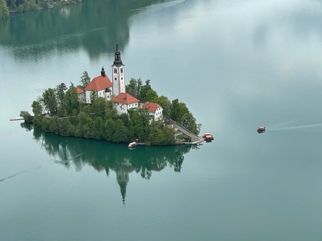
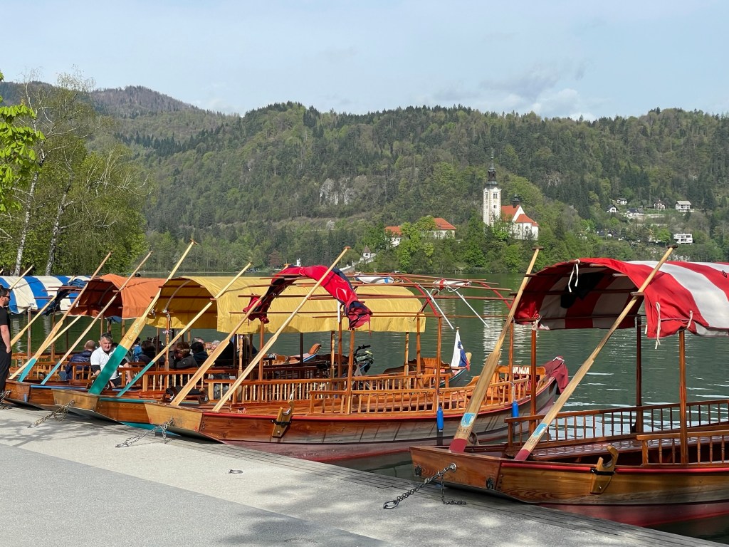
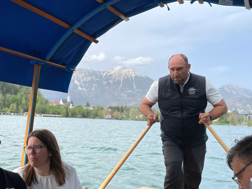
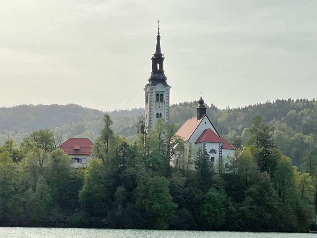
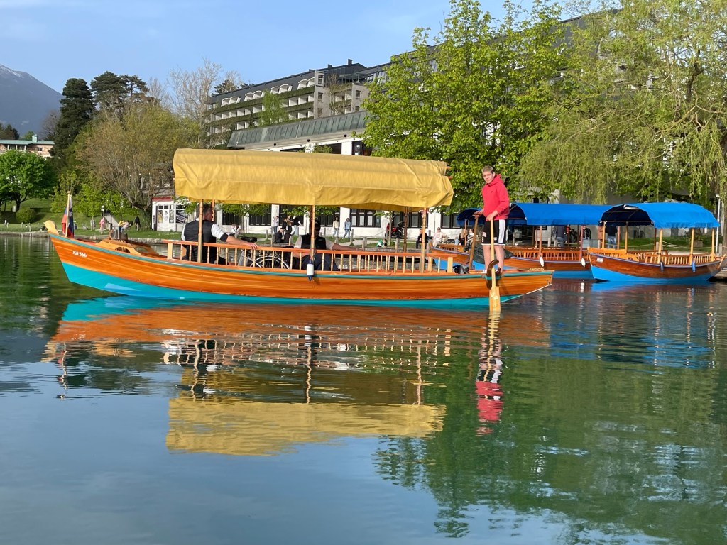
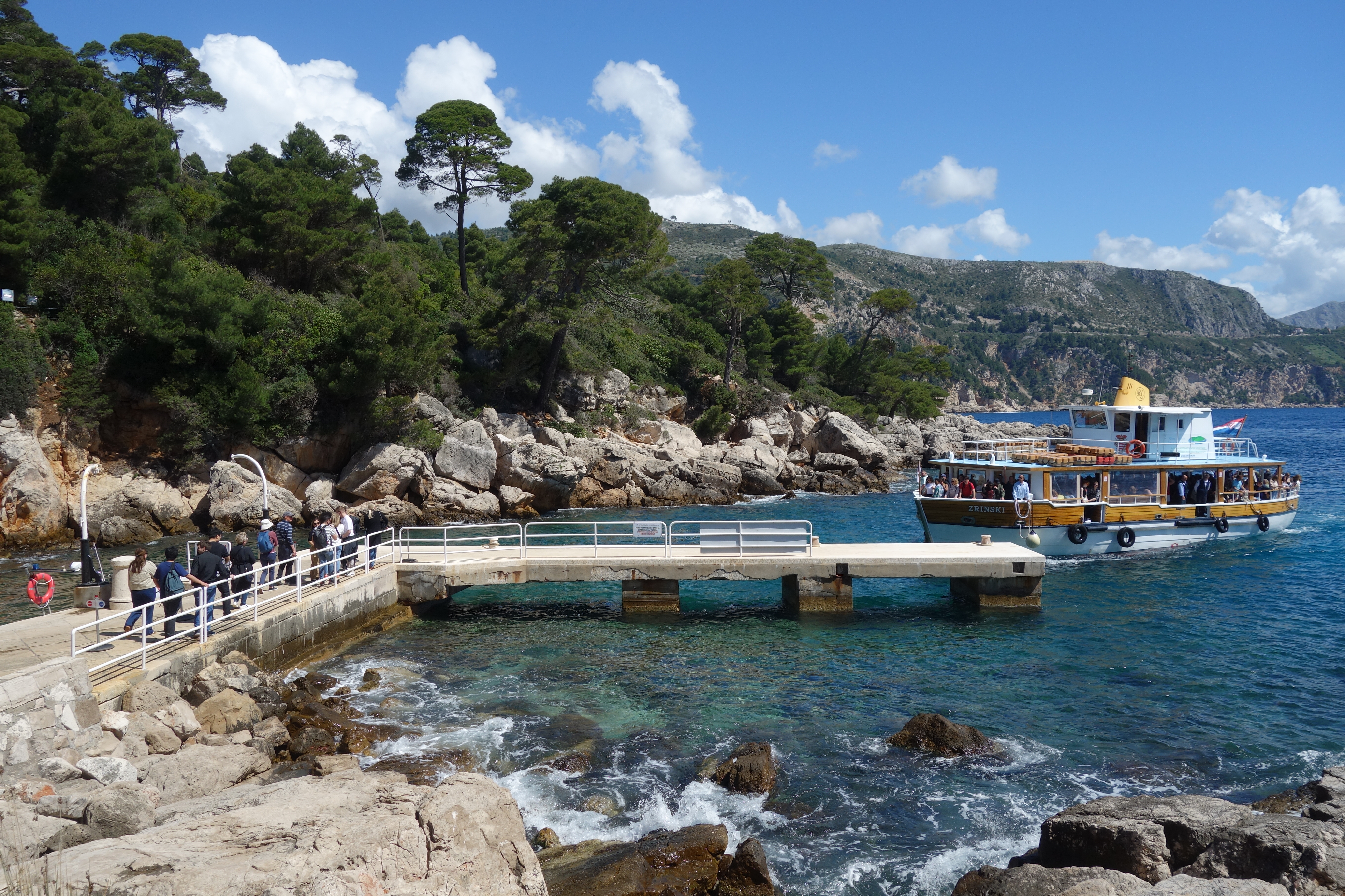
Our visit to the castle took into the early afternoon, so after a late lunch we headed back into town for our last essential Bled experience of the day: a trip to the island where the Church of the Mother of God on the Lake stands overlooking the waters. Traffic on the lake is strictly controlled: during the middle ages twenty-three families were granted the right to ferry pilgrims across the water to the island, and their descendants remain in charge of the business to this day. Gasoline motors are not allowed. Although you can rent your own rowboat by the hour, the majority of visitors take the pletna. These are rowed boats of a specialized design endemic to the area, able to carry up to eighteen passengers at a time and propelled by a single oarsman using double sculls. Though it seems awkward to look at, they move surprisingly fast using this system. The boats have no schedule; instead they take passengers until they are full and then depart. Ours sported at least four or five native languages amongst its passengers: we heard English, Italian, Croatian, German, and Slovenian. From the water, we had excellent views of all the local sights as we traveled the length of the lake.
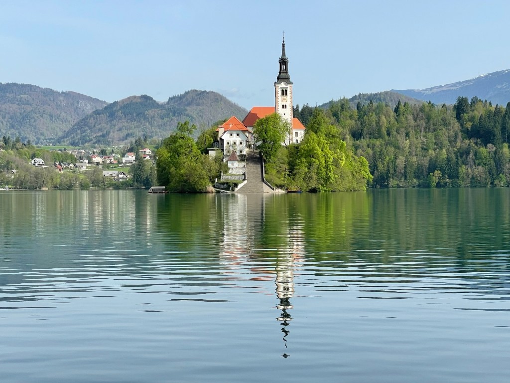
A line of pletna boats waiting for passengersView down the lake toward Bled townClosing in on the islandBoats wait at the island landing while passengers explore
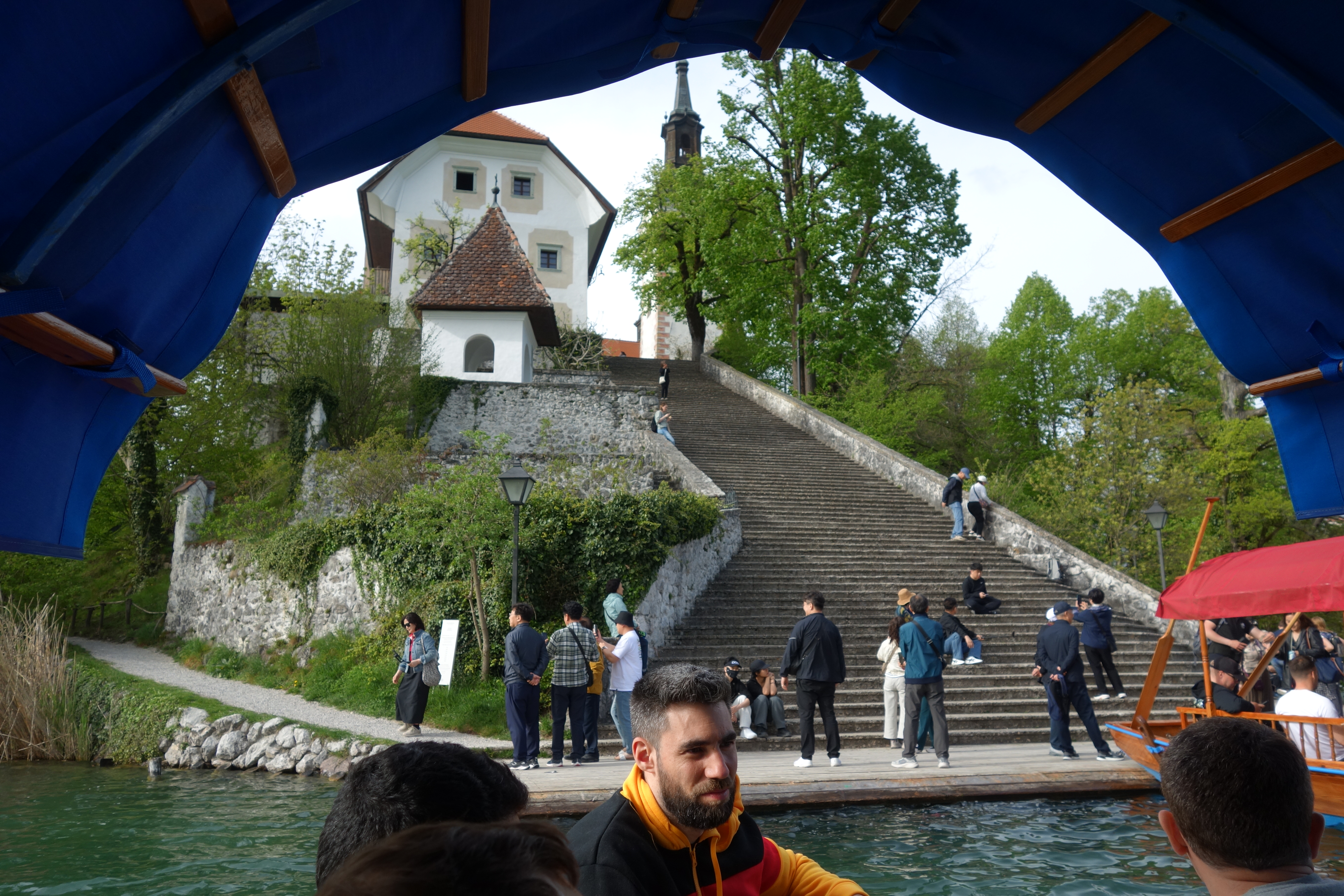
The pletna land on the island at the base of a dramatic series of stone steps leading up to the church and clocktower. Climbing the steps is supposed to bring good luck, or perhaps it is ringing the bell of the church — we heard different stories. A popular local legend tells that a lady of the castle, in mourning for her husband killed by bandits, commissioned a large bell to be cast and placed in the church. However, tragedy struck as the bell was being transported to the island: the boat capsized, and the bell sank to the bottom of the lake, where it can still at times be heard tolling away in mourning for the lost husband. This sad story somehow made its way to the ear of the Pope, who commissioned a new bell and had it installed to replace the one that was lost. Today, those who ring the bell and make a prayer to St. Mary may have their wishes granted. Not wanting to miss our chance, we all took a turn on the rope.
Susannah’s training in change ringing back at Smith served her well today!
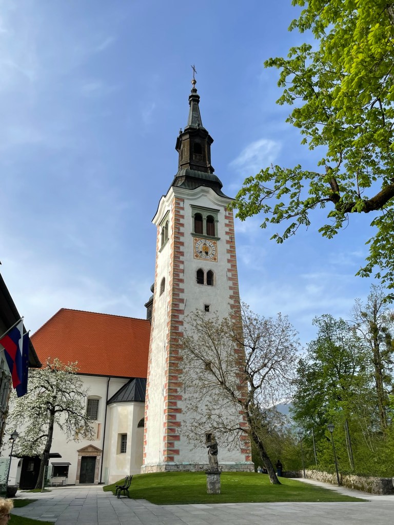
The tall tower next to the church holds a mechanical pendulum clock with a complex mechanism that tools the quarter hours, half hour, and hours, each with a different ring. It had grown rusty and inoperable, and was only recently refurbished within the last ten years. Climbing the tower allowed us to see the workings, and also gave elevated views across the lake.
Besides the church and tower, we also visited a small museum and made the short circuit of the island’s shores. The building that now houses the museum was originally built to accommodate the many pilgrims who used to flock to the island for the Feast of the Assumption in mid-August. These days pilgrims may still visit, but nobody stays on the island overnight. Our own time was limited because our boat operator was waiting to take us home, so we boarded the pletna once more for the trip back to town. The day was near to ending by then, so we spent some time on the waterfront admiring the beauty of the landscape in the late afternoon sunlight.
Sunset over the Alps — still the view from our balcony
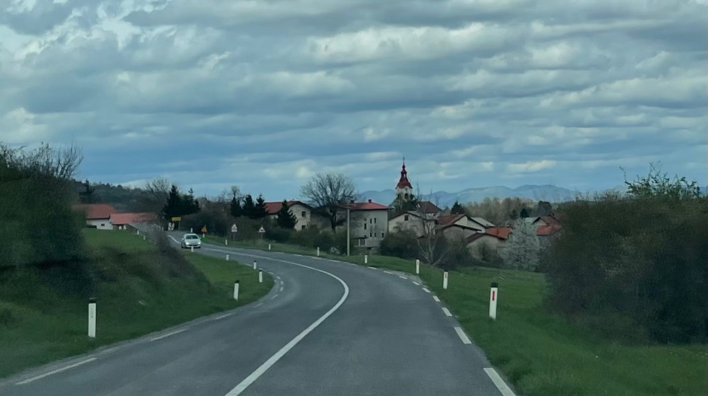
After a delicious breakfast at our B&B just outside the national park, we hit the road again. Destination: Slovenia. Our path took us cross country on tiny roads for the first part of the journey, as we made our way to the larger highway that crosses the border. The buildings in this region have an Austrian feel to them, at least from our perspective — perhaps the Slovenians imagine the influence goes the other way!
Today being Easter Sunday, we weren’t sure how many places would be open for business. We carefully saved some extra food from the day before, just in case. As it turned out, we needn’t have worried — the tourist business carries on regardless. Both of the major attractions we hoped to visit were operating, along with all the restaurants and souvenir shops surrounding them.
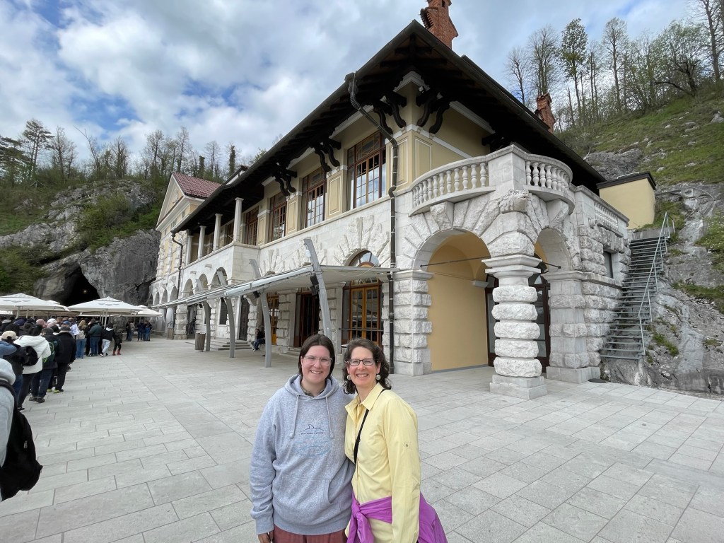
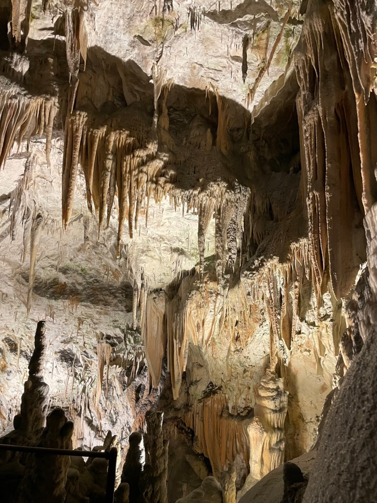
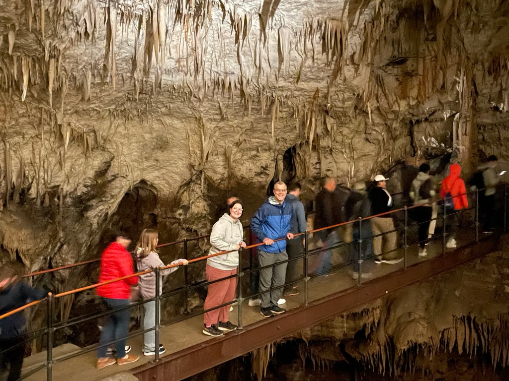
Our first destination was Postojna Jama (cave), carved out by the local river that disappears underground at this location. The entrance has the look of an old-fashioned train station, and in fact the first part of the visit is a 3.5 km ride on underground train cars, whizzing through gallery after gallery of impressive underground formations, mixed with the occasional connecting tunnel where the rock hangs down just barely overhead.
The cave has been known since the 1700s, and has drawn tourists for many years. Today the train is only the start of a smoothly functioning operation that shuttles hundreds of visitors through every hour. Perhaps the machine is too well oiled: although the underground sights were impressive, our English tour group was very large, and the guide walked quickly at the front. In order to have much chance of hearing her commentary, you had to hurry along to keep up. Not much time for lingering, but we did manage a few pictures!
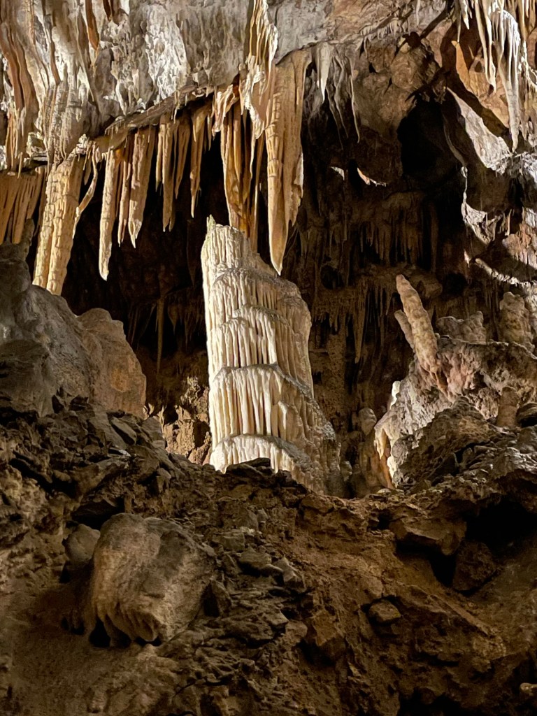
The “Tower of Pisa” — and you thought it was in Italy!
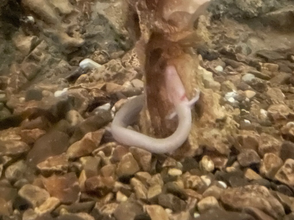
Besides its decorations in stone, this cave also boasts a zoological wonder. The olm has been known since at least the 1600s, when stormwaters occasionally washed dead specimens out of their subterranean homes. The first people to find them mistook them for dragon spawn, taking them as proof that larger mature beasts lived in the deep places underground. Today we know them as a type of cave salamander, related to the axolotl of Central America, which can live up to 100 years and show remarkable powers of regeneration when injured. Water pollution has unfortunately endangered their survival as a species, so the cave operators have begun a program to study, breed, and preserve the olm. We saw a tank where several of the creatures live as part of this effort.
This is one of the olms we sawA high-resolution photograph from the explanatory materials.
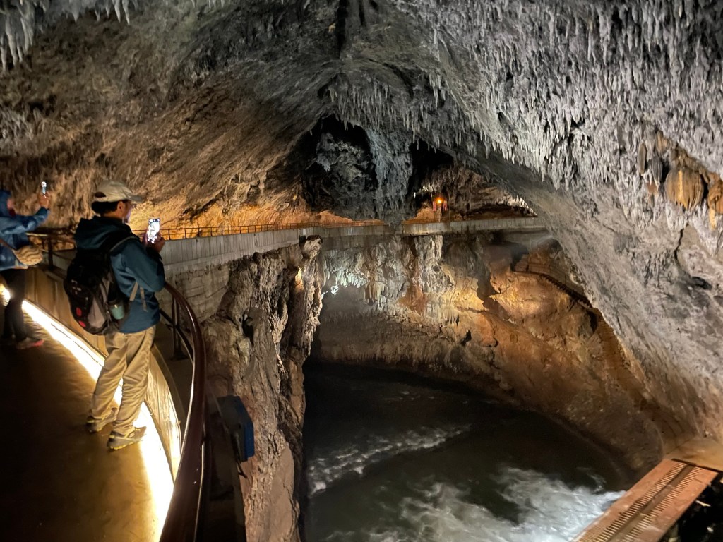
Postojna Jama is host to yet another distinction: the world’s only post office 160 meters below ground, in operation since 1899. After a few tourists sent postcards bearing news of the sights they had seen there, the cave owners convinced the Slovenian postal service to set up a branch within the “Ballroom,” the largest open space in the cave system.
On our way out we passed above the course of the Pivka River, now running underground and excavating new caverns for future visitors to enjoy one day.
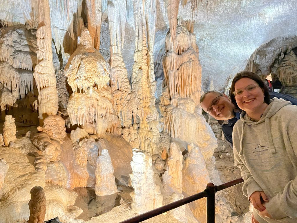
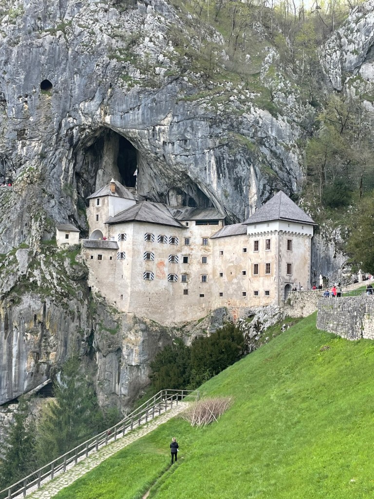
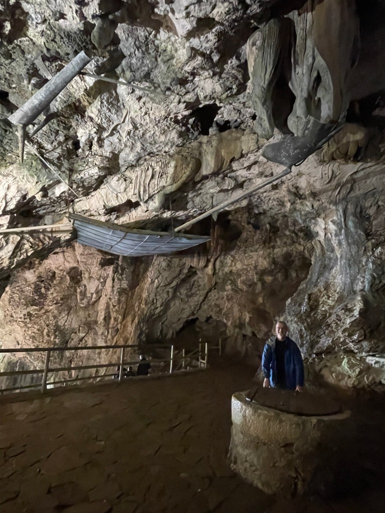
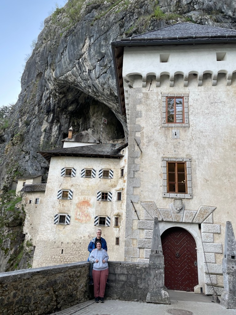
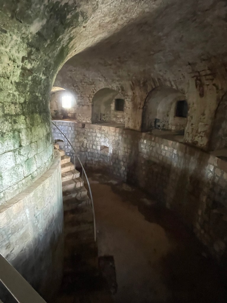
Not far from underground post office there can be found another unusual sight: a stone castle built into a cave. Predjama Castle has been fortified since at least the 13th century, although the current structure dates only to the 1500s. It stands at the mouth of a cave system that provides not only extra space for storage and housing but a secret exit used to bring supplies in during sieges.
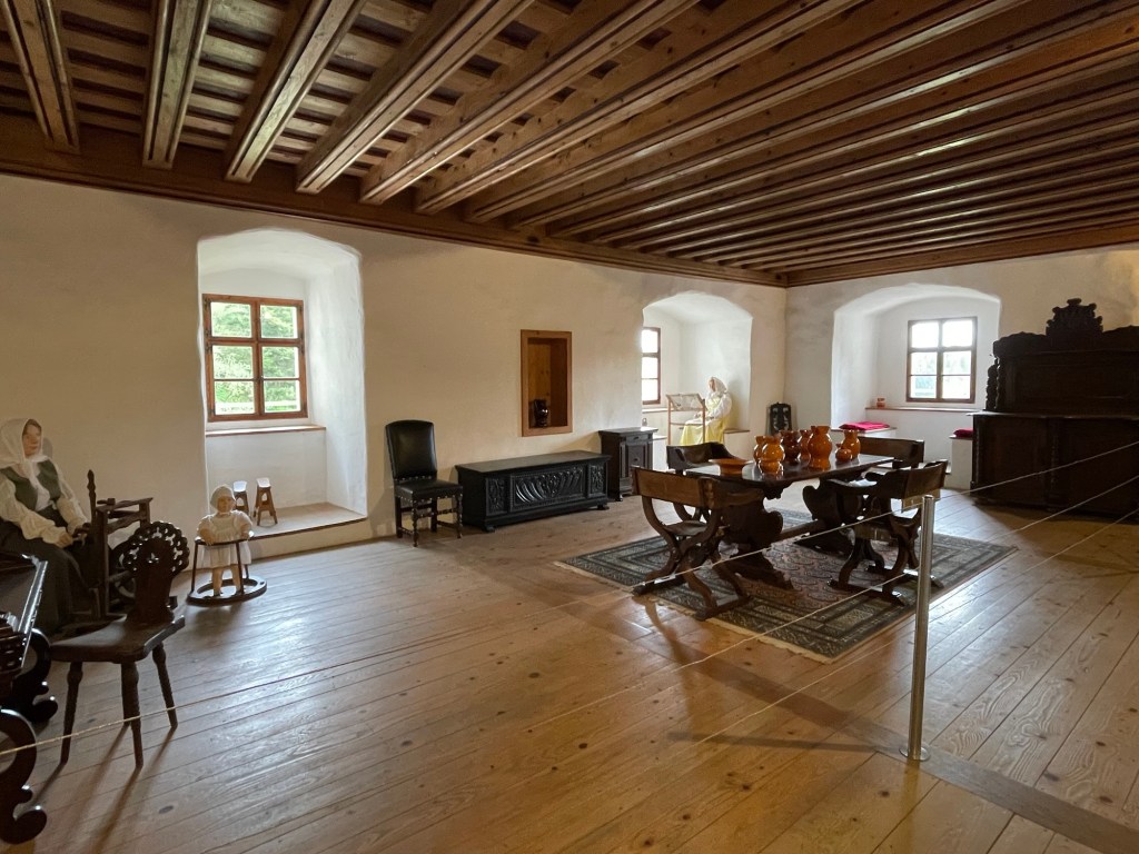
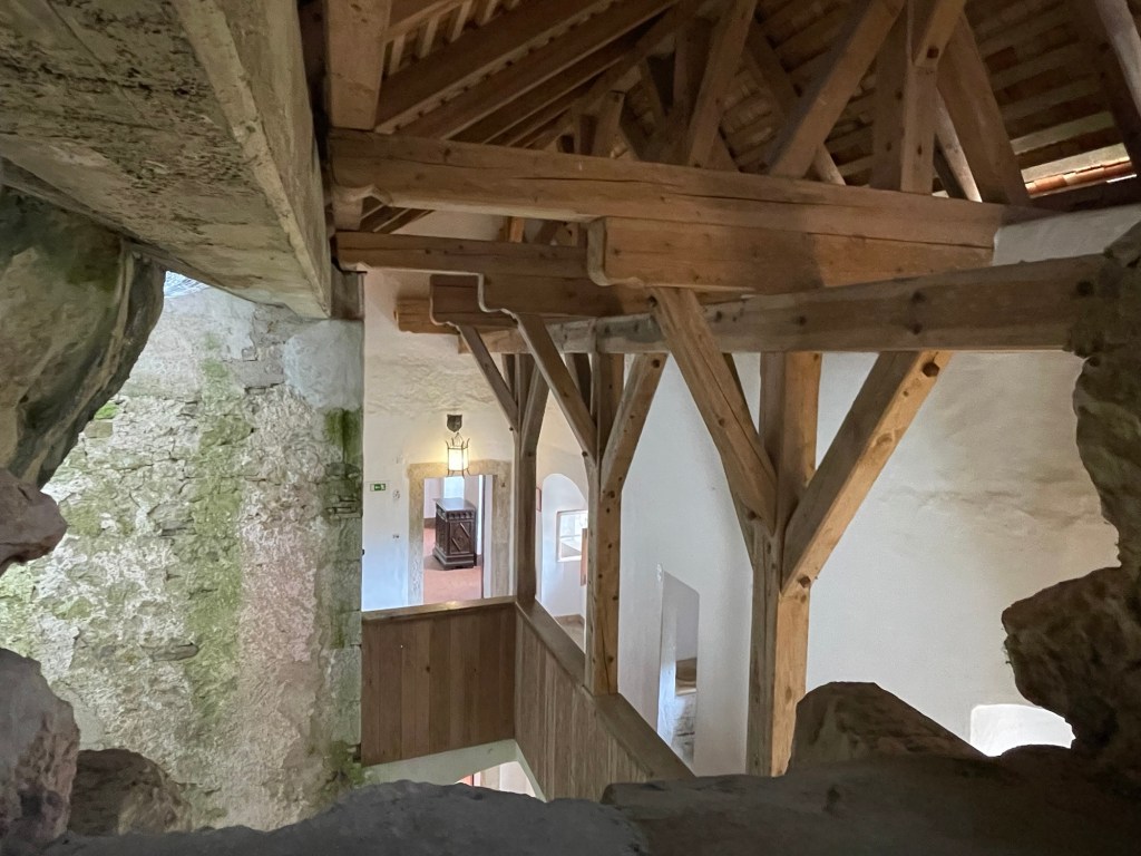
The castle layout is delightfully quirky inside, making the most of the combination of natural and manmade features. The kitchen fireplace is vented through a natural chimney in the stone, while the living areas feature large window seats for light and air. To ensure an unlimited supply of fresh water, the builders rigged up a seemingly precarious system of drip pans and piping to gather natural seepage within the cave. Thus collected, the water is routed throughout the castle via carved stone channels that presage modern plumbing. The castle also features beautifully restored post and beam roofing, a collection of arms and armor, and scenes reenacting earlier life within the castle.
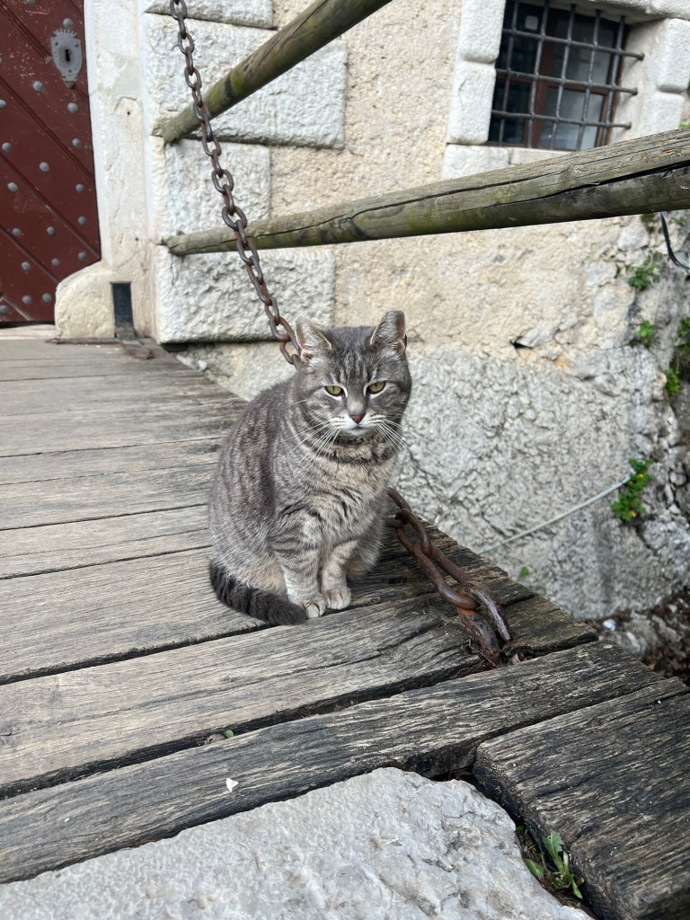
The main dining hallHallway to the terrace. The round stones are trebuchet and cannon shot found on the premises.View from the upper terraceGallery between the entrance tower and the main castleThe armoryAccess to the rear cavesNote the water collection system overheadSecret exit (some climbing involved), which eventually emerges at the top of the cliffDiagram of the entire cave system. The lower caves are closed to the public until high summer, to avoid disturbing the breeding season of the local bats.Rowan was pleased to make the acquaintance of this castle catEntrance tower with door and drawbridgeLocal legend has it that this lime tree was planted by one of the 16th century local lords in honor of his wife. Recently damaged by vandalism, it has been carefully pruned and is beginning to grow back.Getting into the spirit of castle life
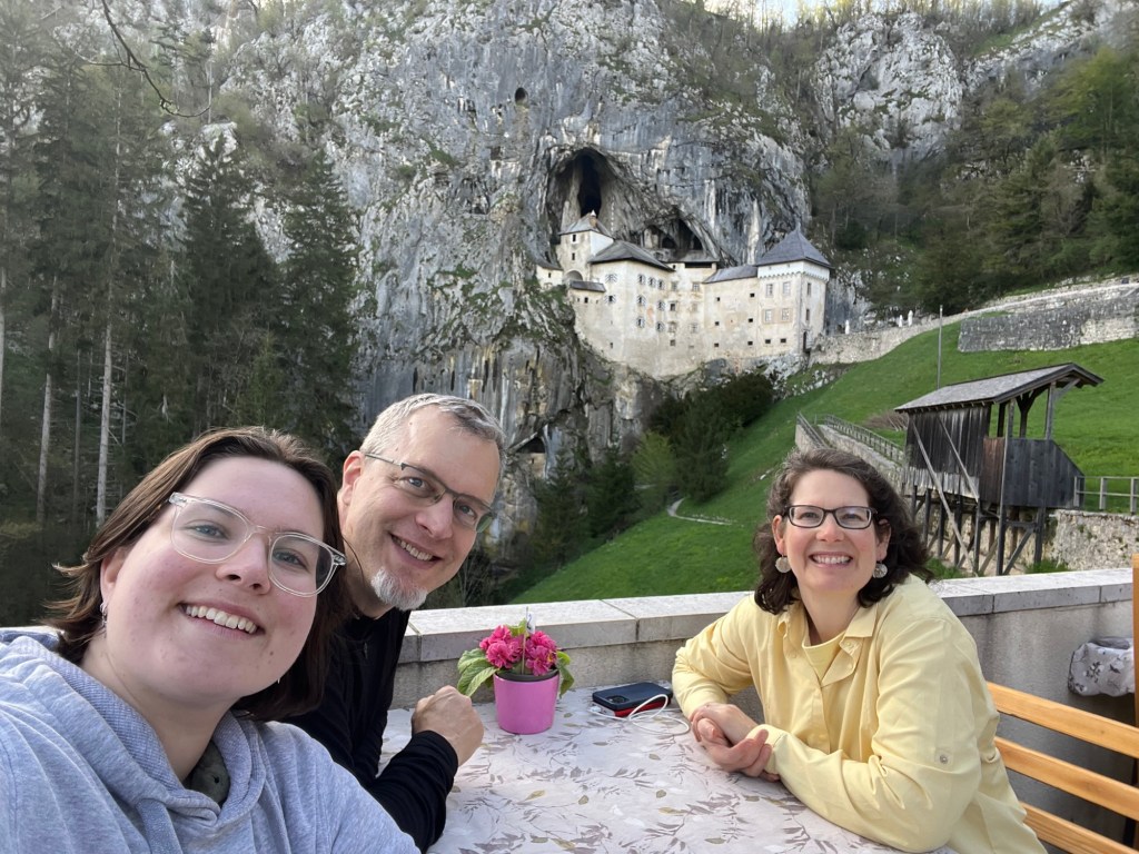
Although we had intended to travel onwards immediately after concluding our castle visit, we could not help but be drawn in by the local restaurant with the fabulous view. So we stayed for dinner, and dined on local fare including traditional Slovenian dumplings and a layered dessert cake made with poppy seed paste and served warm, called gibanica.
Our rental car was all alone by the time we finished our meal, but it too had a great view of the castle!
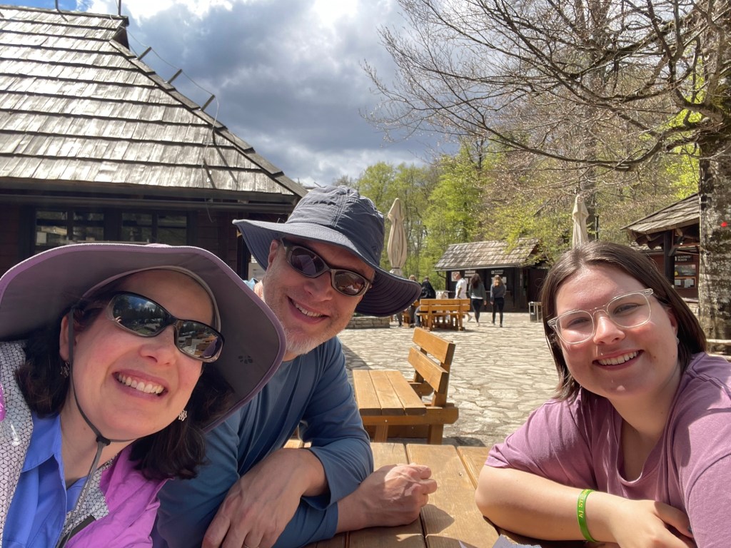
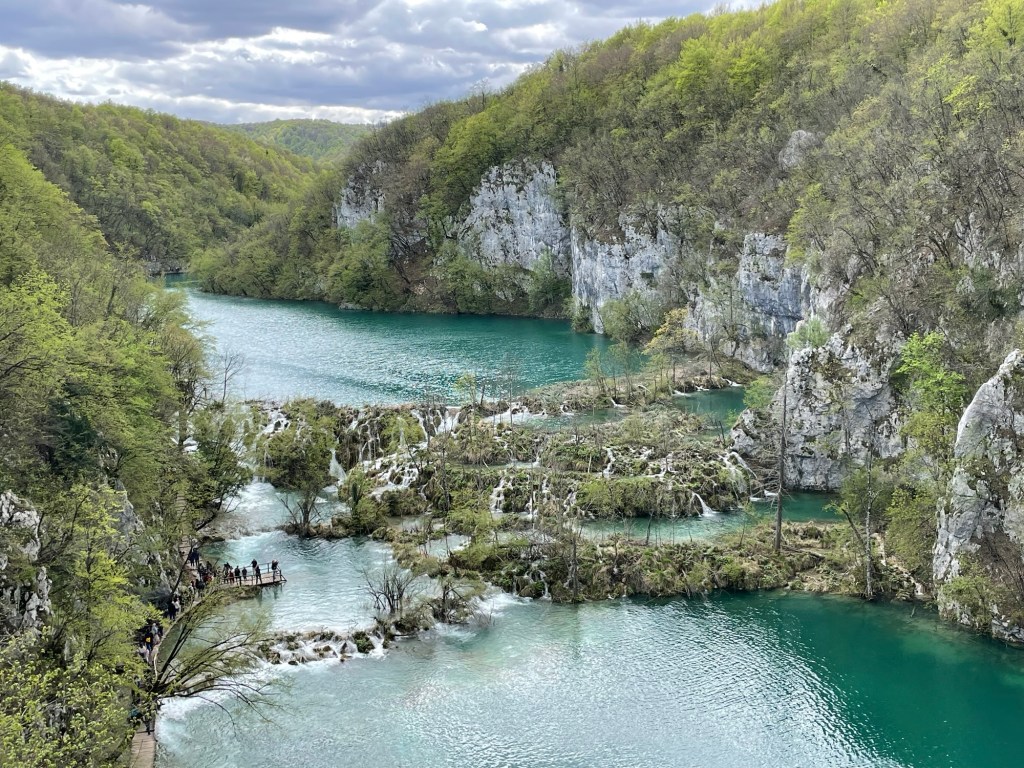
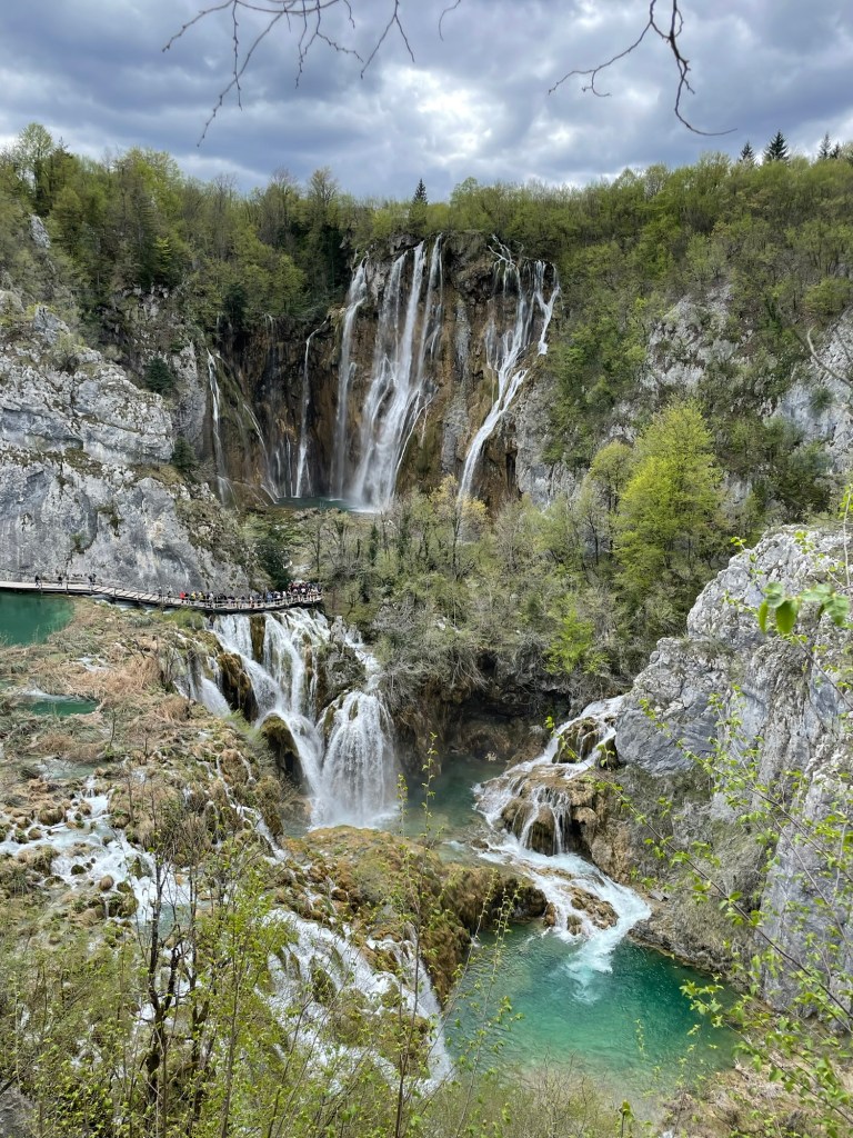
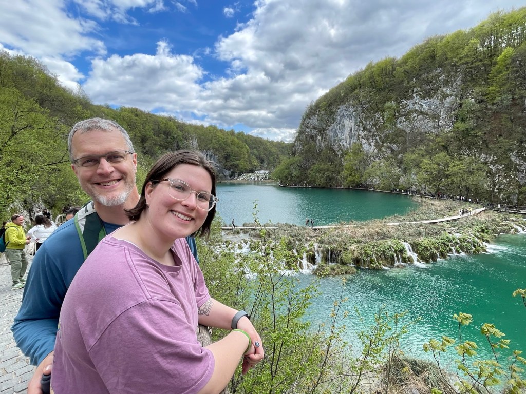
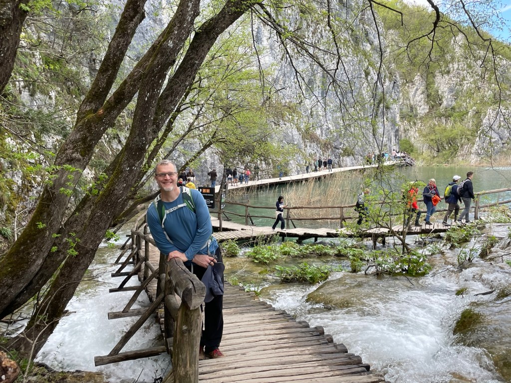
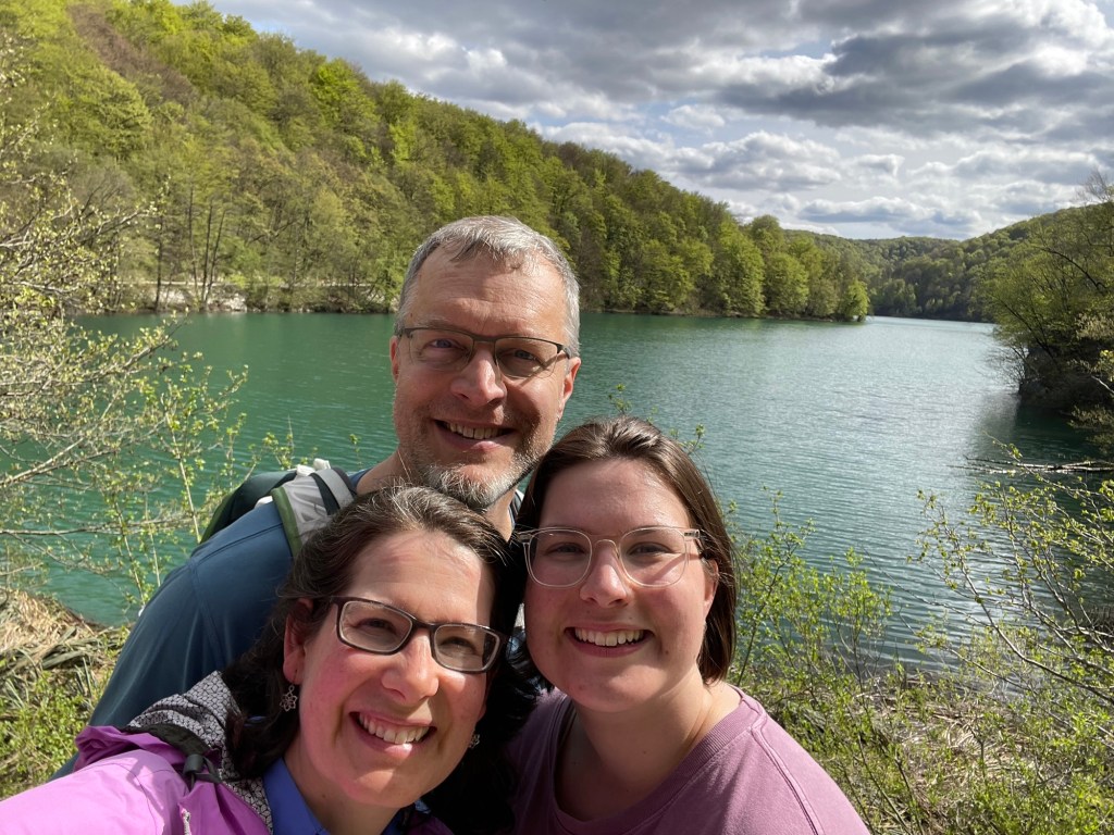
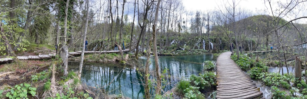
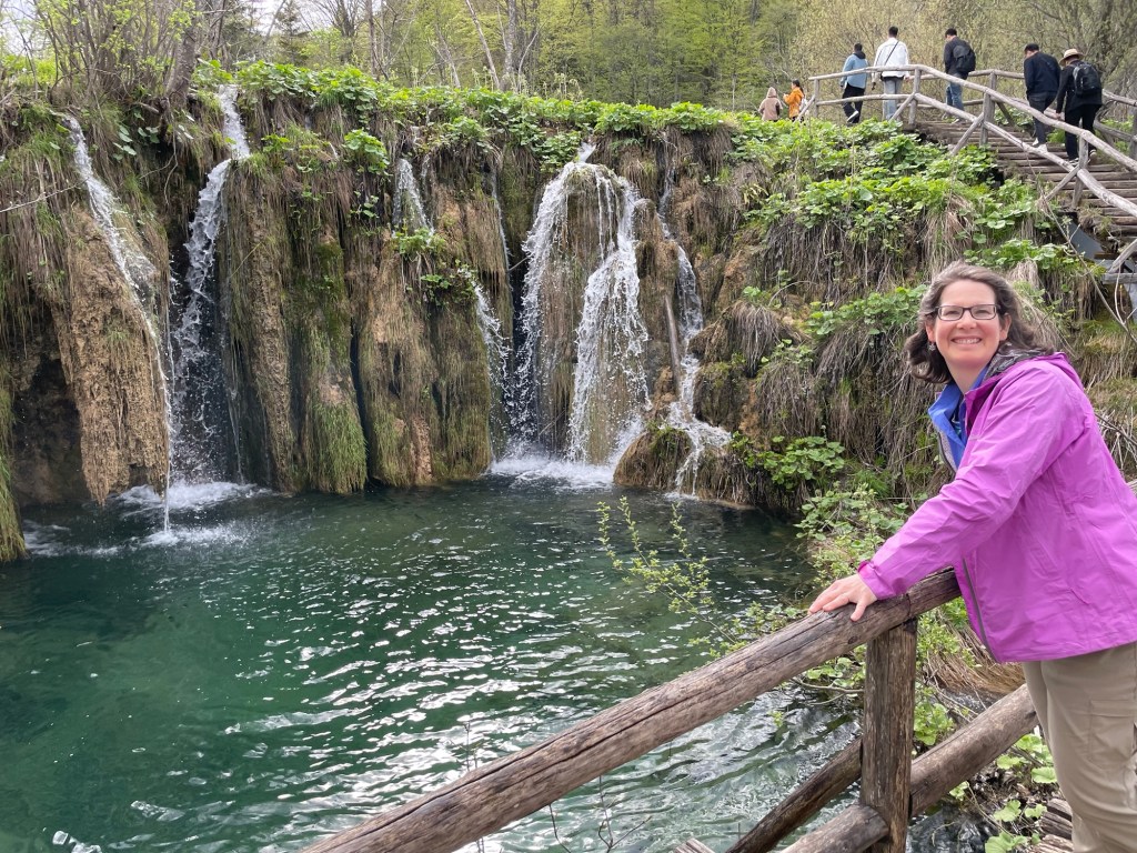
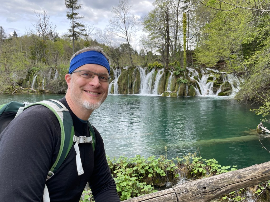
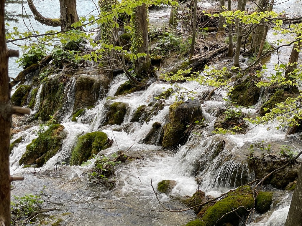
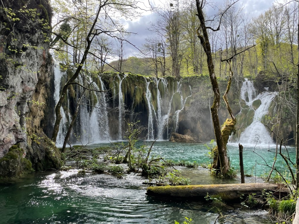
You’ve probably visited a waterfall before. So you know more or less what to expect: it may be taller or shorter, wider or thin. There’s probably a large main cascade, and sometimes a few extras above, below, or to the side. You hike up to it, spend a little while marveling at the spectacle, and then head back. That’s how it’s been for most of the waterfalls we’ve seen. So we were completely unprepared for the delightful experience of Plitvička Jezera National Park, which boasts at least hundreds or, depending how you count, more like thousands of cascades spread over a 9km stretch of lakes and streams.
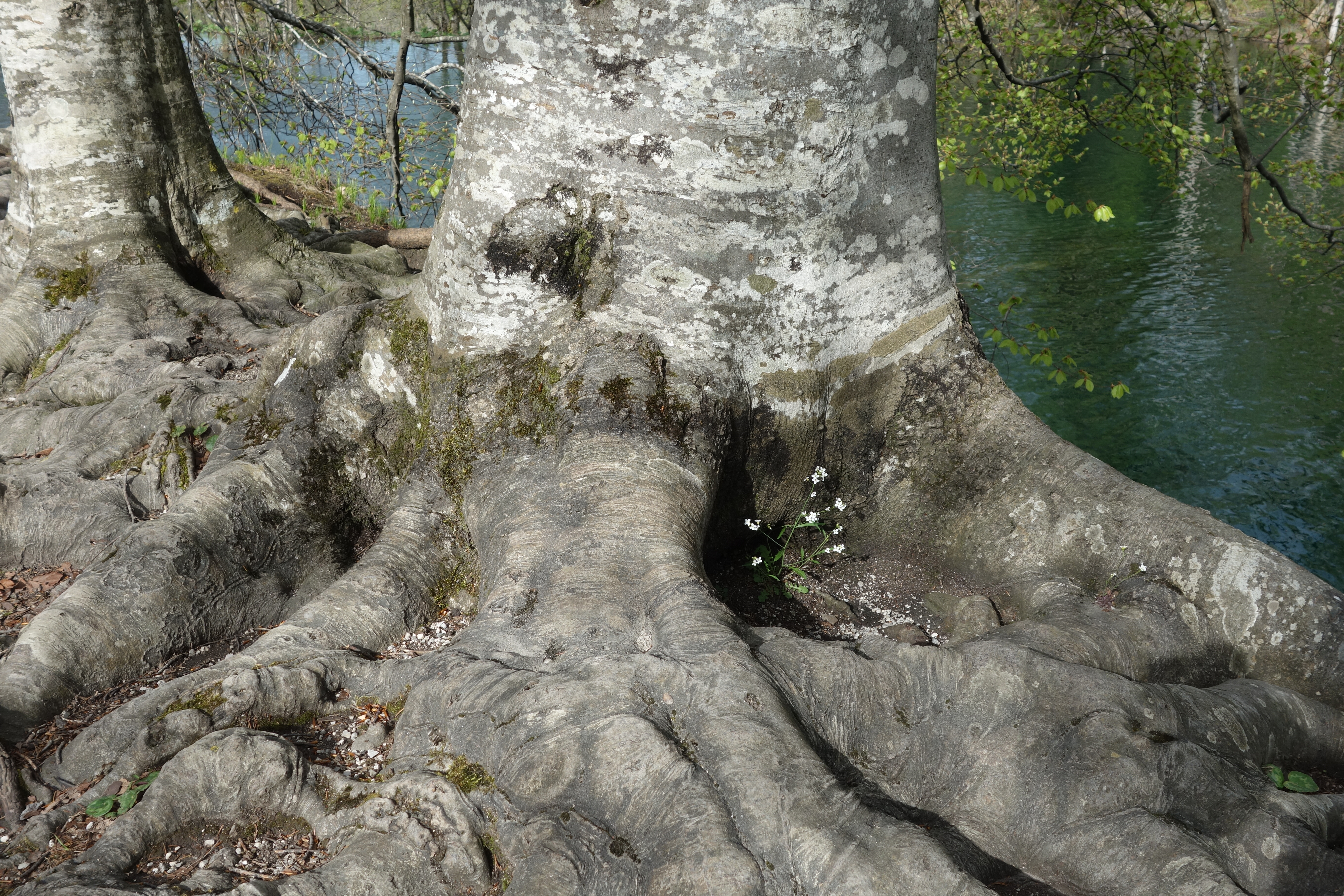
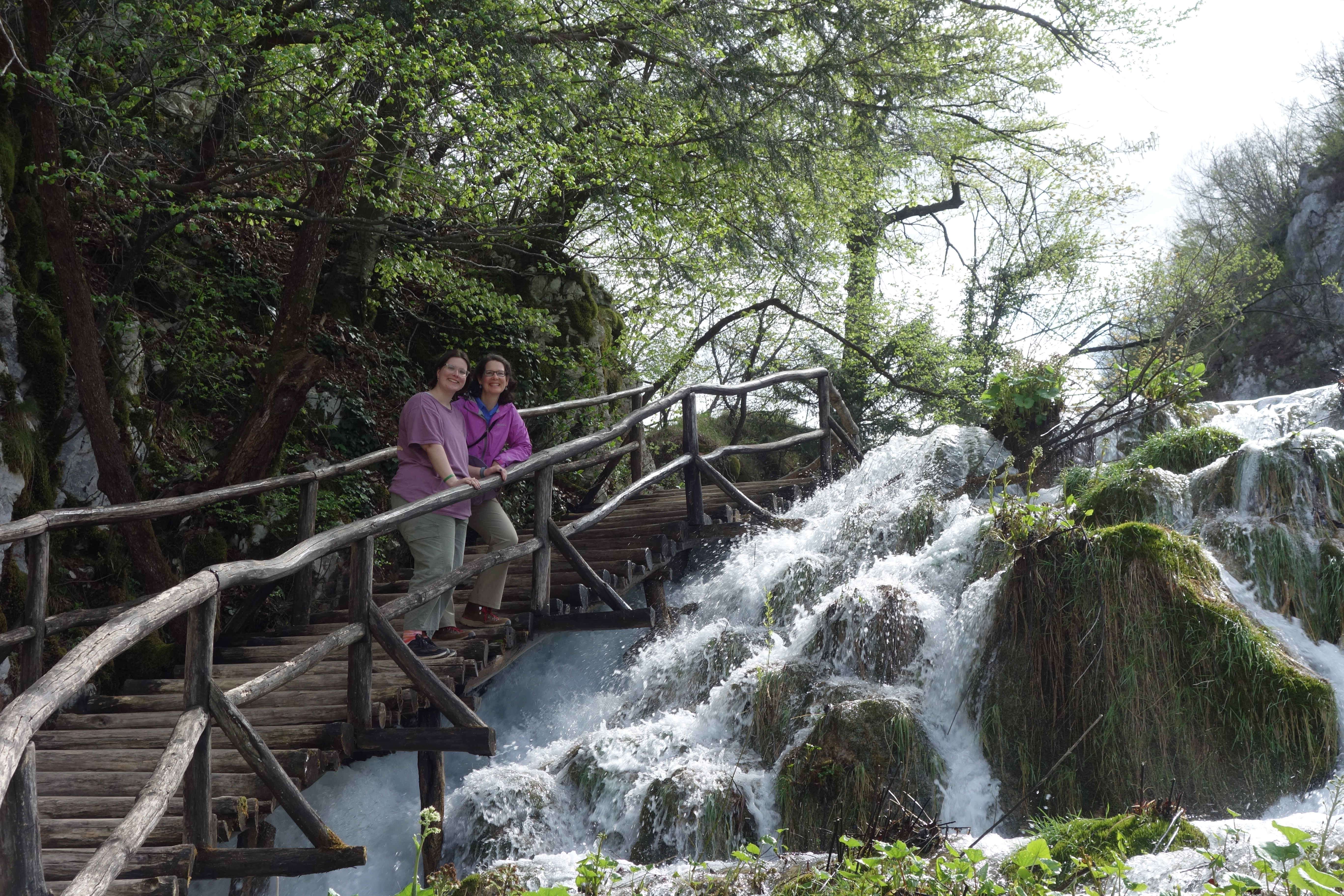
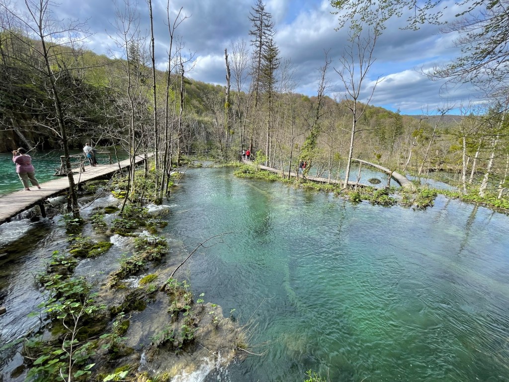
The setting is a limestone karst terrain dotted with sinkholes everywhere you look. Through this landscape, a relatively small river carved out a deep canyon reaching down to a watertight dolomite base. More recently, the flowing water has deposited a series of tufa terraces which spread the water into a latticework of braided cascades that diverge and intersect endlessly as they descend. Vegetation ranging from small grasses to mature trees has established itself on the terrace edges and tussocks between the streamlets, giving the sense that you are walking through forest grown over natural miniature canals. Water, earth and air all combine in a unique combination, and through it an extensive network of curving boardwalks elevated just above the rushing water allows visitors to experience this wonderland seemingly from every possible viewpoint.
It is difficult to find the words to describe this experience, so we will tell the story below mostly through pictures.
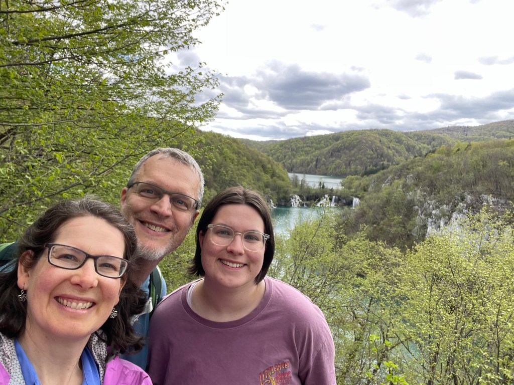
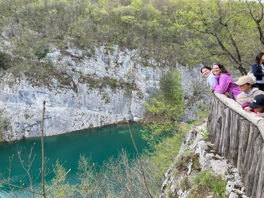
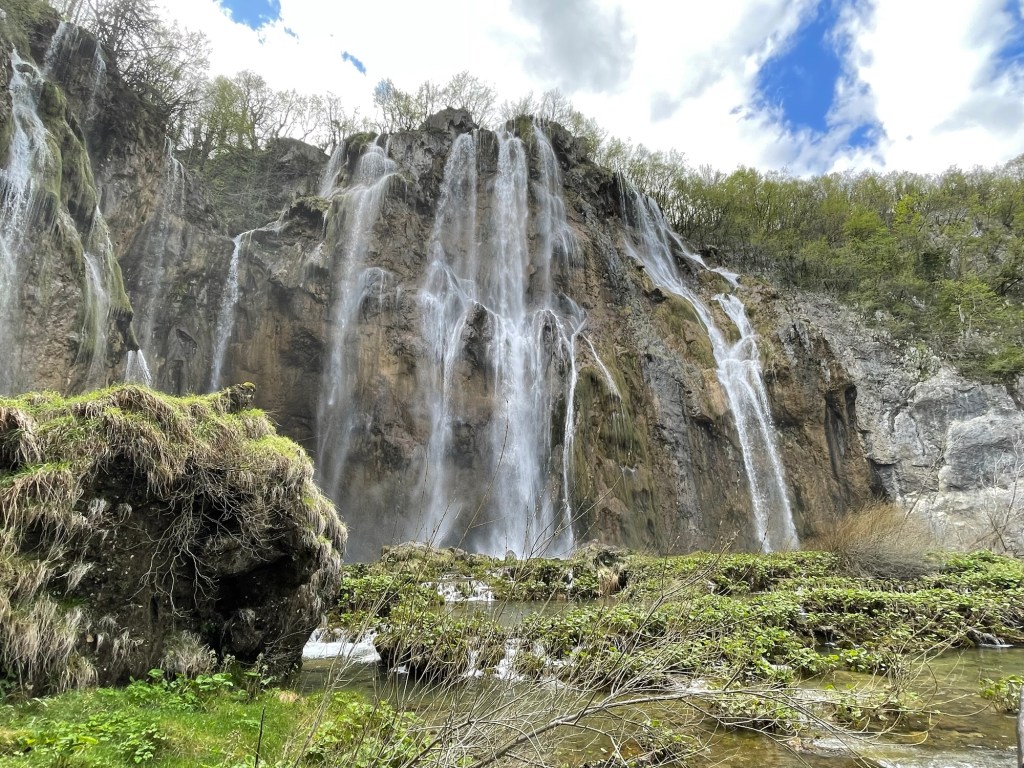
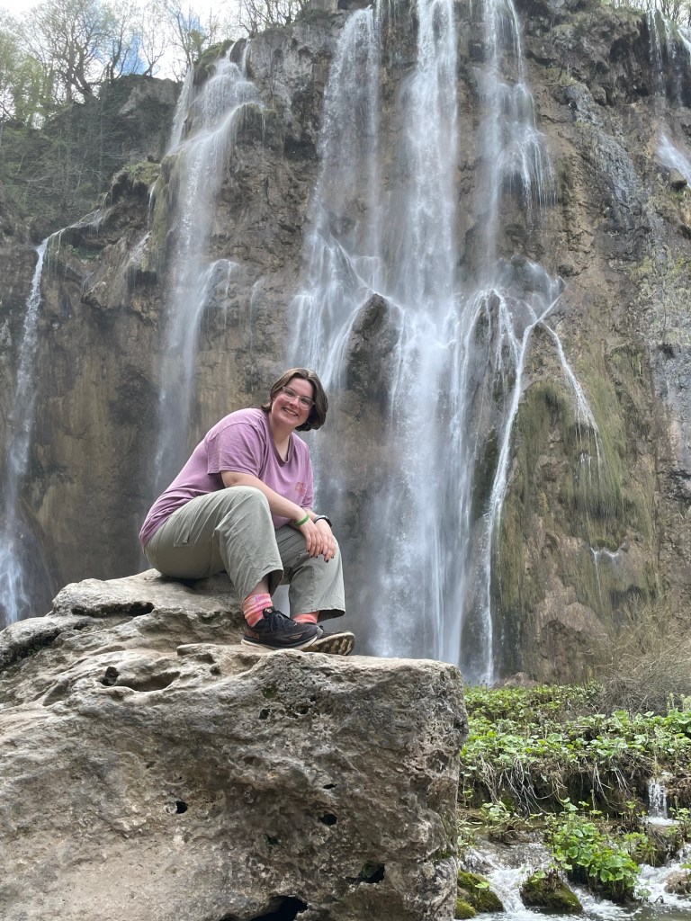
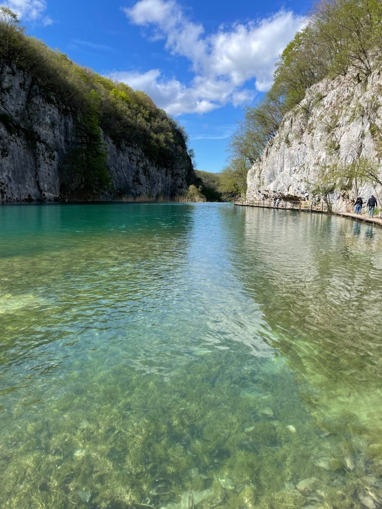
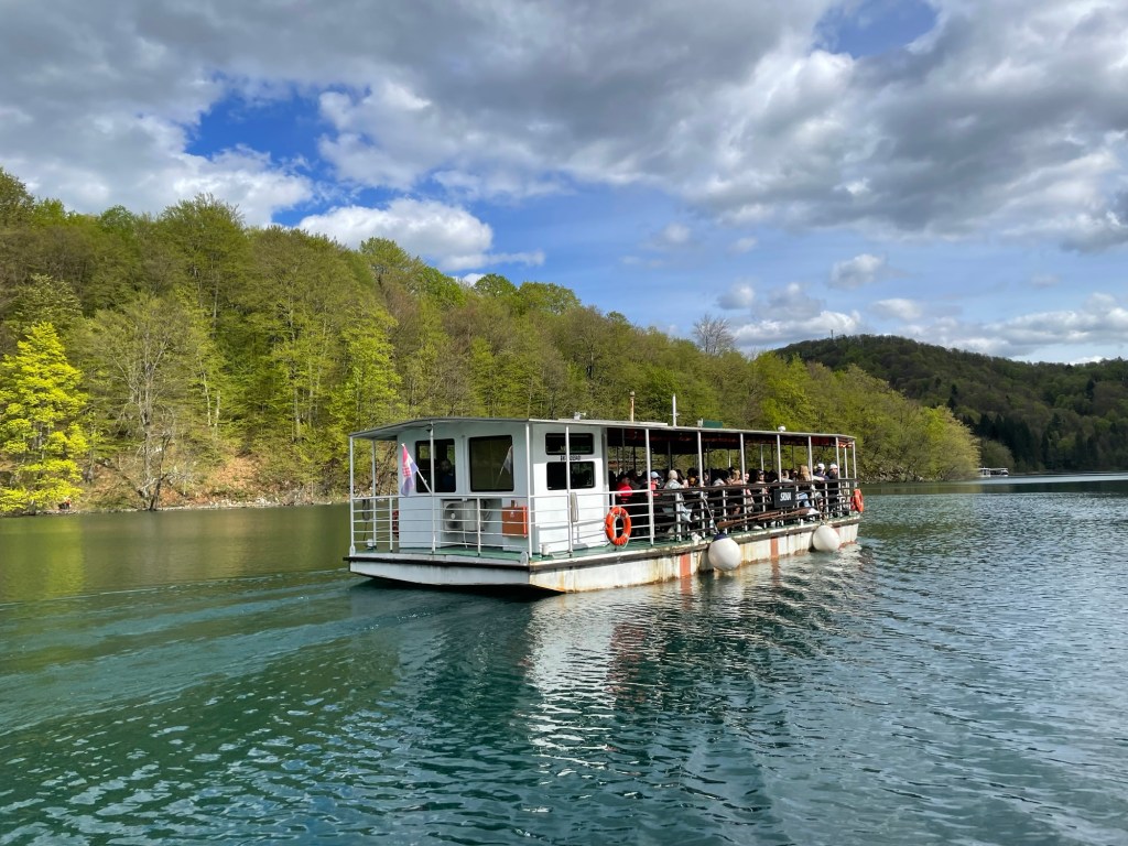
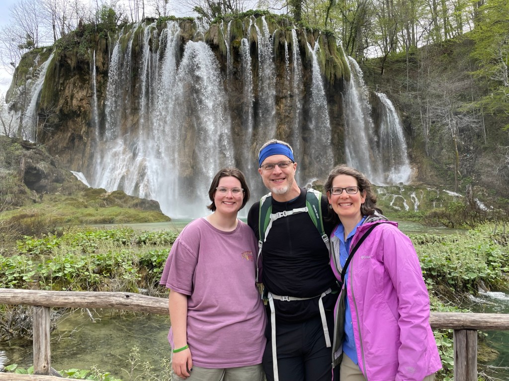
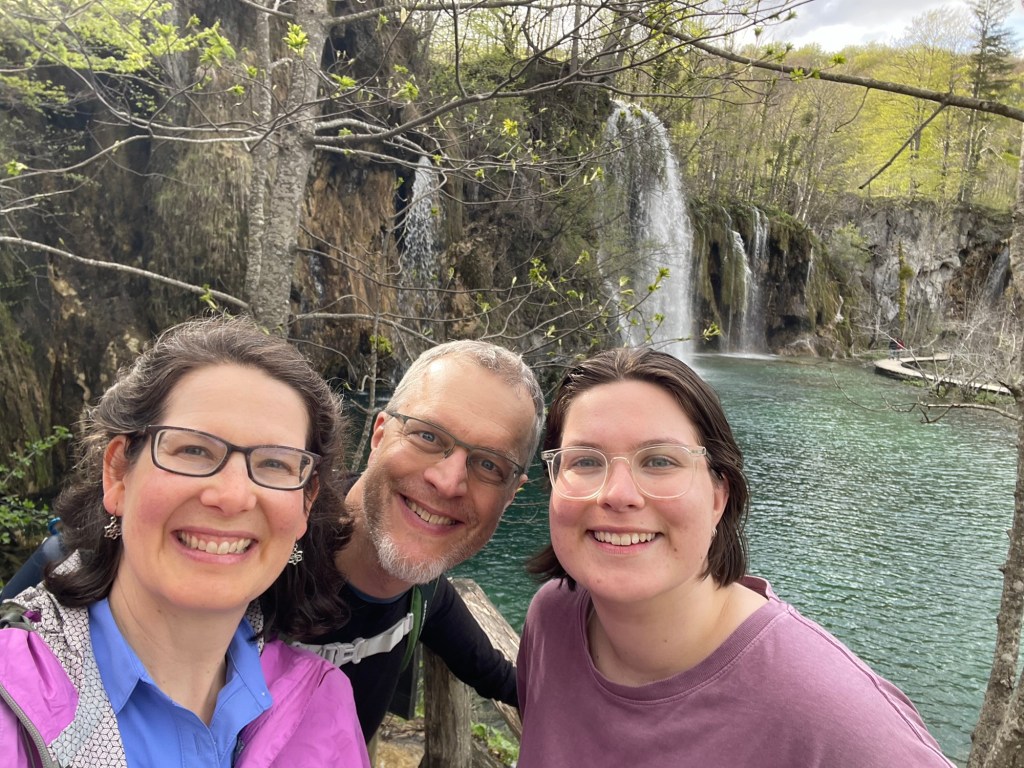
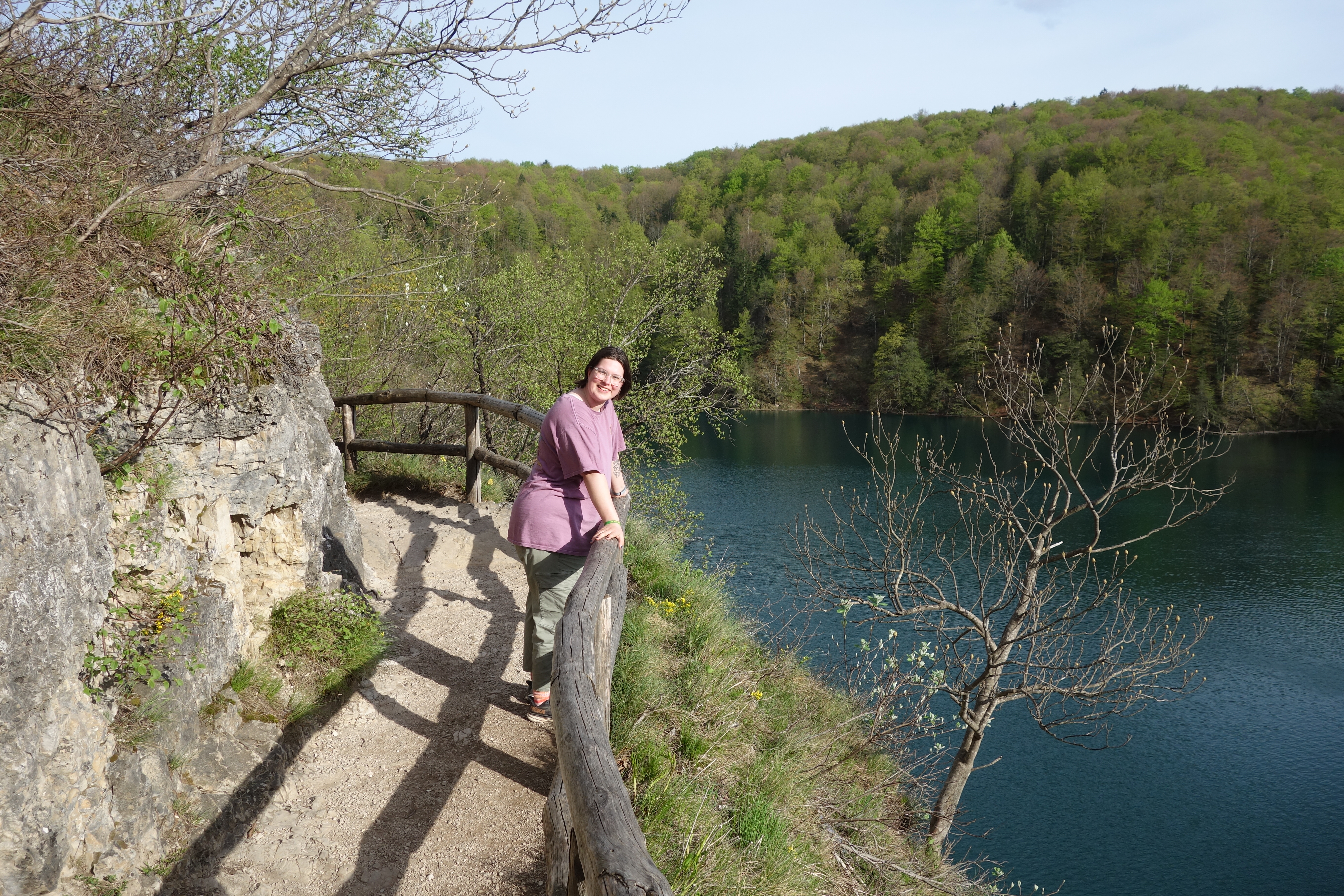
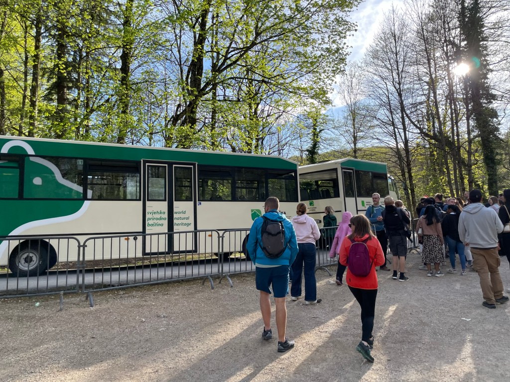
Lunch at the parking areaOur first glimpse of cascadesThe lower lakes lie in a canyon some 40 m tall, and descend half again that much below the surface.Visitors on their way to see Veliki Slap, or the Big Falls. (Slap is the Croatian word for waterfall, which felt quite onomatopoetic at times.)Veliki Slap in all its gloryPerched on a rock below Veliki SlapBoardwalks were often built right over the fastest rushing waters.Besides the lake system, the area is also home to an extensive underground cave system (sadly, not open to visits at the moment)The water was very clear but the depths took on an enigmatic blue-green hueAbout halfway through the park, a ferry shuttles visitors between opposite ends of the largest lake.Things are growing everywhere! The setting feels like a great place for fairies…The park includes 16 major lakes (and innumerable smaller pools). Each major lake has a sign showing its depth and location within the chain. You can see the loop of the boardwalk as it snakes through this wonderland. Water cascades from tier to tier at every level.We hiked upwards from the lower lakes, and were happy to take the shuttle back to our parking lot when we reached the top.This early in the season there aren’t many restaurants serving customers. Luckily the local pizza parlor was open, and doing a brisk business. We sat on the porch overlooking a soccer field and the local ski slope, serviced by a single J-bar lift. The food hit the spot perfectly after our long day hiking, and we washed it down with the local dark pilsner and lemon-beer.Oh yes! This morning, before leaving Zadar we took time to visit the Sea Organ located at the tip of the old city. Beneath the concrete steps, wave action forces air through an array of tubes to generate a medley of overlapping notes. The sound emerges from the small slots on the top step, producing an effect somewhat reminiscent of wind chimes yet more breathy and muted. Clearly this was a day full of water’s wonders for us!
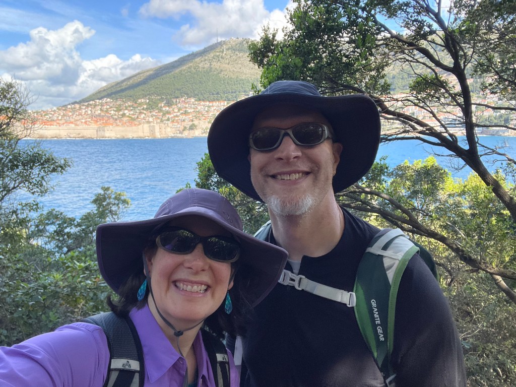
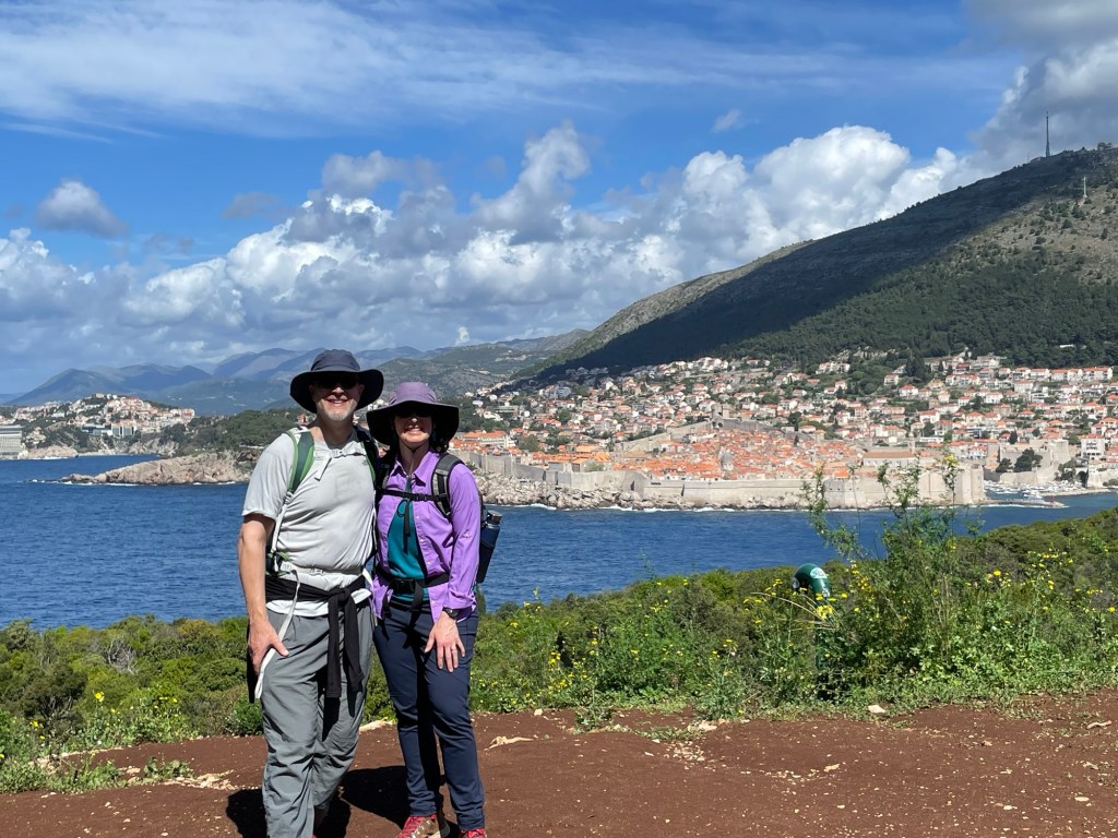
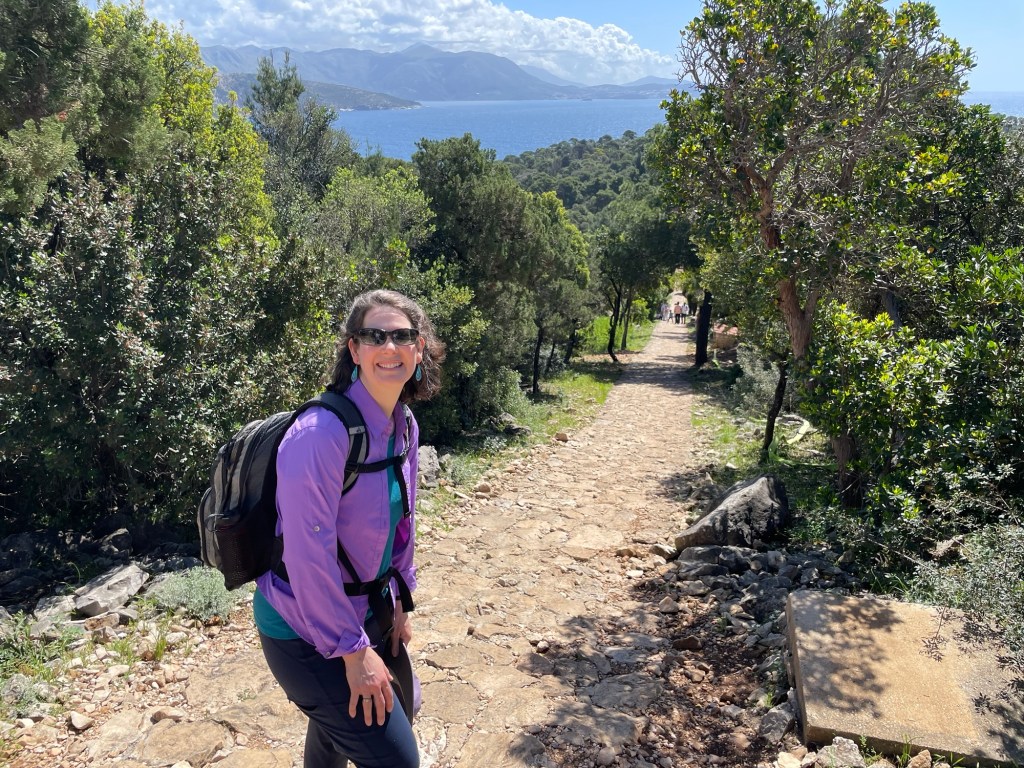
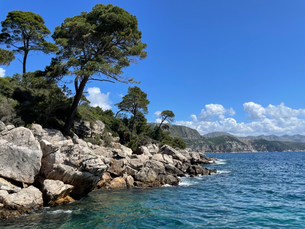
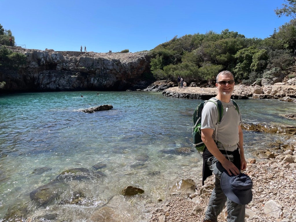
Today we had a final morning to explore the Dubrovnik area before heading north to meet up with Rowan. Unlike our previous two days, the weather was clear and sunny — a perfect day to visit Lokrum Island just off the coast. Once the personal property of Archduke Maximilian of Austria-Hungary, the island is now set aside as a tree preserve. As a result, the hiking trails on the island are marked every hundred meters or so by a blue hydrant standing ready just in case of fire.
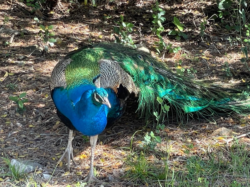
Besides clear views of the city itself and southeast along the coastline, the island boasts a military installation at its highest point, plus the ruins of a former monastery. Its inhabitants include a range of bird life, the largest of which are a flock of peafowl that must be a relic of the onetime royal occupation.
The rocky coastline includes a number of unusual rock formations, and towards the southern tip is an enclosed lagoon entirely separate from the ocean, yet connected to it via some sort of subterranean plumbing system. Normally it is perfectly calm, but today the waves were active enough that the surface of the pool also rose and fell in time with the swells of the open sea.
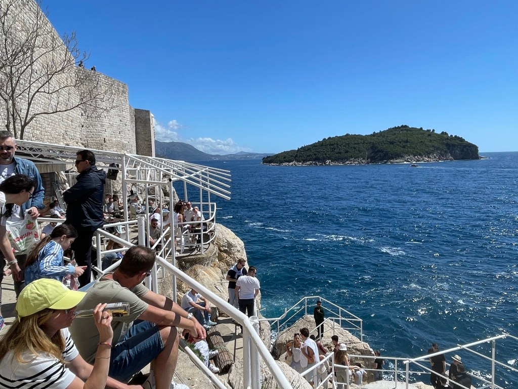
After seeing all that Lokrum had to offer, we made our way back to Dubrovnik for a quick lunch before catching the airport bus. We had a few more moments to explore the maze of alleyways in the city and a few more of its hidden secrets, like the tiny door in the wall that opens onto a cliffside bar.
For reasons not worth relating here, the last part of our day involved a somewhat convoluted sequence of travel: bus to airport, hopper flight from Dubrovnik to Zagreb, rental car at the airport, then a 300km drive to Zadar. The highway passed through some beautiful mountainous terrain, and featured a series of long tunnels, one more than 5km. All the travel was worth it in the end, as we reached the apartment where we will stay tonight, and were greeted there by Rowan, who is on break this week from their study abroad program. Reunited at last!
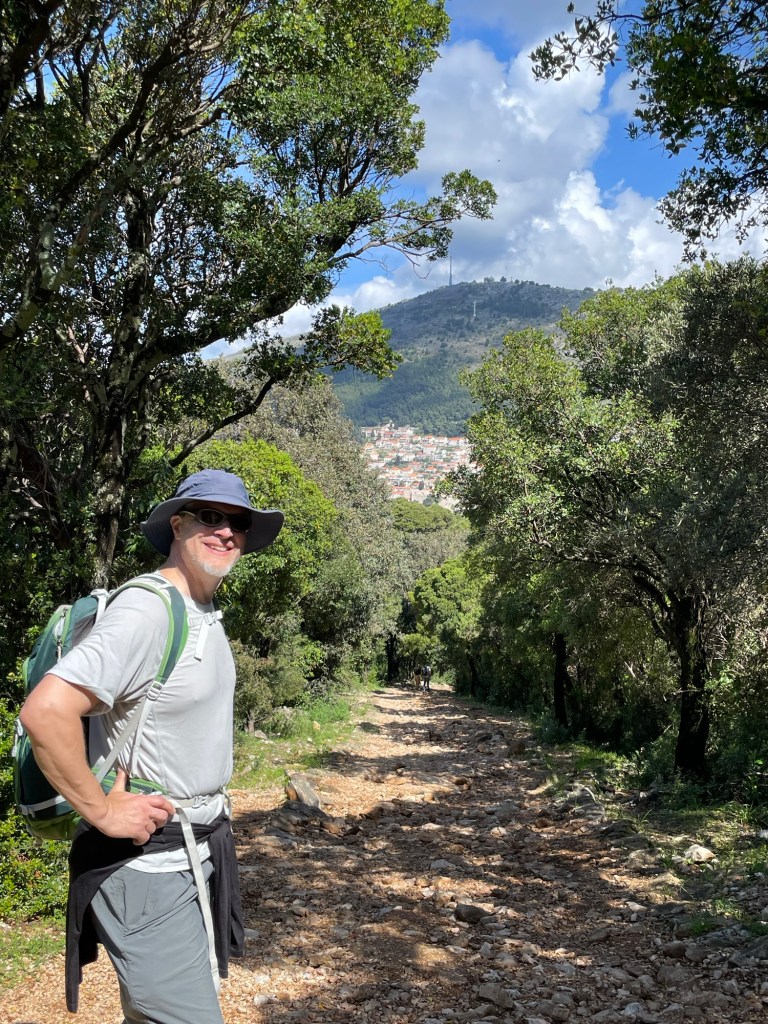
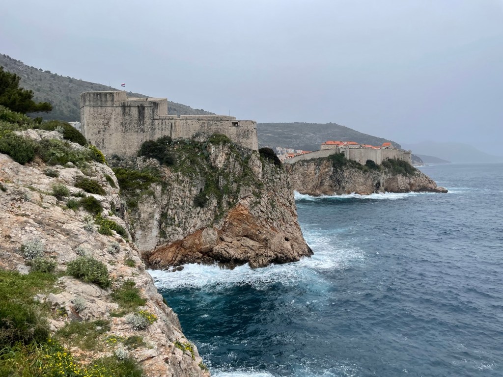
Dubrovnik functioned as an independent city state for centuries, building heavy fortifications to protect itself from Venice and other nearby powers. Continuing our tour of the local military infrastructure, we planned to visit several of the outlying structures that helped keep enemies at bay. First up was Fort Imperial, perched on the summit of Mount Srd overlooking the old city. There is a cable car that was out of commission today due to high winds. Luckily we had planned to take the hiking trail anyway.
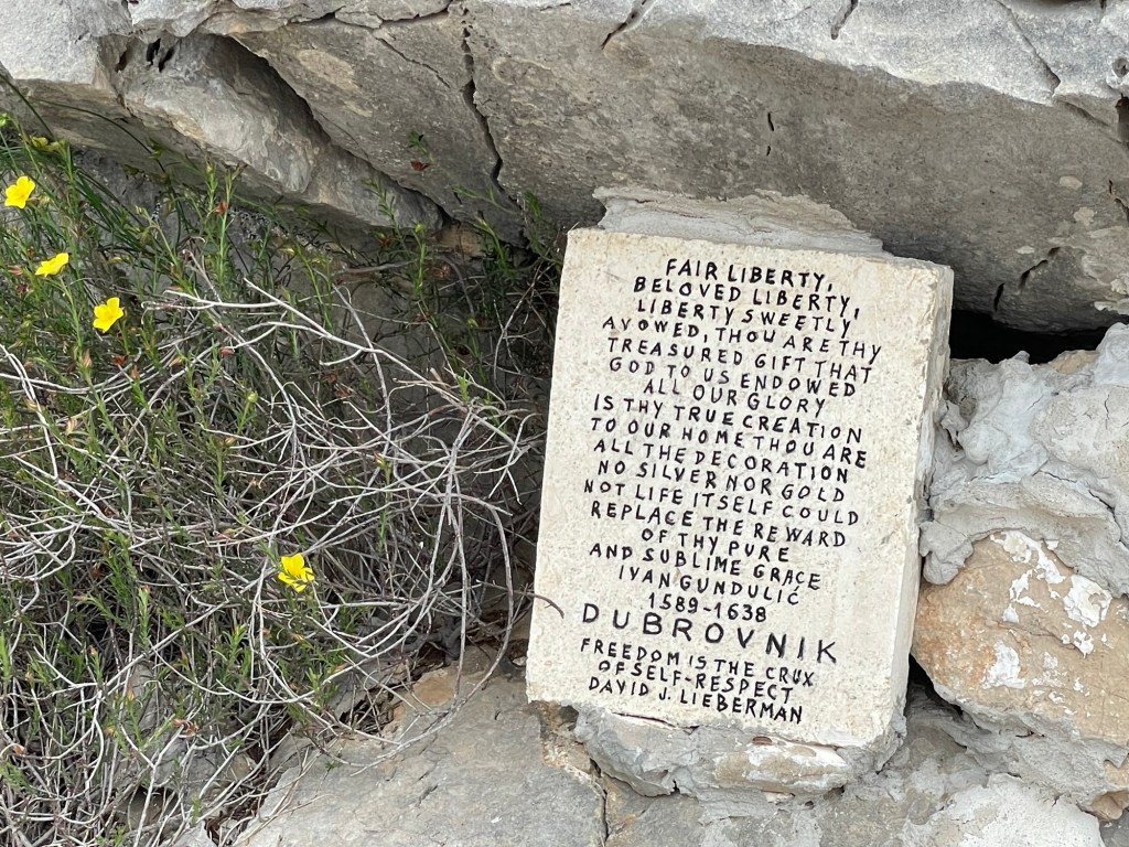
In concordance with its long independent streak, Dubrovnik’s official city motto is “Libertas”. One can still find small odes to liberty and independence displayed around the city, like these trailside pieces.
We
The trail to Fort Imperial features numerous switchbacks on the way up. Around 15 years ago they installed a series of bronze panels depicting the 14 stations of the cross, one at each turnaround.
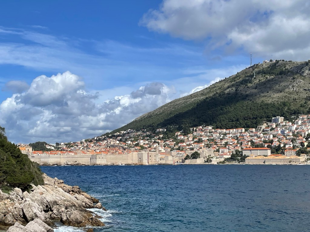
As we gained altitude, we could see the newer parts of Dubrovnik and islands farther to the north. From the top, we could also see the ranges of mountains further inland.
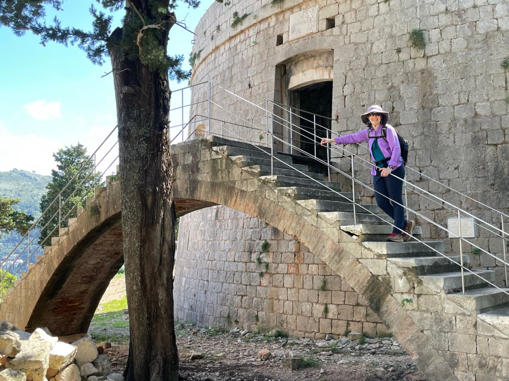
Fort Imperial is quite new by local standards, built by the French in just a few years after Napoleon’s armies ended the city-state’s centuries of independence. With powerful modern artillery, massive city walls became less important and instead it was necessary to control the higher ground nearby. This truth was confirmed anew during the 1991-92 Balkan war. Local residents had assumed that their status as a UNESCO heritage site would protect them from any aggression, and were unprepared for war. This confidence proved hollow when Serbian army units moved into the area, pursuing their dream of a “Greater Serbia”. A small band of just a few dozen men managed to hold Fort Imperial in the face of their attacks, stopping their advance outside the city and turning the invasion into a siege. You can still see the craters left in the fort’s walls by modern high-explosive shells. Cut off from the outside by both land and sea and under fire from the opposing forces, the city’s residents endured a difficult year before negotiations brought an end to fighting in the region. Information boards in the old city detail all the structures that were damaged during this period.
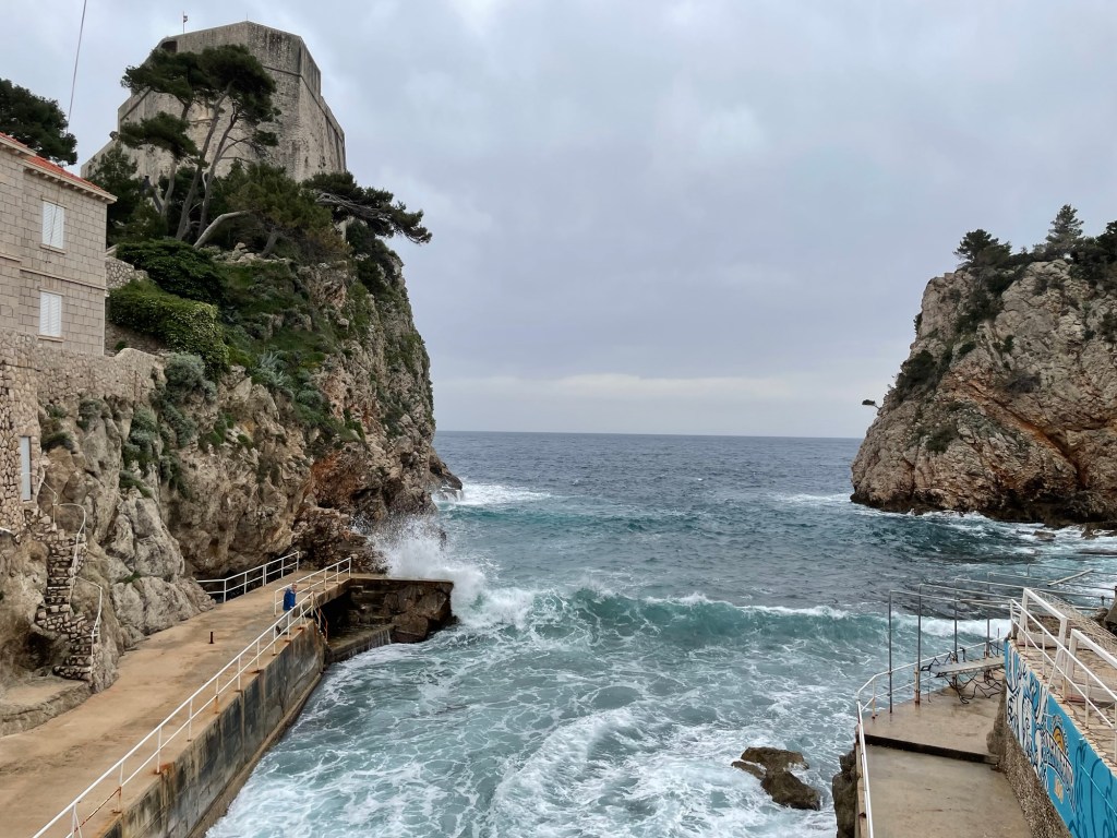
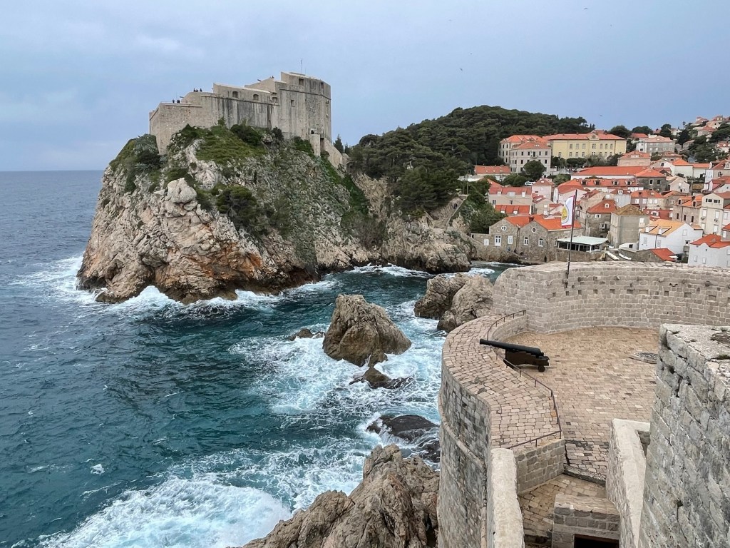
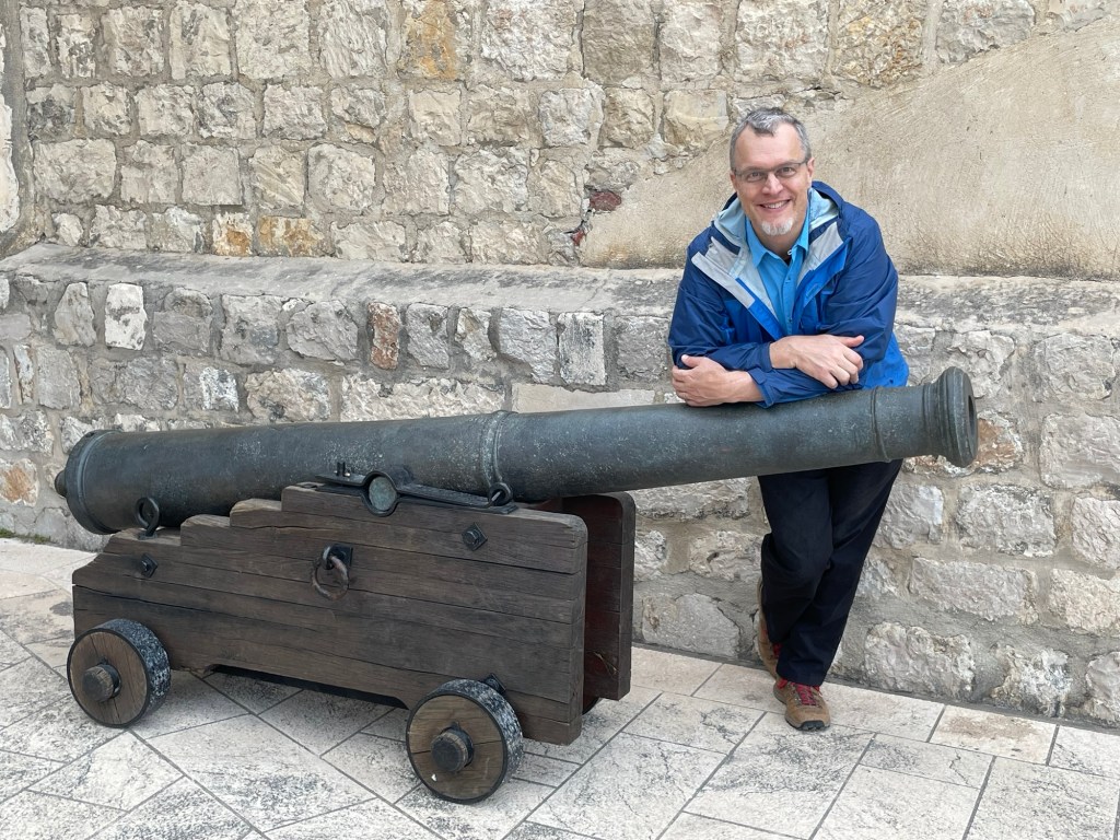
Our second fort of the day is named Tvrdava Lovrijenac (or the Fort of St. Lawrence in English). It sits on the coast next to the city, separated from it by a small rocky cove. Originally built in the 11th century, the structure as it stands today is a massive bastion built to support heavy cannon. From the parapets at its top you can find excellent views of the seaward city walls — but the best views are to be had from still one more headland over, where you can see both the fort and the city in one sweeping vista.
Note Nick on the walkway in the bottom left (blue coat)
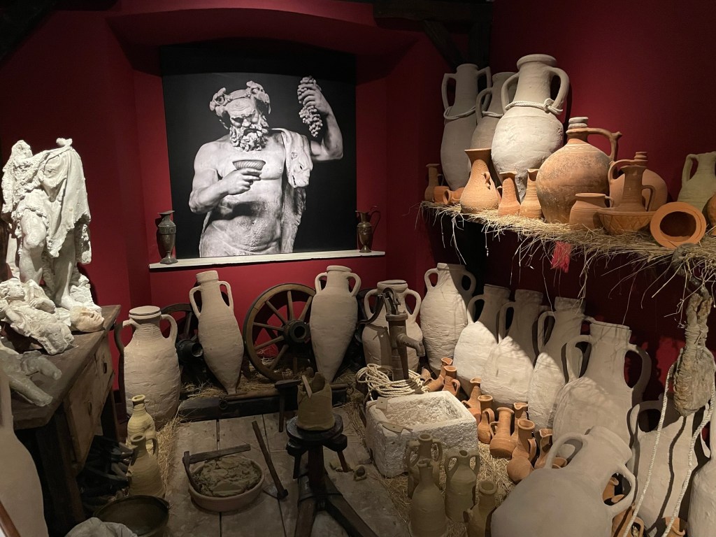
On our way back we stopped at the Wine Museum located just outside the Pile gate. It contained informative exhibits on local winegrowing, including the many grape varietals native to the region (including the once-unknown ancestor of Zinfandel grapes in California) and all the traditional machinery used to harvest grapes, process them into wine, and transport the final product.
A local company makes wine called “Navis Mysterium” that they age in either bottles or amphorae for several years under the surface of the Adriatic Sea. They come out covered with picturesque debris, and (reportedly at least) perfectly aged in a constant temperature environment.
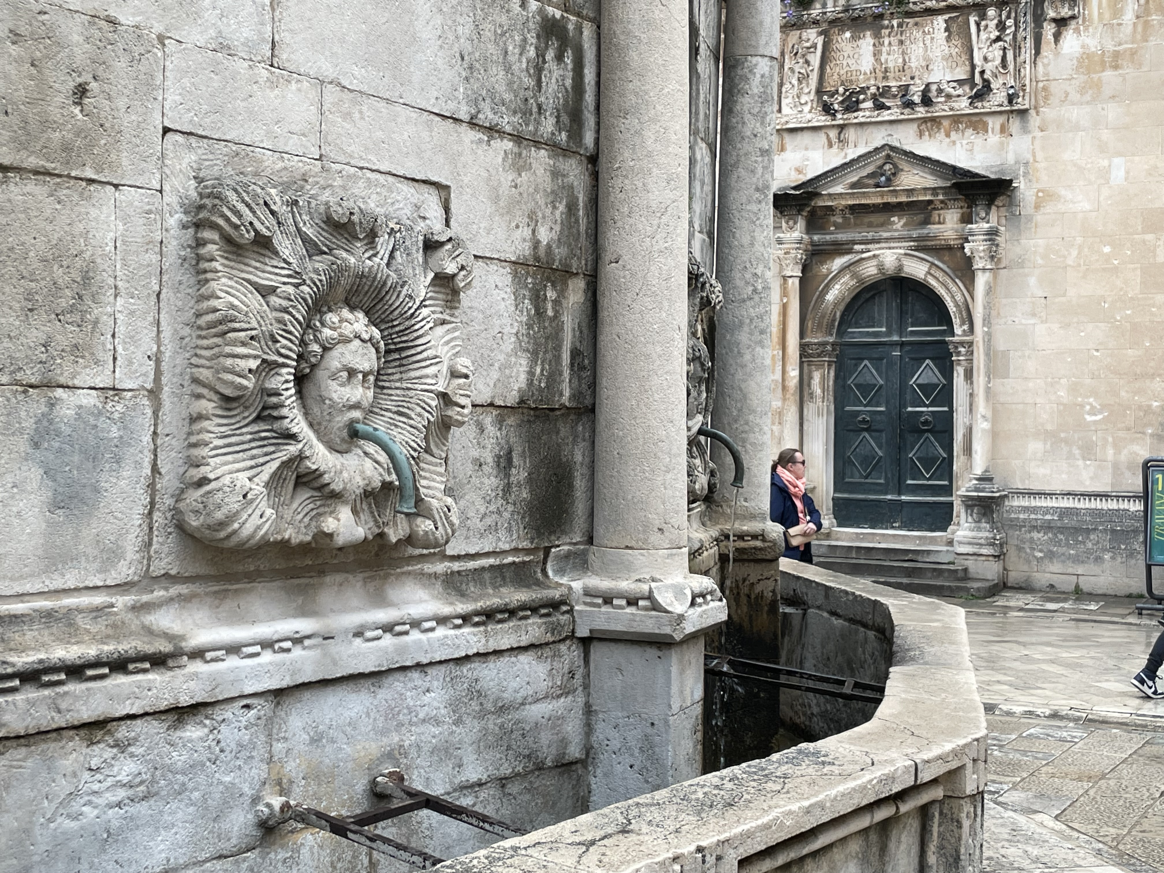
On our way just inside the Pile gate is a sight that Nick especially liked: the city fountain, a circular structure with spouts around on all sides.
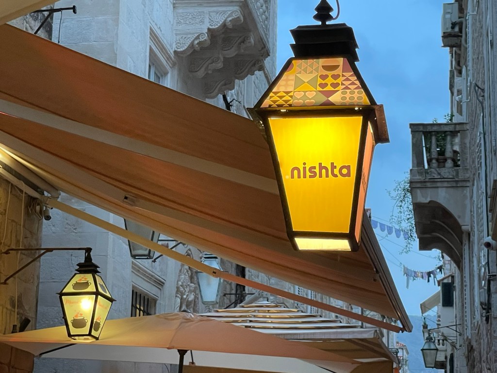
We had a nice dinner with local wine at a vegetarian restaurant not far from our lodging (on a picturesque pedestrian street replete with outdoor seating protected by retractable awnings and dotted with lanterns, before walking to our third fort of the day. For the evening, we had tickets to the Dubrovnik Symphony Orchestra concert held within Fort Revelin overlooking the city harbor. The concert hall was a massive vault within the structure. We had bought two of the last four seats available, numbered 99 and 100, assuming they were all the way at the back. Imagine our surprise to find that we were in the second row, with a clear view of the players! The symphony here has a tradition dating back seven centuries, and the music was quite enjoyable.
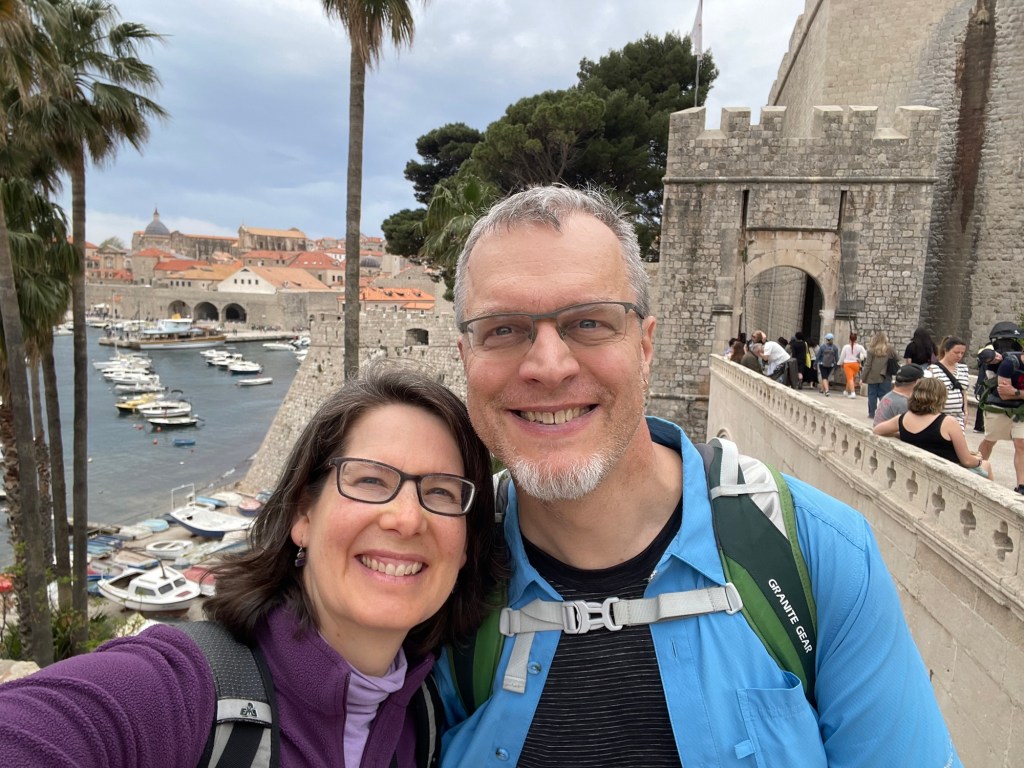
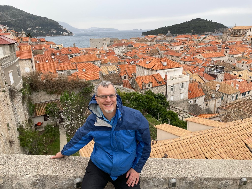
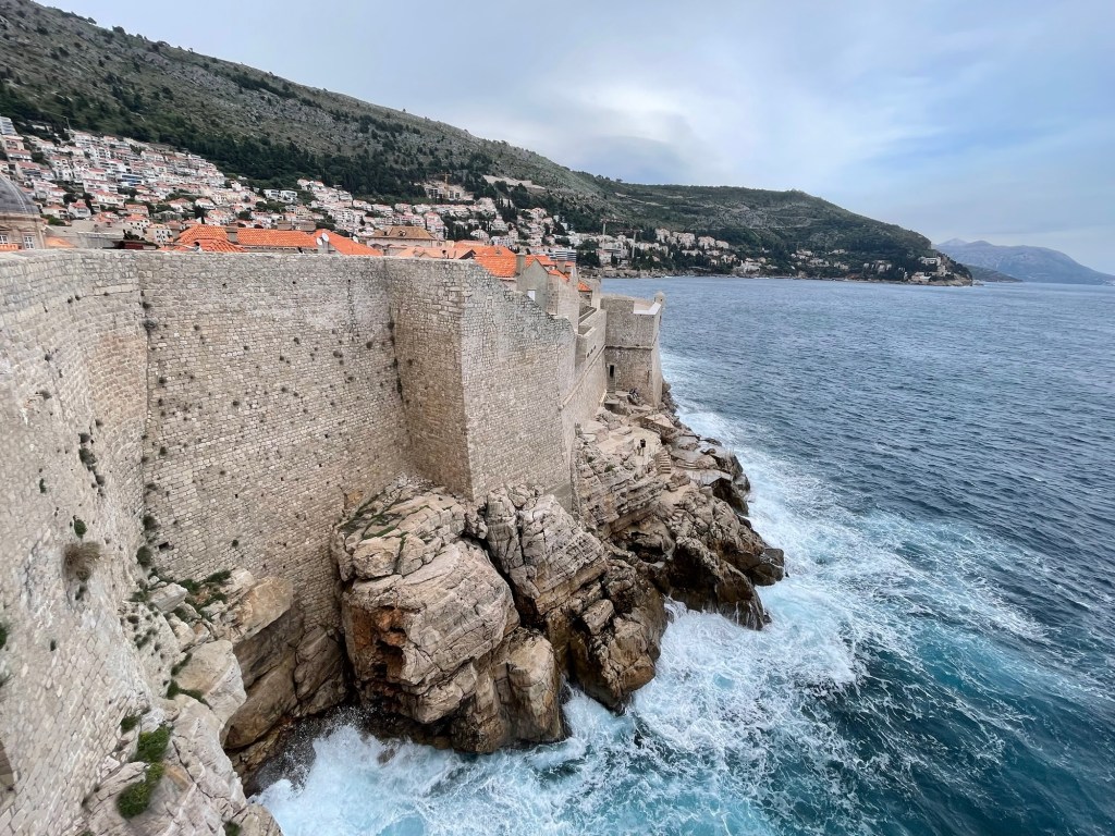
We’re off on another adventure! The main inspiration for this trip is to visit Rowan in Croatia, where they are in the middle of a semester studying abroad. Their program shuts down (including the housing) for a week long spring break right after Easter, so we plan to take advantage of this opportunity to go on a road trip with them. They are located on an island in the northwest, so before our rendezvous we wanted to take a bit of time to see a city in the southeast we’ve always wanted to explore: Dubrovnik. (Some of our readers may know this as the real-life setting for King’s Landing in the Game of Thrones TV series. We’re not huge GoT fans ourselves, but the gift shops here sure have jumped on the bandwagon. Fortunately the old city with its intact wall system is plenty impressive whether you followed the show or not.)
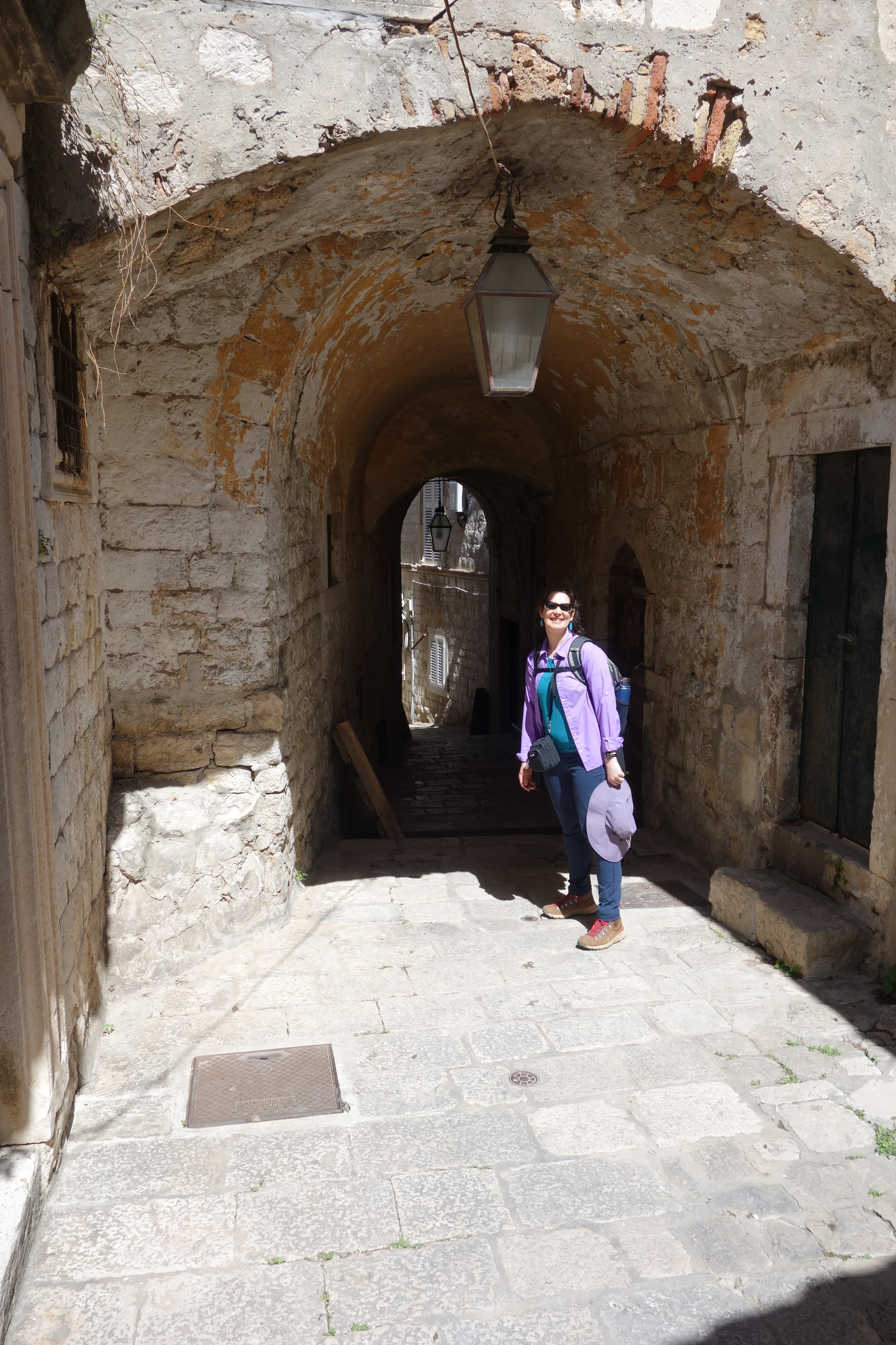
Our lodgings are actually within the old city itself, just across the street from one of the massive external walls. The whole town is built on a mountainside, so the narrow pedestrian-only streets are quite steep and often feature flights of stairs rising one after the other. Of course, our destination is on the uphill side — not so great for lugging baggage, but amply compensated with great views in all directions.
View from our kitchen window
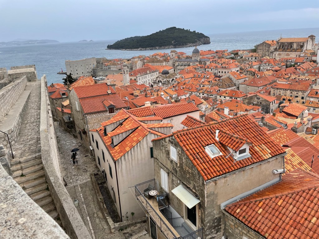
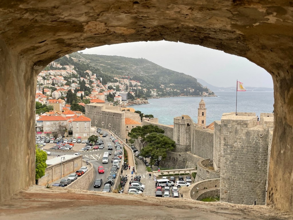
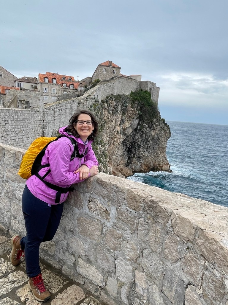
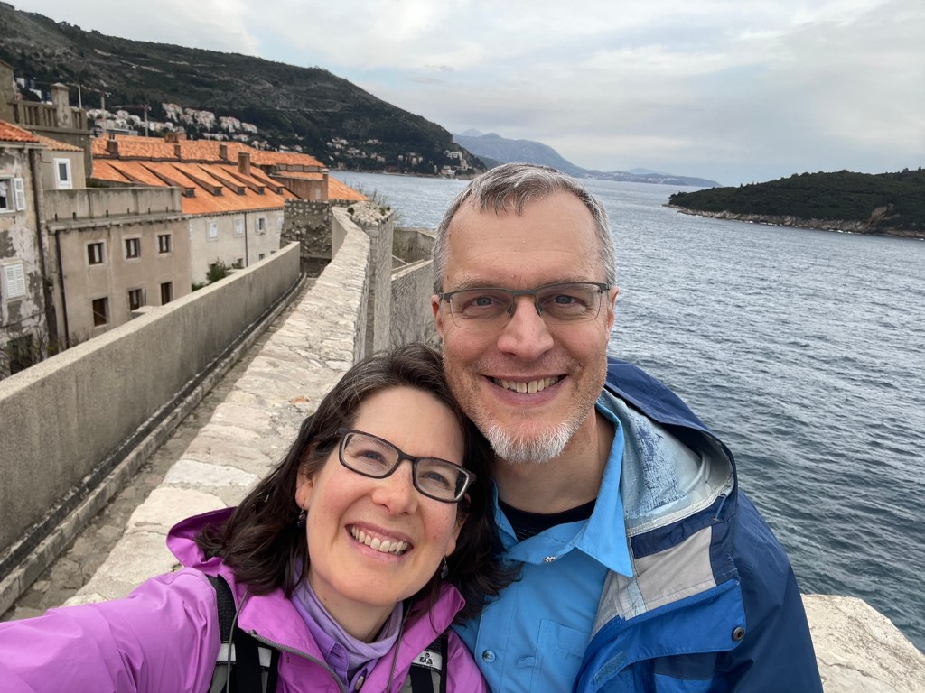
Being longtime fans of stone fortifications, a tour of the city walls was naturally our first choice activity. Guidebooks warn visitors to be wary of the hot sun and massive crowds, especially when cruise ships are in port (sometimes up to five visiting per day!). Conveniently, being here in April means that we miss both of those delights. The weather was far from hot, and though we did feel a few drops of rain, we were well prepared for it — and they may even have helped keep the other tourists away. The walls make a complete circuit around the entire old city, and the ticket counter recommends allowing at least an hour for the tour. We took more than two and loved every minute of it. Seeing the streets from so many different viewpoints really helped us get a sense of the place.
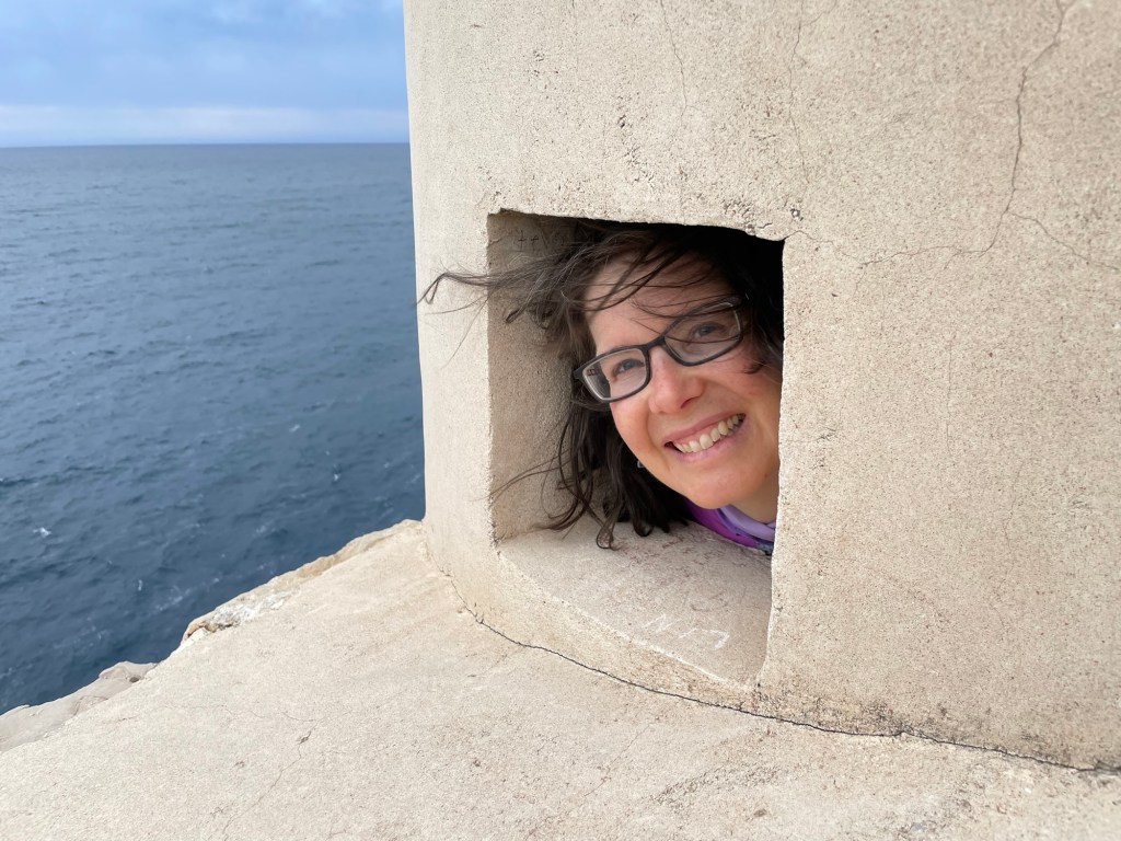
There are two monasteries in the old city. This one belongs to the Dominican order.Landward fortifications. Walls are 4m thick!Our lodging is the top floor of the building with the white gable and skylight to the left in this picture.Our lodging seen from the other side, with views of the harbor and Lokrum island.Susannah really enjoyed taking pictures through openings in the walls.
One observation that surprised us a little in comparison with other walled cities was the amount of open space we saw. Many of the buildings have gardens or other plots nearby, and the photo above shows an area just below the walls that is designated for public recreation. In other places, some of the land simply remains in ruins or sits otherwise unused. With Dubrovnik’s increasing popularity as a tourist destination, it seems likely that a lot of this open space will be put to use in the near future.
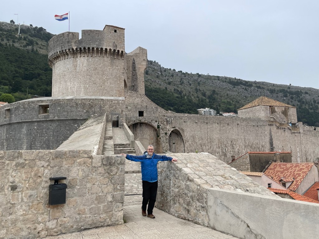
The oldest remaining fortifications of the city date back more than 1000 years. The bulk of the current city walls were built in the 1300s and 1400s, with further modifications over the next few centuries (particularly so when cannons became commonplace, and the defenses were modified to include gun casements). More recently, the Austro-Hungarian Empire made further changes when they gained control of the city in the 19th century.
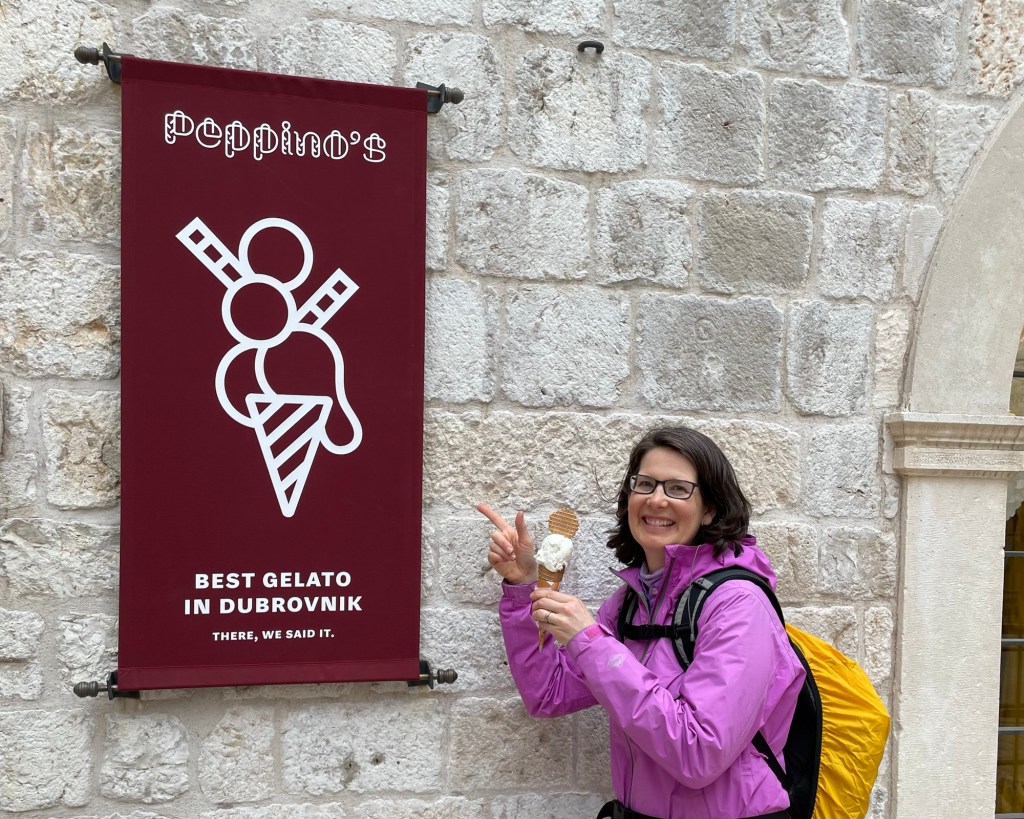
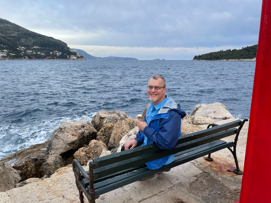
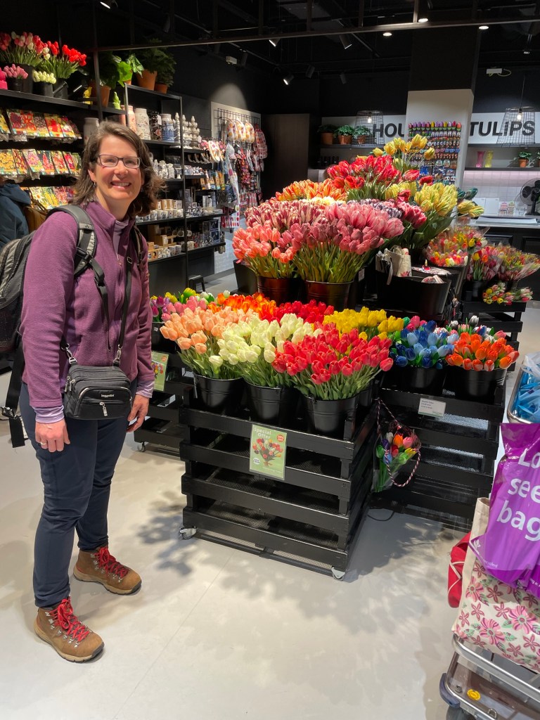
Susannah really enjoyed taking pictures through openings in the walls. (Says Nick…)All days that end with gelato are good days!We finished our gelatos at the end of the Porporela breakwater, which was living up to its name on this windy day. It is said that when one person asks their sweetheart to accompany them on a date to this location, it is recognized that they are an item.Final bonus picture — we flew via the Amsterdam airport, and enjoyed the colorful displays in the House of Tulips.
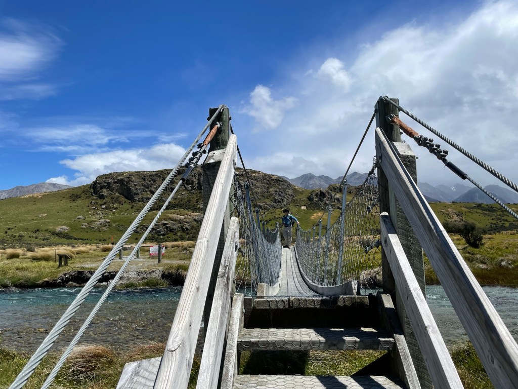
Meduseld once looked down from the highest point of the hill. “There stands a great hall of Men. And it seems to my eyes that it is thatched with gold. The light of its shines far over the land. Golden too are the posts of its doors.” (Tolkein)
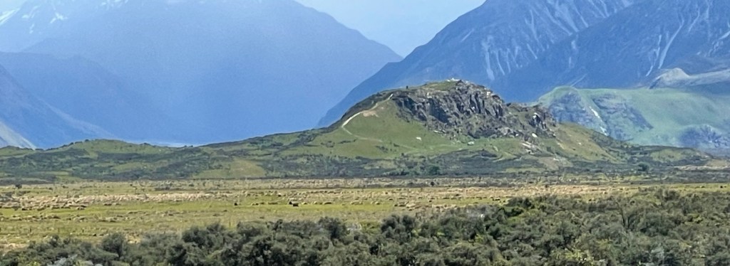
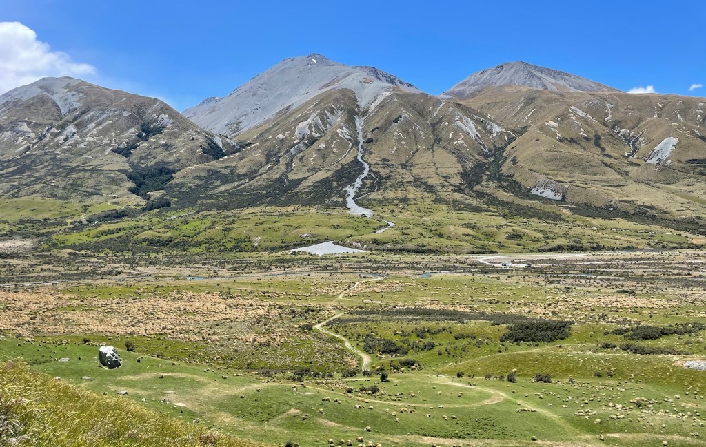
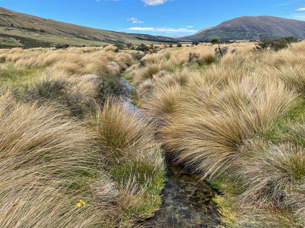
Our adventure to New Zealand is coming to an end, and this will be our last post for the trip because all we do tomorrow is fly home. We wanted something memorable for our last full day, and what could be better than to visit a beautiful natural site that also happens to be one of the most striking locations in the Lord of the Rings movies? That’s right, today we visited Mount Sunday, whose cinematic alter ego is Edoras, the capital of Rohan. You may recognize its craggy ridgeline in the photo above, although it may look somewhat different without its encrustation of Viking buildings and the golden hall of Meduseld glinting at the top.
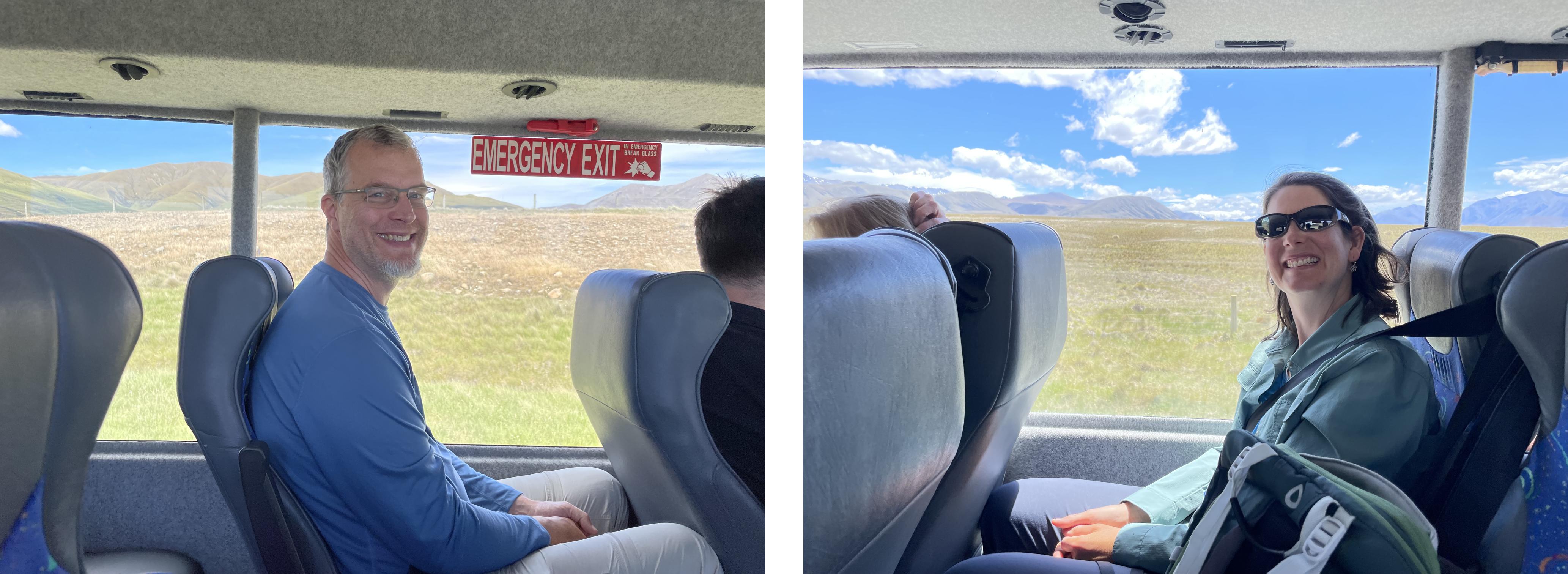
Mount Sunday is hard to reach without a car, lying about a two hour drive from Christchurch, partly on gravel roads. Since we had already returned our rental several days ago, for this day trip we opted to sign up with a tour company (the promisingly-named Hassle-Free Tours) who would take us there and back. As a bonus, we heard movie backstory on the way there and back, and our guide even brought along some movie prop replicas for our use in case we wanted to take pictures with them.
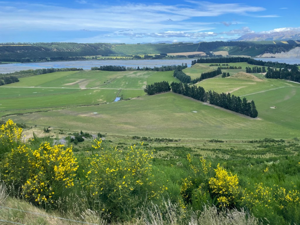
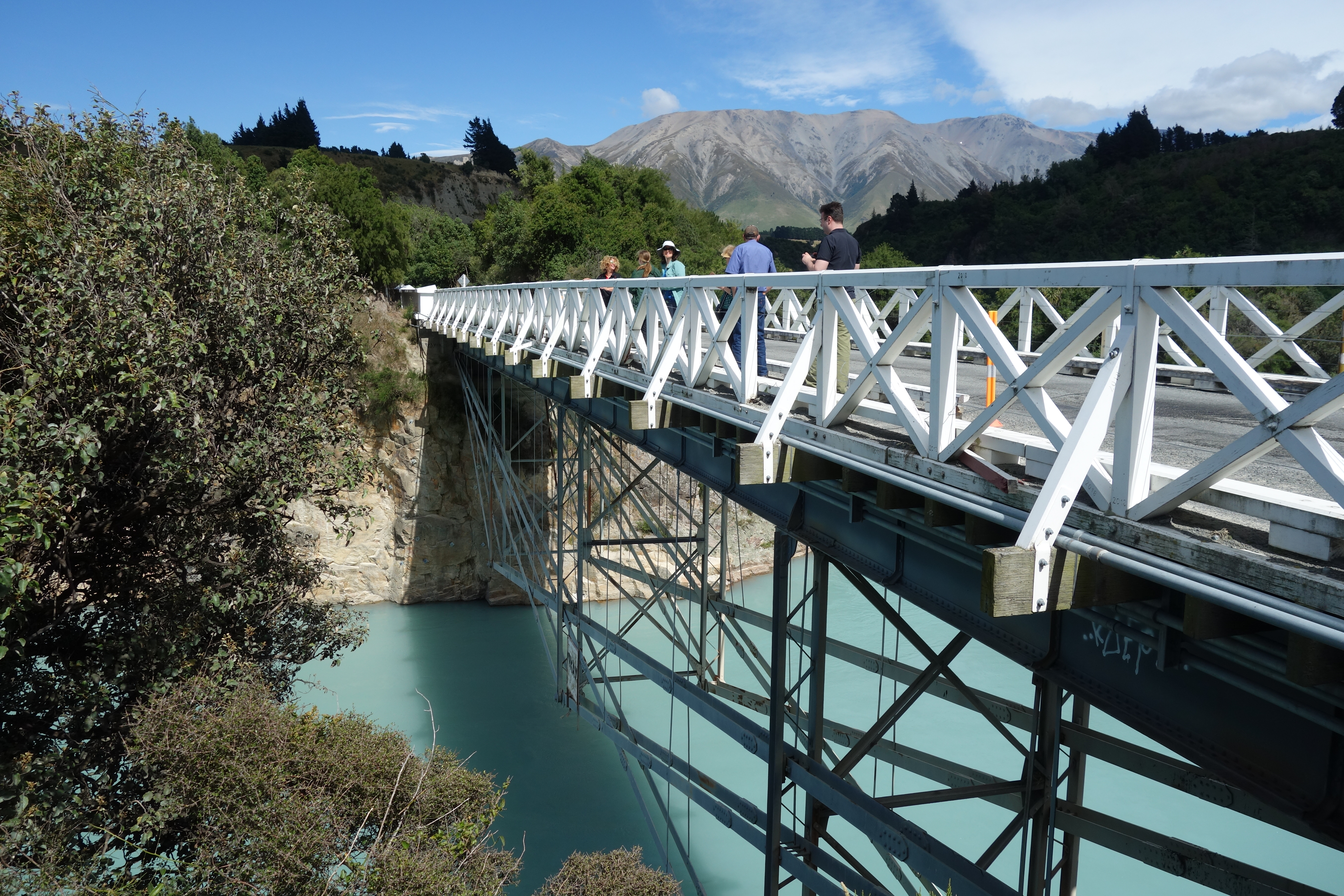
Nice license plate!Countryside on the way there crossed several rivers, including the Rakaia river shown here. It is an example of a “braided” river, which occur only under very specific conditions, including high but variable flow and significant constant erosion.Bridge over the Rakaia River. Built in 1882, it features an unusual design.We stopped at Lake Camp en route. The terrain is already starting to feel like Rohan.Our first view of Mount Sunday in the distance. Can you see it? Surrounded by larger peaks, it is the small rocky outcrop in the middle of the plain.
Mount Sunday differs from Hobbiton in that there are very few traces of the movie left behind. The contract specified that the producers would remove all traces of the set and restore the site to its previous condition. They even had to replace the plants that were removed for the temporary road put in to ferry actors and equipment. However, you can still see a few signs if you know where to look — in the location where the gatehouse was built, the grass is still browner in spots where the ground was compressed either by traffic or from the weight of structures erected on top.
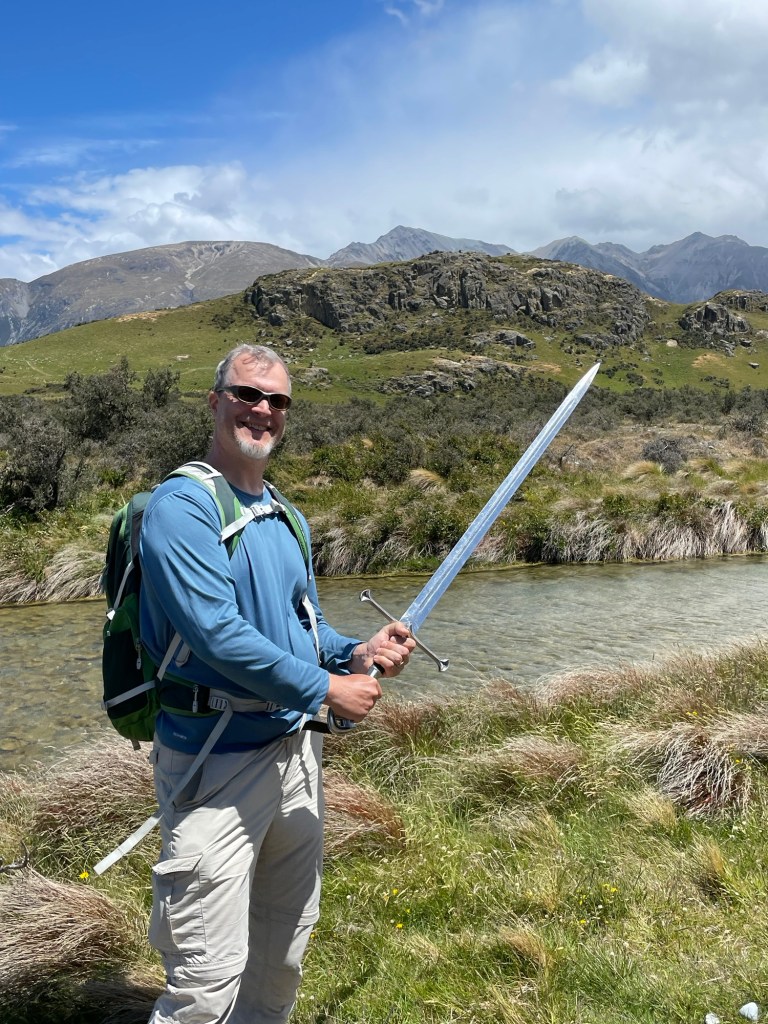
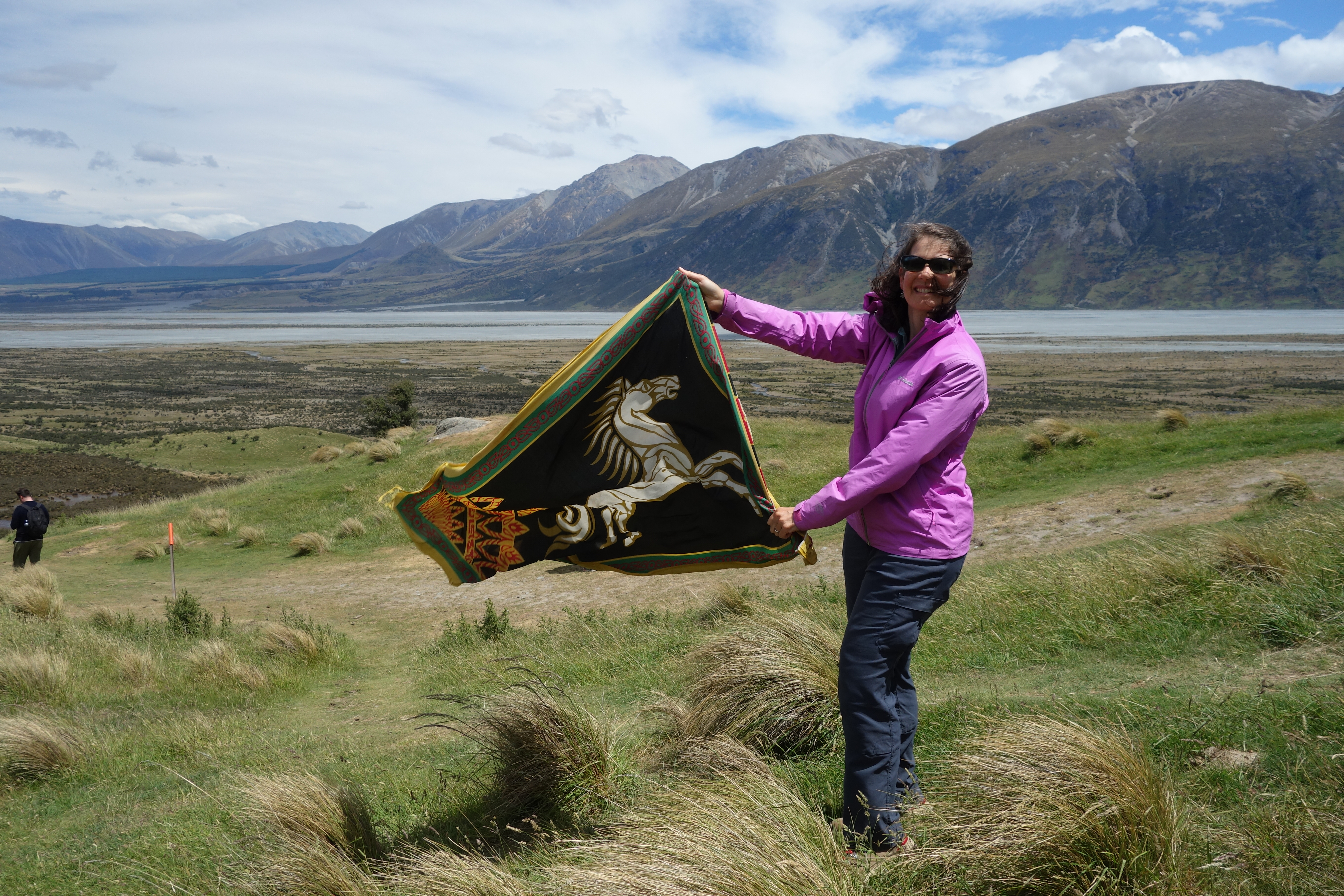
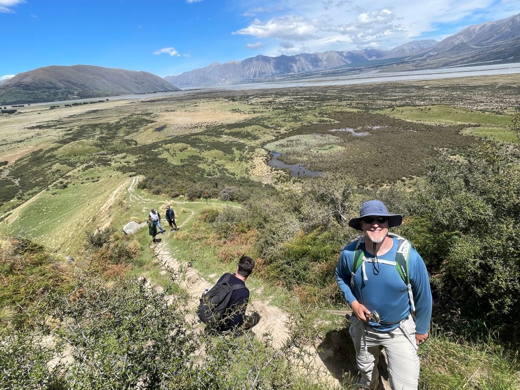
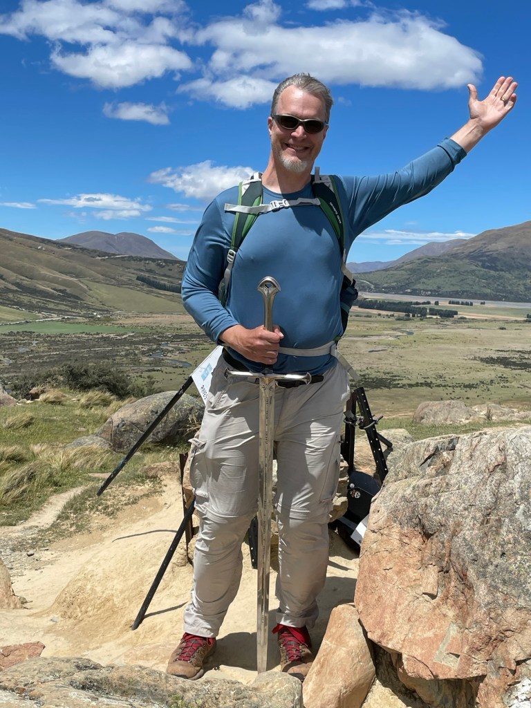
View from the car park. The track to the top is visible to the left. Anduril, Flame of the WestRaising the White Horse of RohanMaximum one person at a time on the swing bridge across the riverCan you see where the gatehouse once stood?On the path to the top, view to the northView to the southeast, showing the steepness of the path up
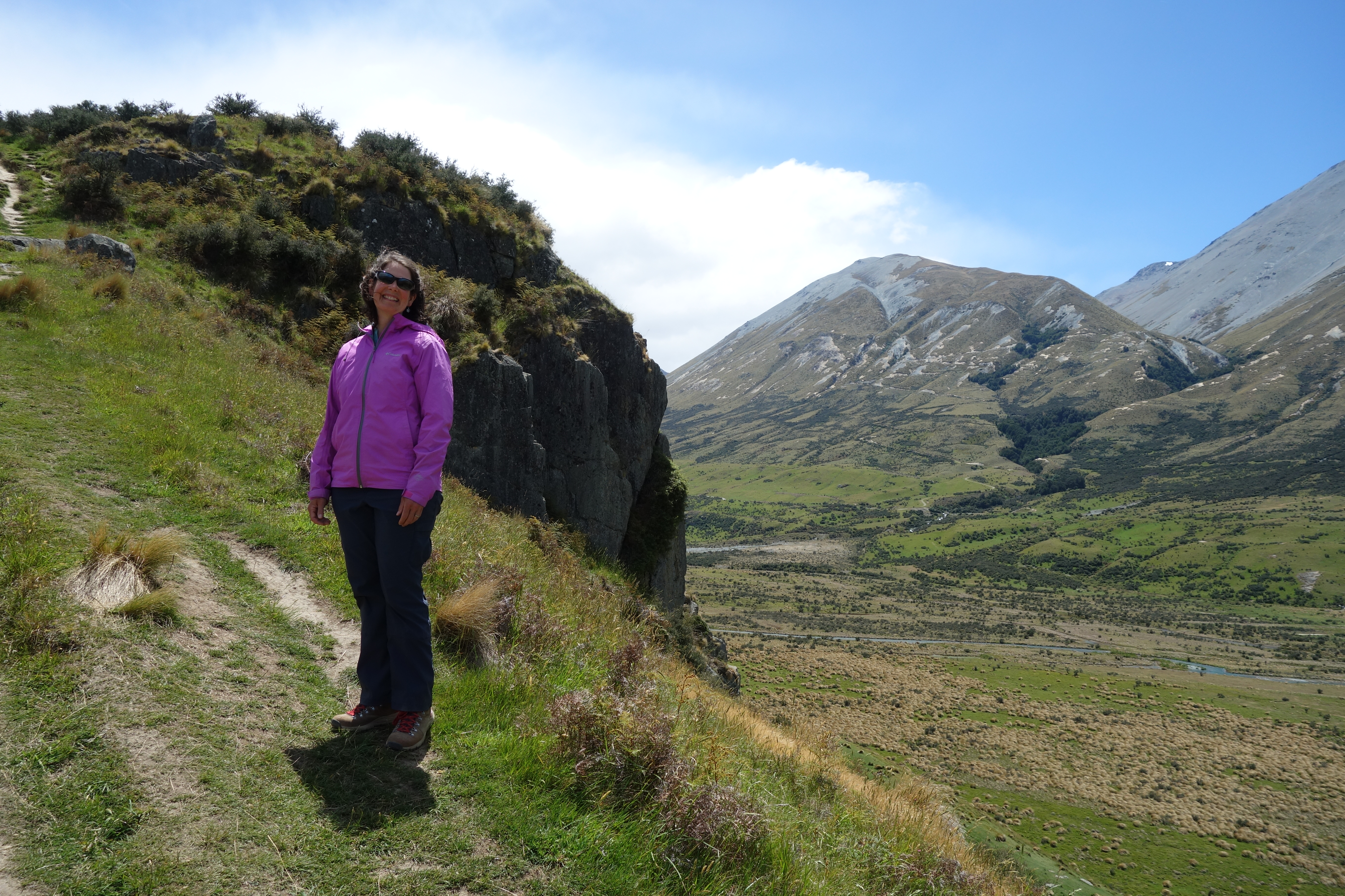
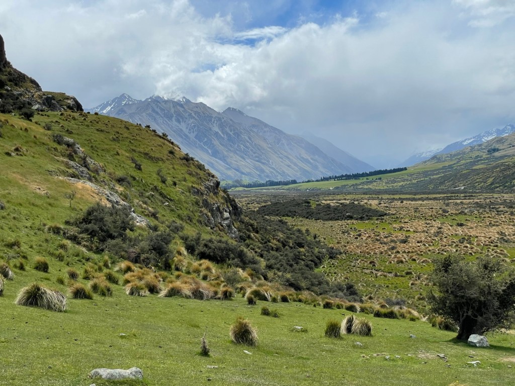
Once at the top we had views of the valley around in all directions. Wind is pretty much a fact of life in this valley, and it intensifies at the top. Though very strong, it was manageable during our visit. The moviemakers sometimes had to contend with speeds over 100 miles per hour, so for extra strength the set was built with a steel frame instead of wood. We had fun taking in the views, and trying to capture some pictures that evoked scenes in the movies.
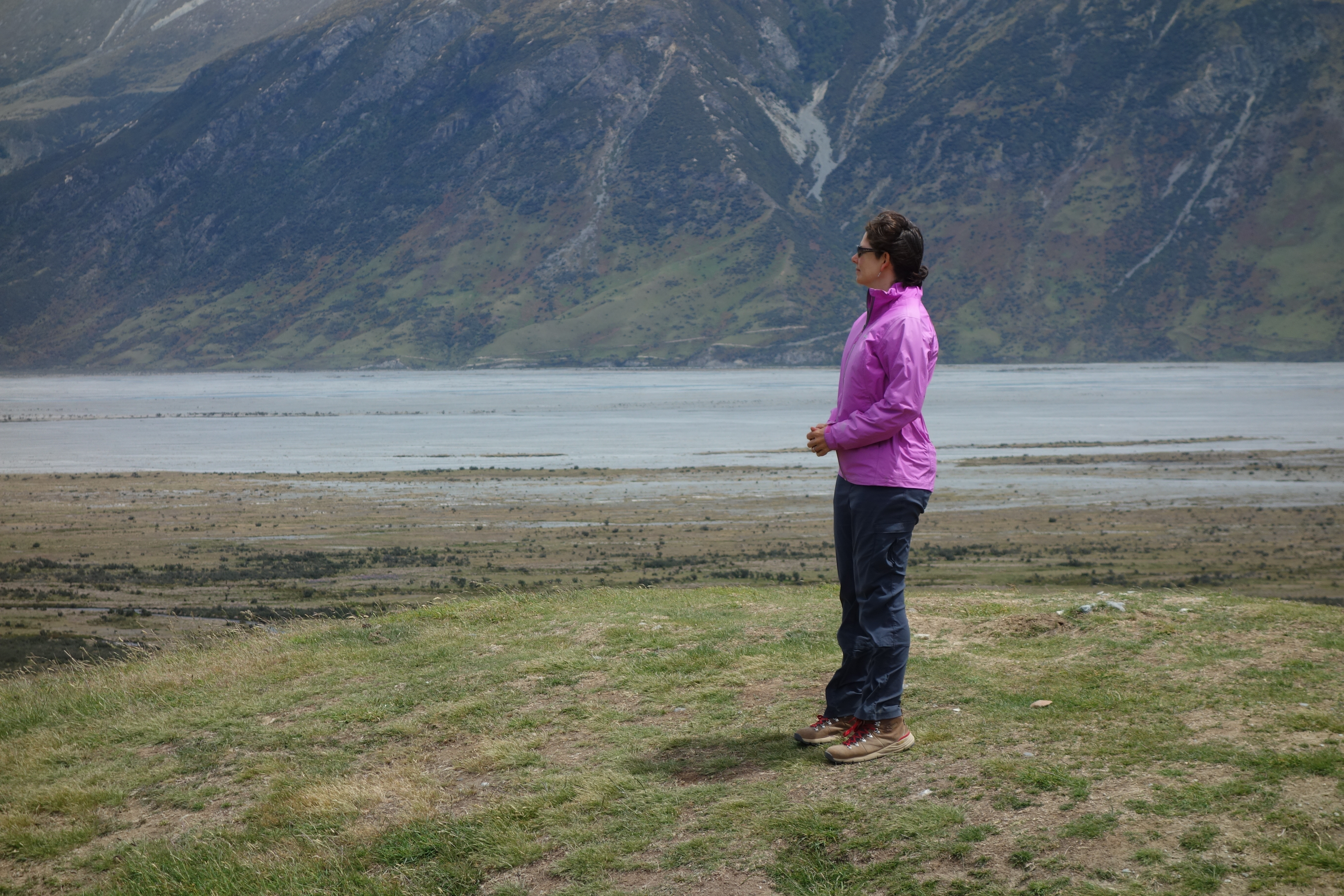
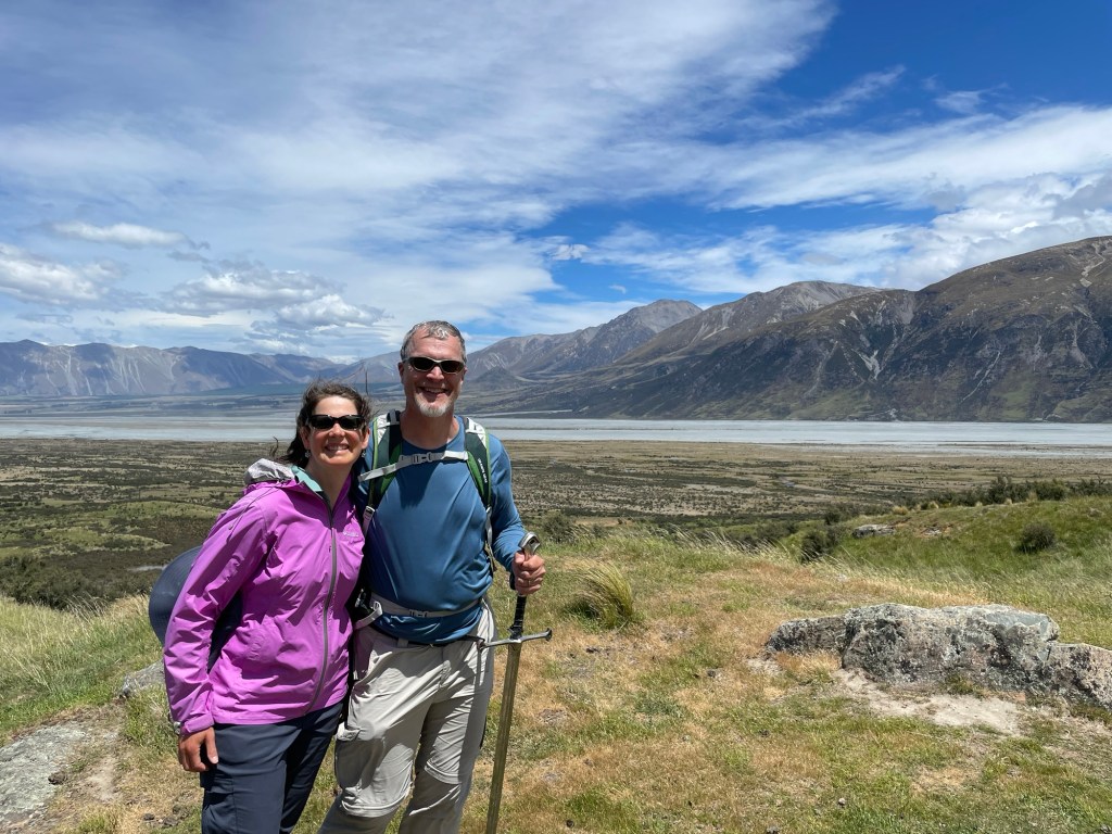
Susannah contemplates the valley below, as Eowyn once did. (View to the southwest)Our guide described scenes from the movie and where they were shot. (View to the southeast)View to the northeast, towards the car parksView to the south. Nick opted to carry the sword to the top for photographic purposes.View to the northwest, with people for scaleAt the summit. Here once stood Meduseld.View to the northwestSelfie in Rohan, contending with the windA narrow valley just west across the river was used for the external shots of Helm’s Deep.View from the trail to the top, looking northThe plain below was covered in tussocks.A final look back, as we depart
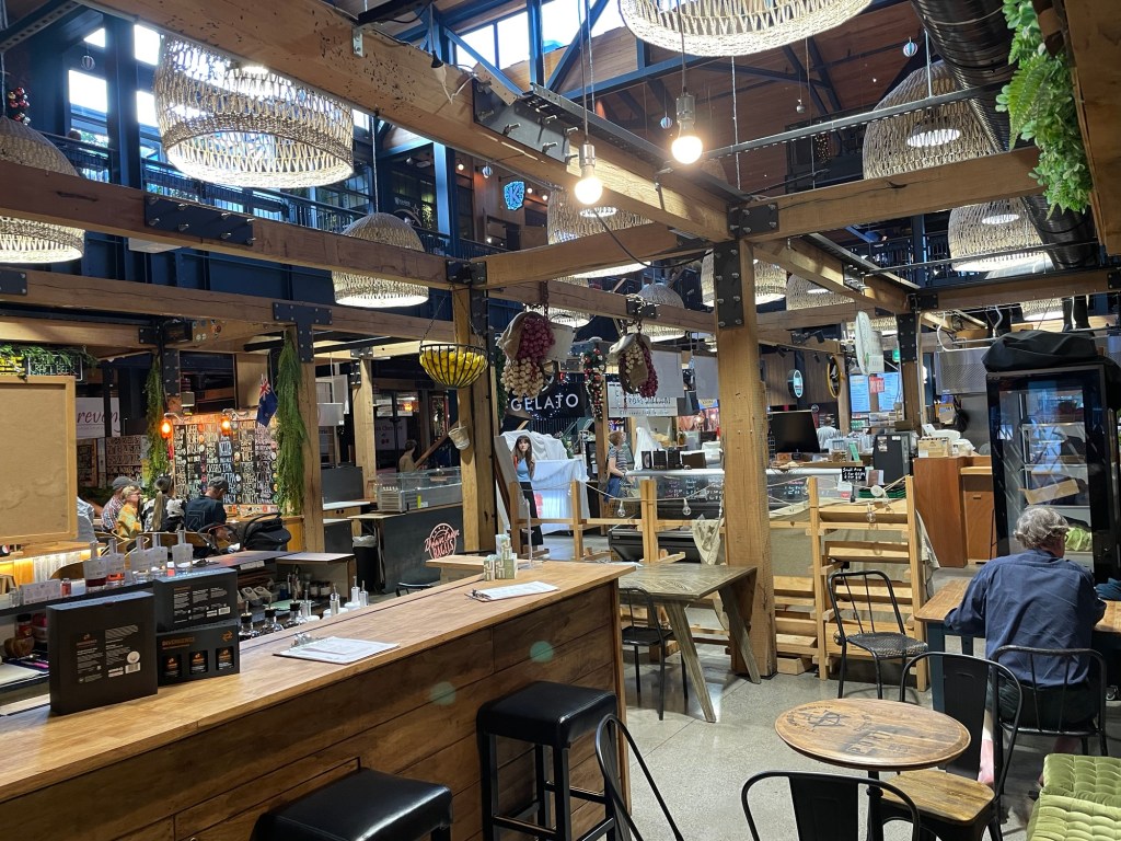
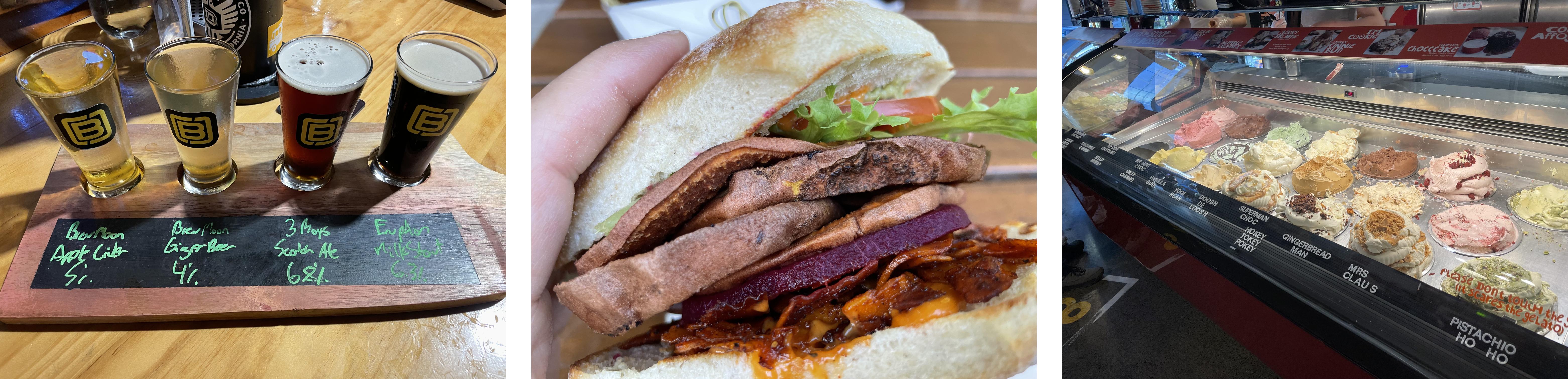
All good things eventually come to an end, as with this day and this fantastic trip. We arrived back in Christchurch in the evening, and were able to visit the Riverside Market for dinner because it stays open late on Thursdays. This emporium effectively serves as a food court for the entire city — within its walls, several dozen food stalls offer nearly every style of food you can imagine. During the day it buzzes with activity as people make their way through the narrow aisles, picking out their favorite foods. We sampled beer (plus cider and ginger), burgers (vegan and lamb), and gelato (dairy and coconut-based) – yum!
As we say goodbye to Aotearoa / New Zealand, we wanted to pause and note a few of the many aspects of the country (both large and small) that made us feel welcome, and for which we are thankful. These are in no particular order, but worth mentioning first is the people, who have all been genuinely friendly to us. We lost track of the number of Kiwis who would ask us about what we had seen and planned to see, and seemed truly interested in our answers. Related to this is the ubiquity of Maori culture, from place names to greeting and welcomes. It served as a constant reminder that there can be multiple perspectives on everything. We were pleased and surprised to discover that toilets in New Zealand can be found nearly everywhere you might want one. Moreover, they are generally both clean, free, and stocked with toilet paper. We found pricing in stores and restaurants to be simple and easy: there is no tipping, and no added taxes. (Some shops do add a small surcharge if you opt to pay by credit card, but we mostly paid cash when possible.) The lack of tipping in particular was a sort of revelation: without the need to make sure that tips reach their intended recipient, the process of buying food becomes easy and efficient. Usually you can just pay at a central register whenever you are ready to leave, and service can be provided by any of the restaurant staff who is available. Finally, we really appreciated how comfortable Kiwis are with walking. It’s easy to do here, and nobody looks at you strangely if you plan to get somewhere on foot. This was good, because we walked a lot and had a lot of fun. Even though we spent five weeks here, there is so much more we’d still like to do and whole sections of the country we haven’t even seen. Odds are good that we’ll be back some day!
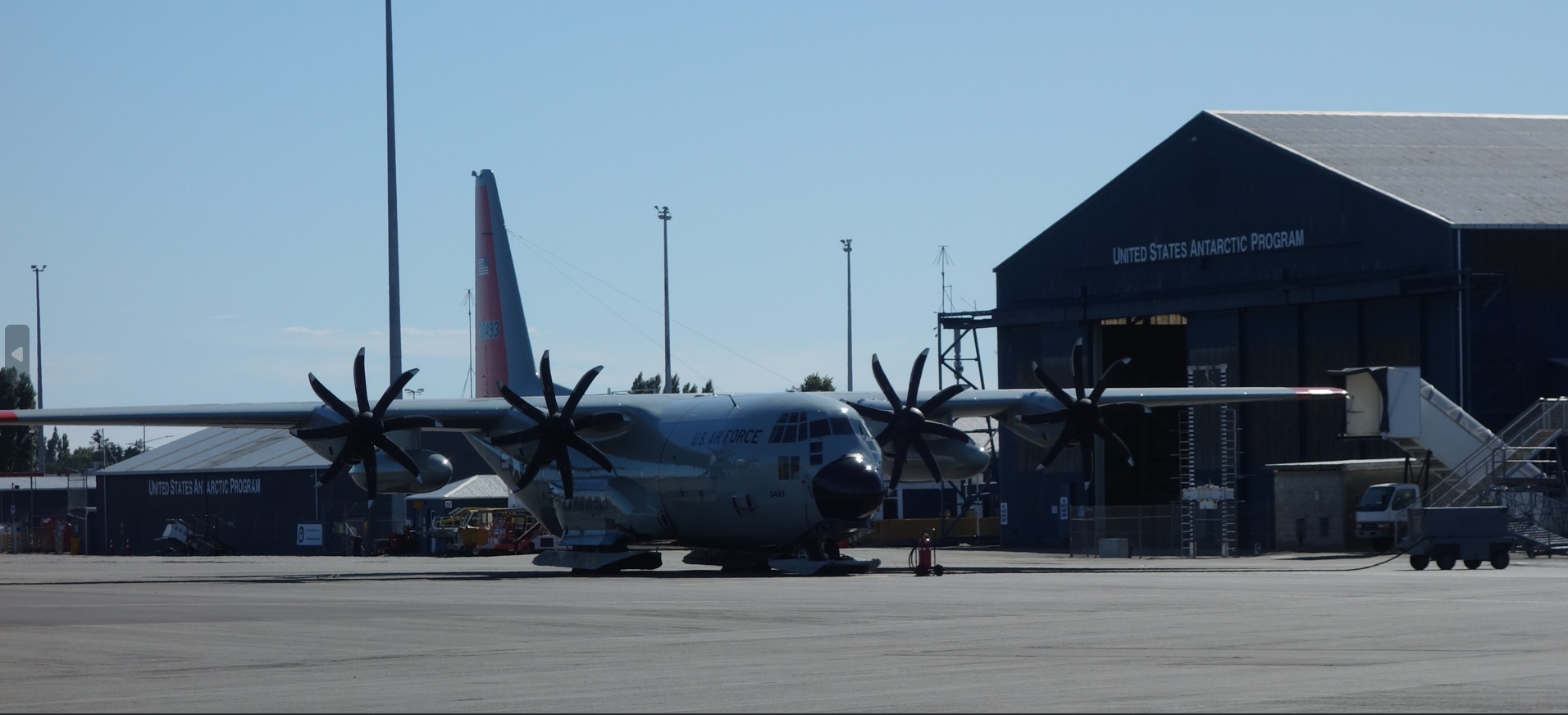
Christchurch has had a close association with Antarctica ever since Robert Scott sailed from Lyttelton Harbor en route to his fateful rendezvous with the South Pole. (There was actually some political machination behind the choice; originally he was to sail from Melbourne, Australia. But Christchurch is closer to the pole, and Scott had a family connection there, so the switch was made.) Today it serves as the supply point for the entire U.S. Antarctic research program. Their facilities are located right next to the civilian airport, and right next door to that is the Antarctic Experience, a quirky exhibit aiming to familiarize people with life in the coldest continent.
Facilities of the U.S. Antarctic Program. Note the landing gear on the C-130 Hercules parked in front.
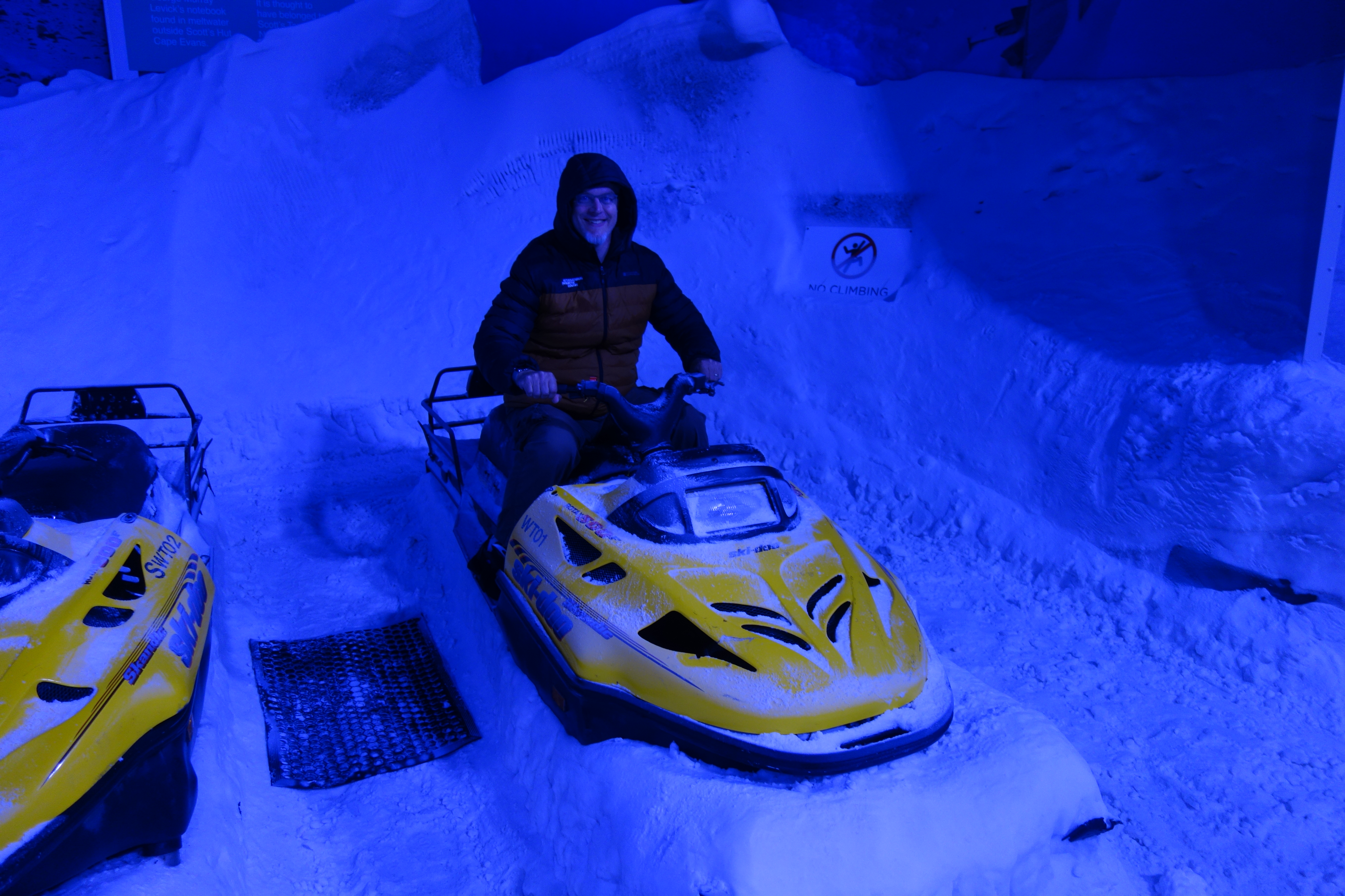
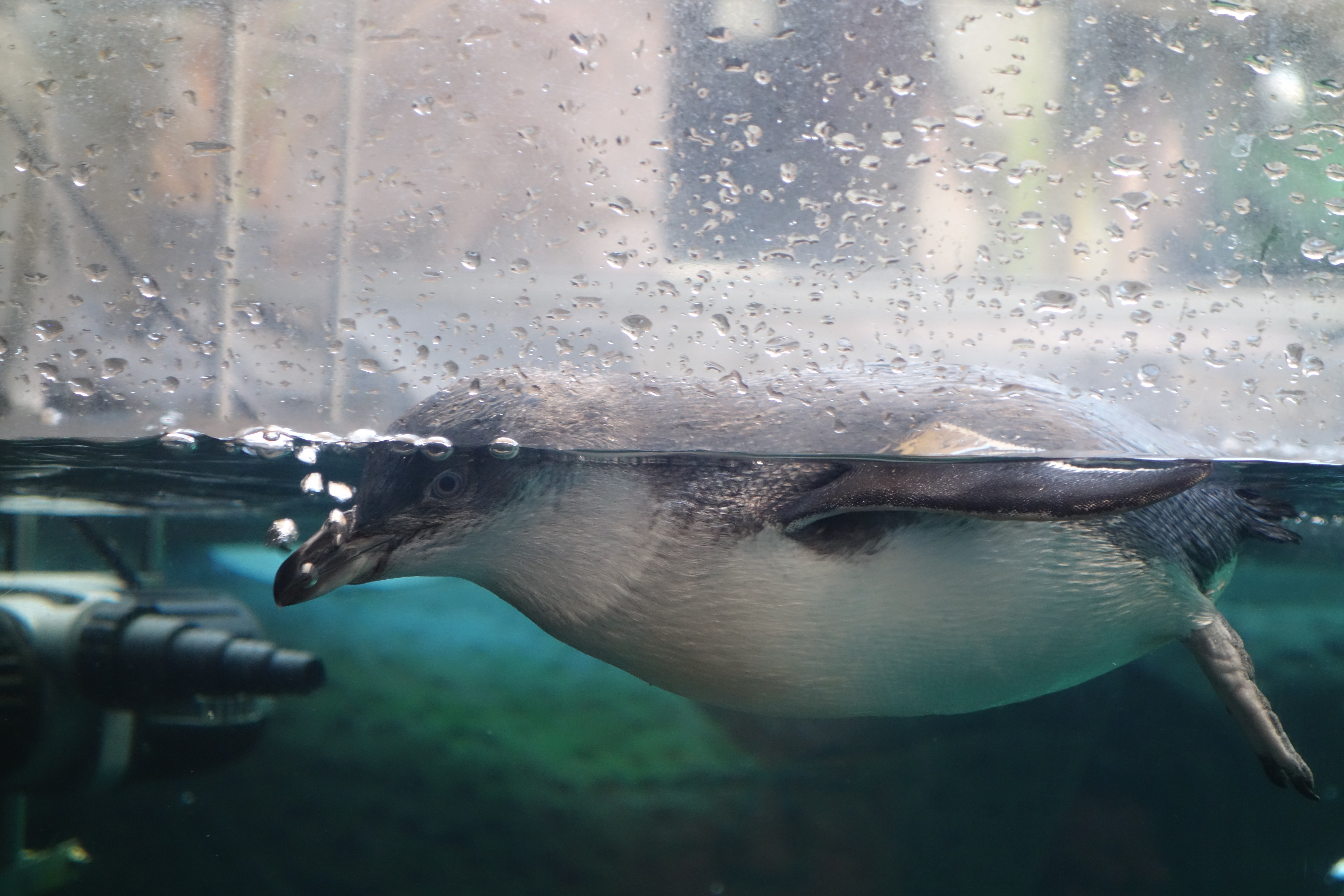
The Antarctic Experience has a number of unusual experiences on offer, including a simulation room chilled to the balmy summertime temperature of -8 degrees C, that featured real snow on the ground and periodic “storms” where the lights would dim and fans would generate a 25 mph breeze. Guests were required to wear insulated parkas and shoe covers before entering. They also run a penguin rehabilitation center, and had a room that featured several live sled dogs. (The latter are included as a historical note since they are no longer used on any of the bases today.) A number of informative exhibits taught about quotidian aspects of the program, such as the food crates (always red), holding enough sustenance to keep one individual alive for 20 days. Following the inside portion of the exhibit, guests like Nick had the chance to ride in a tracked articulated Hägglund cargo carrier as it navigated a prepared obstacle course featuring ravine/crevasse traversals, water crossings, and inclines of up to 45 degrees. These capable machines were originally built for the Swedish Army and have become the vehicle of choice for expeditions across rugged inland terrain.
The simulation room. There is something odd about leaving a wintry place (MA) to come to a summery one (NZ), where one enters a room that simulates a wintry place.A little blue penguinSled dogs at restHägglund crossing– who is this sign for?
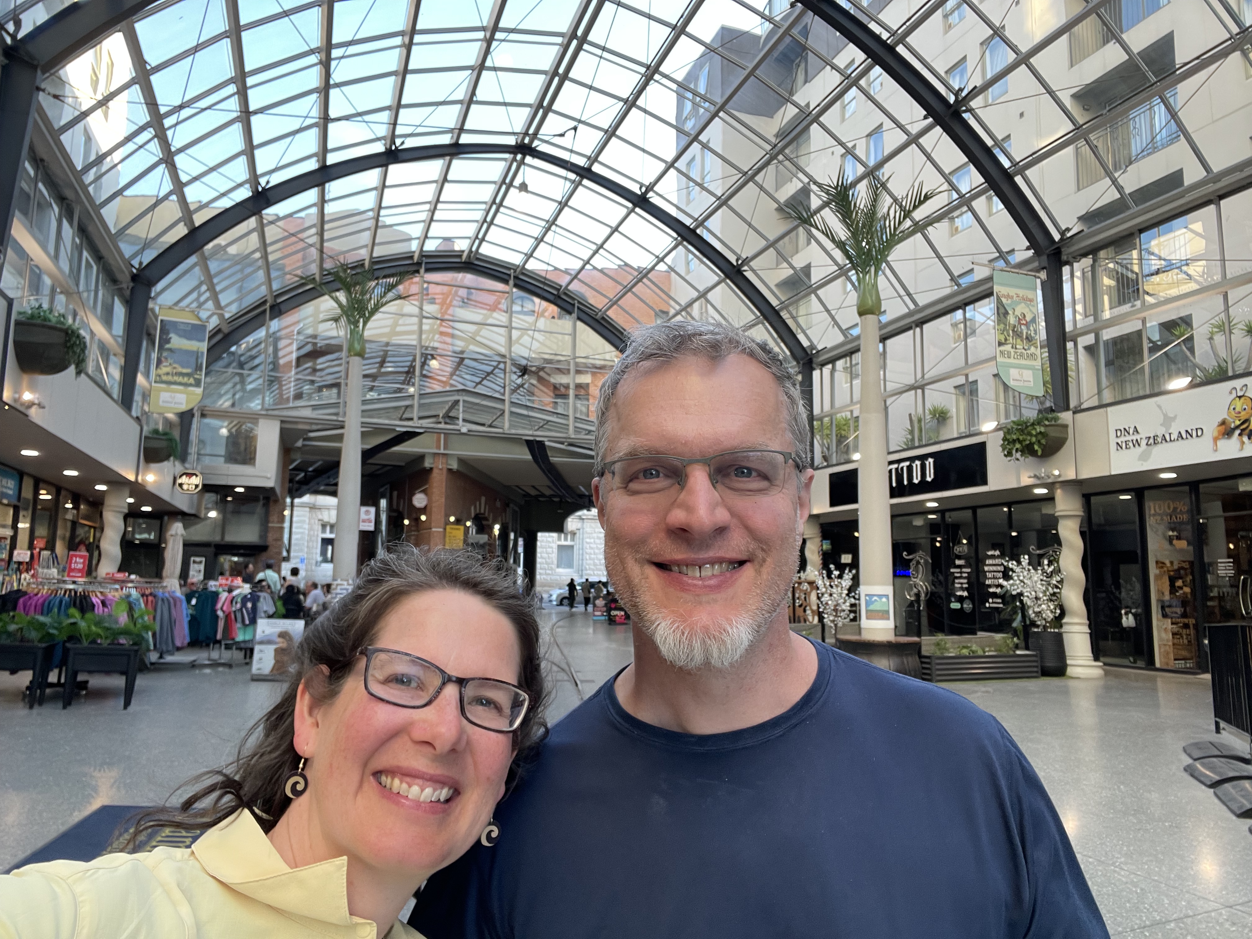
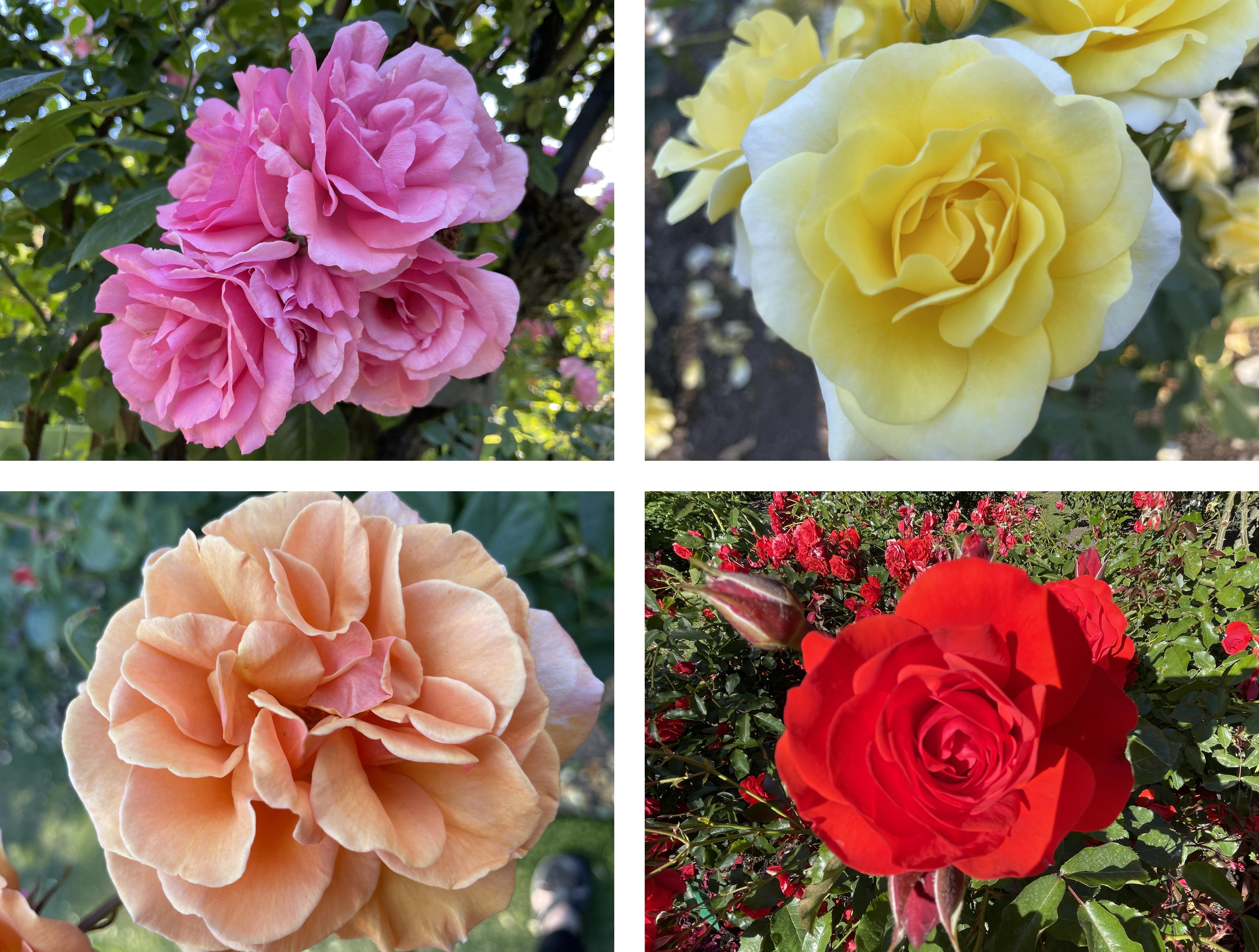
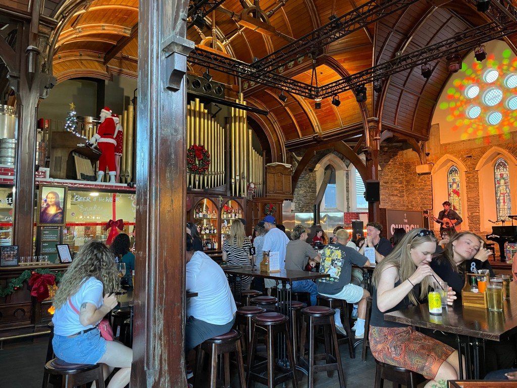
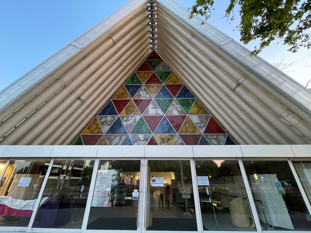
While Nick explored the Antarctic, Susannah attended the last day of her conference, and then spent the afternoon shadowing her former student Helena at Riley Consultants and meeting some of Helena’s work colleagues. By the evening, Nick and Susannah reconnected and took some time walking the city together. We returned to some of the sights that Nick had visited before so that Susannah could see them too, and we took turns on various playground equipment that seemed plenty large for adults. Dinner was at a historic church building that had been badly damaged in the earthquakes but ultimately rescued and turned into a brewpub, appropriately called the Church Brewpub. With live music daily, a pizza oven, and a good beer selection, it is very popular. After dinner we continued exploring, catching a glimpse of the Cardboard Cathedral, which was erected as a transitional building after the earthquake, and wandering the CDB shopping district. We’re well into December and many stores are decorated for Christmas – with the temperatures so warm, we still can’t wrap our heads around the upcoming holiday. One store in particular had several windows decorated with different holiday scenes, each of which was created by a local school, with the best entry set to receive a prize donation from the store.
The former trolley station has been turned into a mall. The tracks still run right through it.Many bridges cross the river, which loops its way through town.We walked through the Botanical Gardens on the way, and photographed some roses.The Margaret Mahy Family Playground is the largest in New Zealand.We both found fun things to try.Take me to Church!The “Cardboard Cathedral”This Christmas window decoration features an I-Spy challenge.